
Ikang tide times
Ikang tide forecast — heights relative to MSL.
Today's tide times for Ikang
Tide times at Ikang on Saturday, 4 July 2026: first low tide at 01:00am, first high tide at 07:00am, second low tide at 01:14pm, second high tide at 06:20pm. Sunrise 06:19am, sunset 06:42pm.
Tide chart for Ikang
24-hour cosine-interpolated curve around the present moment. Heights relative to MSL. Predictions: Predictions: Open-Meteo Marine (MeteoFrance SMOC, 0.08° grid).
Sun, moon and conditions on Sat 04 Jul
Snapshot at build time — refreshes daily. Sea state from Open-Meteo Marine.
Highs and lows next 7 days
Every predicted high and low for the next week, with the daily tidal coefficient (0–120; higher = bigger swing, > 95 means stronger currents).
Other spots nearby
The three closest curated TideTurtle locations to Ikang, measured by great-circle distance.
Today's solunar windows
Solunar tradition: major periods are the ≈3h windows around moon transit and opposition; minor are ≈2h around moonrise and moonset. Pair with the local tide stage and wind for the best read.
Cycle dates near Ikang
Last spring tide on Sat 04 Jul (range 1.9m). Next spring tide on Fri 10 Jul (range 1.7m). Next neap on Wed 08 Jul.
Spring tides cluster around new and full moons (biggest swings). Neap tides land on quarter moons (smallest swings). See the spring tide and neap tide glossary entries for the why.
About tides at Ikang
A short guide to the coastline at Ikang — geography, sea state, and what the tide is actually doing under your feet.
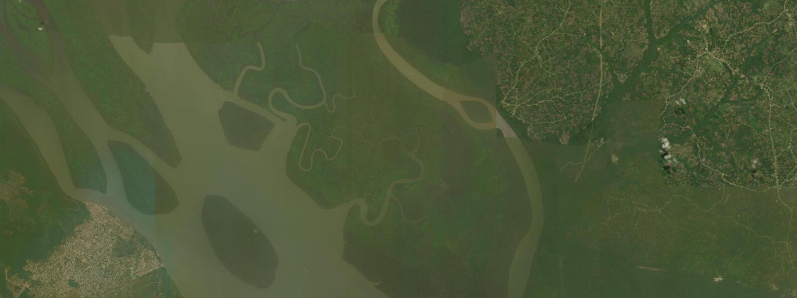
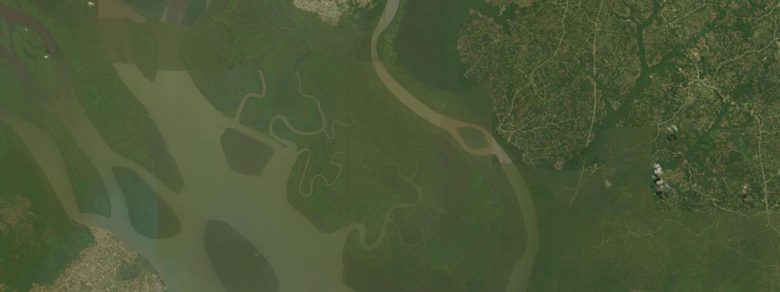
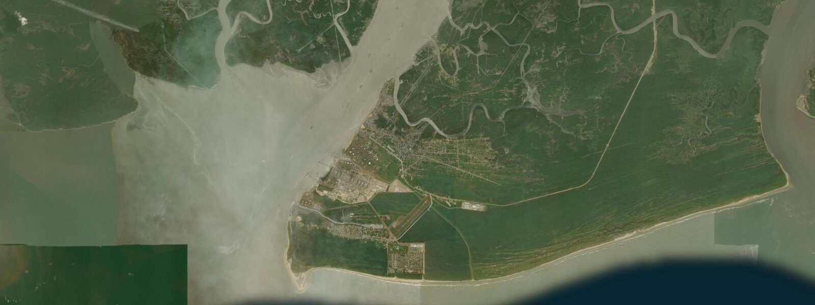
Ikang is a coastal community in Cross River State near the mouth of the Cross River, close to the border with Cameroon. The town sits at the edge of the estuary where the Cross River's multiple channels converge before opening into the Bight of Bonny. This geography — estuary mouth, international border, mangrove fringe, tidal flats — makes Ikang less a tourist destination and more a functional coastal node: a fishing landing, a border-trade point, and a community whose daily schedule is organised around the tide.
The Cross River at Ikang is at its widest and most tidal. The Atlantic signal dominates here: tidal range is 1.0 to 1.5 metres at springs, and the rhythm of two highs and two lows per day is clearly marked in the exposed sediment bands on the river banks and mangrove roots. At low water, the river margins and intertidal flat extend substantially; mangrove pneumatophores — the finger-like breathing roots — emerge from the mud for up to a metre. At high water, the flat is submerged and the mangrove fringe is bordered by open tidal water.
Tide predictions for Ikang use Open-Meteo Marine's global gridded model. Timing accuracy is ±45 minutes; height accuracy is ±0.2 to 0.3 metres. The Cross River discharge modulates actual water levels seasonally: July to September high-water periods push levels above the tidal baseline, and the low-discharge dry season (November through February) gives the cleanest tidal signal with the least freshwater interference.
For anglers, Ikang's position at the estuary mouth is productive. The converging tidal currents concentrate fish on the outgoing tide as the ebb pushes bait out through the channels. Target species include barracuda, grouper, snappers, and the locally important bonga shad. Charter fishing from Calabar extends to this area; local canoe fishermen work the estuary mouth channels from the Ikang landing.
The mangroves at Ikang are part of the Cross River estuary mangrove complex, one of the larger intact mangrove systems in Nigeria. Red mangrove (Rhizophora) dominates the water-facing fringe; black mangrove (Avicennia) and white mangrove (Laguncularia) occupy the higher intertidal zones. These forests are the nursery habitat for most of the commercially important fish species in the estuary and for the blue swimming crab fishery that operates throughout the system.
Access to Ikang from Calabar is by road — approximately 40 kilometres on the road south toward the Cameroon border crossing at Mfum — or by boat through the estuary. The road crosses several creek bridges that are tide-sensitive; in high-discharge periods, some low-lying road sections can be inundated. Boat access from Calabar is 2 to 3 hours by motor canoe depending on the tide and current direction.
The proximity to the Cameroon border adds a cross-border trade dimension to the community. Artisanal fishing boats and goods canoes cross between Ikang and adjacent Cameroonian communities; this cross-border activity peaks at certain tide stages when the crossing channels are navigable.
The broader Cross River coastal zone between Calabar and the Cameroon border contains some of the most intact estuarine mangrove habitat in Nigeria. The combination of government-protected zones, low population density in the border area, and the difficulty of access has limited direct exploitation pressure on the mangrove system here relative to the Niger Delta further west. The mangrove biomass and carbon stock in this system is ecologically significant by West African standards.
The Ikang Bay area, where the Cross River estuary meets the open sea of the Bight of Biafra, is a transition zone with unusually high marine biodiversity. The mixing of fresh river water with the warm Atlantic, the extensive intertidal flats, and the depth gradient from 0 to 20 metres within a few kilometres of the shore create habitat complexity that supports the full range of estuarine and coastal species. The seasonal sardine and bonga aggregations in the estuary mouth are part of a larger pattern of small pelagic fish movement along the Nigeria-Cameroon coast.
Community-based conservation initiatives in the Ikang area have focused on the African manatee, which uses the Cross River and its tributary creeks. Local fishermen who once caught manatees incidentally have been incorporated into monitoring programmes; sighting reports from fishermen are the primary source of manatee distribution data in the lower Cross River. The programme is operated in partnership with Calabar-based conservation organisations.
Tide questions about Ikang
Quick answers to the most common questions about tide times, range, and water access at Ikang.
What is the tidal range at Ikang?
Ikang is near the mouth of the Cross River, where the Atlantic tidal signal is at its strongest in the estuary. Spring tidal range is 1.0 to 1.5 metres, consistent with the southeastern Nigeria coastal pattern. Neap range drops to 0.4 to 0.7 metres. Tide data here uses Open-Meteo Marine, with ±45 minutes accuracy on timing and ±0.2 to 0.3 metres on heights. River discharge adds a seasonal overlay: July through September high-water events can raise effective water levels by 0.3 to 0.5 metres above the tidal prediction, particularly in the river channels behind the main estuary front.
How do I get to Ikang from Calabar?
The road from Calabar runs approximately 40 kilometres south to Ikang, passing through Odukpani and following the eastern bank of the Cross River. Journey time is 60 to 90 minutes by road, depending on road condition and season — some low-lying sections flood during the July to September high-discharge period. Boat access from Calabar's waterfront takes 2 to 3 hours by motor canoe, crossing the estuary and navigating the mangrove channels. For most visitors, the road is the practical option; the boat route is used primarily by local fishermen and traders familiar with the creek navigation.
What wildlife is visible in the mangroves near Ikang?
The Cross River estuary mangroves support the African forest buffalo (a smaller, red-coated forest subspecies), sitatunga antelope in the deeper swamp areas, and the African manatee in the river channels — though manatee sightings require luck and local knowledge. The bird fauna includes African fish eagles, pied and malachite kingfishers, and various heron and egret species. The estuarine crocodile (Nile crocodile subspecies) is present in the lower river; local knowledge on current population distribution should be sought before wading or swimming in any mangrove channels. A local guide is strongly recommended for any mangrove excursion.
Is Ikang a border crossing point with Cameroon?
Ikang is near the Cross River mouth, close to the Nigeria-Cameroon maritime boundary. The formal land border crossing is further north at Mfum on the Cross River road. Ikang itself is not a formal immigration crossing; it is an informal trading and fishing contact point between Cross River State communities and adjacent Cameroonian fishing communities. Crossing the border here without formal immigration documentation is illegal. Visitors to the area should use the designated crossing points at Mfum or cross via the official Calabar-Limbe corridor.
What is the best time of year for fishing at Ikang?
The dry season (November through March) gives the most stable tidal conditions and the clearest estuary water for fishing. The Cross River is at low discharge and the tidal signal is strong and predictable, making current-reading easier for anglers. The rainy season (July to September) raises river levels and muddies the water but concentrates certain species — particularly bonga shad — in the estuary mouth as they respond to the freshwater input. Barracuda and trevally are present year-round in the estuary channels. The outgoing tide is consistently the most productive session, regardless of season.
8-day tide table — Ikang
Heights relative to MSL. Predictions: Open-Meteo Marine (MeteoFrance SMOC, 0.08° grid) — heights relative to MSL (not chart datum / LAT). Model-derived.
| Day | Type | Time | Height |
|---|---|---|---|
| Sat 04 Jul | Low | 01:00 | -1.1m |
| High | 07:00 | 0.8m | |
| Low | 13:14 | -0.6m | |
| High | 18:20 | 0.8m | |
| Sun 05 Jul | Low | 01:33 | -1.0m |
| High | 07:50 | 0.8m | |
| Mon 06 Jul | Low | 02:06 | -0.8m |
| High | 08:47 | 0.8m | |
| Low | 14:40 | -0.5m | |
| High | 20:39 | 0.6m | |
| Tue 07 Jul | Low | 02:50 | -0.7m |
| High | 09:33 | 0.8m | |
| Low | 15:36 | -0.5m | |
| High | 21:40 | 0.6m | |
| Wed 08 Jul | Low | 03:45 | -0.6m |
| High | 10:14 | 0.9m | |
| Low | 16:57 | -0.5m | |
| High | 22:33 | 0.6m | |
| Thu 09 Jul | Low | 05:02 | -0.5m |
| High | 11:00 | 0.9m | |
| Low | 18:05 | -0.6m | |
| High | 23:37 | 0.6m | |
| Fri 10 Jul | Low | 06:15 | -0.5m |
| High | 11:58 | 0.9m | |
| Low | 19:06 | -0.8m | |
| Sat 11 Jul | High | 00:00 | 0.5m |