Whakatāne, Bay of Plenty tide times
Whakatāne, Bay of Plenty tide forecast — heights relative to MSL.
Tide chart for Whakatāne, Bay of Plenty
24-hour cosine-interpolated curve around the present moment. Heights relative to MSL. Predictions: Predictions: Open-Meteo Marine (MeteoFrance SMOC, 0.08° grid).
Sun, moon and conditions on Sun 21 Jun
Snapshot at build time — refreshes daily. Sea state from Open-Meteo Marine.
Highs and lows next 7 days
Every predicted high and low for the next week, with the daily tidal coefficient (0–120; higher = bigger swing, > 95 means stronger currents).
Other spots nearby
The three closest curated TideTurtle locations to Whakatāne, Bay of Plenty, measured by great-circle distance.
Today's solunar windows
Solunar tradition: major periods are the ≈3h windows around moon transit and opposition; minor are ≈2h around moonrise and moonset. Pair with the local tide stage and wind for the best read.
Cycle dates near Whakatāne, Bay of Plenty
Next spring tide on Sat 20 Jun (range 1.8m). Next neap on Thu 25 Jun.
Spring tides cluster around new and full moons (biggest swings). Neap tides land on quarter moons (smallest swings). See the spring tide and neap tide glossary entries for the why.
About tides at Whakatāne, Bay of Plenty
A short guide to the coastline at Whakatāne, Bay of Plenty — geography, sea state, and what the tide is actually doing under your feet.
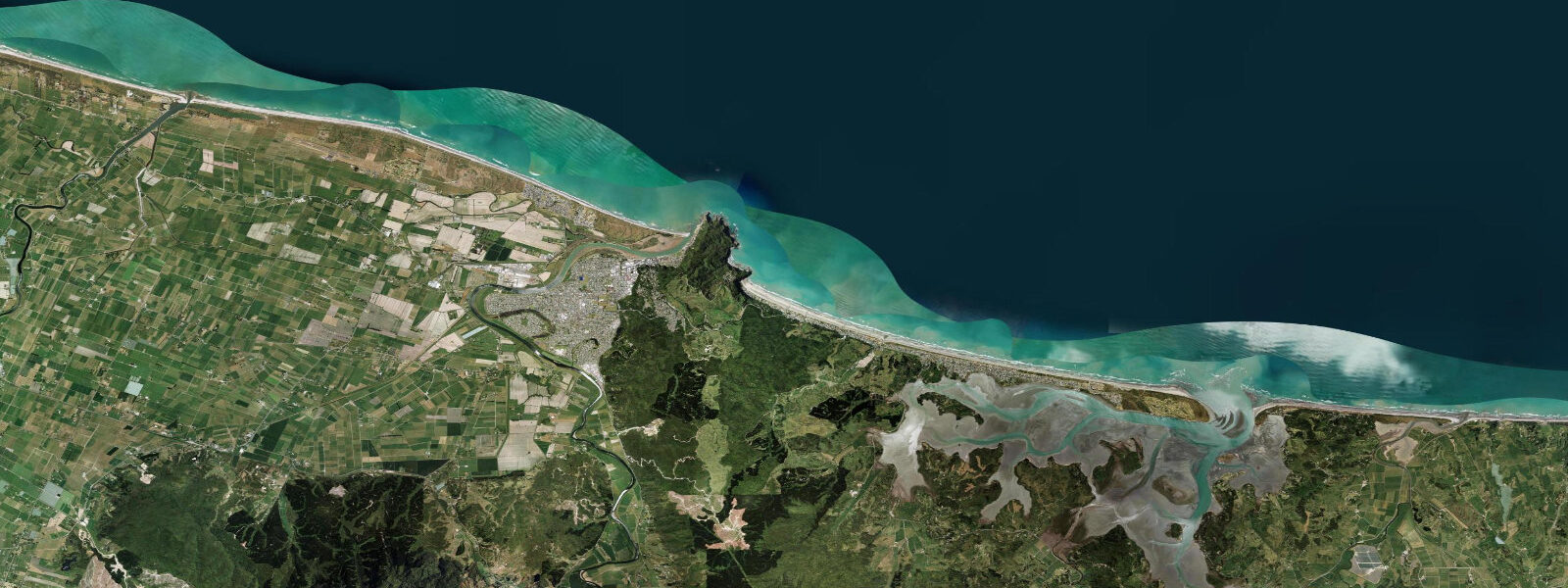
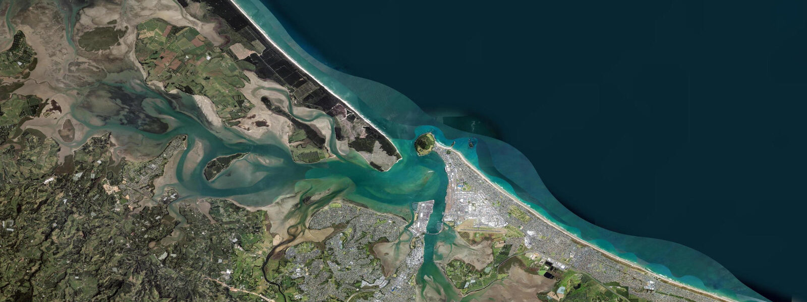
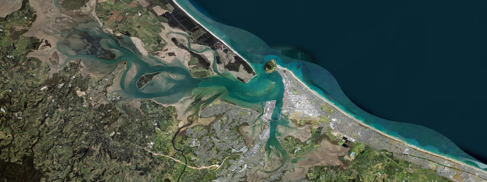
Whakatāne sits at the eastern end of the Bay of Plenty, where the Whakatāne River meets the Pacific Ocean roughly 100 km east of Tauranga. The Bay of Plenty's open geometry produces a Pacific New Zealand semidiurnal tide with a noticeable diurnal inequality — two highs and two lows each day, but the two high waters differ in height by up to 0.3 m on some days. Mean spring range runs 1.5–2.0 m, measurably smaller than the Hauraki Gulf's compressed-funnel range. Low water drops to around 0.2 m above chart datum on a neap, and spring lows can push the water back to reveal tidal flats at the river mouth that are otherwise invisible.
The most dramatic landmark visible from Whakatāne's waterfront is Whakaari, known in English as White Island. The island sits 48 km offshore and is New Zealand's most continuously active stratovolcano. On clear days the summit emits a visible steam and gas plume that marks the island even when cloud covers the sea horizon. In December 2019, an eruption during a tourist visit killed 22 people — the deadliest volcanic event in New Zealand since 1953. Tourist access to the island has been suspended since then and the regulatory framework for any future access remains under active review. The island does not disappear from the Bay of Plenty experience: it defines the seaward horizon from Muriwai Beach and from the Whakatāne Heads, and conditions on the water shift when wind swings around from the northeast sector where Whakaari sits.
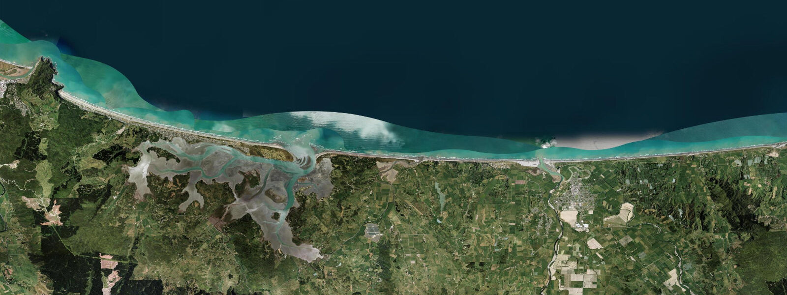
Five kilometres east of Whakatāne town, Ohope Spit extends across the mouth of Ohiwa Harbour and the outer coast faces northeast. The surf break at the Whakatāne Heads works off a long sand bar that builds up against the spit on northeast swell. It activates properly from around 1.5 m swell height and is best on a light southwest to offshore wind. Tidal state matters: the break tends to section badly at dead low water when the bar runs too shallow and too uniform. The middle two hours of the rising tide — roughly from 0.5 m to 1.2 m — hold the most shape. Check the tide table and add an hour: the sand bar runs about a kilometre from town, and paddling out against an ebbing current costs time. Northeast swell at this beach arrives from the same general direction as Whakaari, which gives the offshore view a rare framing of an active volcano behind a breaking wave.
Ohiwa Harbour itself is a large sheltered estuary 10 km east of Whakatāne, with its own tidal range of around 1.5 m on springs. The harbour entrance is narrow — tidal flow through the entrance channel runs fast enough on the ebb to require attention from kayakers and small boat operators. Inside, the harbour opens into several square kilometres of intertidal mudflat and seagrass bed. Godwits — bar-tailed godwits, which migrate nonstop from Alaska — arrive at Ohiwa in late September and use the estuary intensively through summer before departing north in March. Oystercatchers and variable oystercatchers are resident year-round. At low water the mudflats extend 300–400 m from the mangrove fringe on the northern shore. Cockle gathering in the harbour is managed under a customary fishery framework — the local hapū hold harvesting rights and commercial collection is prohibited in the inner harbour.
From the Whakatāne Heads rock platform, shore fishing for snapper and kahawai produces best results on the incoming tide. Snapper move onto the rock edges in around 3–5 m of water as the tide floods and hold there for roughly 90 minutes before the current becomes too strong to fish the bottom comfortably. The platform is accessible by a short track from the Ohope end of the spit. Kahawai tend to school in the wash zone closer to the surface — they can be taken on metal lures or flies in the surge gutters during the same flooding tidal window. Bring a decent set of rock shoes: the platform is kelp-covered near the water line. The best sessions tend to run from about 1.5 hours before high water until high water itself.
Muriwai Beach (not to be confused with the gannet-colony beach near Auckland) faces the open Bay of Plenty north of Whakatāne. It is a flat, wide sweep of sand that holds family-friendly swimming at mid-tide when the shorebreak backs off. Rip patterns shift with the tide: at low water rips are more concentrated and visible, while at mid-flood they widen and slow. Swimming is safest from mid-rising to mid-ebbing tide on the upper beach section.
Tide data for Whakatāne, Bay of Plenty comes from the Open-Meteo Marine API, a gridded model product. Timing accuracy is ±45 minutes, height accuracy ±0.3 m — usable for trip planning, not for navigation.
Tide questions about Whakatāne, Bay of Plenty
Quick answers to the most common questions about tide times, range, and water access at Whakatāne, Bay of Plenty.
What tidal range can I expect at Whakatāne?
Whakatāne runs a Pacific New Zealand semidiurnal tidal pattern with a mean spring range of 1.5–2.0 m. The range is smaller than the Hauraki Gulf because the open Bay of Plenty geometry doesn't compress tidal energy in the same way a funnel-shaped gulf does. Neap tides drop the range to around 0.7–1.0 m. On any given day, the two high waters differ slightly in height — the diurnal inequality is mild here, typically under 0.3 m, but worth checking when precision matters for a shore-fishing session or a kayak launch off the Ohiwa Harbour entrance.
When is the best tide for surfing at the Whakatāne Heads?
The Whakatāne Heads sand bar break works best during the middle portion of the rising tide — from approximately 0.5 m to 1.2 m on the tide gauge. At low water the bar runs too shallow and the wave sections rather than peeling. As the flood fills in, the bar produces longer, more connected rides. The break needs northeast swell of at least 1.5 m to activate. A light southwest wind keeps conditions clean. Allow extra time: the break is around a kilometre from the Ohope end of the spit, and paddling against a ripping outgoing current on a falling tide makes the session considerably harder.
Can I visit Whakaari/White Island from Whakatāne?
Tourist landing access to Whakaari has been suspended since the December 2019 eruption, which killed 22 people during a guided visit. That event was the deadliest volcanic incident in New Zealand since 1953. The regulatory framework for any future access is under review and no landing tours have operated since then. The island is still visible from the Whakatāne waterfront and from the Whakatāne Heads on clear days — the summit steam plume is usually visible on the northeast horizon 48 km offshore. Some boat operators offer offshore viewing without landing. Check with local operators for the current status before making plans.
Is Ohiwa Harbour good for kayaking?
Ohiwa Harbour is a large, sheltered estuary 10 km east of Whakatāne and suitable for kayaking across a wide range of conditions. The most important timing consideration is the harbour entrance: on a strong ebb, tidal flow through the narrow channel runs fast and should be treated with respect by beginners. Launching from inside the harbour and staying clear of the entrance on the ebb makes for a relaxed paddle. Inside, the harbour holds several square kilometres of intertidal flats, seagrass beds, and mangrove fringe. Mid-rising to high tide gives the most water depth over the flats and the best access to the inner reaches for birdwatching — bar-tailed godwits are present from late September through March.
What are the best tides for shore fishing at Whakatāne Heads?
The rock platform at Whakatāne Heads fishes well for snapper and kahawai on the incoming tide. Snapper move onto the rock edges as the flood reaches the 3–5 m depth zone, typically around 90 minutes before high water. The productive window runs from about 1.5 hours before high to high water itself. Kahawai school in the wash zone and respond to metal lures and flies in the surge gutters during the same period. The platform is accessible by a short track from the Ohope spit road. Kelp covers the lower sections so grip-sole footwear is necessary. On spring tides, the surge on the platform is heavier — add caution and pick a calm-wind day for the lower-level sections.
7-day tide table — Whakatāne, Bay of Plenty
Heights relative to MSL. Predictions: Open-Meteo Marine (MeteoFrance SMOC, 0.08° grid) — heights relative to MSL (not chart datum / LAT). Model-derived.
| Day | Type | Time | Height |
|---|---|---|---|
| Sun 21 Jun | Low | 04:10 | -0.7m |
| High | 10:15 | 0.9m | |
| Low | 16:27 | -0.7m | |
| High | 22:46 | 1.1m | |
| Mon 22 Jun | Low | 05:04 | -0.7m |
| High | 11:12 | 0.9m | |
| Low | 17:23 | -0.6m | |
| High | 23:39 | 1.0m | |
| Tue 23 Jun | Low | 05:58 | -0.6m |
| High | 12:07 | 0.9m | |
| Wed 24 Jun | Low | 06:52 | -0.5m |
| High | 13:05 | 0.9m | |
| Low | 19:11 | -0.4m | |
| Thu 25 Jun | High | 01:22 | 1.0m |
| Low | 07:41 | -0.4m | |
| High | 14:03 | 0.9m | |
| Low | 20:03 | -0.2m | |
| Fri 26 Jun | High | 02:14 | 1.0m |
| Low | 08:34 | -0.3m | |
| High | 14:55 | 1.0m | |
| Low | 21:02 | -0.1m | |
| Sat 27 Jun | High | 03:06 | 1.0m |
| Low | 09:26 | -0.3m |