Ouvéa, Loyalty Islands tide times
Ouvéa, Loyalty Islands tide forecast — heights relative to MSL.
Today's tide times for Ouvéa, Loyalty Islands
Tide times at Ouvéa, Loyalty Islands on Saturday, 4 July 2026: first high tide at 11:00am, first low tide at 02:16pm, second high tide at 09:10pm. Sunrise 06:30am, sunset 05:25pm.
Tide chart for Ouvéa, Loyalty Islands
24-hour cosine-interpolated curve around the present moment. Heights relative to MSL. Predictions: Predictions: Open-Meteo Marine (MeteoFrance SMOC, 0.08° grid).
Sun, moon and conditions on Sat 04 Jul
Snapshot at build time — refreshes daily. Sea state from Open-Meteo Marine.
Highs and lows next 7 days
Every predicted high and low for the next week, with the daily tidal coefficient (0–120; higher = bigger swing, > 95 means stronger currents).
Other spots nearby
The three closest curated TideTurtle locations to Ouvéa, Loyalty Islands, measured by great-circle distance.
Today's solunar windows
Solunar tradition: major periods are the ≈3h windows around moon transit and opposition; minor are ≈2h around moonrise and moonset. Pair with the local tide stage and wind for the best read.
Cycle dates near Ouvéa, Loyalty Islands
Last spring tide on Sat 04 Jul (range 0.8m). Next spring tide on Fri 10 Jul (range 1.0m). Next neap on Tue 07 Jul.
Spring tides cluster around new and full moons (biggest swings). Neap tides land on quarter moons (smallest swings). See the spring tide and neap tide glossary entries for the why.
About tides at Ouvéa, Loyalty Islands
A short guide to the coastline at Ouvéa, Loyalty Islands — geography, sea state, and what the tide is actually doing under your feet.
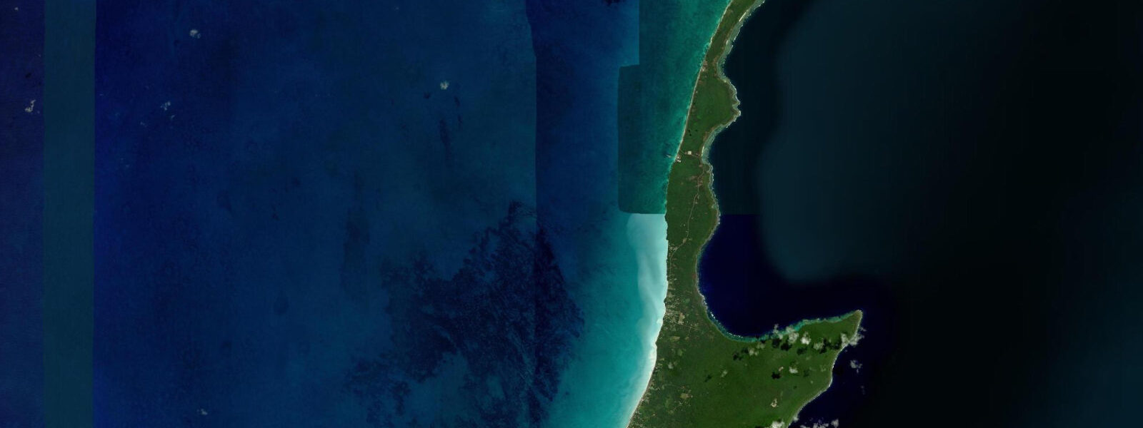
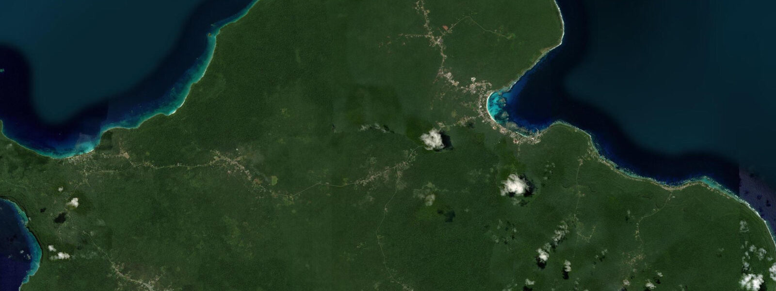
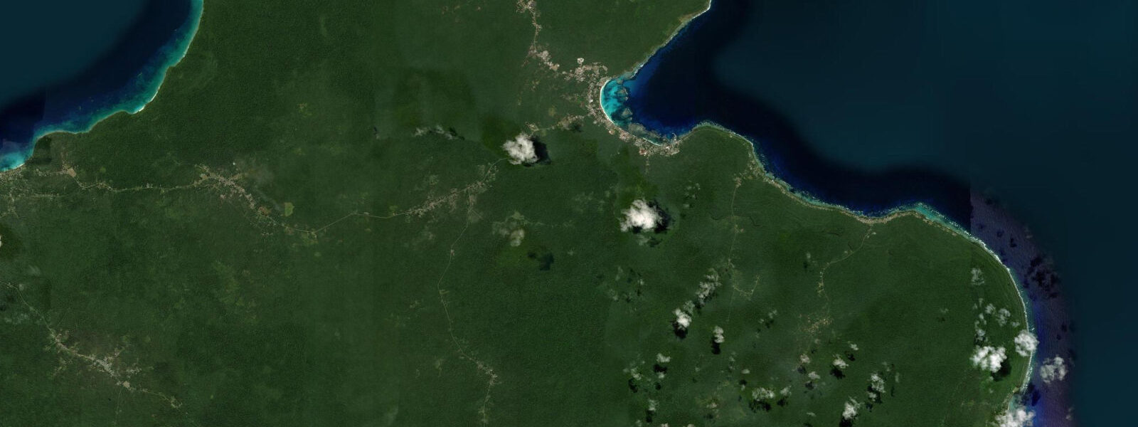
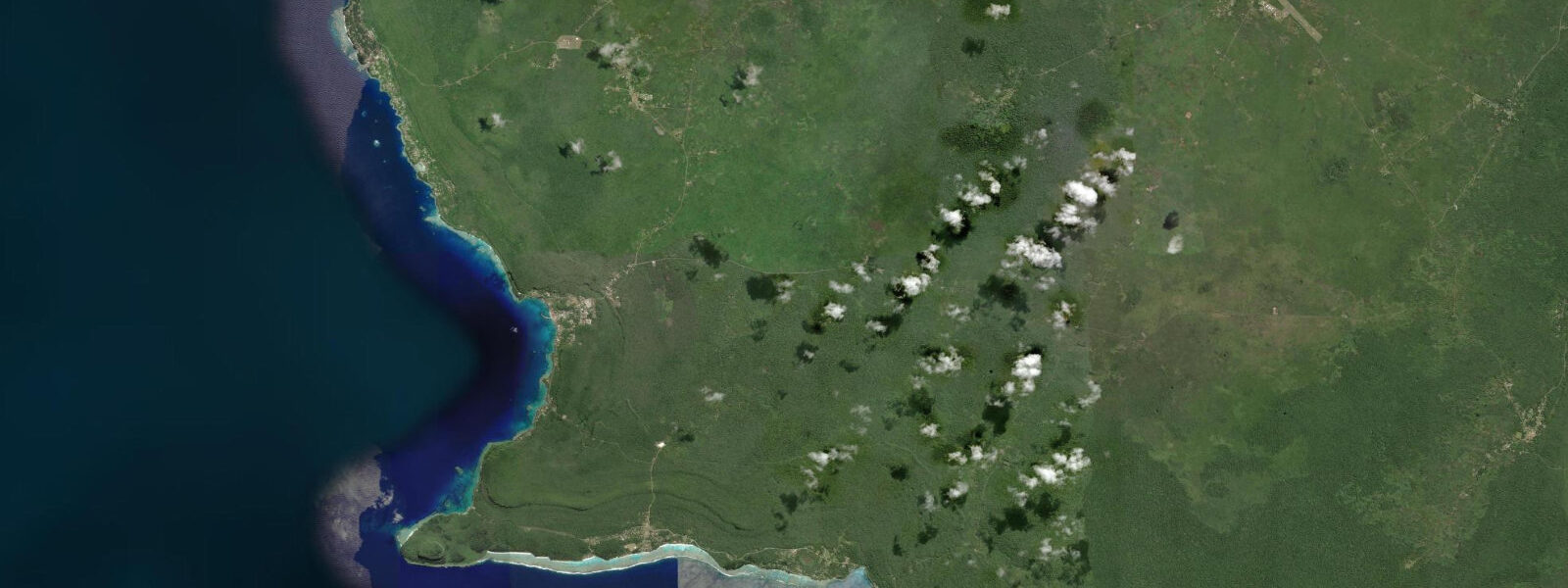
Ouvéa is the northernmost Loyalty Island, 25 km long and lying north-south in the Pacific east of New Caledonia's Grande Terre. The western side faces open Pacific across 150 km of blue water; a continuous barrier reef on the eastern side encloses a lagoon of exceptional clarity. The beach running the full western length of the island — through the settlements of Mouli, Fayaoué, and Wadrilla — is unbroken white coral sand, and the water colour shifts from glass-clear turquoise in the lagoon shallows to deep Pacific blue at the reef edge 5 km offshore. There are essentially no structures between the beach and the reef on the eastern horizon; the landscape is undisturbed in a way rare in the Pacific.
The island gained international attention in April and May 1988 when Kanak pro-independence militants took 30 French gendarmes hostage in a cave at Gossanah, on the northeastern part of the island. After 10 days of negotiation, French special forces assaulted the cave and killed 19 Kanak captives and 2 soldiers. The operation was conducted two days before the French parliamentary election — the timing generated a political scandal that has not fully resolved in the subsequent decades. The 19 Kanak killed are buried in the cemetery at the Gossanah site; the cave itself and the surrounding landscape carry the weight of that history. Visiting the memorial site with a local guide who can provide the community's account of events, rather than only the French government narrative, is the appropriate approach.
The Mouli Bridge at the southern end of the island is the tidal feature. The bridge spans a narrow channel connecting the western open Pacific to the eastern lagoon, and on the spring tides the tidal exchange through this constriction runs 2 to 3 knots. The current is visible as turbulence against the bridge pilings on both the flood and the ebb; the standing wave on the ebb side is photographable from the bridge deck. Anglers work the bridge pilings at the tide turns for barracuda, trevally, and the reef species using the current concentration; the 30-minute slack window either side of the high and low is when fish sit directly on the structure. Snorkellers who enter from the lagoon side on the last of the flood (before the ebb builds) can drift through the clear shallow channel between the pilings — visibility in the channel is 10 to 15 m when the lagoon is settled.
Pacific semidiurnal, spring range 0.8 to 1.2 m at Ouvéa. The Mouli channel current of 2 to 3 knots follows the predicted high and low by approximately 2 hours, as the lagoon volume introduces a lag in the channel flow timing. Predictions on this page come from Open-Meteo Marine (gridded model, ±45 min / ±0.2–0.3 m). The Ouvéa lagoon pearl farm at Fayaoué is one of the less-known pearl operations in New Caledonia; the lagoon's clarity and tidal flushing make it suitable for Pinctada margaritifera culture. Tours of the operation are available through the Fayaoué tourism office. The Ouvéa pearls tend toward darker overtones than the central Polynesian pearls; colour variation in a single growing site is wide. The Ouvéa lagoon runs the full length of the island and contains some of the clearest water in the Pacific; a UNESCO Marine Park designation covers the lagoon's northern section. Snorkelling the lagoon on the flood is recommended: the incoming water from the outside reef brings visibility to 30 m or more in the lagoon centre, while the ebb draws lagoonal water toward the passes and briefly reduces clarity. The coral reef on the ocean side of the northern tip is accessible by boat and offers wall diving from 10 to beyond 40 m; current at this exposed reef face can be strong at springs and dive timing should match the first two hours of the flood. The village of Fayaoué on the lagoon side has limited accommodation and services; most visitors arrive by Air Calédonie from Nouméa. The long Ouvéa beach on the lagoon shore stretches for over 25 km and the tidal excursion here — less than 1.5 m — means the beach retains width throughout the tidal cycle. White sand flats north of Fayaoué are walkable at low water to small motu.
Tide questions about Ouvéa, Loyalty Islands
Quick answers to the most common questions about tide times, range, and water access at Ouvéa, Loyalty Islands.
When is the next high tide at Ouvéa?
The hero block shows the next predicted high at Ouvéa in New Caledonia Time (NCT, UTC+11). Pacific semidiurnal, spring range 0.8 to 1.2 m. The Mouli Bridge tidal channel current builds approximately 2 hours after the predicted high and low, reaching 2 to 3 knots at the spring maximum. The 7-day table covers all tidal extremes. Predictions from Open-Meteo Marine (gridded model, ±45 min / ±0.2–0.3 m). The Mouli Pass current of 2 to 3 knots follows the predicted high and low by approximately 2 hours; plan snorkelling entry at the lagoon side around 2.5 hours before the predicted high for the best flood current window.
What is the tidal range at Ouvéa?
Spring range runs 0.8 to 1.2 m; neap range about 0.4 to 0.6 m. The barrier reef on the eastern side concentrates the tidal exchange through the Mouli Pass channel, producing 2 to 3 knot current even at the modest tidal heights of the Loyalty Islands. The current maximum follows the predicted high and low by about 2 hours. At the western beach, the visible tidal change is a 0.8 to 1.2 m level variation that alters the beach width by 20 to 40 m across the spring cycle.
Where do these predictions come from?
Open-Meteo Marine, a free gridded global ocean model, accuracy ±45 min / ±0.2–0.3 m. SHOM publishes authoritative tidal predictions for New Caledonia; the Ouvéa reference station is Fayaoué in the central part of the island. The Mouli channel current timing lags the predicted coastal high and low by approximately 2 hours due to the lagoon volume phase shift. SHOM publishes tidal data for Ouvéa; the Fayaoué reference station is in the SHOM tide tables. The 2-hour lag between the coastal prediction and the Mouli Pass current maximum is a consistent local offset.
Is the beach accessible from Fayaoué on Ouvéa?
Yes. The beach at Fayaoué, the island's main settlement, is directly accessible from the road and is the primary visitor beach. The 25 km stretch from Mouli in the south to Wadrilla in the north is mostly accessible by road with tracks to the beach at intervals. Most of the beach is on Kanak customary land; the guesthouses and the Ouvéa tourism office navigate access arrangements as part of their normal operations. Some remote northern sections require passing through village land — the standard courteous protocol of informing the local chief applies for extended walks.
Is this safe to use for navigation?
No. TideTurtle is a planning tool. The Mouli Pass channel runs 2 to 3 knots and is a navigational hazard on the spring ebb; the eastern barrier reef has limited marked passages with poorly charted coral heads between them. Use SHOM chart products for vessel operations around Ouvéa. The Mouli Pass channel runs 2 to 3 knots at springs and creates standing waves at the entrance on the ebb; SHOM chart products are required for vessel navigation around Ouvéa and the eastern barrier reef.
8-day tide table — Ouvéa, Loyalty Islands
Heights relative to MSL. Predictions: Open-Meteo Marine (MeteoFrance SMOC, 0.08° grid) — heights relative to MSL (not chart datum / LAT). Model-derived.
| Day | Type | Time | Height |
|---|---|---|---|
| Sat 04 Jul | High | 11:00 | 0.5m |
| Low | 14:16 | 0.1m | |
| High | 21:10 | 1.0m | |
| Sun 05 Jul | Low | 03:06 | 0.5m |
| High | 08:21 | 0.9m | |
| Low | 15:00 | 0.2m | |
| High | 21:52 | 1.0m | |
| Mon 06 Jul | Low | 04:06 | 0.5m |
| High | 09:20 | 0.8m | |
| Low | 15:38 | 0.3m | |
| Tue 07 Jul | High | 23:12 | 1.0m |
| Wed 08 Jul | Low | 06:00 | 0.3m |
| Thu 09 Jul | High | 00:00 | 1.1m |
| Low | 06:56 | 0.3m | |
| High | 13:10 | 0.8m | |
| Low | 18:21 | 0.5m | |
| Fri 10 Jul | High | 00:50 | 1.1m |
| Low | 07:47 | 0.2m | |
| High | 14:22 | 0.9m | |
| Low | 19:37 | 0.5m | |
| Sat 11 Jul | High | 01:42 | 1.1m |
| Low | 08:42 | 0.1m |