Lifou, Loyalty Islands tide times
Lifou, Loyalty Islands tide forecast — heights relative to MSL.
Today's tide times for Lifou, Loyalty Islands
Tide times at Lifou, Loyalty Islands on Saturday, 4 July 2026: first high tide at 11:00am, first low tide at 02:22pm, second high tide at 09:12pm. Sunrise 06:28am, sunset 05:22pm.
Tide chart for Lifou, Loyalty Islands
24-hour cosine-interpolated curve around the present moment. Heights relative to MSL. Predictions: Predictions: Open-Meteo Marine (MeteoFrance SMOC, 0.08° grid).
Sun, moon and conditions on Sat 04 Jul
Snapshot at build time — refreshes daily. Sea state from Open-Meteo Marine.
Highs and lows next 7 days
Every predicted high and low for the next week, with the daily tidal coefficient (0–120; higher = bigger swing, > 95 means stronger currents).
Other spots nearby
The three closest curated TideTurtle locations to Lifou, Loyalty Islands, measured by great-circle distance.
Today's solunar windows
Solunar tradition: major periods are the ≈3h windows around moon transit and opposition; minor are ≈2h around moonrise and moonset. Pair with the local tide stage and wind for the best read.
Cycle dates near Lifou, Loyalty Islands
Last spring tide on Sat 04 Jul (range 0.9m). Next spring tide on Fri 10 Jul (range 1.0m). Next neap on Tue 07 Jul.
Spring tides cluster around new and full moons (biggest swings). Neap tides land on quarter moons (smallest swings). See the spring tide and neap tide glossary entries for the why.
About tides at Lifou, Loyalty Islands
A short guide to the coastline at Lifou, Loyalty Islands — geography, sea state, and what the tide is actually doing under your feet.
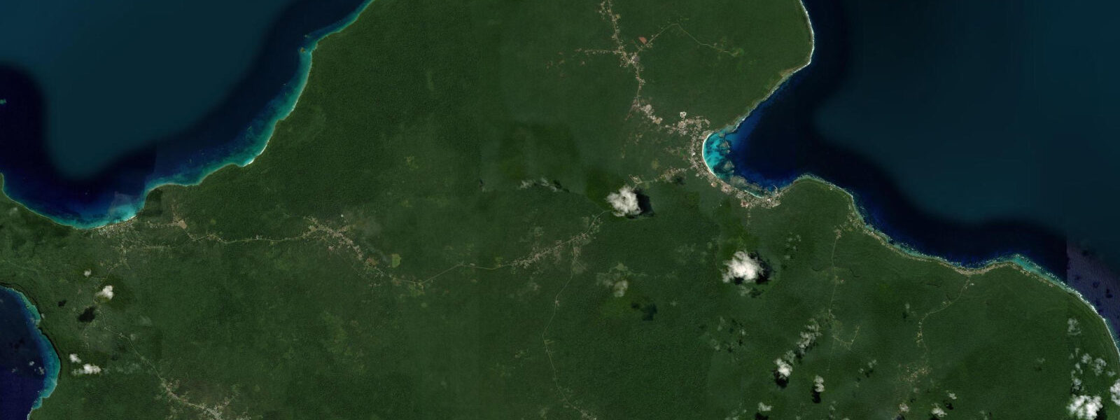
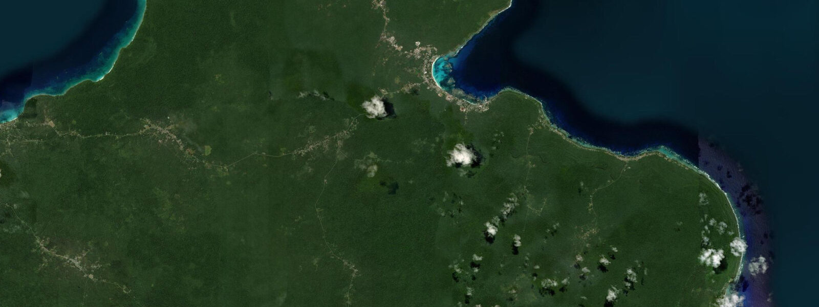
Lifou is the largest of the Loyalty Islands, 45 km long, a raised coral atoll elevated 10 to 30 m above sea level as the Pacific Plate moved over an underlying hotspot. There is no volcanic core, no surface rivers, and no beach sand of volcanic origin anywhere on the island. The entire surface is porous limestone, the freshwater held in cisterns and underground pools recharged by rainfall. The coast is a series of bays, limestone coves, and cliff sections alternating in rough proportion around the island perimeter, connected by a single main road and a network of tracks to the 13 traditional chiefdoms.
Wé is the administrative capital and the main town, holding the island's airstrip (daily flights from Nouméa, 45 minutes), a covered market, government offices, and a handful of guesthouses and restaurants. The airstrip is the primary access route; the sea catamaran from Nouméa reaches Lifou in 5 to 6 hours but runs on limited schedule.
The Jokin cliffs on the northeastern coast are the most unusual coastal feature: smooth limestone walls dropping 10 to 15 m into a turquoise bay, used by the local Kanak community at Jokin village as a traditional access point to the sea. The cliff-jumping is not a performance — it is how the people of Jokin enter the water from a shoreline that has no beach or gradual entry point. The act of jumping from the top of the cliff into the bay below the rock is part of the daily relationship between the village and the sea. Visitors who arrive with a local guide and appropriate introduction from the Jokin chief are welcome to observe and, if the guide considers it appropriate, to participate. The current at the cliff base on the outgoing tide runs 0.5 to 1.0 knots, and the experienced locals choose their entry positions and angles to account for it.
Easo Bay on the northwestern coast is the turtle snorkelling destination. Green and hawksbill turtles are resident on the bay reef, feeding on the seagrass and algae in 1 to 4 m of water, and surface regularly within the bay in front of the beach. The reef edge is 50 to 100 m from the beach; intermediate swimmers reach it easily. The tidal state affects the water clarity — the spring low exposes some of the seagrass area to very shallow water (0.3 to 0.5 m) and wading access is possible near the beach for the 1 to 2 hours around the low. At the spring high, the full reef area is covered by 1.5 to 2 m of water and swimming throughout the turtle zone is comfortable.
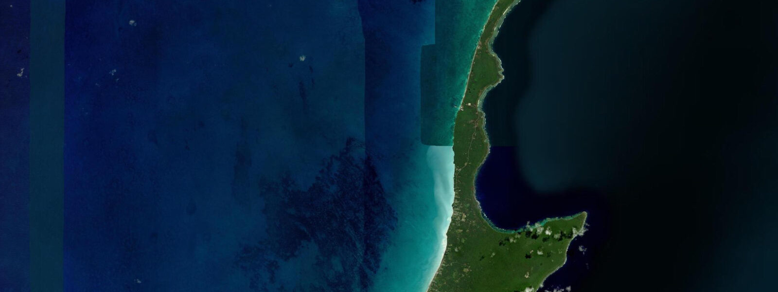
Xodre Beach on the south coast is a broad, undeveloped sandy bay accessible by a short track from the main road. The Pacific tidal regime here is semidiurnal, spring range 0.8 to 1.2 m. Predictions on this page come from Open-Meteo Marine (gridded model, ±45 min / ±0.2–0.3 m). The Drehu language, spoken by the people of Lifou, is the most widely spoken Kanak language in New Caledonia — approximately 12,000 speakers — and a member of the Oceanic language family quite distinct from French. Lifou is one of the centres of Kanak literary and artistic production in New Caledonia; the annual Kanak cultural festival Je Suis Kanak is held on Lifou when the schedule falls there. The festival is publicly accessible and includes traditional music, dance, weaving, and cooking demonstrations. The coast north of Wé at Luengöni Beach has a shallow reef lagoon of exceptional clarity; snorkelling conditions are best on the late flood when clean ocean water has pushed completely into the lagoon and replaced the overnight lagoonal water. The beach at Luengöni is publicly accessible and backed by pine and coconut; the tidal excursion of roughly 1.2 m means the beach retains usable width throughout the day. Kayaking south from Wé toward the Jozip headland takes roughly 2 hours on the flood and returns easily on the ebb; the paddle passes several small cliff formations that are only visible from the water. The seasonal spiny lobster fishery around Lifou operates under traditional Kanak resource management rules; the harvest window is set by the tribal authority and does not necessarily align with any particular tidal period, though lobsters are most active at night on the ebb.
Tide questions about Lifou, Loyalty Islands
Quick answers to the most common questions about tide times, range, and water access at Lifou, Loyalty Islands.
When is the next high tide at Lifou?
The hero block shows the next predicted high at Lifou in New Caledonia Time (NCT, UTC+11). Pacific semidiurnal, spring range 0.8 to 1.2 m. Easo Bay reef access is comfortable at the spring high (1.5 to 2 m of water throughout the turtle zone); the spring low exposes the inner seagrass to 0.3 to 0.5 m, allowing wading access. The Jokin cliffs water level changes by 0.8 to 1.2 m across the spring tidal cycle. Predictions from Open-Meteo Marine (gridded model, ±45 min / ±0.2–0.3 m).
What is the tidal range at Lifou?
Spring range runs 0.8 to 1.2 m; neap range about 0.4 to 0.6 m. The raised limestone coast has limited intertidal platform — most of the coastline is cliff dropping into deep water, not a sloping rock shelf. The tidal change is most visible as a water-level variation in the protected bays: at spring high, Easo Bay is deepest and calmest; at spring low, the inner reef flat is shallowest and most accessible on foot. The raised limestone coast means most of Lifou's shoreline is cliff rather than sloping beach; the accessible intertidal zone is concentrated in the protected bays where the raised platform steps down to the sea level.
Where do these predictions come from?
Open-Meteo Marine, a free gridded global ocean model, accuracy ±45 min / ±0.2–0.3 m. SHOM publishes authoritative tidal predictions for New Caledonia including the Loyalty Islands; the Lifou reference station is Wé and is included in SHOM tide tables for gauge-calibrated timing. SHOM publishes tidal data for the Loyalty Islands; the Wé (Lifou) reference station is in the SHOM tide tables, available through the SHOM website. Official tide tables for Loyalty Islands ports are produced by SHOM (Service Hydrographique et Océanographique de la Marine); these are the reference source for navigation-grade predictions.
Can I access the Jokin cliffs?
Yes, with appropriate community access. The Jokin cliffs are on the customary land of the Jokin village chief. Contact the Lifou tourism office in Wé or arrange through your accommodation for a guide with the right community connections. The standard protocol is a meeting with the local chief, a customary payment, and a guided walk to the cliff. The guide advises on which entry point is appropriate for the current sea state and tide level. Jumping without local guidance is not recommended: the entry angles, current direction at the cliff base, and the specific safe water depth in each spot are known to the village and need to be communicated.
Is this safe to use for navigation?
No. TideTurtle is a planning tool. The Loyalty Islands are surrounded by reef and the approaches require proper chart navigation. SHOM chart products cover New Caledonian and Loyalty Islands waters for vessel operations. Lifou's eastern coast has a continuous reef with limited marked passages; SHOM chart products are required for vessel navigation around the Loyalty Islands. For vessel navigation in New Caledonia and Loyalty Islands waters, use SHOM chart products and the official SHOM tide tables. TideTurtle presents Open-Meteo Marine gridded model data — accuracy ±45 min / ±0.2–0.3 m — intended for coastal planning, not vessel navigation.
8-day tide table — Lifou, Loyalty Islands
Heights relative to MSL. Predictions: Open-Meteo Marine (MeteoFrance SMOC, 0.08° grid) — heights relative to MSL (not chart datum / LAT). Model-derived.
| Day | Type | Time | Height |
|---|---|---|---|
| Sat 04 Jul | High | 11:00 | 0.5m |
| Low | 14:22 | 0.1m | |
| High | 21:12 | 1.0m | |
| Sun 05 Jul | Low | 15:04 | 0.2m |
| High | 21:52 | 1.0m | |
| Mon 06 Jul | Low | 04:10 | 0.5m |
| High | 09:21 | 0.8m | |
| Low | 15:45 | 0.3m | |
| Tue 07 Jul | High | 23:12 | 1.1m |
| Wed 08 Jul | Low | 06:00 | 0.4m |
| Thu 09 Jul | High | 00:00 | 1.1m |
| Low | 06:52 | 0.3m | |
| Fri 10 Jul | High | 00:52 | 1.1m |
| Low | 07:50 | 0.2m | |
| High | 14:22 | 0.9m | |
| Low | 19:37 | 0.5m | |
| Sat 11 Jul | High | 01:43 | 1.1m |
| Low | 08:46 | 0.1m |