
Walvis Bay tide times
Walvis Bay tide forecast — heights relative to MSL.
Today's tide times for Walvis Bay
Tide times at Walvis Bay on Saturday, 4 July 2026: first low tide at 11:14am, first high tide at 05:43pm, second low tide at 11:57pm. Sunrise 07:43am, sunset 06:28pm.
Tide chart for Walvis Bay
24-hour cosine-interpolated curve around the present moment. Heights relative to MSL. Predictions: Predictions: Open-Meteo Marine (MeteoFrance SMOC, 0.08° grid).
Sun, moon and conditions on Sat 04 Jul
Snapshot at build time — refreshes daily. Sea state from Open-Meteo Marine.
Highs and lows next 7 days
Every predicted high and low for the next week, with the daily tidal coefficient (0–120; higher = bigger swing, > 95 means stronger currents).
Other spots nearby
The three closest curated TideTurtle locations to Walvis Bay, measured by great-circle distance.
Today's solunar windows
Solunar tradition: major periods are the ≈3h windows around moon transit and opposition; minor are ≈2h around moonrise and moonset. Pair with the local tide stage and wind for the best read.
Cycle dates near Walvis Bay
Last spring tide on Sat 04 Jul (range 1.1m). Next spring tide on Fri 10 Jul (range 0.9m). Next neap on Wed 08 Jul.
Spring tides cluster around new and full moons (biggest swings). Neap tides land on quarter moons (smallest swings). See the spring tide and neap tide glossary entries for the why.
About tides at Walvis Bay
A short guide to the coastline at Walvis Bay — geography, sea state, and what the tide is actually doing under your feet.
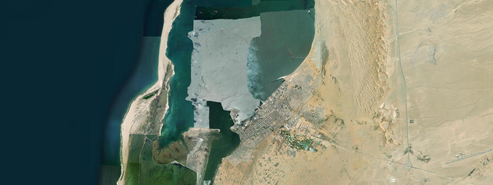
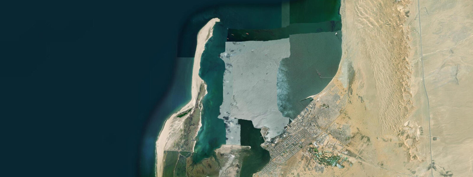
Walvis Bay is Namibia's main commercial port and, simultaneously, the site of one of the most significant coastal wetlands in the southern hemisphere. The lagoon on the southern side of the bay is RAMSAR-listed and supports populations of birds that are globally significant by any measure: 60,000 or more greater flamingo gather on the tidal mudflats, and the lagoon holds up to 80 percent of the world population of the chestnut-banded plover. That these numbers coexist with an active container port, a diamond industry, and one of Africa's most productive fishing fleets is not a paradox the landscape resolves neatly — it simply contains all of it.
The tidal regime at Walvis Bay is mixed semidiurnal, with spring tidal range of approximately 1.5 to 2.0 metres. At low water on a spring tide, the lagoon mudflat is exposed across a broad area — in the shallower sections, the water retreats 1.5 to 2 kilometres from the road edge, and the flamingo that were wading at depth are left standing in ankle-deep water or walking across exposed mud. At high water, the lagoon fills and the flamingo distribution spreads and deepens, less concentrated but more dramatic in the way that a fully flooded, pink-scattered lagoon appears from the road. Both states are worth seeing; the low-water spring tide is the most accessible for photography from the shore.
Kayaking the lagoon is the most direct way to experience it. Licensed operators run tours from the waterfront that paddle directly into the flamingo and pelican feeding flocks; the pelicans (both great white and pink-backed are present) are tolerant of kayaks at distances of 10 to 20 metres, and the flamingo, approached slowly and from downwind, allow reasonable proximity. Cape fur seals haul out at several points inside the lagoon and are reliably curious — they approach kayaks and body-surf in bow wakes. The tidal window that matters for kayak tours is the mid-water period, roughly two hours either side of high water: the channels are navigable but not so full that the birds are dispersed into the deeper sections.
The oyster farms operate in the lagoon's sheltered eastern arm. The cold, nutrient-rich Benguela water at 12-15°C produces slow-growing, dense-bodied Pacific oysters (Crassostrea gigas) farmed from suspended longlines. Tours of the oyster farm include a boat trip through the lines with harvesting demonstration and a tasting at the water's edge — the combination of cold water, sea smell, and oysters consumed within sight of the farm is straightforwardly good. Book in advance in the December-January peak season; capacity is limited.
The port itself is the economic centre of Walvis Bay. Container throughput from the port serves landlocked Zambia, Zimbabwe, Botswana, and the DRC via the Trans-Caprivi Highway corridor — Walvis Bay functions as the effective deep-water port for much of southern Africa's interior. Alongside containers, the port moves uranium oxide concentrate from Namibia's mines (the country is among the top five uranium producers globally) and the catch from one of the southern hemisphere's most productive fishing fleets. Pilchards and anchovy are the target of the industrial fleet; horse mackerel (Atlantic chub mackerel locally) is the largest volume species by tonnage.
The diamond offshore industry is visible from the port and waterfront. Marine diamond dredge vessels — modified trailing suction hopper dredges — work the seabed on the Namibian continental shelf and are regularly visible at anchor or transiting from the harbour. The offshore operation recovers diamonds that were transported from the Kalahari by rivers and deposited in seabed gravels over millions of years; the current offshore dredge fleet is operated principally by Debmarine Namibia, a joint venture between De Beers and the Namibian government.
Sandwich Harbour, 50 kilometres south of Walvis Bay along the coast road, is accessible only by 4WD at low tide — the track crosses tidal flats and is impassable within two hours either side of high water. The lagoon at Sandwich Harbour is RAMSAR-listed separately from Walvis Bay and holds comparable bird concentrations in a more remote setting, with dunes running directly into the lagoon edge. The tide timing for the access track is non-negotiable; check the tide table and plan departure from Walvis Bay no later than three hours before low water.
For shore fishing, the southern breakwater and the rocks at the lagoon entrance hold kabeljou (kob), steenbras, and elf (bluefish). The flood tide concentrates fish against the structure; the two hours before high water is the most consistent period.
Predictions on this page come from Open-Meteo Marine, a gridded global ocean model. Accuracy is typically within plus or minus 45 minutes on timing and 0.2 to 0.3 metres on height — model-derived, not from a local gauge. The authoritative national sources for tidal and maritime data on the Namibian coast are the Namibian Meteorological Service and the Namibia Ports Authority.
Tide questions about Walvis Bay
Quick answers to the most common questions about tide times, range, and water access at Walvis Bay.
When is the best time to see the flamingos at Walvis Bay Lagoon?
Greater flamingo are present at Walvis Bay Lagoon year-round in numbers exceeding 60,000. The most productive viewing condition is a spring low tide — the mudflat exposure at low water on a spring cycle can extend 1.5 to 2 kilometres from the road edge, concentrating the birds in shallow sections very close to the shore drive. Mid-morning, after the advection fog has lifted but before midday heat creates heat shimmer, gives the clearest conditions for photography. The lagoon road (the B2 south of Walvis Bay town, turning onto the waterfront drive) gives 4 to 5 kilometres of unobstructed lagoon viewing from a vehicle. November through January also brings migratory waders from the northern hemisphere in large numbers, adding to the total bird count.
How do oyster farm tours work and what do they involve?
Oyster farm tours depart from the Walvis Bay waterfront and operate by small boat through the longline rafts in the lagoon's eastern arm. The Pacific oysters (Crassostrea gigas) are grown on suspended lines in the cold Benguela water — the slow growth in 12-15°C water produces dense, firm-bodied oysters with a clean saline flavour distinct from warmer-water farmed oysters. Tours typically run 1.5 to 2 hours, include a harvesting demonstration, and end with an oyster tasting at the lagoon edge. Book directly with the farm operators in Walvis Bay; capacity per tour is small (6-12 people). Peak season is December through January — book a week or more ahead.
Can I access Sandwich Harbour from Walvis Bay, and what do the tides mean for access?
Sandwich Harbour is 50 kilometres south of Walvis Bay along the Namib coast and requires a 4WD vehicle for the beach and tidal flat section of the route. The final 15 to 20 kilometres crosses tidal flats that flood within two hours either side of high water — a low-slung vehicle on this section at the wrong tidal moment will be stranded in water. Check the tide table for Walvis Bay, depart no later than three hours before low water, and plan to be back on the tidal flat section no more than two hours after low water. This timing window is not advisory; it is a physical constraint. Guided 4WD tours from Walvis Bay manage the timing correctly. Independent access requires a Namibia National Parks permit.
What makes the fishing fleet at Walvis Bay significant?
Walvis Bay is the operational base for one of the most productive fishing fleets in the southern hemisphere. The cold, nutrient-rich Benguela upwelling supports enormous fish biomass — pilchards and anchovy dominate the small pelagic harvest; Atlantic chub mackerel (horse mackerel locally) represents the largest tonnage landed. The hake trawl fishery is certified by the Marine Stewardship Council (MSC) and is among the largest MSC-certified fisheries in Africa. Rock lobster (crayfish) are cold-water species caught from the surf zone and reef along the entire Namibian coast; the Walvis Bay canning and processing industry handles both the pelagic and rock lobster harvest.
What is the tidal range at Walvis Bay and how does it affect the lagoon?
Walvis Bay has a mixed semidiurnal tidal pattern with a spring range of approximately 1.5 to 2.0 metres. The tidal exchange through the lagoon entrance drives the entire ecological functioning of the wetland: at flood tide, nutrient-rich seawater enters and distributes across the mudflat, bringing the microscopic diatoms and invertebrates that flamingo filter-feed on; at ebb tide, the water drains and the mudflat is exposed. The flamingo distribution tracks this cycle — at high water they wade in deeper sections; at low water they spread across the exposed flat. Spring tides expose more mudflat than neaps and generally produce higher concentrations of birds in accessible shallows.
7-day tide table — Walvis Bay
Heights relative to MSL. Predictions: Open-Meteo Marine (MeteoFrance SMOC, 0.08° grid) — heights relative to MSL (not chart datum / LAT). Model-derived.
| Day | Type | Time | Height |
|---|---|---|---|
| Sat 04 Jul | Low | 11:14 | -0.8m |
| High | 17:43 | 0.3m | |
| Low | 23:57 | -0.8m | |
| Sun 05 Jul | High | 06:08 | 0.1m |
| Low | 11:57 | -0.7m | |
| High | 18:17 | 0.3m | |
| Mon 06 Jul | Low | 00:40 | -0.8m |
| High | 06:57 | 0.1m | |
| Low | 12:46 | -0.6m | |
| High | 19:02 | 0.2m | |
| Tue 07 Jul | Low | 13:37 | -0.6m |
| High | 19:55 | 0.1m | |
| Wed 08 Jul | Low | 14:56 | -0.6m |
| High | 21:00 | 0.1m | |
| Thu 09 Jul | Low | 03:37 | -0.8m |
| High | 10:10 | 0.1m | |
| Low | 16:15 | -0.6m | |
| High | 22:12 | 0.1m | |
| Fri 10 Jul | Low | 04:50 | -0.8m |
| High | 11:19 | 0.1m | |
| Low | 17:24 | -0.7m | |
| High | 23:36 | 0.1m |