Pelican Point tide times
Pelican Point tide forecast — heights relative to MSL.
Today's tide times for Pelican Point
Tide times at Pelican Point on Saturday, 4 July 2026: first low tide at 11:14am, first high tide at 05:43pm, second low tide at 11:57pm. Sunrise 07:43am, sunset 06:29pm.
Tide chart for Pelican Point
24-hour cosine-interpolated curve around the present moment. Heights relative to MSL. Predictions: Predictions: Open-Meteo Marine (MeteoFrance SMOC, 0.08° grid).
Sun, moon and conditions on Sat 04 Jul
Snapshot at build time — refreshes daily. Sea state from Open-Meteo Marine.
Highs and lows next 7 days
Every predicted high and low for the next week, with the daily tidal coefficient (0–120; higher = bigger swing, > 95 means stronger currents).
Other spots nearby
The three closest curated TideTurtle locations to Pelican Point, measured by great-circle distance.

Today's solunar windows
Solunar tradition: major periods are the ≈3h windows around moon transit and opposition; minor are ≈2h around moonrise and moonset. Pair with the local tide stage and wind for the best read.
Cycle dates near Pelican Point
Last spring tide on Sat 04 Jul (range 1.1m). Next spring tide on Fri 10 Jul (range 0.9m). Next neap on Wed 08 Jul.
Spring tides cluster around new and full moons (biggest swings). Neap tides land on quarter moons (smallest swings). See the spring tide and neap tide glossary entries for the why.
About tides at Pelican Point
A short guide to the coastline at Pelican Point — geography, sea state, and what the tide is actually doing under your feet.
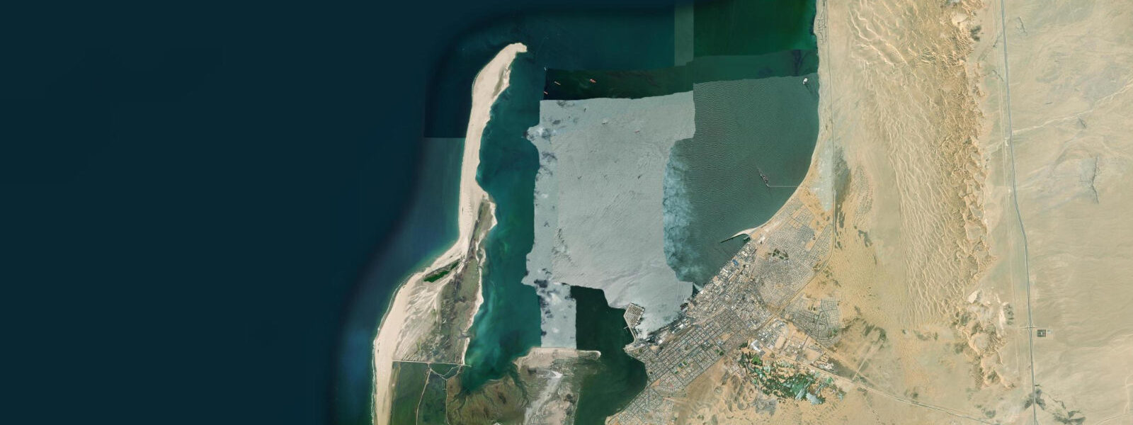
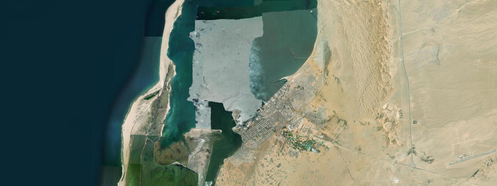
Pelican Point is a narrow sand spit projecting into the mouth of Walvis Bay Lagoon, its tip marked by a lighthouse and its shores occupied by one of the largest Cape fur seal colonies on the Namibian coast. The spit is low-lying, wind-scoured, and populated almost entirely by wildlife — there is nothing here for human comfort except the lighthouse keeper's quarters and, at the right tidal moment, the extraordinary experience of paddling through 15,000 seals.
The Cape fur seal colony at Pelican Point numbers roughly 15,000 to 20,000 animals, making it one of the largest accessible seal aggregations in southern Africa. The colony is not shy of kayaks. Seals enter the water in the tidal channels alongside the spit and actively approach paddlers — they investigate keels, surface alongside hulls, and body-surf the pressure wave off a kayak bow in a way that is unmistakably deliberate. Juveniles are the most interactive; adult bulls are more territorial and should be given space. Kayak operators from Walvis Bay run tours that paddle the spit perimeter and enter the channel between the spit and the main lagoon body, where the current runs at 1 to 1.5 knots on a spring tide.
That channel — the lagoon entrance — is where the tidal dynamics of Pelican Point become practically relevant. The tidal prism flowing in and out of the Walvis Bay Lagoon passes through the narrow channel between Pelican Point and the southern shore of the bay. On a spring tide, the flow accelerates through the constriction to moderate current speeds, running flood (into the lagoon) through the rising tide and ebb (out of the bay) through the falling tide. The current at the channel narrows is noticeable to a kayaker — paddling against a 1.5-knot ebb requires effort — and provides a genuine water-reading exercise. Going with the flood gives an effortless glide into the lagoon body; the return is helped by the incoming ebb if timed correctly.
The lighthouse at Pelican Point dates from 1910. It is a red-and-white striped structure standing approximately 19 metres above the spit, active as a navigational aid for vessels entering Walvis Bay. The lighthouse is not open to the public in the normal tourist sense, but the tour boats that operate from Walvis Bay approach the spit and the structure is clearly visible from the water. The keeper's quarters and ancillary buildings are occupied.
The bird populations at the point are exceptional. Great white pelicans and pink-backed pelicans both feed in the tidal channels; at high water, when the channel is full, they float in loose groups at the entrance and dive on fish concentrated by the current. Cape cormorants nest on the spit in their thousands — dense, jostling colonies that produce an extraordinary amount of guano and noise. Kelp gull, swift tern, and African penguin are all present, though the penguin numbers are small compared to colonies further south toward Lüderitz.
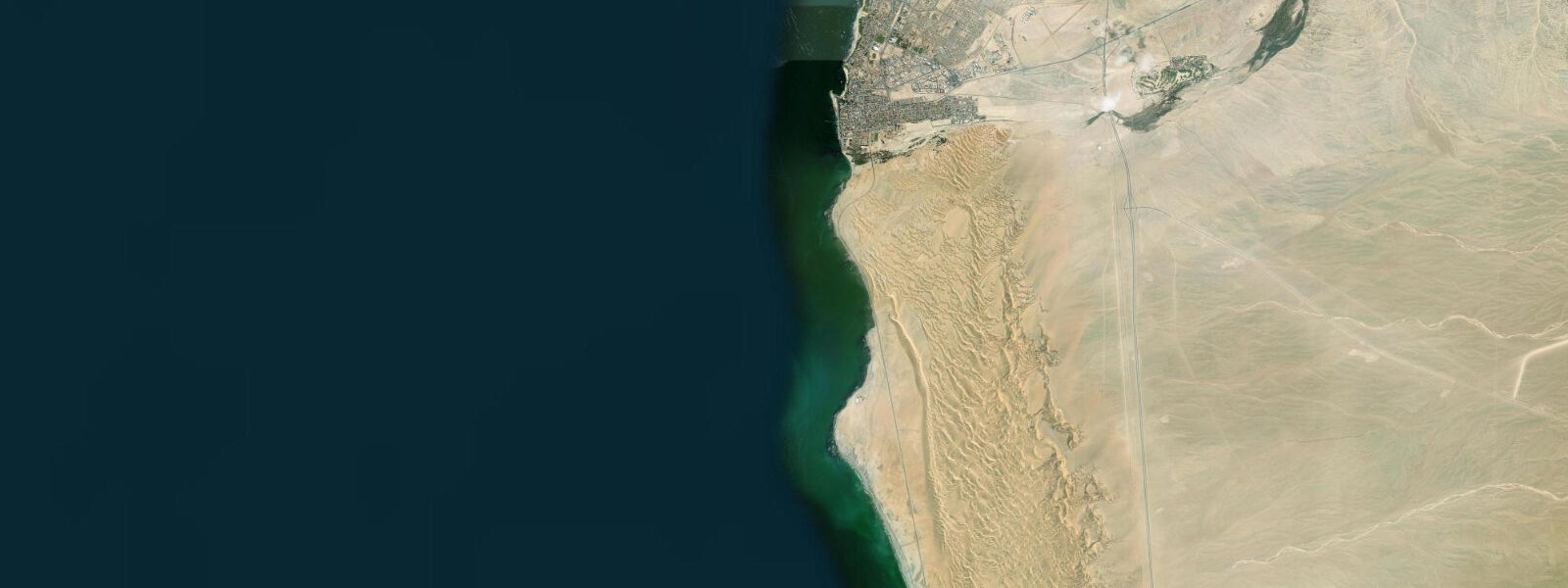
The spit itself can be accessed by 4WD vehicle along the beach track from Walvis Bay at low tide. The access requires driving the exposed tidal flat for a section and is not possible at high water. Independent vehicles need to time arrival for low water on a spring tide and be off the track before the tide returns; guided tours manage this timing. Most visitors choose the kayak approach, which has no tidal access restriction — the channel is navigable at all tidal heights, though the current strength and direction vary.
Wildlife photography from the water is particularly productive at Pelican Point because of the seals' comfort with close approach. A 200-400mm focal length is appropriate for close-range seal portraiture from a kayak; wider angles capture the scale of the colony from offshore. Morning light, after the fog has lifted (usually by 10:00-11:00), is the most useful for colour photography. The spit orientation means that the colony face is side-lit in the morning and front-lit in the afternoon.
For the widest tidal channel current at the lagoon entrance, plan the kayak tour to coincide with the mid-ebb — the last two hours of the outgoing tide produce the fastest flow through the constriction and the most concentrated bait-fish activity. Pelicans fishing in a tidal rip, seals riding the current, and the lighthouse in the background — the combination is compact and genuinely extraordinary.
Predictions on this page come from Open-Meteo Marine, a gridded global ocean model. Accuracy is typically within plus or minus 45 minutes on timing and 0.2 to 0.3 metres on height — model-derived, not from a local gauge. The authoritative national sources for tidal and maritime data on the Namibian coast are the Namibian Meteorological Service and the Namibia Ports Authority.
Tide questions about Pelican Point
Quick answers to the most common questions about tide times, range, and water access at Pelican Point.
How do I visit Pelican Point — kayak tour or 4WD?
Both options are workable. Kayak tours depart from the Walvis Bay waterfront and paddle to the spit — the journey takes 30 to 45 minutes one-way and the tours typically spend 1.5 to 2 hours at the spit perimeter before returning. No tidal restriction applies to the kayak approach; the channel is navigable at all heights, though the current direction and strength vary. 4WD vehicle access via the beach track requires low water on a spring tide — the track crosses tidal flats that flood around high water. Most first-time visitors find the kayak tour more rewarding because the water-level perspective makes the seal interaction far more engaging than viewing the colony from a vehicle on the spit.
How strong is the current at the Pelican Point tidal channel?
The channel between Pelican Point and the southern shore of Walvis Bay is the main entrance to the lagoon. The entire tidal prism of the lagoon — a large body of water — flows in and out through this constriction on each tidal cycle. On spring tides, current speeds in the channel run approximately 1 to 1.5 knots. This is noticeable but not dangerous for competent paddlers in a stable sea kayak; it requires genuine effort to paddle against on the ebb and gives a useful assist when running with the flood. Kayak tour operators are aware of the current timing and factor it into tour structure. Independent kayakers should plan to enter the lagoon on the flood and exit on the flood, avoiding the ebb current at the narrows.
How many seals are at Pelican Point and are they safe to approach?
The Cape fur seal colony at Pelican Point numbers roughly 15,000 to 20,000 animals. The colony is tolerant of kayaks at close range — seals regularly approach paddlers, surface alongside hulls, and body-surf bow wakes. Juveniles are the most interactive; adult bulls, particularly during the December-January breeding season, should be given more space as they are territorial and will vocalize aggressively if closely approached. From a kayak, maintain a few metres of clearance from hauled-out animals on the spit edge. Seals in the water will approach on their own terms. Do not attempt to touch them; their bite is strong and their teeth are sharp.
What birds can I expect to see at Pelican Point?
Great white pelicans and pink-backed pelicans feed in the tidal channel — the current concentrates small fish, and pelicans fish the rip actively. Cape cormorants nest in large numbers on the spit. African penguin are present in small numbers; the nearest significant penguin colony is at Halifax Island near Lüderitz. Kelp gull, swift tern, sandwich tern, and Hartlaub's gull are regular along the spit. Flamingo from the Walvis Bay Lagoon body are visible at high water when they float close to the lagoon entrance. Chestnut-banded plover, one of the globally significant species in the lagoon, can be found on the spit perimeter at low water on exposed sandy areas.
What does the Pelican Point lighthouse look like and can I go inside?
The lighthouse is a red-and-white striped tower approximately 19 metres tall, built in 1910 and still active as a navigational aid for vessels entering Walvis Bay. It stands at the tip of the spit beside the keeper's quarters. It is not open to the public for interior visits — the structure is a working lighthouse and the compound is occupied. It is clearly visible from the water on kayak tours and from the spit road for 4WD visitors. The lighthouse appears on the Official Namibian Lighthouse Heritage list; its position at the lagoon mouth makes it a useful navigation reference for boat operators entering and leaving the bay.
7-day tide table — Pelican Point
Heights relative to MSL. Predictions: Open-Meteo Marine (MeteoFrance SMOC, 0.08° grid) — heights relative to MSL (not chart datum / LAT). Model-derived.
| Day | Type | Time | Height |
|---|---|---|---|
| Sat 04 Jul | Low | 11:14 | -0.8m |
| High | 17:43 | 0.3m | |
| Low | 23:57 | -0.8m | |
| Sun 05 Jul | High | 06:08 | 0.1m |
| Low | 11:57 | -0.7m | |
| High | 18:17 | 0.3m | |
| Mon 06 Jul | Low | 00:40 | -0.8m |
| High | 06:57 | 0.1m | |
| Low | 12:46 | -0.6m | |
| High | 19:02 | 0.2m | |
| Tue 07 Jul | Low | 13:37 | -0.6m |
| High | 19:55 | 0.1m | |
| Wed 08 Jul | Low | 14:56 | -0.6m |
| High | 21:00 | 0.1m | |
| Thu 09 Jul | Low | 03:37 | -0.8m |
| High | 10:10 | 0.1m | |
| Low | 16:15 | -0.6m | |
| High | 22:12 | 0.1m | |
| Fri 10 Jul | Low | 04:50 | -0.8m |
| High | 11:19 | 0.1m | |
| Low | 17:24 | -0.7m | |
| High | 23:36 | 0.1m |