Swakopmund tide times
Swakopmund tide forecast — heights relative to MSL.
Today's tide times for Swakopmund
Tide times at Swakopmund on Saturday, 27 June 2026: first high tide at 02:00am, first low tide at 07:16am, second high tide at 02:02pm, second low tide at 07:50pm. Sunrise 07:42am, sunset 06:27pm.
Tide chart for Swakopmund
24-hour cosine-interpolated curve around the present moment. Heights relative to MSL. Predictions: Predictions: Open-Meteo Marine (MeteoFrance SMOC, 0.08° grid).
Sun, moon and conditions on Sat 27 Jun
Snapshot at build time — refreshes daily. Sea state from Open-Meteo Marine.
Highs and lows next 7 days
Every predicted high and low for the next week, with the daily tidal coefficient (0–120; higher = bigger swing, > 95 means stronger currents).
Other spots nearby
The three closest curated TideTurtle locations to Swakopmund, measured by great-circle distance.

Today's solunar windows
Solunar tradition: major periods are the ≈3h windows around moon transit and opposition; minor are ≈2h around moonrise and moonset. Pair with the local tide stage and wind for the best read.
Cycle dates near Swakopmund
Next spring tide on Wed 01 Jul (range 1.2m). Last neap on Sat 27 Jun. Next neap on Thu 02 Jul.
Spring tides cluster around new and full moons (biggest swings). Neap tides land on quarter moons (smallest swings). See the spring tide and neap tide glossary entries for the why.
About tides at Swakopmund
A short guide to the coastline at Swakopmund — geography, sea state, and what the tide is actually doing under your feet.
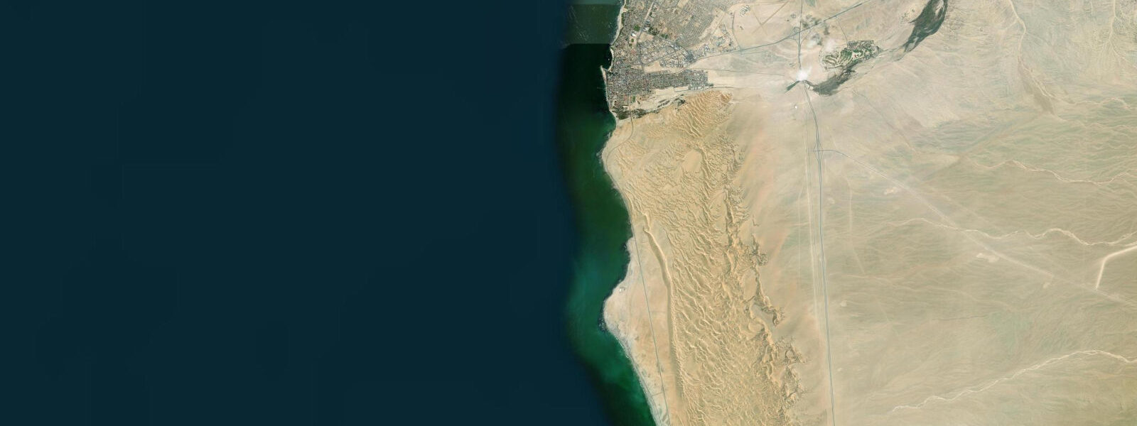
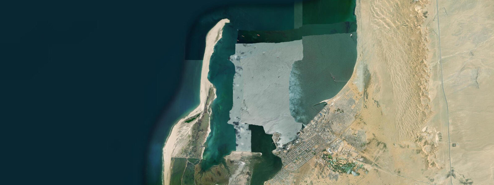
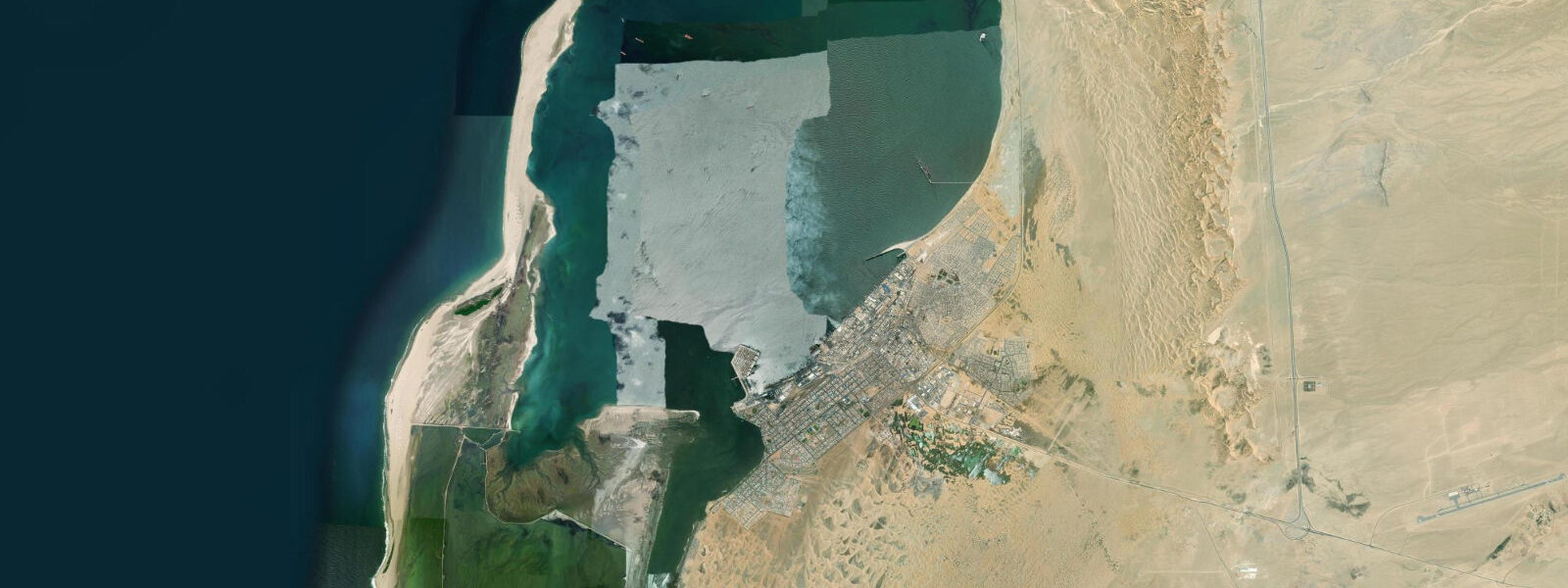
Swakopmund is 30 km north of Walvis Bay on the Namibian coast, a German colonial resort town established in 1892 as the landing point for German South West Africa — chosen because Walvis Bay, the obvious natural harbour, was at the time under British control. The town's German-colonial architecture (the lighthouse, the Woermann House, the Altes Gefängnis prison) has been preserved well enough to make the streetscape unusually intact for a sub-Saharan African town, and this colonial overlay on a Namib Desert backdrop — white gabled buildings, palm-lined streets, and the roar of the South Atlantic surf two blocks away — gives Swakopmund its distinct visual identity.
The tidal regime at Swakopmund is semidiurnal with a spring range of approximately 1.5 m, slightly less than Walvis Bay to the south due to the more exposed, open-coast position. The Swakop River mouth, immediately south of the town centre, is the defining coastal geography: the Swakop drains the Namib Desert interior, carrying almost no water for most of the year (the annual discharge is one of the lowest of any named river in Africa) but occupying a wide sandy channel that creates a significant tidal mixing zone at its mouth. On the flooding tide, Atlantic water advances 2–4 km up the dry sandy river channel, creating a brackish zone that attracts unusual concentrations of wading birds — avocets, stilts, sandpipers, and the occasional flamingo that wanders north from the Walvis Bay lagoon.
The Benguela fog is as prevalent at Swakopmund as at Walvis Bay: sea surface temperatures of 12–16°C drive overnight fog formation, and the town wakes to reduced visibility on most mornings. The fog is the reason the town's character is distinctly un-tropical despite its position at 22°S latitude — the cold sea and the fog create a grey, cool ambience more reminiscent of a northern European coastal town than a warm-ocean resort. Air temperatures are moderate year-round: rarely above 25°C in summer, rarely below 10°C in winter. The desert interior begins 5 km inland and temperatures there reach 40°C on summer afternoons while the coast stays at 22°C.
Beach fishing at Swakopmund is practised from the town beach north of the jetty and from the wider beaches stretching 30 km north toward Henties Bay. The primary targets are kob (kabeljou, Argyrosomus coronus) and steenbras, both of which move onto the Benguela coast beaches on the incoming tide in the early morning. The standard technique is longshore casting into the surf zone on a flooding tide, using pilchards or squid as bait. The most productive window is the first 2–3 hours of incoming tide at first light — the combination of dim light, fresh flood tide, and cooler post-dawn temperatures aligns the fish feeding behaviour and the fishing conditions.
The Swakop River mouth area north of town is the birding focus. Arriving at low tide on a spring ebb maximises the exposed tidal flat area on the river mouth sand. The species list for this site runs to over 300 birds in the year; short-stay visitors can reliably identify flamingos, avocets, several sandpiper species, herons, and the African fish eagle that holds a territory above the river channel most years. The river mouth habitat changes substantially with rainfall events in the interior — a rare but dramatic situation when the Swakop actually flows, flooding the river mouth, flushing the lagoon, and temporarily altering the tidal mixing zone.
For quad-biking and sandboarding in the Namib dunes directly east of town, the activity operators base their departures on morning (fog-clear) timing rather than tidal state. The Star Dune and the dune field immediately behind the coastal fog zone are accessible within 20 minutes of town. The sand-to-sea contrast — orange dune crests visible through the dissipating fog, with surf audible below — is the experience most specific to Swakopmund and most different from any other coastal destination.
Anglers visiting specifically for kob should note the seasonal pattern: kob feeding on the Benguela coast beaches is most reliable from March through June, when the post-summer sea temperatures are at their highest (relatively — still only 16–18°C) and kob move inshore. The peak spring tides of this period, with their larger tidal range and stronger flooding currents, concentrate fish along the beach most effectively.
All tide predictions for Swakopmund come from the Open-Meteo Marine gridded model. Timing accuracy is ±45 minutes; height accuracy is ±0.3 m above Chart Datum.
Tide questions about Swakopmund
Quick answers to the most common questions about tide times, range, and water access at Swakopmund.
What is the tidal range at Swakopmund and how does it affect beach fishing?
Swakopmund has a spring tidal range of approximately 1.5 m. Beach kob fishing is most productive on the first 2–3 hours of the incoming (flooding) tide at dawn — the flood brings fresh, oxygenated water into the surf zone and drives kob feeding behaviour. Spring tides, with their larger range and stronger flooding current, concentrate fish along the beach more effectively than neap tides. The standard fishing location is the town beach north of the jetty and the open beaches stretching 30 km north toward Henties Bay; high-clearance access is needed on some northern sections.
What birds can I see at the Swakop River mouth?
The Swakop River mouth tidal flat hosts flamingos, avocets, multiple sandpiper species, herons, and often an African fish eagle holding a territory above the channel. Spring low tide maximises the exposed flat area and concentrates birds in the shallow water at the tide's edge. The site records over 300 bird species annually — one of Namibia's most productive birding locations despite being 2 km from a town centre. Early morning after the fog clears (08:00–10:00) gives the best light and the most active feeding behaviour. The habitat shifts substantially after rare rainfall events in the interior when the Swakop actually runs water.
Why is Swakopmund so cold and foggy compared to other beach towns at the same latitude?
Swakopmund sits at 22°S — a latitude where the Mediterranean or subtropical climate would normally apply. Instead, the Benguela Current brings upwelled water at 12–16°C northward along the coast, cooling the maritime air below the dew point most nights and producing coastal fog on most mornings. Air temperatures rarely exceed 25°C at the coast even in midsummer. The Namib Desert begins 5 km inland, where temperatures reach 40°C on summer afternoons while the coast stays at 22°C. This fog-desert juxtaposition — cold grey surf town backed by one of the world's oldest and hottest deserts — is what makes Swakopmund unique.
What is the best way to combine Swakopmund dunes and the coast in one day?
The standard Swakopmund day: sandboarding or quad-biking in the dunes from 09:00 (after the fog clears), then beach fishing or a beach walk in the afternoon when the onshore wind picks up. Morning birding at the Swakop River mouth is feasible before the dune activities if you are at the river mouth by 08:00 on a spring ebb. The contrast between the dune interior (40°C, orange sand, absolute silence) and the coast (18°C, fog, Atlantic surf) within 20 minutes of each other is available in the same morning. Sunset from the top of the dune field looking west over the fog bank rolling in off the Benguela current is visually unrepeatable.
When is the best season for beach kob fishing at Swakopmund?
Kob (kabeljou) fishing from Swakopmund beaches is most reliable from March through June, when post-summer sea temperatures are at their seasonal peak (16–18°C) and kob move inshore along the Benguela coast. Spring tides in this period — with larger tidal range and stronger flooding current — produce the most productive sessions. The first 2–3 hours of the incoming tide at dawn is the standard productive window. Winter (July through September) brings colder water and kob move offshore; the summer months (December–February) are variable. The 30 km of beach north toward Henties Bay is less fished and can produce larger fish.
8-day tide table — Swakopmund
Heights relative to MSL. Predictions: Open-Meteo Marine (MeteoFrance SMOC, 0.08° grid) — heights relative to MSL (not chart datum / LAT). Model-derived.
| Day | Type | Time | Height |
|---|---|---|---|
| Sat 27 Jun | High | 02:00 | 0.0m |
| Low | 07:16 | -0.8m | |
| High | 14:02 | 0.2m | |
| Low | 19:50 | -0.7m | |
| Sun 28 Jun | High | 02:05 | 0.1m |
| Low | 07:57 | -0.9m | |
| High | 14:38 | 0.2m | |
| Low | 20:24 | -0.8m | |
| Mon 29 Jun | High | 02:43 | 0.1m |
| Low | 08:25 | -0.9m | |
| High | 15:06 | 0.2m | |
| Low | 20:57 | -0.9m | |
| Tue 30 Jun | High | 03:15 | 0.1m |
| Low | 09:02 | -0.9m | |
| High | 15:39 | 0.2m | |
| Low | 21:26 | -0.9m | |
| Wed 01 Jul | High | 03:45 | 0.1m |
| Low | 09:35 | -0.9m | |
| High | 16:06 | 0.2m | |
| Low | 22:06 | -0.9m | |
| Thu 02 Jul | High | 04:15 | 0.1m |
| Low | 10:06 | -1.0m | |
| Fri 03 Jul | High | 04:55 | 0.0m |
| Low | 10:38 | -0.9m | |
| High | 17:10 | 0.2m | |
| Low | 23:17 | -0.9m | |
| Sat 04 Jul | High | 01:00 | -0.7m |