Kolmanskop tide times
Kolmanskop tide forecast — heights relative to MSL.
Today's tide times for Kolmanskop
Tide times at Kolmanskop on Saturday, 4 July 2026: first low tide at 02:00am, first high tide at 05:12am, second low tide at 11:08am, second high tide at 05:34pm, third low tide at 11:51pm. Sunrise 07:48am, sunset 06:18pm.
Tide chart for Kolmanskop
24-hour cosine-interpolated curve around the present moment. Heights relative to MSL. Predictions: Predictions: Open-Meteo Marine (MeteoFrance SMOC, 0.08° grid).
Sun, moon and conditions on Sat 04 Jul
Snapshot at build time — refreshes daily. Sea state from Open-Meteo Marine.
Highs and lows next 7 days
Every predicted high and low for the next week, with the daily tidal coefficient (0–120; higher = bigger swing, > 95 means stronger currents).
Other spots nearby
The three closest curated TideTurtle locations to Kolmanskop, measured by great-circle distance.

Today's solunar windows
Solunar tradition: major periods are the ≈3h windows around moon transit and opposition; minor are ≈2h around moonrise and moonset. Pair with the local tide stage and wind for the best read.
Cycle dates near Kolmanskop
Last spring tide on Sat 04 Jul (range 1.1m). Next spring tide on Fri 10 Jul (range 0.9m). Next neap on Wed 08 Jul.
Spring tides cluster around new and full moons (biggest swings). Neap tides land on quarter moons (smallest swings). See the spring tide and neap tide glossary entries for the why.
About tides at Kolmanskop
A short guide to the coastline at Kolmanskop — geography, sea state, and what the tide is actually doing under your feet.
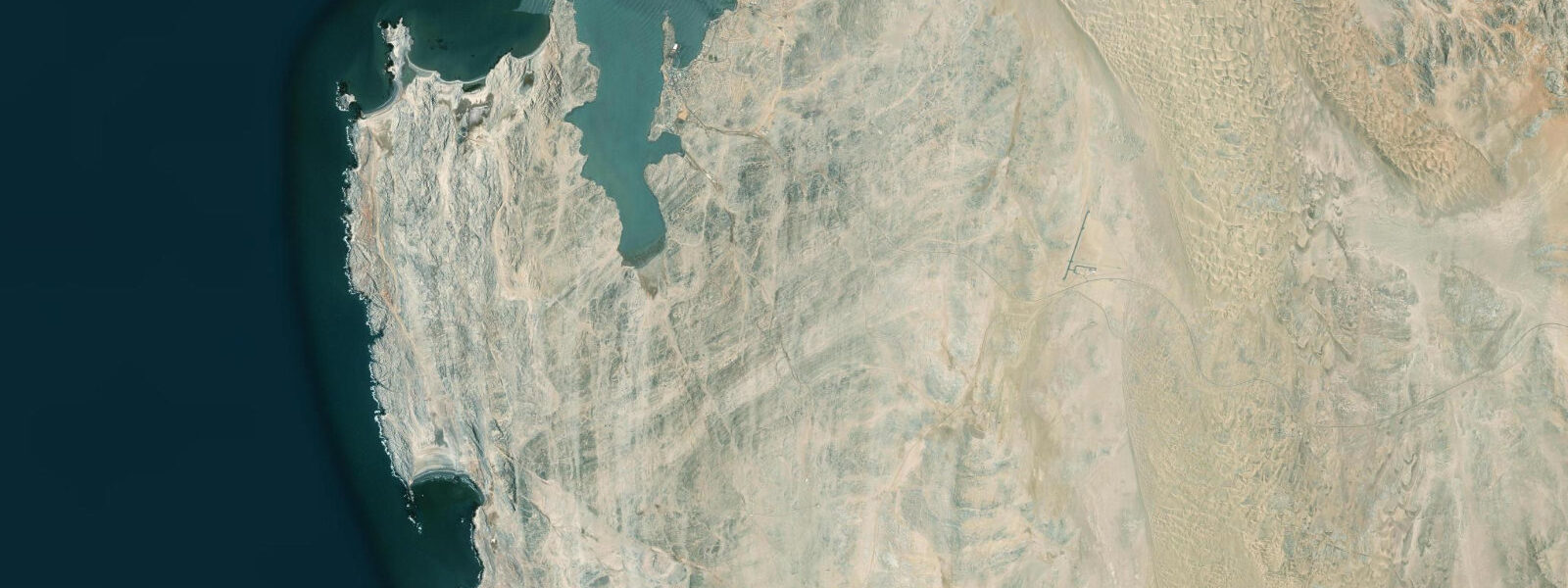
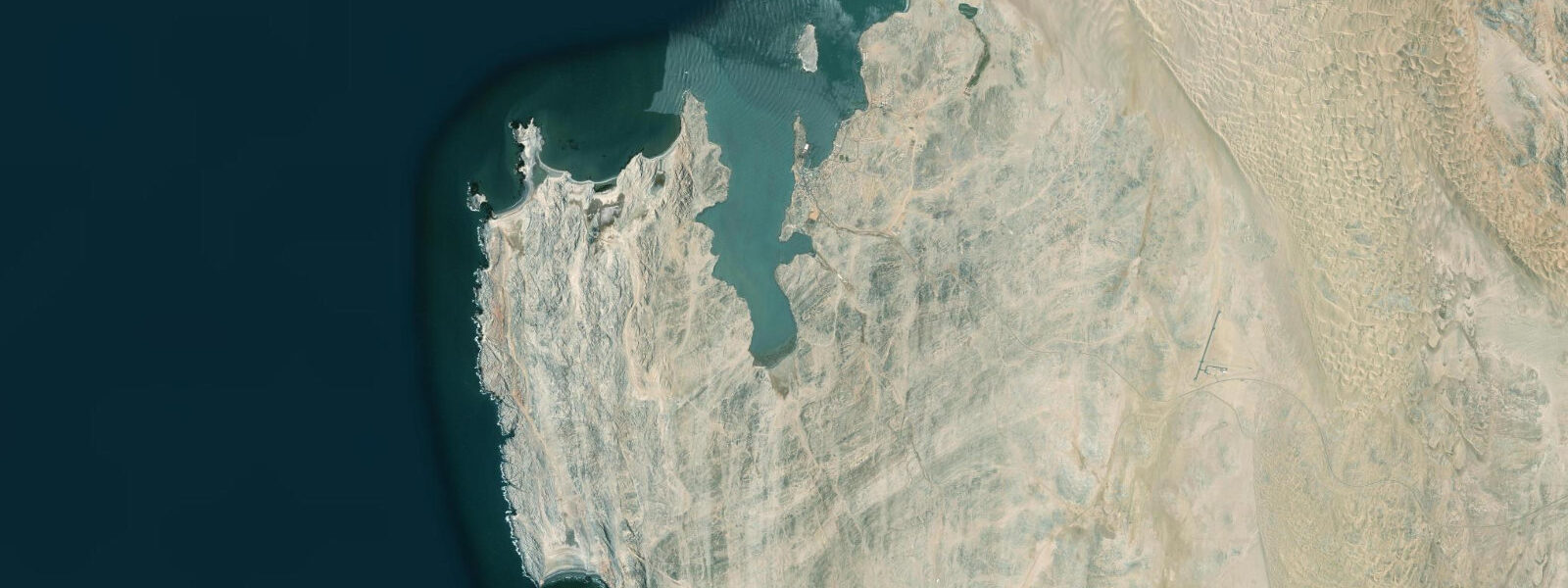
Kolmanskop is 10 kilometres east of Lüderitz, accessible by permit through the Sperrgebiet — the Forbidden Area of the Namibian diamond coast. What makes it one of the most photographed abandoned settlements in the world is straightforwardly physical: Namib sand dunes have filled the colonial buildings to window height, poured through doorways in smooth frozen waves, and buried walls to their eaves. The rooms are half-full of sand. The wallpaper is peeling in the still, dry air. The ballroom floor has buckled under 70 years of sand pressure. This is not ruin porn — it is a genuinely unusual juxtaposition of colonial domesticity and geological process, and it is worth the permit.
Kolmanskop was built between 1908 and 1912 after the diamond discovery that transformed the entire southern Namibian coast. The diamonds at Kolmanskop were not found at Kolmanskop itself — they were surface deposits scattered across the desert gravel, picked up by hand in the early days of the rush. The town was the administrative and residential centre for the surrounding diamond field. At its peak in the 1910s, it held a hospital with the first X-ray machine in the southern hemisphere, a school, a casino, a ballroom, a skittle alley, and an ice factory — an improbable assemblage of civilised amenity in the Namib gravel plain.
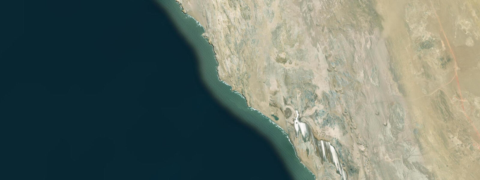
The coastal connection is the reason the diamonds exist here at all. Over millions of years, rivers flowing from the Namibian interior carried diamonds eroded from kimberlite pipes in the interior and deposited them in river gravels, eventually transporting them to the coast and into the ocean. The surf and longshore drift then sorted and concentrated the stones in beach gravels. The richest deposits were surface deposits in the dry coastal Namib where wind had removed the lighter sediment, leaving the diamond-bearing gravel concentrated. Today the same material is recovered offshore by marine dredge vessels working the Namibian continental shelf — Kolmanskop's diamond story continues underwater, 30 to 150 metres below sea level, where the seabed holds the reworked gravel deposits that the ancient rivers delivered.
The Sperrgebiet (Forbidden Area) was demarcated in 1908 to protect the diamond fields from illegal mining. The restricted zone covers most of the southern Namibian coast from Lüderitz to the Orange River — an area larger than Switzerland. In 2008 the zone was redesignated as Sperrgebiet National Park, opening limited access under permit while retaining the mining concession in most of the area. The park contains some of the most undisturbed desert landscape in Africa, including coastal areas that have had no human access for over a century. The flora of the southern Namib — quartz plains, succulent karoo plants, the extraordinary Welwitschia mirabilis — is largely intact within the zone.
The guided tour of Kolmanskop takes approximately one hour and covers the main residential buildings, the hospital, the recreation facilities, and the dune-filled interior rooms that are the principal photographic subjects. The morning tour (07:00 or 08:00 departure from Lüderitz) is preferred by photographers because the low-angle light enters the room interiors through the windows and illuminates the sand dunes within — late morning and afternoon light is flatter and less dramatic in the room interiors. The permit system is managed by Lüderitz Safaris and Tours; independent entry without a guide is not permitted.
There are no tidal dynamics at Kolmanskop — the site is 10 kilometres inland and 160 metres above sea level. Its inclusion on TideTurtle is justified by the coastal context: the diamond coast geology that makes Kolmanskop historically significant is the same process that drives the marine dredging visible from Lüderitz harbour and shapes the entire southern Namibian coastal economy. The site is the most accessible window into that geology and that history for visitors based in Lüderitz.
The Benguela Current, the Sperrgebiet, and the marine diamond industry are all part of the same system. The cold water suppresses evaporation, keeps the coast hyperarid, and preserves both the buildings and the diamond gravel concentrations in the seabed. The abandoned hospital with its original X-ray equipment in the dry air, the dunes filling the ballroom, and the dredge vessel working the offshore gravel bank 30 kilometres away are connected by geology and by the specific conditions of the southern Benguela coast.
Predictions for Lüderitz (the nearest coastal reference) come from Open-Meteo Marine, a gridded global ocean model. Accuracy is typically within plus or minus 45 minutes on timing and 0.2 to 0.3 metres on height — model-derived, not from a local gauge. The authoritative national sources for tidal and maritime data on the Namibian coast are the Namibian Meteorological Service and the Namibia Ports Authority.
Tide questions about Kolmanskop
Quick answers to the most common questions about tide times, range, and water access at Kolmanskop.
How do I get a permit to visit Kolmanskop?
Kolmanskop is inside the Sperrgebiet National Park (the restricted diamond zone) and requires an entry permit. Permits are managed by Lüderitz Safaris and Tours, which operates the official guided tours. Visitors purchase a permit and join a guided tour — independent access without a guide is not permitted. Tours depart from Lüderitz at 07:00 and 08:00 on most mornings (times may vary by season). Book at least a day in advance during the peak Namibian summer season (December-January). The permit system exists because the area remains an active diamond mining concession and unrestricted access is legally restricted.
Why are the buildings at Kolmanskop filled with sand?
Kolmanskop was abandoned in 1956 when the surface diamond deposits were exhausted and the population relocated to richer fields at Oranjemund near the Orange River. The buildings were left standing but unoccupied. The Namib Desert gravel plains around Kolmanskop support active dune fields fed by the prevailing southwest wind; with no maintenance to keep doors and windows sealed, sand entered the buildings through any opening and accumulated over decades. In rooms with windows facing the prevailing wind direction, the dune inside has reached ceiling height. The hyperarid climate — less than 20mm of rain per year — has preserved the wallpaper, woodwork, and fittings in the dry air while the sand continues to redistribute within the rooms.
What is the connection between Kolmanskop and the offshore diamond mining visible from Lüderitz?
Both the surface deposits at Kolmanskop and the seabed deposits worked by marine dredge vessels offshore are part of the same geological process. Rivers flowing from the Namibian interior eroded diamonds from kimberlite pipes in the ancient interior over millions of years, carrying them to the coast and depositing them in river gravels and beach gravels. Wind removed the lighter sediment and concentrated the diamond-bearing fraction on the desert surface — those were the deposits picked up by hand in 1908. The same rivers also deposited material offshore, where wave sorting and longshore drift concentrated diamonds in seabed gravels on the continental shelf. The marine dredge fleet works those offshore deposits, which are richer by volume than the land deposits ever were.
What was Kolmanskop like at its peak and how long did the boom last?
Kolmanskop was active from roughly 1908 to the late 1930s, with peak population and building activity in the 1910s. At its height it held approximately 300 German adults and 800 Owambo workers, along with the infrastructure one would not expect in a desert settlement: the first X-ray machine in the southern hemisphere (in the hospital), a school, a casino, a bowling alley, a ballroom, an ice factory (essential in the Namib heat), and a narrow-gauge railway connecting the settlement to Lüderitz. Production declined steeply after 1930 as the accessible surface deposits were exhausted. The final residents left in 1956 when operations ceased entirely; the settlement was not demolished because there was no reason to do so in a location this remote.
Is Kolmanskop worth visiting if I am not a photographer?
Yes, for the historical context as much as the visual spectacle. The tour covers the hospital (original equipment intact), the residential quarters, and the recreation buildings in one hour. The guide explains the diamond rush of 1908, the mechanics of alluvial diamond discovery and sorting, the demographics of the colonial settlement (German management, Owambo contract labour, rigid racial separation), and what drove the collapse. The dune-filled rooms are dramatic regardless of photography interest — the physical process of a building being consumed by desert over 70 years is visible in real time. Combine it with a morning harbour visit in Lüderitz to see the marine dredge fleet — the before and after of the same geology.
8-day tide table — Kolmanskop
Heights relative to MSL. Predictions: Open-Meteo Marine (MeteoFrance SMOC, 0.08° grid) — heights relative to MSL (not chart datum / LAT). Model-derived.
| Day | Type | Time | Height |
|---|---|---|---|
| Sat 04 Jul | Low | 02:00 | -0.5m |
| High | 05:12 | 0.1m | |
| Low | 11:08 | -0.9m | |
| High | 17:34 | 0.2m | |
| Low | 23:51 | -0.8m | |
| Sun 05 Jul | High | 05:57 | 0.1m |
| Low | 11:46 | -0.8m | |
| High | 18:10 | 0.2m | |
| Mon 06 Jul | Low | 12:36 | -0.7m |
| High | 18:55 | 0.2m | |
| Tue 07 Jul | — | ||
| Wed 08 Jul | Low | 02:23 | -0.8m |
| High | 08:43 | -0.0m | |
| Low | 14:38 | -0.6m | |
| High | 20:54 | 0.1m | |
| Thu 09 Jul | Low | 03:36 | -0.8m |
| High | 10:03 | -0.0m | |
| Low | 16:00 | -0.6m | |
| High | 22:08 | 0.1m | |
| Fri 10 Jul | Low | 04:43 | -0.8m |
| High | 11:12 | 0.1m | |
| Low | 17:18 | -0.7m | |
| High | 23:20 | 0.1m | |
| Sat 11 Jul | Low | 01:00 | -0.0m |