Vilankulo tide times
Vilankulo tide forecast — heights relative to MSL.
Today's tide times for Vilankulo
Tide times at Vilankulo on Sunday, 21 June 2026: first low tide at 01:51pm, first high tide at 08:01pm. Sunrise 06:16am, sunset 05:03pm.
Tide chart for Vilankulo
24-hour cosine-interpolated curve around the present moment. Heights relative to MSL. Predictions: Predictions: Open-Meteo Marine (MeteoFrance SMOC, 0.08° grid).
Sun, moon and conditions on Sun 21 Jun
Snapshot at build time — refreshes daily. Sea state from Open-Meteo Marine.
Highs and lows next 7 days
Every predicted high and low for the next week, with the daily tidal coefficient (0–120; higher = bigger swing, > 95 means stronger currents).
Other spots nearby
The three closest curated TideTurtle locations to Vilankulo, measured by great-circle distance.
Today's solunar windows
Solunar tradition: major periods are the ≈3h windows around moon transit and opposition; minor are ≈2h around moonrise and moonset. Pair with the local tide stage and wind for the best read.
Cycle dates near Vilankulo
Last spring tide on Sun 21 Jun (range 1.7m). Next spring tide on Sat 27 Jun (range 1.8m). Next neap on Wed 24 Jun.
Spring tides cluster around new and full moons (biggest swings). Neap tides land on quarter moons (smallest swings). See the spring tide and neap tide glossary entries for the why.
About tides at Vilankulo
A short guide to the coastline at Vilankulo — geography, sea state, and what the tide is actually doing under your feet.
Vilankulo — also spelled Vilanculos — is the main gateway to the Bazaruto Archipelago National Park, the group of five coral islands (Bazaruto, Benguerra, Magaruque, Bangué, and Santa Carolina) that lie 15 to 35 km offshore and form one of the most significant marine conservation areas in the southwestern Indian Ocean. The Mozambican government established the national park in 1971; the archipelago holds the largest remaining dugong population on the east African coast, nesting green turtles, extensive seagrass systems, and fringing coral reef.
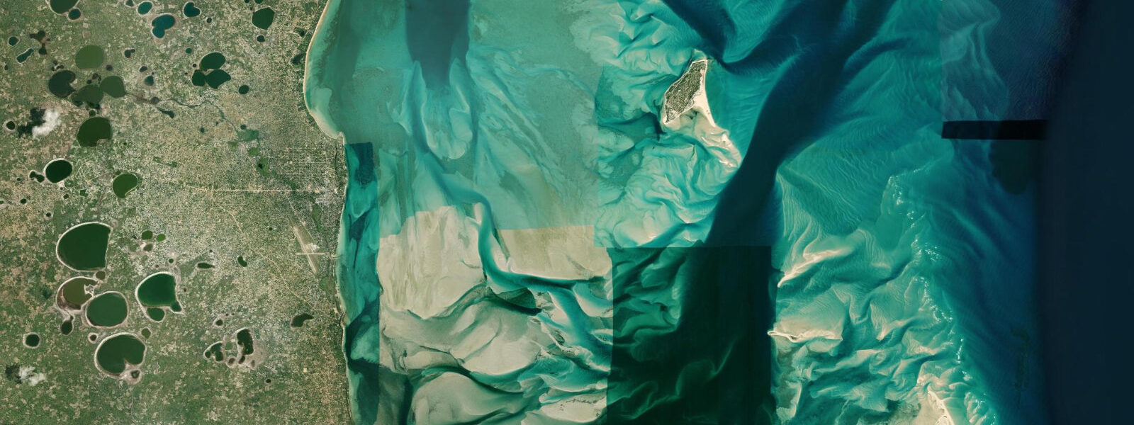
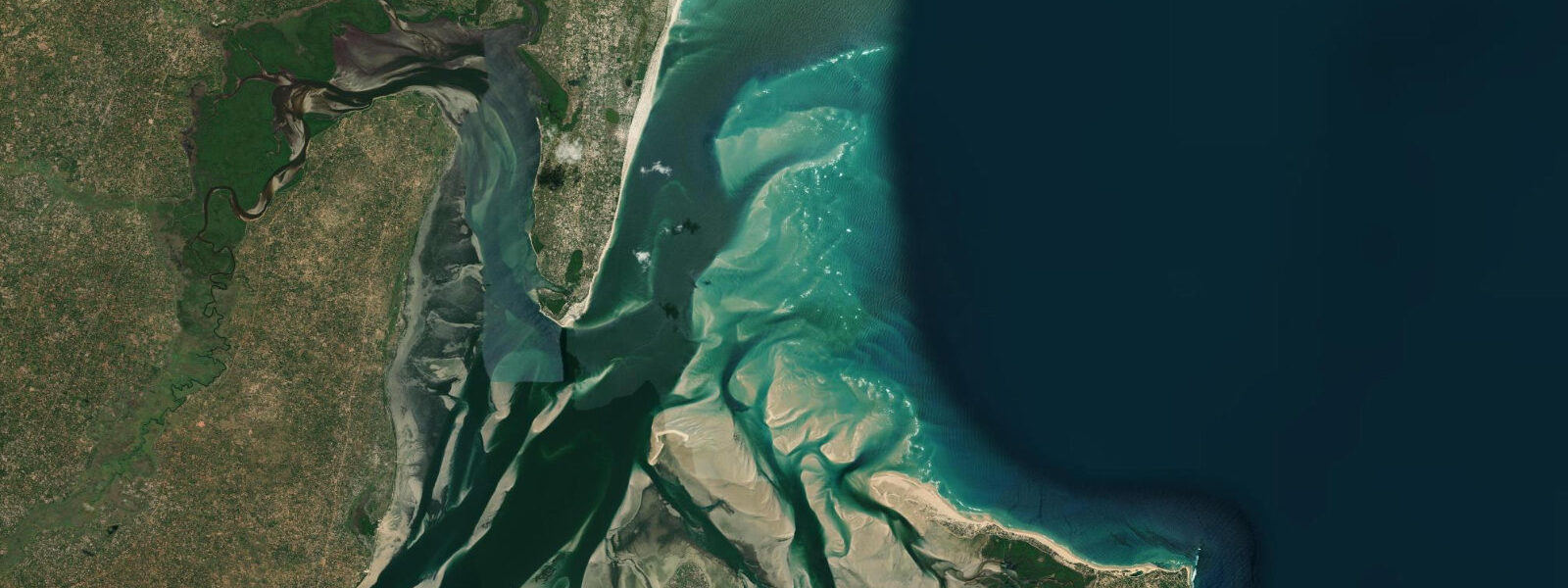
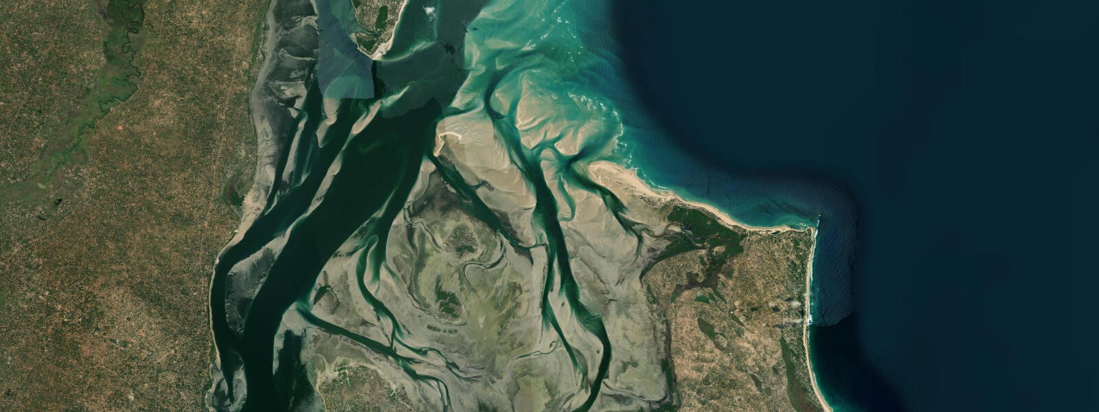
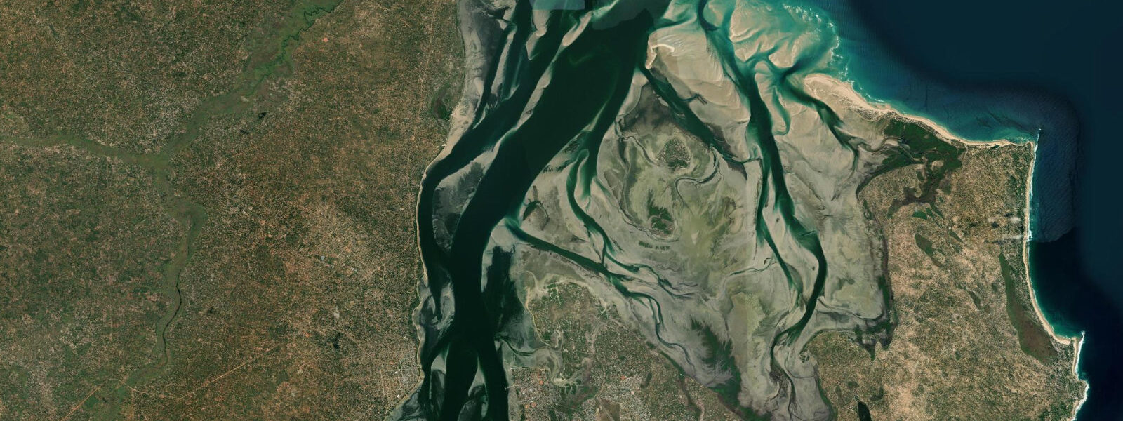
The bay at Vilankulo faces north-northeast and is sheltered from the dominant southeast swell by the peninsula and the offshore islands. The water inside the bay is shallow — large areas dry or reduce to 0.3 to 0.5 m at chart datum on a spring low. The dhow harbour, north of the town centre, dries partially at spring low water, and vessel movements from Vilankulo to the archipelago are governed by the tidal cycle as much as by the distance.
The tidal range at Vilankulo is approximately 3.5 m on a spring tide, consistent with the macrotidal Mozambique Channel regime; neap range is around 1.7 m. The combination of the large tidal range and the shallow bay bathymetry produces the most tide-sensitive departure logistics of any coastal town on the Mozambique coast. Captains at the dhow harbour plan departures using a simple rule based on the sandbank marker positions visible in the bay: if the markers at the channel entrance are clearly out of the water, the ebb is advanced and departures to the archipelago are possible; if the markers are submerged, the tide is on. The channel between the mainland and the outer islands has sections that shoal to 0.4 m at chart datum, and loaded boats cannot transit those sections on the lowest spring tides without kedging through.
The most practical departure window for the archipelago is from approximately two hours after low water to three hours before the next low — roughly a seven-hour window in a twelve-hour tidal cycle. Morning departures on the flood, departures timed to arrive at Bazaruto or Benguerra near high water, are the standard practice. Overnight-stay itineraries on the islands avoid the timing pressure entirely.
Dugong in the Bazaruto Archipelago seagrass beds — the most important remaining east African population — are most reliably sighted in the shallow seagrass flats on the leeward (western) side of Bazaruto and Benguerra islands. The feeding areas are accessible by kayak or by flat-bottomed boat from the island lodges. Dugong feed in the seagrass at all tidal states but concentrate in the shallow inner flats on the rising flood, when the seagrass beds are accessible without the animals needing to enter very shallow water.
Kite-surfing in Vilankulo bay is a developed activity, exploiting the consistent southeast trade wind — typically 15 to 25 knots from May through October — and the flat, shallow bay water. The kite launch area is north of town; at low water on the spring ebb the flats north of the harbour are barely knee-deep for hundreds of metres, producing the flat-water conditions that make the site suitable for learning.
Photographers at Vilankulo find the spring low on the bay flat one of the most unusual compositions available on the Mozambican coast: kilometres of water-reflective exposed sand with the profiles of the Bazaruto and Benguerra islands visible 20 km offshore, the dhow harbour poles standing in ankle-deep puddles, and the town's market beginning its morning activity behind the beach. The low lasts approximately one and a half hours before the flood rebuilds; timing a dawn arrival for the early morning low on a spring-tide day near full or new moon produces the widest bay flat and the most dramatic light angle. Shore anglers work the deeper channel margins around the harbour entrance for barracuda and kingfish on the early flood, when the rising water moves baitfish off the shallow flat and into the channel edges.
Predictions for Vilankulo come from Open-Meteo Marine, a gridded global ocean model; accuracy is typically within plus or minus 45 minutes on timing and 0.2 to 0.3 m on height above chart datum. The authoritative Mozambican tide tables are published by Instituto Nacional de Hidrografia e Navegação (INAHINA). These predictions are not for navigation.
Tide questions about Vilankulo
Quick answers to the most common questions about tide times, range, and water access at Vilankulo.
Does the tide affect boat departures from Vilankulo to the Bazaruto Archipelago?
Yes, significantly. The bay at Vilankulo is shallow — many sections dry at spring low water — and the channel between the mainland and the outer islands of the Bazaruto Archipelago shoals to 0.4 m or less at chart datum in several places. Loaded vessels cannot transit those sections near spring low without grounding. Captains at the dhow harbour plan departures around the tidal state: the standard practice is to depart on the flood or at high water and return on the early ebb. The practical departure window runs from approximately two hours after low water to three hours before the next low — about seven hours in the twelve-hour semidiurnal cycle. Morning departures on the flood, arriving at Bazaruto or Benguerra around high water, are the most common itinerary. If the tide state means a departure is not possible until late morning, book accordingly or consider an overnight stay on the islands.
What is the tide range at Vilankulo?
Spring tidal range at Vilankulo is approximately 3.5 m — macrotidal, consistent with the Mozambique Channel regime. Neap range drops to around 1.7 m. The bay faces north-northeast and is partially sheltered from open ocean, but the tidal amplitude is transmitted through the channel and expressed fully across the shallow bay floor. Large areas of the bay north of the harbour are dry or ankle-deep at chart datum on spring lows; the same areas are 2.5 to 3 m deep at spring high water. This 3.5 m variation across a shallow flat bay is the most consequential tidal feature of the Vilankulo area — it governs boat movements and kite-surfing conditions alike. Instituto Nacional de Hidrografia e Navegação (INAHINA) publishes the authoritative Mozambican tide tables.
Can dugong be seen in the Bazaruto Archipelago?
Dugong are confirmed residents of the Bazaruto Archipelago's seagrass systems and the archipelago holds the largest remaining population on the east African coast. Sightings are not guaranteed on any given trip — dugong are cautious and range widely across the seagrass beds — but the lodge operations on Bazaruto and Benguerra islands run dugong-search boat trips with experienced local guides who know the core feeding areas. The shallow seagrass flats on the leeward (western) sides of the main islands are the primary habitat; dugong feed at all tidal states but are more accessible to observers in flat-bottomed boats on the rising flood, when the seagrass is at 0.5 to 1.5 m depth. Early morning departures (before 08:00) are standard for dugong searches, as animals are more active before the daytime boat traffic increases.
Where do these tide predictions come from?
Tide predictions for Vilankulo come from Open-Meteo Marine, a free gridded global ocean model. The model estimates tidal height across a geographic grid rather than from harmonic analysis of a local Vilankulo gauge. Accuracy is typically within plus or minus 45 minutes on timing and 0.2 to 0.3 m on height above chart datum. At the 3.5 m spring range of the Mozambique Channel coast, the height uncertainty is below 10% of the total swing. However, because boat departures to the Bazaruto Archipelago are sensitive to precise water depth in the access channels, the timing uncertainty of plus or minus 45 minutes is material for planning purposes. Confirm departure times with your boat captain or lodge on the day, using their local knowledge of channel depth and tidal state. For authoritative data, consult the tide tables from Instituto Nacional de Hidrografia e Navegação (INAHINA).
Is kite-surfing at Vilankulo tide-dependent?
The kite-surfing at Vilankulo depends on the tide for water depth rather than for the wind. The launch area north of the harbour has extensive flat water at all tidal states above mid-neap; the best learning conditions are at mid to high water when the shallow bay holds 0.5 to 1.5 m depth across a large area — enough to stand but too shallow for serious chop to build. On spring low water the flat north of the harbour reduces to ankle depth over hundreds of metres, which is fine for launching and landing but produces a drier, harder surface underfoot. The wind is the primary planning variable: the southeast trade runs most consistently from May through October at 15 to 25 knots, producing the flat-water regime that makes Vilankulo one of the recognised kite destinations on the east African coast. Schools and operators are based along the beach north of town.
8-day tide table — Vilankulo
Heights relative to MSL. Predictions: Open-Meteo Marine (MeteoFrance SMOC, 0.08° grid) — heights relative to MSL (not chart datum / LAT). Model-derived.
| Day | Type | Time | Height |
|---|---|---|---|
| Sun 21 Jun | Low | 13:51 | -0.6m |
| High | 20:01 | 1.1m | |
| Mon 22 Jun | Low | 02:23 | -0.5m |
| High | 08:23 | 1.0m | |
| Low | 14:50 | -0.5m | |
| High | 21:03 | 0.9m | |
| Tue 23 Jun | Low | 03:26 | -0.4m |
| High | 09:38 | 0.8m | |
| Low | 16:00 | -0.4m | |
| High | 22:12 | 0.8m | |
| Wed 24 Jun | Low | 04:42 | -0.3m |
| High | 10:55 | 0.8m | |
| Low | 17:25 | -0.4m | |
| High | 23:38 | 0.8m | |
| Thu 25 Jun | Low | 06:02 | -0.4m |
| High | 12:14 | 0.8m | |
| Low | 18:36 | -0.5m | |
| Fri 26 Jun | High | 00:48 | 0.8m |
| Low | 07:03 | -0.5m | |
| High | 13:15 | 0.9m | |
| Low | 19:33 | -0.6m | |
| Sat 27 Jun | High | 01:39 | 1.0m |
| Low | 07:50 | -0.7m | |
| High | 14:01 | 1.1m | |
| Low | 20:15 | -0.7m | |
| Sun 28 Jun | High | 01:00 | 0.9m |