Inhambane tide times
Inhambane tide forecast — heights relative to MSL.
Today's tide times for Inhambane
Tide times at Inhambane on Saturday, 4 July 2026: first low tide at 02:00am, first high tide at 05:34am, second low tide at 11:45am, second high tide at 05:56pm. Sunrise 06:21am, sunset 05:03pm.
Tide chart for Inhambane
24-hour cosine-interpolated curve around the present moment. Heights relative to MSL. Predictions: Predictions: Open-Meteo Marine (MeteoFrance SMOC, 0.08° grid).
Sun, moon and conditions on Sat 04 Jul
Snapshot at build time — refreshes daily. Sea state from Open-Meteo Marine.
Highs and lows next 7 days
Every predicted high and low for the next week, with the daily tidal coefficient (0–120; higher = bigger swing, > 95 means stronger currents).
Other spots nearby
The three closest curated TideTurtle locations to Inhambane, measured by great-circle distance.
Today's solunar windows
Solunar tradition: major periods are the ≈3h windows around moon transit and opposition; minor are ≈2h around moonrise and moonset. Pair with the local tide stage and wind for the best read.
Cycle dates near Inhambane
Last spring tide on Sat 04 Jul (range 2.1m). Next neap on Fri 10 Jul.
Spring tides cluster around new and full moons (biggest swings). Neap tides land on quarter moons (smallest swings). See the spring tide and neap tide glossary entries for the why.
About tides at Inhambane
A short guide to the coastline at Inhambane — geography, sea state, and what the tide is actually doing under your feet.
Inhambane is a town that has been facing the sea for over a thousand years. Arab traders established a presence on this stretch of the Mozambican coast from at least the 9th century, drawn by the sheltered bay, the trade routes into the interior, and the reliable holding ground for dhows riding the monsoon winds. Vasco da Gama anchored here in 1498 and recorded the coast in his log as Terra da Boa Gente — Land of Good People — a name that the Portuguese preserved in documents for decades after.
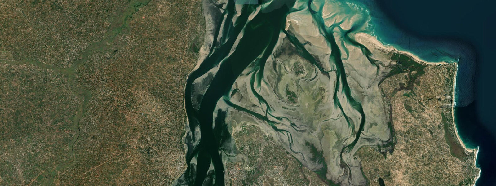
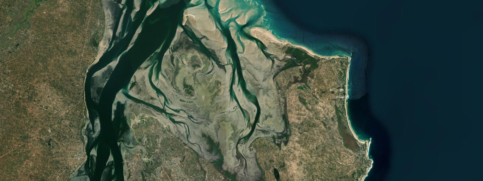
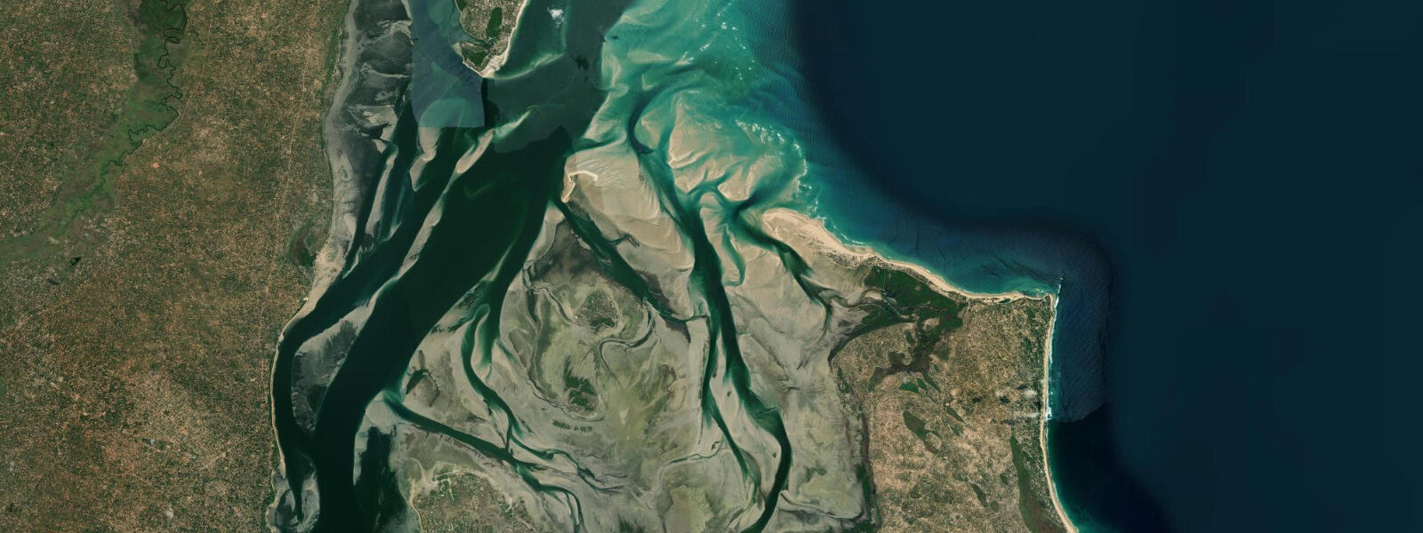
The colonial-era cathedral, the Igreja Nossa Senhora da Conceição, anchors the town's historic centre: a whitewashed baroque-influenced structure that dates from the 18th century and remains the largest building on the Inhambane Bay shoreline. The town is the administrative capital of Inhambane Province and the regional hub for the coast north toward Vilanculos and the Bazaruto Archipelago. Inhambane Bay is one of southern Africa's larger estuarine systems — approximately 50 kilometres long and sheltered enough to support a functioning small-craft harbour, a mangrove ecosystem along its margins, and a cross-bay ferry service that has been operating continuously, under various sail and motor configurations, for centuries.
The dhow ferry from Inhambane's waterfront to Maxixe on the opposite shore takes roughly 15 minutes. It is the fastest crossing of the bay, and it is the main transport link for overland travellers: buses from Maputo and Vilanculos arrive at Maxixe, and the ferry carries foot passengers across to Inhambane town. Watching the dhow and motor ferry traffic at the jetty against the background of the bay and the distant Barra Peninsula is one of the more photogenic moments the Mozambican coast offers.
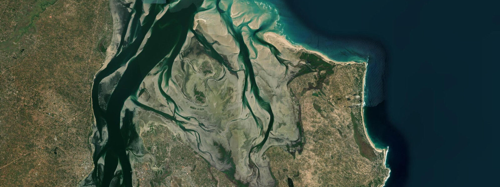
0 metres. At spring high water, the mangrove edges of the bay are inundated — the red mangroves (Rhizophora mucronata) that fringe the southern and eastern bay shores are submerged to mid-trunk, and the root network becomes an underwater labyrinth accessible only by kayak or canoe. At spring low water, the same mangroves stand on exposed mud and the bay floor south of the town shallows to sand and seagrass, with wading birds — greater and lesser flamingos, various egret species — working the margins in the early morning.
The bay supports a relic population of dugong (Dugong dugon) — one of the few remaining in southern Africa outside South Africa's iSimangaliso system. Dugong are difficult to sight without deliberate searching, but their presence is documented by local marine researchers, and the seagrass beds they depend on are visible from a boat at low tide. The broader bay ecosystem is a significant artisanal fishing ground: hand-line fishers and cast-netters work the seagrass flats at low tide from small fibreglass boats and dugouts, and the Inhambane fish market on the waterfront operates every morning from before first light.
The cashew nut and coconut plantations inland from the bay have been part of the local economy since the Portuguese colonial period. Cashew is Mozambique's largest agricultural export, and the trees are ubiquitous in the land behind the town — the canopy visible from the waterfront roads between the buildings, and the raw cashew sold in the market through harvest season (March to June). The town itself is navigable on foot: the waterfront promenade, the cathedral, the market, and the ferry jetty are all within a 15-minute walk of each other.
The colonial street grid north of the cathedral retains a significant stock of Portuguese-period buildings in various states of preservation. Accommodation ranges from guesthouses in the town centre to mid-range hotels on the waterfront. Tofo Beach is 22 kilometres by road; Barra Point is 15 kilometres in the other direction.
Inhambane is the practical hub for exploring the province's coast, with vehicle hire, fuel, and a small domestic airport with connections to Maputo on LAM Mozambique Airlines. Predictions on this page come from Open-Meteo Marine, a gridded global ocean model. 3 metres on height — model-derived, not from a local gauge.
For authoritative maritime information on Mozambican waters, consult the Instituto Nacional de Hidrografia e Navegação (INAHINA).
Tide questions about Inhambane
Quick answers to the most common questions about tide times, range, and water access at Inhambane.
What is the dhow ferry from Inhambane and how do I use it?
The dhow ferry connects Inhambane town's waterfront jetty to Maxixe on the opposite shore of the bay, a crossing of roughly 15 minutes. It operates throughout the day from early morning until late afternoon; frequency increases at peak commuter times. Foot passengers only — no vehicles. The fare is minimal and paid on board. For overland travellers arriving from Maputo or Vilanculos by bus, Maxixe is the bus terminal side; the ferry is the quickest route across to Inhambane town. Motor ferries also run the route and are faster than the traditional dhow version; both use the same jetty.
Are there dugong in Inhambane Bay?
Yes, a relic dugong population persists in Inhambane Bay, dependent on the seagrass beds that cover the bay floor at low tide. Dugong are difficult to sight without dedicated searching — they surface briefly to breathe and spend most of their time grazing on the bottom. Local boat operators occasionally spot them near the seagrass beds south of town, particularly at mid-tide when the water is shallow enough to see the bottom clearly but deep enough for the animals to move comfortably. There is no organised dugong tour industry at Inhambane; sightings are incidental.
What is the tidal range at Inhambane and how does it change the bay?
The spring tidal range at Inhambane is approximately 2.0 to 3.0 metres. This range produces a visible change in the bay: at high water the mangrove edges are inundated and the bay fills to its maximum navigable extent; at low water the bay shallows to exposed sand and seagrass flats in the southern section, with wading birds active along the margins. The bay is always navigable for the dhow ferry regardless of tide state, as the main channel through the bay remains deep. Tidal flow at the bay entrance near Barra is strongest on spring tides.
What are the best historical sites in Inhambane town?
The Igreja Nossa Senhora da Conceição — the cathedral — is the centrepiece of the colonial historic district: an 18th-century whitewashed baroque-influenced structure on the waterfront, still an active church. The town's grid of colonial-era streets north of the cathedral retains a significant stock of Portuguese-period buildings in various states of preservation, from restored facades to picturesque ruin. The Inhambane Museum on the waterfront covers the town's history from Arab trade routes through the colonial period. The fish market and the ferry jetty are functional rather than historic but reflect the continuous maritime economy that brought the town into existence.
Is Inhambane a good base for the Inhambane Province coast?
Yes. Inhambane town has the regional infrastructure: vehicle hire, fuel, a domestic airport with connections to Maputo, accommodation at multiple price points, and a central position between the main coastal attractions. Tofo Beach is 22 kilometres east by road (roughly 25 minutes). Barra Point is 15 kilometres north. The Guinjata and Jangamo reefs are accessible as day trips. The dhow ferry connects to Maxixe and the overland bus network. Most visitors use Inhambane as an arrival and logistics base, then move to Tofo or Barra for beach and dive time.
7-day tide table — Inhambane
Heights relative to MSL. Predictions: Open-Meteo Marine (MeteoFrance SMOC, 0.08° grid) — heights relative to MSL (not chart datum / LAT). Model-derived.
| Day | Type | Time | Height |
|---|---|---|---|
| Sat 04 Jul | Low | 02:00 | -0.1m |
| High | 05:34 | 1.2m | |
| Low | 11:45 | -0.9m | |
| High | 17:56 | 1.3m | |
| Sun 05 Jul | Low | 00:06 | -0.8m |
| High | 06:08 | 1.1m | |
| Low | 12:18 | -0.8m | |
| Mon 06 Jul | High | 06:47 | 1.0m |
| Low | 12:57 | -0.8m | |
| High | 19:11 | 1.0m | |
| Tue 07 Jul | Low | 01:24 | -0.7m |
| High | 20:00 | 0.9m | |
| Wed 08 Jul | Low | 02:15 | -0.5m |
| High | 08:26 | 0.8m | |
| Low | 14:38 | -0.5m | |
| High | 21:02 | 0.9m | |
| Thu 09 Jul | Low | 03:25 | -0.4m |
| High | 09:34 | 0.7m | |
| Low | 15:57 | -0.4m | |
| High | 22:25 | 0.8m | |
| Fri 10 Jul | Low | 04:50 | -0.3m |
| High | 23:53 | 0.8m |