Barra Beach tide times
Barra Beach tide forecast — heights relative to MSL.
Today's tide times for Barra Beach
Tide times at Barra Beach on Sunday, 21 June 2026: first low tide at 01:50pm, first high tide at 08:06pm. Sunrise 06:19am, sunset 04:59pm.
Tide chart for Barra Beach
24-hour cosine-interpolated curve around the present moment. Heights relative to MSL. Predictions: Predictions: Open-Meteo Marine (MeteoFrance SMOC, 0.08° grid).
Sun, moon and conditions on Sun 21 Jun
Snapshot at build time — refreshes daily. Sea state from Open-Meteo Marine.
Highs and lows next 7 days
Every predicted high and low for the next week, with the daily tidal coefficient (0–120; higher = bigger swing, > 95 means stronger currents).
Other spots nearby
The three closest curated TideTurtle locations to Barra Beach, measured by great-circle distance.
Today's solunar windows
Solunar tradition: major periods are the ≈3h windows around moon transit and opposition; minor are ≈2h around moonrise and moonset. Pair with the local tide stage and wind for the best read.
Cycle dates near Barra Beach
Last spring tide on Sun 21 Jun (range 1.5m). Next spring tide on Sat 27 Jun (range 1.5m). Next neap on Wed 24 Jun.
Spring tides cluster around new and full moons (biggest swings). Neap tides land on quarter moons (smallest swings). See the spring tide and neap tide glossary entries for the why.
About tides at Barra Beach
A short guide to the coastline at Barra Beach — geography, sea state, and what the tide is actually doing under your feet.
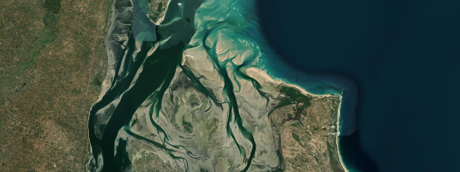
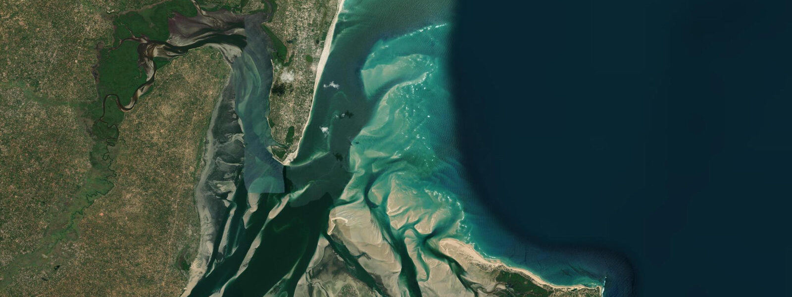
Barra Beach sits 15 km north of Tofo on the Inhambane Peninsula, at a point where the peninsula narrows to less than 500 m between the Indian Ocean-facing eastern coast and the Inhambane Bay-facing western coast. Barra Point, the northernmost tip of the beach, is within sight of both water bodies simultaneously — the open-ocean swell running in from the southeast on one side and the flat calm of the bay on the other.
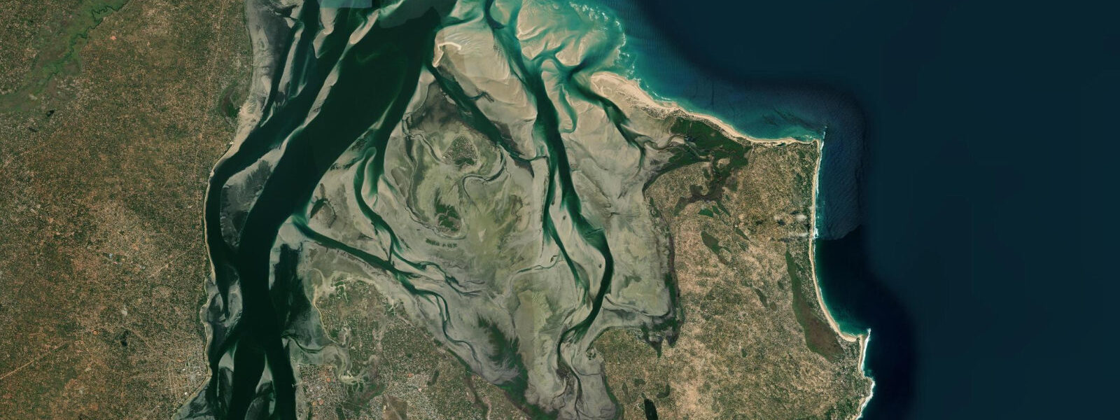
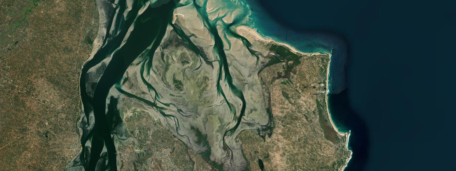
The two coastlines are functionally different beaches accessed from the same narrow piece of land. The eastern, ocean-facing beach at Barra is exposed, with consistent southeast swell and the full macrotidal range of approximately 3.5 m on springs. At spring low water the beach widens by 150 to 200 m and the outer sandbar, which generates a shore-break on swell days, becomes exposed on its crest. The western, bay-facing shore is sheltered — mangrove fringe, calm water, soft bottom — with the same 3.5 m spring range but expressed across a shallow intertidal flat rather than a surf beach. At spring low the bay flat around the mangrove edge exposes several hundred metres of mudflat.
The dhow crossing from Maxixe to Inhambane town — across the 3 km of Inhambane Bay that separates the mainland from the peninsula — is one of the most atmospheric short passages on the Mozambique coast. Traditional ngalawa sailing dhows make the crossing through the day, timing departures with the tide and the wind. The bay is shallow over most of its extent; the dhows draw less than 0.5 m on flat water and can cross on almost any tidal state, but the operators prefer the flood and the slack high for ease of navigation through the sandbank channels. The crossing from Maxixe market on the mainland to Inhambane town is the practical transport link for most visitors arriving by bus from Maputo; the motorised ferry supplements the dhows on the busier morning runs.
Barra Lodge, at the northern end of the beach, is the main resort accommodation. The lodge sits on a prominent dune overlooking the beach with views north to Barra Point and south toward Tofo. Access from Inhambane town is by road around the peninsula — approximately 20 minutes by vehicle — or by boat across the bay and then by road to the lodge.
Shore fishing from the ocean-facing beach at Barra is consistent for the same species as Tofo: kingfish, barracuda, garrick, snapper, and queenfish from the beach gutters and the rocky headland at Barra Point. The headland rocks are fishable from approximately mid-ebb through the first two hours of the flood; spring high water submerges the ledge fishing positions. The bay side at Barra also produces flatfish and smaller reef species from the exposed mudflat edges at low water.
Kayakers and paddleboarders on the bay side find a protected flat-water environment with consistent conditions across most tidal states — the bay is navigable throughout the range, though the shallow inner flat near the mangrove edge is inaccessible at low spring. The ocean side is suitable for experienced paddlers on calm days when swell is below 1.5 m.
Beach-walkers at Barra on a spring low find one of the widest and most varied stretches of shore on the Inhambane Peninsula. The 150 to 200 m of firm wet sand that emerges on the ocean side at spring low runs south from the lodge to Barra Point without obstruction; the equivalent low-water bay-side exposure on the mangrove edge is a different landscape entirely — dark mud, crab burrows, and the clicking of fiddler crabs working the exposed flat. Photographers with early morning access to the spring low find both environments within a 10-minute walk of each other and both lit by the same low eastern light. Kayakers departing from the bay side at Barra should avoid the mangrove drainage channels on the spring ebb: the flow through narrow mangrove channels can reach 1.5 knots as the flat drains, and paddling against it wastes energy that is better conserved for open-bay crossing.
Predictions for Barra Beach come from Open-Meteo Marine, a gridded global ocean model; accuracy is typically within plus or minus 45 minutes on timing and 0.2 to 0.3 m on height above chart datum. The authoritative Mozambican tide tables are published by Instituto Nacional de Hidrografia e Navegação (INAHINA). These predictions are not for navigation.
Tide questions about Barra Beach
Quick answers to the most common questions about tide times, range, and water access at Barra Beach.
What is special about the Inhambane Bay dhow crossing near Barra?
The dhow crossing between Maxixe on the mainland and Inhambane town, across the 3 km of Inhambane Bay, uses traditional ngalawa sailing dhows — outrigger vessels that have operated on this coast for centuries. The crossing is a practical transport link (the most direct route between the bus terminal at Maxixe and the town centre of Inhambane) and one of the more atmospheric short passages available to any visitor. The dhows carry passengers, market goods, and bicycles, timing their runs with the wind and tide. The bay is shallow — most of the crossing is over 0.5 to 2 m at mean water level — and the operators read the sandbank channels by eye rather than by chart. Peak crossings are in the morning as market traffic moves from the mainland to Inhambane town.
What is the tide range at Barra Beach?
Spring tidal range at Barra Beach is approximately 3.5 m, consistent with the macrotidal Mozambique Channel regime. Neap range is around 1.7 m. The regime is semidiurnal — two highs and two lows per day. The 3.5 m range is expressed very differently on the two sides of the Inhambane Peninsula: the ocean-facing eastern beach at Barra widens by 150 to 200 m at spring low with a surf beach character; the bay-facing western shore exposes several hundred metres of mangrove-edged mudflat. Same amplitude, very different result. Instituto Nacional de Hidrografia e Navegação (INAHINA) publishes the authoritative Mozambican tide tables; predictions here come from Open-Meteo Marine, accurate to typically plus or minus 45 minutes on timing and 0.2 to 0.3 m on height.
Is Barra Beach better for swimming than Tofo Beach?
Barra and Tofo face the same southeast ocean swell — both are exposed Indian Ocean shores on the same peninsula and both carry the same surf-beach safety considerations. On calm days with swell below 1.0 m both beaches are comfortable for confident swimmers. On a typical southeast swell day of 1.5 to 2.0 m, the shore-break at both beaches requires care. The key practical difference is that Barra has a sheltered bay-side option on the western coast: the Inhambane Bay shore is flat, calm, shallow, and suitable for children at almost any tidal state above mid-neap. For families with young children, the bay side at Barra is generally more relaxed than the ocean side at either Barra or Tofo.
Where do these tide predictions come from?
Tide predictions for Barra Beach come from Open-Meteo Marine, a free gridded global ocean model. The model estimates tidal height across a geographic grid rather than from harmonic analysis of a local Barra gauge. Accuracy is typically within plus or minus 45 minutes on timing and 0.2 to 0.3 m on height above chart datum. At the 3.5 m spring range of the Mozambique Channel coast, the height uncertainty is below 10% of the total swing — appropriate for beach, fishing, and kayaking activity planning. For navigation in Inhambane Bay, use the tide tables from Instituto Nacional de Hidrografia e Navegação (INAHINA) and the relevant Mozambican coastal charts.
Can paddlers kayak around Barra Point between the two coasts?
Rounding Barra Point by kayak is possible on calm days and is the most direct route between the ocean beach on the eastern side and the bay on the western side. The point is exposed to the southeast swell and generates a confused sea in the few hundred metres around the tip when swell is above 1.0 m — both the refracted swell from the ocean side and the reflected wave from the point converge. At neap tides on swell days of less than 1.0 m with the wind below 15 knots, the rounding is straightforward for experienced paddlers. At spring ebb the current around the point can run at 0.5 to 0.8 knots in the narrow gap between the headland rocks and the outer sandbar, which adds effort on the ebb but provides assistance on the flood. The bay side from the point south to the mangrove line is flat and sheltered in all conditions — a good destination in its own right for those not wanting the rounding.
8-day tide table — Barra Beach
Heights relative to MSL. Predictions: Open-Meteo Marine (MeteoFrance SMOC, 0.08° grid) — heights relative to MSL (not chart datum / LAT). Model-derived.
| Day | Type | Time | Height |
|---|---|---|---|
| Sun 21 Jun | Low | 13:50 | -0.6m |
| High | 20:06 | 0.9m | |
| Mon 22 Jun | Low | 02:22 | -0.4m |
| High | 08:25 | 0.8m | |
| Low | 14:46 | -0.4m | |
| High | 21:06 | 0.8m | |
| Tue 23 Jun | Low | 15:55 | -0.3m |
| High | 22:18 | 0.7m | |
| Wed 24 Jun | Low | 04:40 | -0.3m |
| High | 10:54 | 0.6m | |
| Low | 17:20 | -0.3m | |
| High | 23:36 | 0.6m | |
| Thu 25 Jun | Low | 06:02 | -0.4m |
| Fri 26 Jun | High | 00:47 | 0.7m |
| Low | 07:02 | -0.5m | |
| Sat 27 Jun | High | 01:41 | 0.8m |
| Low | 07:48 | -0.6m | |
| High | 14:03 | 0.9m | |
| Low | 20:12 | -0.6m | |
| Sun 28 Jun | High | 01:00 | 0.8m |