Taghazout tide times
Taghazout tide forecast — heights relative to MSL.
Today's tide times for Taghazout
Tide times at Taghazout on Sunday, 21 June 2026: first low tide at 01:00, first high tide at 07:15, second low tide at 13:10, second high tide at 19:32. Sunrise 06:36, sunset 20:44.
Tide chart for Taghazout
24-hour cosine-interpolated curve around the present moment. Heights relative to MSL. Predictions: Predictions: Open-Meteo Marine (MeteoFrance SMOC, 0.08° grid).
Sun, moon and conditions on Sun 21 Jun
Snapshot at build time — refreshes daily. Sea state from Open-Meteo Marine.
Highs and lows next 7 days
Every predicted high and low for the next week, with the daily tidal coefficient (0–120; higher = bigger swing, > 95 means stronger currents).
Other spots nearby
The three closest curated TideTurtle locations to Taghazout, measured by great-circle distance.
Today's solunar windows
Solunar tradition: major periods are the ≈3h windows around moon transit and opposition; minor are ≈2h around moonrise and moonset. Pair with the local tide stage and wind for the best read.
Cycle dates near Taghazout
Last spring tide on Sun 21 Jun (range 1.9m). Next spring tide on Sat 27 Jun (range 1.7m). Next neap on Wed 24 Jun.
Spring tides cluster around new and full moons (biggest swings). Neap tides land on quarter moons (smallest swings). See the spring tide and neap tide glossary entries for the why.
About tides at Taghazout
A short guide to the coastline at Taghazout — geography, sea state, and what the tide is actually doing under your feet.
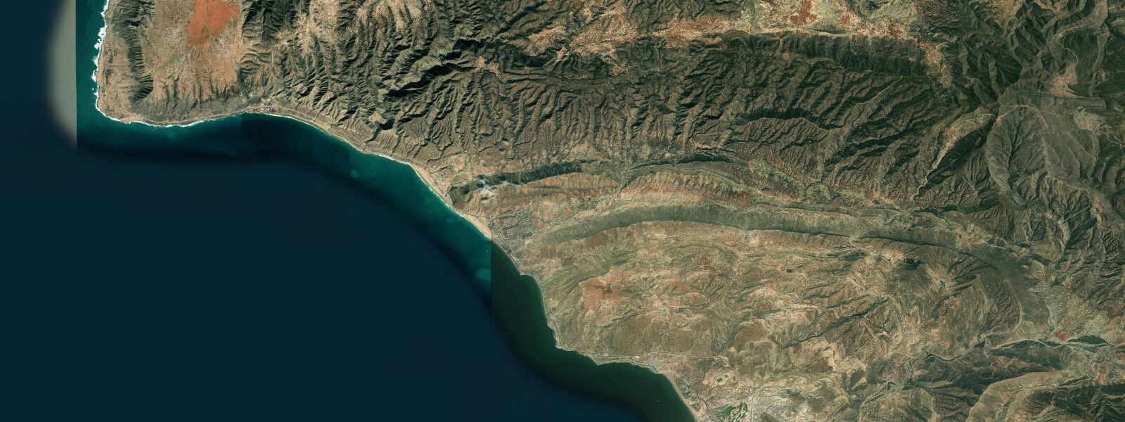
Taghazout is 20 kilometres north of Agadir on the Atlantic coast of the Souss-Massa — a fishing village that became, over the course of two decades, one of the primary surf destinations in Africa. The village sits on a low headland above a small beach; the point breaks to the north and south of the headland are what draw the surf traffic. The tidal regime is the same mesotidal semidiurnal pattern as Agadir: mean range approximately 1.7 metres at Chart Datum, spring range around 2.2 metres, two highs and two lows per day. At these breaks, that 1.7-metre range matters directly — tide height changes wave shape.
Anchor Point is the benchmark break, a right-hand point break at the rocky headland approximately 1 kilometre north of the village centre. It works on northwest swell — the dominant Atlantic fetch direction for this coast — and produces long, peeling walls from the point across the bay. The break works best at mid to high tide: as the water rises above 0.8 to 1.0 metres, the shallow sections of the point cover and the wave becomes more makeable, particularly for the inside sections. At low water on a large swell, the reef is exposed and the wave closes out on the dry sections of rock. Swell size 1.5 to 2.5 metres is the sweet spot; bigger swells (3 m+) on spring high tide can produce long rides of 150 metres or more.
Panaromas — sometimes spelled Panoramas — is a right-hand point break a few hundred metres south of Anchor Point, below a clifftop terrace. The restaurant on the terrace above the break has an unobstructed view of the line-up and has become a standard watching point for photographers and non-surfing observers. The break is more user-friendly than Anchor Point at smaller swell sizes (0.8 to 1.5 m) and mid-tide, making it the first introduction to Taghazout's point break character for many visiting surfers. Hash Point and Boilers are further south toward Agadir — Hash Point is a rock reef that can be fast and hollow on a good northwest swell at mid to high tide.
The original identity of Taghazout as a fishing village is still present in the small boat fleet moored in the cove below the village. The argan tree forests inland from the coast, in the foothills of the Anti-Atlas, are the source of argan oil — the nut-cracking cooperatives operated by Berber women are visible along the road between Taghazout and Agadir. The argan tree (Argania spinosa) grows only in southwest Morocco and a small area of Algeria; the oil from the cold-pressed nuts is used in Moroccan cooking and has become a global cosmetic ingredient. Goats climb the argan trees to eat the fruit — a genuine phenomenon and not a tourist staging.
Accommodation in Taghazout ranges from surf camps with board hire and guided sessions, concentrated in the village and on the road north toward Anchor Point, to the larger resort complex (Taghazout Bay, developed from 2019) north of the breaks. The village itself retains the narrow alleys, rooftop terraces, and small restaurants of its fishing-village origins.
Tide predictions on this page come from Open-Meteo Marine, a gridded global ocean model. Accuracy is typically within plus or minus 45 minutes on timing and 0.2 to 0.3 metres on height. For authoritative official tide tables for this coast, consult SHOMAR, the Service Hydrographique et Océanographique de la Marine.
Tide questions about Taghazout
Quick answers to the most common questions about tide times, range, and water access at Taghazout.
When does Anchor Point surf best and how does the tide affect it?
Anchor Point works on northwest swell, the dominant Atlantic fetch direction for the Taghazout coast, from September through April. The break fires best at mid to high tide — above roughly 0.8 to 1.0 metres — when the shallow sections of the rocky point are covered and the wave peels more smoothly. At low water on larger swells, exposed reef sections cause the wave to close out on the inside. Mean spring high water at Taghazout is around 2.2 metres above Chart Datum; the optimal tide window is the 2 hours either side of high water on a northwest swell of 1.5 to 2.5 metres. Swell from the west or southwest produces less consistent walls.
What is the difference between Anchor Point and Panoramas?
Both are right-hand point breaks on the same stretch of coast. Anchor Point (1 km north of the village) is longer, more powerful, and works best on mid-to-high swells of 1.5 metres or above — it can produce rides of over 100 metres on a good day. Panoramas (just south of Anchor Point) is shorter and more forgiving at smaller swell sizes, typically 0.8 to 1.5 metres, and is better suited to intermediate surfers making their first visit to Taghazout. Panoramas breaks below a clifftop terrace restaurant where the line-up is visible from above — a useful vantage point for assessing conditions before paddling out.
What is argan oil and where does it come from?
Argan oil is pressed from the nut of the argan tree (Argania spinosa), a species that grows only in southwest Morocco and a small patch of Algeria — the Souss-Massa region between Agadir and Tiznit is the centre of production. The trees are drought-tolerant and have been farmed and managed by Berber communities for centuries. The nuts are cracked and cold-pressed to extract oil used in Moroccan cooking (for dipping, finishing, and the paste amlou) and, after the 1990s, as a premium cosmetic ingredient. Goats climb the trees to eat the fruit; they excrete the pits, which are collected and pressed. Cooperatives run by Berber women process and sell the oil along the road between Agadir and Taghazout.
What is the best time of year to surf at Taghazout?
October through March is the peak surf window. October and November bring the first consistent northwest swells of the season while air temperature is still warm (24 to 27°C) and the water sits at 19 to 21°C. December through February has the most consistent swell (1.5 to 3 m northwest) and the longest point-break walls at Anchor Point; air temperature drops to 18 to 22°C, water to 17 to 19°C — a 3/2mm wetsuit is comfortable. The surf camps and international visitors peak between November and February. Summer (June–September) is largely flat with small, inconsistent surf; July and August are the months to avoid for surfing.
Are the tide predictions on this page official forecasts I can use for navigation or safety decisions?
No. Predictions shown here come from Open-Meteo Marine, a global ocean model with a typical accuracy of plus or minus 45 minutes on timing and 0.2 to 0.3 metres on height. They are provided to help plan surf sessions and understand the tidal cycle — useful for timing the Anchor Point tide window, but not for vessel navigation, harbour entry, or any safety-critical planning. For authoritative official tide predictions for the Taghazout and Agadir coast, use SHOMAR — Service Hydrographique et Océanographique de la Marine, Morocco's official hydrographic authority.
8-day tide table — Taghazout
Heights relative to MSL. Predictions: Open-Meteo Marine (MeteoFrance SMOC, 0.08° grid) — heights relative to MSL (not chart datum / LAT). Model-derived.
| Day | Type | Time | Height |
|---|---|---|---|
| Sun 21 Jun | Low | 01:00 | -1.3m |
| High | 07:15 | 0.4m | |
| Low | 13:10 | -1.1m | |
| High | 19:32 | 0.6m | |
| Mon 22 Jun | Low | 01:58 | -1.1m |
| High | 08:17 | 0.3m | |
| Low | 14:11 | -0.9m | |
| High | 20:36 | 0.5m | |
| Tue 23 Jun | Low | 02:58 | -1.0m |
| High | 09:19 | 0.3m | |
| Low | 15:18 | -0.9m | |
| High | 21:40 | 0.4m | |
| Wed 24 Jun | Low | 03:58 | -0.9m |
| High | 10:22 | 0.4m | |
| Thu 25 Jun | Low | 04:54 | -1.0m |
| High | 11:16 | 0.4m | |
| Low | 17:26 | -1.0m | |
| High | 23:39 | 0.4m | |
| Fri 26 Jun | Low | 05:41 | -1.0m |
| High | 12:04 | 0.5m | |
| Low | 18:13 | -1.0m | |
| Sat 27 Jun | High | 00:27 | 0.4m |
| Low | 06:26 | -1.1m | |
| High | 12:48 | 0.6m | |
| Low | 19:00 | -1.1m | |
| Sun 28 Jun | High | 00:00 | 0.3m |