Tuxpan, Veracruz tide times
Tuxpan, Veracruz tide forecast — heights relative to MSL.
Today's tide times for Tuxpan, Veracruz
Tide times at Tuxpan, Veracruz on Friday, 19 June 2026: first high tide at 07:00, first low tide at 23:45. Sunrise 05:48, sunset 19:13.
Tide chart for Tuxpan, Veracruz
24-hour cosine-interpolated curve around the present moment. Heights relative to MSL. Predictions: Predictions: Open-Meteo Marine (MeteoFrance SMOC, 0.08° grid).
Sun, moon and conditions on Fri 19 Jun
Snapshot at build time — refreshes daily. Sea state from Open-Meteo Marine.
Highs and lows next 7 days
Every predicted high and low for the next week, with the daily tidal coefficient (0–120; higher = bigger swing, > 95 means stronger currents).
Other spots nearby
The three closest curated TideTurtle locations to Tuxpan, Veracruz, measured by great-circle distance.


Today's solunar windows
Solunar tradition: major periods are the ≈3h windows around moon transit and opposition; minor are ≈2h around moonrise and moonset. Pair with the local tide stage and wind for the best read.
About tides at Tuxpan, Veracruz
A short guide to the coastline at Tuxpan, Veracruz — geography, sea state, and what the tide is actually doing under your feet.
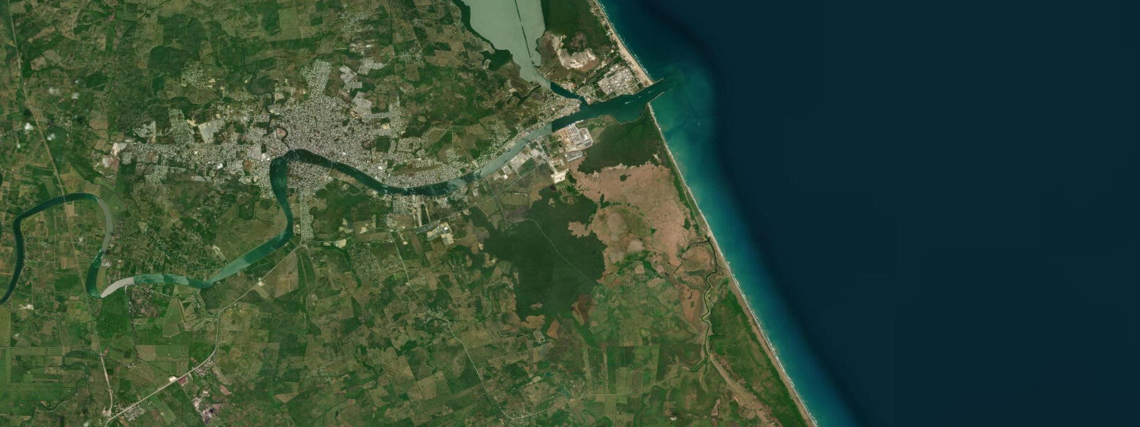
Tuxpan — formally Tuxpan de Rodríguez Cano — is a river port city on the Tuxpan River in northern Veracruz state. The city sits 12 km inland from the Gulf of Mexico along the lower river, and the tidal signal from the Gulf reaches it clearly. The Gulf of Mexico at this latitude runs a semidiurnal pattern, two high and two low tides per day, with a mean range of 0.4–0.6 m. That vertical range appears modest, but in a river 80–120 m wide with a gentle gradient, a 0.5 m change in water level moves the river surface visibly. The Malecón — the 2 km waterfront promenade along the south bank of the Tuxpan River — sits close enough to the water that locals judge the tide by how far the stone embankment extends above the waterline. When the river is at high tide, the surface is 0.4–0.5 m higher than at low; when a spring flood combines with a high tide, the Malecón seating at the water's edge gets wet.
The tidal influence in the Tuxpan River extends 20 km upstream under typical river flow conditions — saltwater intrusion on the flood tide pushes brackish water well past the city, affecting the fish species distribution in the lower river. Commercial fishing boats and the local canoe fishery time departures to use the ebb current on the way out to the bar and the flood current on the return upstream, shaving fuel consumption on both legs. The river channel is navigated by local knowledge rather than chart; the significant navigational constraint is not the river itself but the Bar de Tuxpan at the Gulf entrance.
The Bar de Tuxpan is the shallow crossing where the river meets the Gulf of Mexico, constricted by the bar that forms naturally at the river mouth. At low spring water, the bar shallows to 1.0–1.5 m in the shallowest sections. Larger commercial vessels — supply boats to the Pemex oil platforms offshore, fishing vessels with deep drafts — must time their departures and arrivals to the tidal cycle. A vessel drawing 1.2 m can cross the bar at mean high water but cannot safely transit at low spring water without risk of grounding. The local fishing fleet has crossed the bar for generations; the timing knowledge is passed boat to boat rather than published in any official table. Recreational boaters without local knowledge should transit the bar within two hours of high water and allow for the model's ±45 minute timing uncertainty.
The Malecón is the social centre of Tuxpan. Families walk it in the evenings; food stalls set up from around 18:00; the park benches fill after dark when the river breeze makes the riverside more comfortable than the city streets. A plaque on the Malecón marks the departure point of the Granma, the yacht that carried Fidel Castro and 82 members of the 26th of July Movement from Tuxpan to Cuba on the night of 25 November 1956. The departure was clandestine — the vessel was loaded at night, past Mexican customs and harbour authority, and slipped down the river on the outgoing ebb tide into the Gulf. The crossing to Cuba took seven days in an overloaded vessel; the expedition landed at Las Coloradas in the Oriente province on 2 December 1956. The plaque is a modest concrete marker by Mexican historical monument standards, easy to miss unless you know to look for it beside the river.
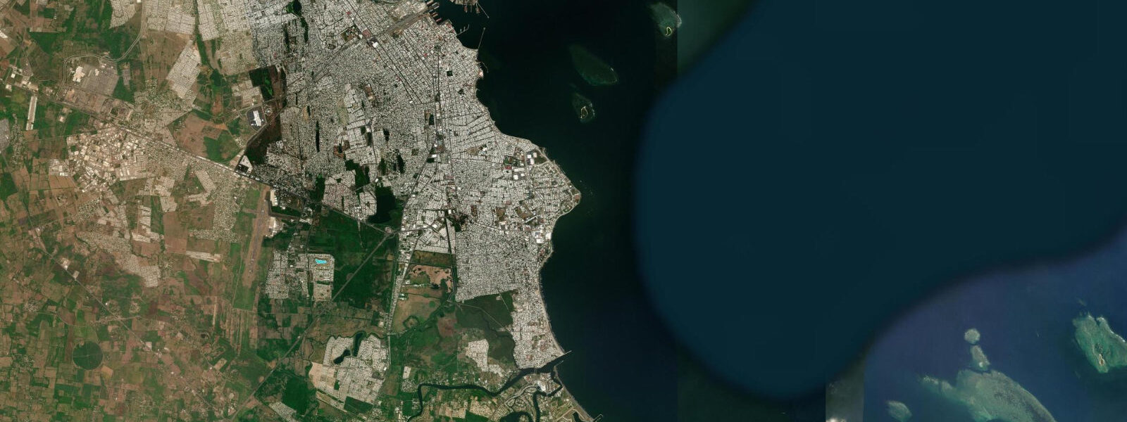
Playa Tuxpan — known locally as Playa Norte — is 12 km east of the city on the Gulf coast, a broad beach backed by coconut palms and tourist infrastructure stretching roughly 50 km along the coast. The Gulf of Mexico swell here is moderate and consistent, averaging 0.5–1.0 m on normal days. The beach is wide at low tide and narrows as the tide comes in, though the small range means the change is subtle. Beach vendors operate year-round but the main season runs December through April when Mexican families from the Veracruz and Mexico City interior arrive for beach holidays. The water temperature hovers around 25–28°C from May through October, dropping to 20–22°C in winter.
The El Tajín archaeological site — a UNESCO World Heritage Totonac pyramid complex — lies 60 km inland from Tuxpan, near Papantla. It has no tidal relevance, but the combination of Playa Tuxpan and El Tajín makes Tuxpan a practical base for visitors combining Gulf coast beach time with pre-Columbian archaeology. The Tajín site is most famous for the Pyramid of the Niches (365 niches, one per day of the solar year) and the carved ball court reliefs.
Tide data for Tuxpan, Veracruz comes from the Open-Meteo Marine API, a gridded model product. Timing accuracy is ±45 minutes, height accuracy ±0.3 m — usable for trip planning, not for navigation.
Tide questions about Tuxpan, Veracruz
Quick answers to the most common questions about tide times, range, and water access at Tuxpan, Veracruz.
How far does the tide travel up the Tuxpan River into the city?
The tidal influence in the Tuxpan River is perceptible 20 km upstream from the Gulf entrance under typical flow conditions. The river rises and falls 0.4–0.6 m with the tidal cycle at the city waterfront, which is 12 km from the bar. Saltwater intrusion on the flood tide pushes a brackish wedge upriver past the city, affecting salinity and fish species distribution in the lower river. During wet season high flow (June–October), the freshet from the upper river partially suppresses tidal penetration; during the dry season (January–May) tidal influence extends further upstream. The Malecón waterfront provides a direct visual reference — locals read the river level by the height of water against the embankment wall.
What is the Bar de Tuxpan and when is it safe to cross?
The Bar de Tuxpan is the shallow sandbar at the Gulf entrance to the Tuxpan River, where the river's sediment load deposits as the current meets the open Gulf. At low spring water the bar shallows to 1.0–1.5 m in the shallowest sections. Vessels drawing more than 0.8 m should time their crossing within two hours of high water, when the tidal stage adds 0.3–0.5 m above the low-water depth. The local commercial fishing fleet, supply vessels for offshore oil platforms, and recreational boaters all work around this constraint. Given the Open-Meteo model's ±45 minute timing uncertainty, add a 45-minute buffer when planning a bar crossing — arrive early, wait at anchor in the river if needed, and transit on the rising tide.
Where is the Granma departure plaque on the Malecón?
The plaque marking the Granma's 1956 departure from Tuxpan is located on the Malecón waterfront promenade, along the south bank of the Tuxpan River. It is a modest concrete marker — not a large monument — positioned near the area of the riverbank from which the vessel was loaded and launched on the night of 25 November 1956. The vessel slipped downstream on the ebb tide to avoid detection, crossing the Bar de Tuxpan in darkness before heading south across the Gulf to Cuba. The plaque is most easily found by walking the Malecón from the central park toward the downstream end and watching for the riverside markers; locals can point it out directly.
What is Playa Tuxpan like and does the tide affect beach conditions?
Playa Tuxpan (Playa Norte) is a broad Gulf of Mexico beach 12 km east of Tuxpan city, backed by palm trees and backed by low dunes and tourist infrastructure for roughly 50 km of coastline. The beach is wide — 80–120 m from dune to waterline at low water — and narrows by 20–30 m at high tide, a modest change given the Gulf's 0.4–0.6 m range. Gulf swell averages 0.5–1.0 m under normal trade wind conditions, with larger swells from 1.5–2.5 m during the occasional Gulf storm. Swimming is generally calm here by open-coast standards; the beach shelves gently. The main visitor season is December through April; summer months are warm but humid with afternoon thunderstorm risk.
Can you visit both Playa Tuxpan and El Tajín on the same trip?
Tuxpan makes a practical base for combining Gulf Coast beach time with the El Tajín archaeological site. The ruins are 60 km inland via highway toward Papantla, a 1–1.5 hour drive. El Tajín is a UNESCO World Heritage site of the Totonac culture, most notable for the Pyramid of the Niches with its 365 decorated openings and the detailed stone carvings on the ball court walls. The site opens at 08:00 and closes at 17:00; a half day is sufficient for most visitors, leaving the afternoon for Playa Tuxpan. The Papantla voladores (pole flyers) perform at El Tajín on weekends and during the Cumbre Tajín festival held each March around the spring equinox. The tide at Tuxpan has no bearing on El Tajín planning.
7-day tide table — Tuxpan, Veracruz
Heights relative to MSL. Predictions: Open-Meteo Marine (MeteoFrance SMOC, 0.08° grid) — heights relative to MSL (not chart datum / LAT). Model-derived.
| Day | Type | Time | Height |
|---|---|---|---|
| Fri 19 Jun | High | 07:00 | 0.1m |
| Low | 23:45 | -0.4m | |
| Sat 20 Jun | High | 07:00 | 0.0m |
| Sun 21 Jun | Low | 14:10 | -0.2m |
| Mon 22 Jun | High | 07:10 | -0.1m |
| Tue 23 Jun | — | ||
| Wed 24 Jun | — | ||
| Thu 25 Jun | Low | 17:00 | -0.5m |