Mahébourg tide times
Mahébourg tide forecast — heights relative to MSL.
Today's tide times for Mahébourg
Tide times at Mahébourg on Sunday, 21 June 2026: first high tide at 04:00am, first low tide at 10:50am, second high tide at 05:15pm. Sunrise 06:43am, sunset 05:37pm.
Tide chart for Mahébourg
24-hour cosine-interpolated curve around the present moment. Heights relative to MSL. Predictions: Predictions: Open-Meteo Marine (MeteoFrance SMOC, 0.08° grid).
Sun, moon and conditions on Sun 21 Jun
Snapshot at build time — refreshes daily. Sea state from Open-Meteo Marine.
Highs and lows next 7 days
Every predicted high and low for the next week, with the daily tidal coefficient (0–120; higher = bigger swing, > 95 means stronger currents).
Other spots nearby
The three closest curated TideTurtle locations to Mahébourg, measured by great-circle distance.
Today's solunar windows
Solunar tradition: major periods are the ≈3h windows around moon transit and opposition; minor are ≈2h around moonrise and moonset. Pair with the local tide stage and wind for the best read.
About tides at Mahébourg
A short guide to the coastline at Mahébourg — geography, sea state, and what the tide is actually doing under your feet.
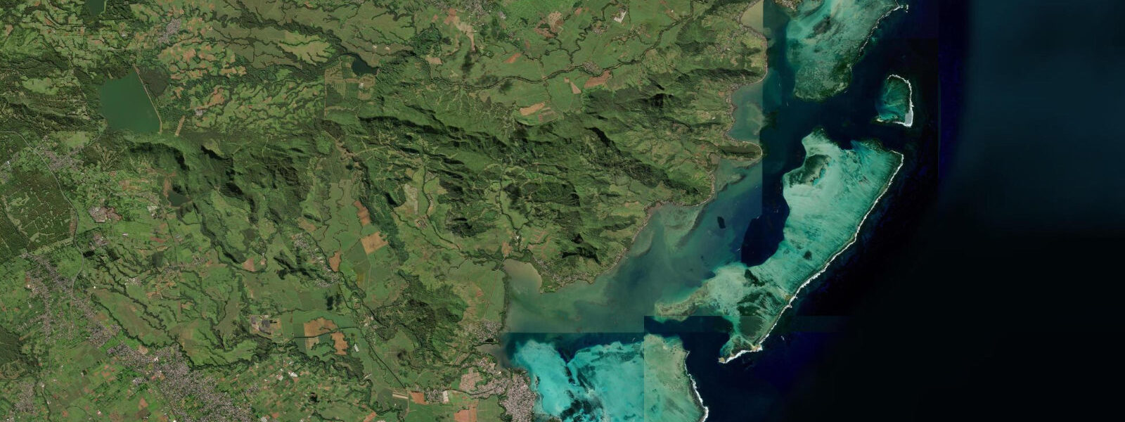
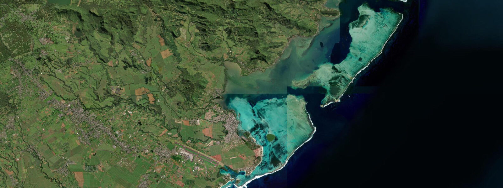
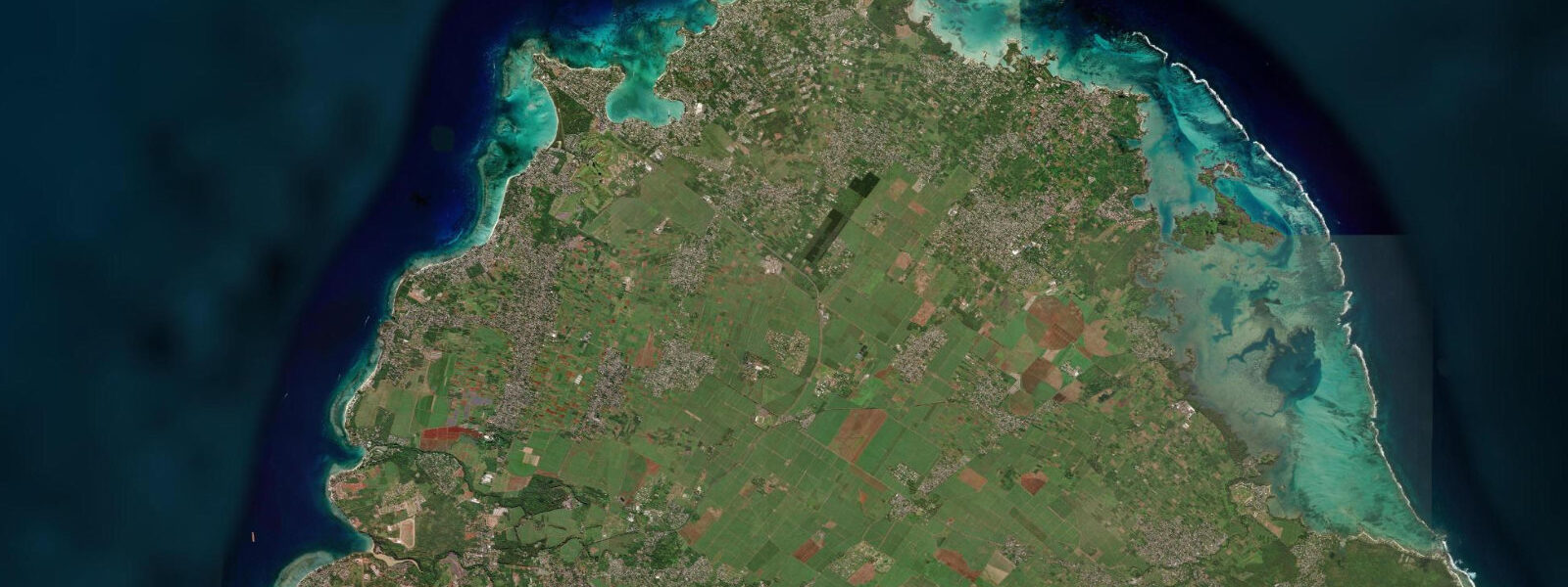
Mahébourg is a coastal town of roughly 15,000 on the west shore of Grand Port Bay, facing west-southwest into a sheltered lagoon backed by the offshore reef system. It is the principal town of the Mahébourg District and the largest settlement on the southeast coast. The Mahébourg Waterfront Promenade — a 1.5 km paved esplanade along the bay — fronts the town, built in 2010 on reclaimed land and running from the central market north to the small boat harbour at Mahébourg Port.
Grand Port Bay holds a specific place in naval history: on 22–27 August 1810, a Franco-Mauritian fleet under Vice-Admiral Duperré defeated a British squadron attempting to land at Mahébourg, sinking three British frigates and capturing a fourth. The Battle of Grand Port was the only naval defeat of the British during the Napoleonic Wars to be inscribed on the Arc de Triomphe in Paris, and the National History Museum at Mahébourg (housed in a colonial mansion on the waterfront) presents the original cannon, ship's logs, and charts from the engagement. The museum is worth 90 minutes of any coastal itinerary on the southeast.
The tidal regime at Mahébourg is semidiurnal — two highs and two lows daily — with spring range 0.8–1.0 m. Neap range 0.3–0.5 m. The Grand Port lagoon is notably shallower than the northern Mauritius lagoons; the inner reach between the promenade and the main reef channel is 0.5–1.2 m at mean water level. At low spring water (the full 0.9–1.0 m spring range), the inner lagoon can drop to 0.0–0.3 m in the shallowest reaches adjacent to the promenade. Local fishing boats carrying outboard motors in 0.4–0.6 m draft require the flood tide — or at minimum the mid-tide level — to transit from the small harbour out to the main reef channel without touching bottom.
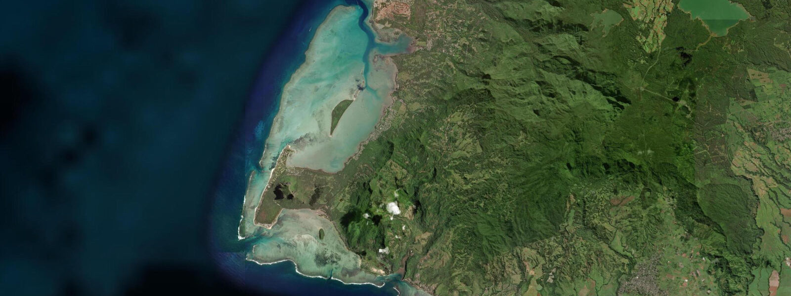
The lagoon at Mahébourg is wide (3–4 km to the outer reef) and the view from the promenade across to the offshore islands — Île aux Aigrettes and the distant peak of Île aux Fouquets — is one of the more expansive coastal views on the island. Île aux Aigrettes, 850 m offshore and accessible by boat from Mahébourg Harbour, is a managed island coral cay where the Mauritian Wildlife Foundation runs the native flora and fauna restoration programme: pink pigeons (Nesoenas mayeri), Aldabra giant tortoises, and the native Mauritian skink all present in a forest that is being returned to its pre-human composition. Boat trips to Île aux Aigrettes depart from the pontoon at the south end of the promenade, twice daily at approximately 09:30 and 13:00. Advance booking is required.
For shore anglers, the Mahébourg Waterfront Promenade and the sea wall at the southern harbour are active fishing points, particularly at dusk and dawn. The incoming tide brings mullet and juvenile trevally into the shallow lagoon margins; the outgoing ebb concentrates fish in the channels between the shallow lagoon floor and the deeper boat channel. Night fishing with bait on the bottom targets barracuda and larger trevally. Crab collection (Mauritian swimming crab, Portunus pelagicus) in the seagrass beds at low tide is a local tradition at the southern end of the bay.
The Mahébourg waterfront market (Bazar de Mahébourg) operates on Mondays, the main weekly market day in the town. Fresh fish is landed at the small harbour and sold at the market stalls adjacent to the promenade from 06:00. The best fish selection is before 08:30 on market mornings; by 09:30 the premium catch is distributed to restaurants and buyers.
Predictions for Mahébourg on this page come from Open-Meteo Marine, a gridded global ocean model; accuracy is typically ±45 minutes on timing and ±0.2–0.3 m on height. The Mauritius Oceanography Institute (MOI) at Albion publishes authoritative harmonic tide predictions for Mauritius.
Tide questions about Mahébourg
Quick answers to the most common questions about tide times, range, and water access at Mahébourg.
How does the tide affect boat access at Mahébourg Harbour?
The Grand Port lagoon is shallow — the inner reach adjacent to the promenade shallows to 0.0–0.3 m at low spring water (spring range 0.8–1.0 m). Local fishing boats and smaller motorised vessels drawing 0.4–0.6 m require at least mid-tide level to transit from the small harbour out to the main reef channel without grounding. Visitors joining the Île aux Aigrettes tour boat should confirm departure time relative to the tide; the 09:30 departure is usually timed for the morning flood. Larger vessels — the occasional inter-island cargo scow — use the dredged channel that runs through the lagoon on the line established during the French colonial period; that channel maintains adequate depth on all but the lowest spring tides.
What is the National History Museum at Mahébourg?
The National History Museum is housed in the colonial mansion of the Robillard family on the waterfront, one of the oldest surviving buildings in Mahébourg. It focuses on the Battle of Grand Port (August 1810), the only French naval victory of the Napoleonic Wars inscribed on the Arc de Triomphe in Paris. The collection includes original cannon, ship's navigational instruments, charts of the Grand Port engagement, and personal effects from officers on both sides. The museum also covers the colonial era more broadly: the slavery period, the indentured labour system that followed abolition, and the natural history of Mauritius. Open Tuesday–Sunday, approximately 09:00–16:00; entry free or nominal fee. Allow 60–90 minutes.
How do I visit Île aux Aigrettes from Mahébourg?
Île aux Aigrettes is 850 m offshore from the south end of the Mahébourg waterfront promenade. The Mauritian Wildlife Foundation (MWF) runs the restoration programme and the visitor boats, departing from the south pontoon at approximately 09:30 and 13:00. Advance booking is required — contact MWF directly or book through a registered Mauritius tour operator. The boat crossing takes approximately 10 minutes across the inner lagoon, navigating the shallow channel that is best transited on the flood tide. The island programme covers endemic bird species (pink pigeon, Mauritius fody), Aldabra giant tortoises introduced as ecological proxies for the extinct Rodrigues giant tortoise, and the native forest restoration. A 90-minute guided walk is the standard visit format.
What is the tidal range at Mahébourg and why does it matter?
Spring range at Mahébourg is 0.8–1.0 m, the same semidiurnal range as the rest of Mauritius. The small range would be unremarkable on a deeper-lagooned coast, but at Mahébourg the Grand Port lagoon is exceptionally shallow: the inner reach adjacent to the promenade is 0.5–1.2 m at mean water level and can drop to less than 0.3 m at low spring. The 0.9 m range therefore changes the character of the inner lagoon materially — at high water it is knee-to-waist depth, at low spring water it is ankle depth or exposed mud flat in the shallowest corners. Fishing activity, crab collection, and boat access all calibrate to the tidal state in a way that is more obvious here than at the deeper northern lagoons. Open-Meteo Marine predictions carry ±45 minutes / ±0.2–0.3 m accuracy.
Is it safe to use these tide predictions for boat navigation in Grand Port Bay?
No. Open-Meteo Marine gridded predictions are not gauge-calibrated harmonic data and should not be used for vessel navigation. Grand Port Bay has a complex shallow-water bathymetry with a dredged channel, scattered shoals, and reef passes that require local knowledge and current charts. For navigation in Grand Port Bay, use UKHO Admiralty charts for Mauritius (BA 711 or the relevant large-scale sheet) and the MOI harmonic tide tables. The bay was navigated under combat conditions in 1810 — its shoals were dangerous then and they remain a navigation consideration for vessels unfamiliar with the approach. The Marine Police at Mahébourg Harbour can advise on current conditions and channel status.
8-day tide table — Mahébourg
Heights relative to MSL. Predictions: Open-Meteo Marine (MeteoFrance SMOC, 0.08° grid) — heights relative to MSL (not chart datum / LAT). Model-derived.
| Day | Type | Time | Height |
|---|---|---|---|
| Sun 21 Jun | High | 04:00 | 0.9m |
| Low | 10:50 | 0.5m | |
| High | 17:15 | 0.8m | |
| Mon 22 Jun | — | ||
| Tue 23 Jun | Low | 00:50 | 0.6m |
| High | 06:10 | 0.7m | |
| Wed 24 Jun | — | ||
| Thu 25 Jun | — | ||
| Fri 26 Jun | Low | 04:15 | 0.5m |
| High | 22:06 | 0.9m | |
| Sat 27 Jun | Low | 05:00 | 0.4m |
| High | 11:10 | 0.8m | |
| Low | 16:42 | 0.5m | |
| High | 22:50 | 1.0m | |
| Sun 28 Jun | Low | 03:00 | 0.6m |