Le Morne Peninsula tide times
Le Morne Peninsula tide forecast — heights relative to MSL.
Today's tide times for Le Morne Peninsula
Tide times at Le Morne Peninsula on Sunday, 21 June 2026: first high tide at 04:00am, first low tide at 11:06am, second high tide at 05:50pm, second low tide at 11:50pm. Sunrise 06:45am, sunset 05:39pm.
Tide chart for Le Morne Peninsula
24-hour cosine-interpolated curve around the present moment. Heights relative to MSL. Predictions: Predictions: Open-Meteo Marine (MeteoFrance SMOC, 0.08° grid).
Sun, moon and conditions on Sun 21 Jun
Snapshot at build time — refreshes daily. Sea state from Open-Meteo Marine.
Highs and lows next 7 days
Every predicted high and low for the next week, with the daily tidal coefficient (0–120; higher = bigger swing, > 95 means stronger currents).
Other spots nearby
The three closest curated TideTurtle locations to Le Morne Peninsula, measured by great-circle distance.
Today's solunar windows
Solunar tradition: major periods are the ≈3h windows around moon transit and opposition; minor are ≈2h around moonrise and moonset. Pair with the local tide stage and wind for the best read.
Cycle dates near Le Morne Peninsula
Last spring tide on Sun 21 Jun (range 0.3m). Next spring tide on Sat 27 Jun (range 0.5m). Next neap on Mon 22 Jun.
Spring tides cluster around new and full moons (biggest swings). Neap tides land on quarter moons (smallest swings). See the spring tide and neap tide glossary entries for the why.
About tides at Le Morne Peninsula
A short guide to the coastline at Le Morne Peninsula — geography, sea state, and what the tide is actually doing under your feet.
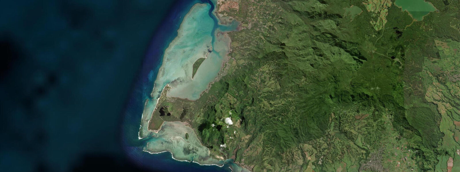
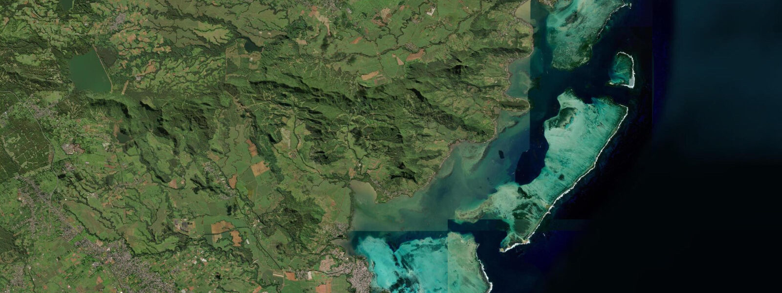
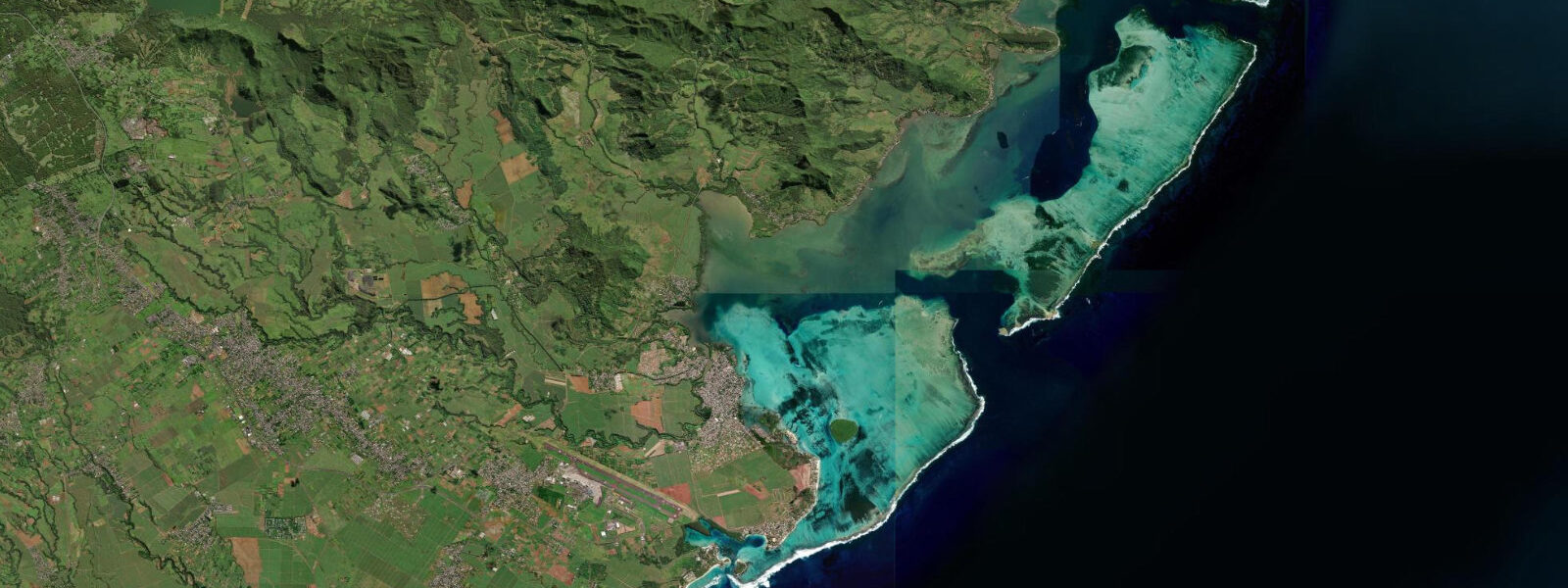
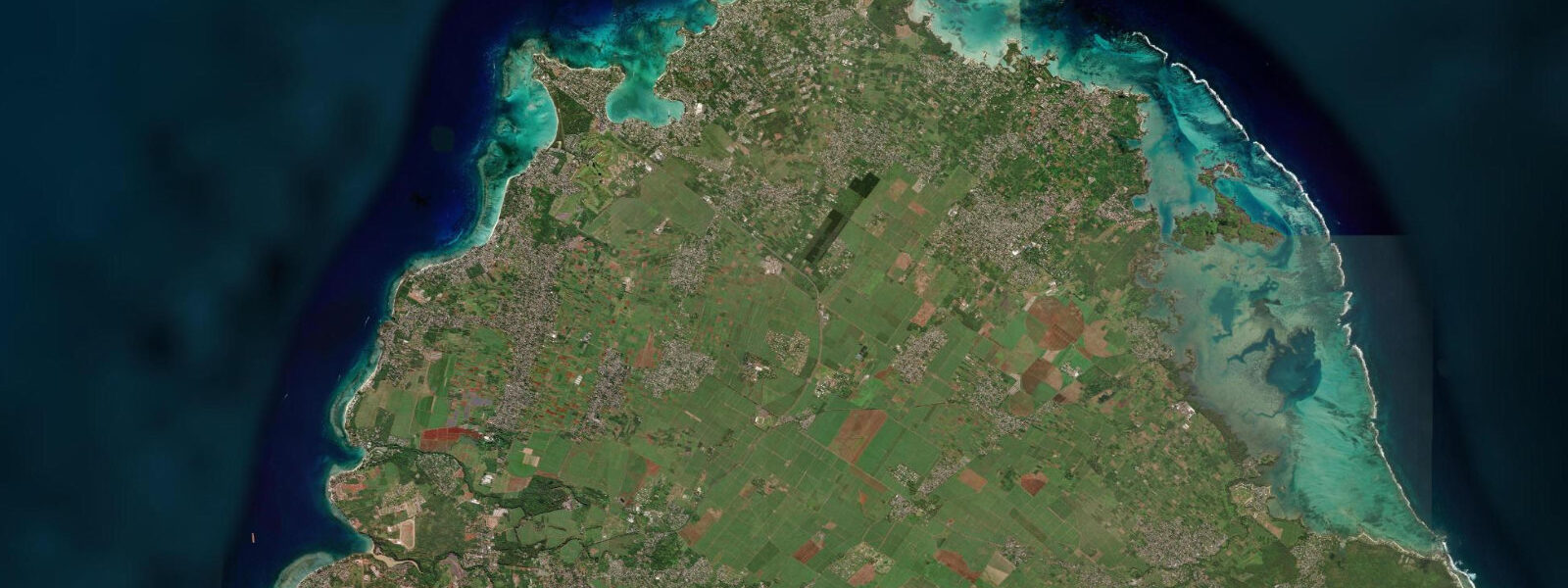
Le Morne Peninsula extends southwest from the main body of Mauritius, a narrow basaltic finger of land dominated by the Le Morne Brabant mountain (556 m), which rises from the peninsula in an almost vertical basalt plug visible from 30 km at sea. The mountain and surrounding lagoon are a UNESCO World Heritage Site — inscribed in 2008 to commemorate the mountain's use as a refuge by escaped slaves (Maroons) in the 18th and 19th centuries. The site carries the specific cultural designation of a landscape of resistance; the inscribed area includes the mountain, the lagoon, and the beach at the peninsula's base.
The tidal regime at Le Morne follows the standard Mauritius semidiurnal pattern, with spring range 0.8–1.0 m above chart datum and neap range 0.3–0.5 m. On this coast, however, the tidal range is almost operationally irrelevant for the primary activity: kitesurfing and windsurfing. The lagoon inside the southwestern reef at Le Morne provides flat, waist-to-chest-deep water, and the activity is driven entirely by the wind — specifically the SE trade winds that funnel around the southwestern tip of Mauritius and create consistent 15–25 knot averages from May through October.
Le Morne is rated by kitesurfing publications as one of the top five kitesurfing locations in the world, specifically because the wind-tide-reef configuration produces two distinct zones in the same lagoon: an inner flat-water section over the sand and seagrass, ideal for freestyle and freeride kitesurfing, and a wave zone at the outer reef edge where the trade swell wraps over the reef crest and provides a wave for wave-riding style. The lagoon at the base of the peninsula measures approximately 2 km across; the full distance from the beach to the outer reef is enough to accommodate multiple disciplines simultaneously.
The reef at Le Morne is also the source of the famous "underwater waterfall" illusion visible from aircraft and drone footage. Sand and sediment transported off the peninsula's submarine shelf by the prevailing current cascades over the edge of an underwater escarpment to the southwest. The effect is entirely visual — the sand appears to be falling off a cliff into deep water, creating what looks from above like a waterfall. It is most visible from a drone or helicopter at between 100 and 300 m altitude when the sun angle is between 10:00 and 14:00 local time. Several aerial tour operators from Grand Baie and the west coast fly Le Morne specifically for this image.
The tidal state has two practical effects at Le Morne. First, the lagoon depth over the inner flat-water section varies by 0.8–1.0 m spring range — at low spring water the inner shallows near the beach edge are 0.2–0.4 m deep, limiting the entry and exit angle for kitesurfers. Most kiters prefer at least 0.5 m of depth for a comfortable walk-in start, which occurs around mid-tide or above on spring days. Second, the tidal current through the reef passes at the southwestern tip creates a longshore drift component that affects the track of a kite session; experienced kiters at Le Morne read the tidal current as a navigation input, particularly when downwinding toward the reef edge.
For beach walkers and photographers, the Le Morne Peninsula beach (the northwestern face of the peninsula, facing the lagoon) is most photogenic in the late afternoon when the low sun illuminates the basalt face of Le Morne Brabant from the southwest. The mountain turns orange-red in the last 45 minutes of direct light. At spring high water the lagoon colour is deepest — cobalt in the channel, turquoise over the sand, with the mountain silhouette behind.
Accommodation on the peninsula includes the Lux Le Morne, Heritage Le Telfair, and Beachcomber Paradis resorts, all on the northwestern lagoon side. Public access to the beach and the lagoon is guaranteed by Mauritian law (foreshore to the high-water mark is public); public parking is available at the base of the peninsula road. Kitesurfing instruction from certified instructors is available through the kite centres at the peninsula base.
Predictions for Le Morne Peninsula on this page come from Open-Meteo Marine, a gridded global ocean model; accuracy is typically ±45 minutes on timing and ±0.2–0.3 m on height.
Tide questions about Le Morne Peninsula
Quick answers to the most common questions about tide times, range, and water access at Le Morne Peninsula.
Why is Le Morne considered a top kitesurfing destination?
The Le Morne lagoon receives consistent SE trade winds funnelled around the southwestern tip of Mauritius, producing 15–25 knot averages from May through October with reliable sea-breeze enhancement to 20–30 knots in the afternoon. The lagoon geometry provides two distinct zones in a 2 km width: an inner flat-water section over sand and seagrass at waist-to-chest depth (mid-tide and above), and a wave zone at the outer reef edge where trade swell wraps over the crest. The combination of flat-water freestyle and wave-riding in the same session, at consistent wind strength and without significant tidal interference, places Le Morne in the same tier as Tarifa, Maui, and Dakhla for the range of discipline it supports. Kitesurfing instruction from certified instructors is available at the kite centres at the peninsula base.
Does the tide affect kitesurfing at Le Morne?
The tidal range at Le Morne is 0.8–1.0 m spring — small, but not negligible for the inner flat-water zone. At low spring water the shallow inner section near the beach can be 0.2–0.4 m deep, which restricts the walk-in start depth for kitesurfers and concentrates the usable flat-water area toward the deeper mid-lagoon. Most kiters prefer at least 0.5 m of entry depth, which occurs from mid-tide upward on spring days. The tidal current through the southwestern reef passes creates a modest longshore drift (typically 0.2–0.4 knots) that experienced kiters incorporate into their session track, particularly when approaching the reef edge on a downwind run. Check the tide table for session planning; the high-water window gives the most usable lagoon depth.
What is the UNESCO World Heritage significance of Le Morne?
Le Morne Brabant mountain and its surrounding landscape were inscribed as a UNESCO World Heritage Site in 2008 under the category of cultural landscape. The designation commemorates the history of Maroon communities — escaped enslaved people — who used the mountain's sheer cliffs and difficult terrain as a refuge from colonial authorities during the 18th and 19th centuries. The mountain became a symbol of resistance and freedom in Mauritian cultural memory. The inscribed site encompasses the mountain, the lagoon, and the beach area; visitor access to the mountain is via a marked trail (guide recommended, contact the local guide association at the peninsula base). The National Heritage Fund manages the site.
How do I see the 'underwater waterfall' at Le Morne?
The underwater waterfall illusion at Le Morne is visible from the air — specifically from a drone, helicopter, or light aircraft at 100–300 m altitude over the southwestern tip of the peninsula. It is caused by sand and sediment carried off the peninsula's submarine shelf by the prevailing current cascading over an underwater escarpment into deep water; from above and at the right angle it resembles a waterfall dropping off a cliff. The effect is most visible when the sun is between 10:00 and 14:00 local time and the water is clear. Aerial tour operators running helicopter or light-aircraft tours from Grand Baie or the west coast regularly include Le Morne in their route. It is not visible from the beach or from sea level.
Where do the tide predictions for Le Morne come from?
Predictions on this page come from Open-Meteo Marine, a free gridded global ocean model with typical accuracy of ±45 minutes on timing and ±0.2–0.3 m on height. The authoritative source for Mauritius tide predictions is the Mauritius Oceanography Institute (MOI) at Albion — coincidentally close to Le Morne on the west coast — which publishes annual tide tables using harmonic analysis of the Port Louis gauge record. The tidal range and timing at Le Morne differ from Port Louis by less than 5 minutes and 0.05 m. For vessel navigation around the southwestern reef at Le Morne — a complex outer reef with passes used by charter vessels heading for the southern banks — use UKHO Admiralty charts (BA 711) and MOI harmonic tables.
8-day tide table — Le Morne Peninsula
Heights relative to MSL. Predictions: Open-Meteo Marine (MeteoFrance SMOC, 0.08° grid) — heights relative to MSL (not chart datum / LAT). Model-derived.
| Day | Type | Time | Height |
|---|---|---|---|
| Sun 21 Jun | High | 04:00 | 0.8m |
| Low | 11:06 | 0.5m | |
| High | 17:50 | 0.8m | |
| Low | 23:50 | 0.6m | |
| Mon 22 Jun | High | 19:00 | 0.8m |
| Tue 23 Jun | Low | 01:50 | 0.6m |
| High | 20:00 | 0.8m | |
| Wed 24 Jun | Low | 03:00 | 0.6m |
| High | 20:50 | 0.8m | |
| Thu 25 Jun | — | ||
| Fri 26 Jun | Low | 04:50 | 0.5m |
| High | 11:10 | 0.8m | |
| Sat 27 Jun | Low | 05:15 | 0.4m |
| High | 22:54 | 0.9m | |
| Sun 28 Jun | Low | 03:00 | 0.6m |