Valletta tide times
Valletta tide forecast — heights relative to MSL.
Today's tide times for Valletta
Tide times at Valletta on Friday, 31 July 2026: first low tide at 10:45pm. Sunrise 06:07am, sunset 08:08pm.
Tide chart for Valletta
24-hour cosine-interpolated curve around the present moment. Heights relative to MSL. Predictions: Predictions: Open-Meteo Marine (MeteoFrance SMOC, 0.08° grid).
Sun, moon and conditions on Fri 31 Jul
Snapshot at build time — refreshes daily. Sea state from Open-Meteo Marine.
Highs and lows next 7 days
Every predicted high and low for the next week, with the daily tidal coefficient (0–120; higher = bigger swing, > 95 means stronger currents).
Other spots nearby
The three closest curated TideTurtle locations to Valletta, measured by great-circle distance.
Today's solunar windows
Solunar tradition: major periods are the ≈3h windows around moon transit and opposition; minor are ≈2h around moonrise and moonset. Pair with the local tide stage and wind for the best read.
About tides at Valletta
A short guide to the coastline at Valletta — geography, sea state, and what the tide is actually doing under your feet.
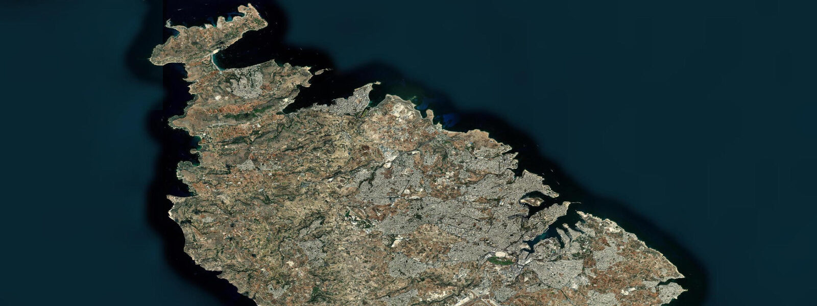
Valletta sits on the Sciberras Peninsula between Grand Harbour to the south and Marsamxett Harbour to the north, a fortified city of 320 metres wide and 600 metres long that the Knights of St John built in a single planned act of construction after the Great Siege of 1565. The harbour on either side is the reason the city exists: Grand Harbour is one of the finest natural deep-water anchorages in the Mediterranean, a long creek system behind the protection of Fort St. Elmo at the peninsula's tip, with the fortified promontories of Senglea and Vittoriosa across the water forming the Three Cities that predate Valletta itself.
The tides here are the smallest of any European harbour of comparable historical significance. 3 metres even at spring tides near new and full moons. This is not a rounding issue or a data gap: Malta sits close to a nodal point in the Mediterranean's tidal oscillation where the astronomical forcing is genuinely minimal.
The Mediterranean is a semi-enclosed sea, and the tidal wave that propagates in from the Atlantic through the Strait of Gibraltar loses energy crossing the basin, arriving in the central Mediterranean as a weak signal. At Malta's latitude, the combination of basin geometry and the nodal amphidromic point in the central Mediterranean suppresses the tidal range to its absolute minimum. What moves water level at Grand Harbour is almost entirely atmospheric.
A sustained Grigal — the northeast winter wind that funnels down the Adriatic and across the central Mediterranean — pushes surge into the exposed northeast-facing openings and around the St. Elmo headland. Historical accounts of the Knights' harbour operations and later Royal Navy dockyard records at Grand Harbour document sea-level rises of 30 to 50 centimetres during winter northeasters, events driven entirely by wind setup and pressure, not by tidal prediction.
The harbour entrance between Fort St. Elmo and Fort Ricasoli faces northeast, directly into the Grigal fetch, and surge propagates up the three creek inlets — Dockyard Creek, French Creek, and Kalkara Creek — on the southern side of the harbour. The cruise-ship berths along the Valletta waterfront at Pinto Wharf hold large vessels independent of tidal state because the water depth is constant to within a fraction of a metre across the day.
The same is true of the passenger ferry between Valletta and Senglea (the Dghajsa water taxi service) and the fast ferry terminal at the Valletta Waterfront that connects to Sliema and St. Julian's — scheduling here is driven by wind and ferry timetable, not by tide state. For swimmers, the rock platforms and small beaches near Valletta are limited and mostly on the Marsamxett Harbour side — St.
Elmo beach at the tip of the peninsula and the narrow stretch at Tigné Point across the harbour entrance. Neither site changes character meaningfully between the tidal highs and lows; the governing variable at both is the swell direction and the state of the northeasterly wind. Snorkellers working the walls below the bastions on the Marsamxett side find the water clarity driven by recent rain — the limestone runoff from the city streets after heavy rain clouds the harbour water for a day or two — rather than by tidal state.
Shore anglers working the breakwaters and harbour walls at Grand Harbour and the Marsamxett entrance fish for white seabream, two-banded seabream, and occasional grouper on the harbour walls, timing their sessions to the early morning calm rather than to any tidal cycle. The Ports and Yachts Directorate under Transport Malta is the authority responsible for harbour operations and water-level monitoring at Grand Harbour and Marsamxett. The predictions on this page come from Open-Meteo Marine, a gridded global ocean model.
3 metres on height — model-derived, not from a local gauge. At Valletta, the model's height uncertainty comfortably equals or exceeds the entire predicted astronomical signal. The predicted tide here should be understood as a rough indicator of the tidal phase — rising, falling, near high, near low — rather than as a precise water-level forecast.
Atmospheric pressure and wind are the dominant sea-level forces.
Tide questions about Valletta
Quick answers to the most common questions about tide times, range, and water access at Valletta.
When is the next high tide at Valletta?
The hero block at the top of this page shows the next predicted high at Valletta's Grand Harbour in local Malta time (CET in winter, CEST in summer, UTC+1/UTC+2). Malta is semidiurnal — two highs and two lows each day, roughly 12 hours 25 minutes apart — but the astronomical range is so small, around 0.1 to 0.2 metres, that the high-tide prediction has limited practical significance for most users. Wind and atmospheric pressure drive a far larger sea-level signal than the tide. The Ports and Yachts Directorate under Transport Malta is the authoritative source for Grand Harbour water-level data.
Why is the tidal range at Valletta so small?
Malta sits near a nodal point in the Mediterranean's tidal oscillation — an amphidromic region where the tidal wave's height is minimal. The Mediterranean is a semi-enclosed basin with a narrow connection to the Atlantic at the Strait of Gibraltar, and tidal energy diminishes substantially crossing the basin. By the time the tidal signal reaches the central Mediterranean, the astronomical range at Malta's latitude is down to 0.1 to 0.2 metres mean, with spring tides rarely exceeding 0.3 metres. This is among the smallest tidal ranges of any inhabited coast in Europe. What you see as apparent 'tide' at the Grand Harbour steps is mostly atmospheric pressure and wind.
Where do the tide predictions on this page come from?
Open-Meteo Marine, a free gridded global ocean model. The model derives tidal estimates from oceanographic equations applied across a geographic grid, not from harmonic analysis of a calibrated gauge at Valletta. Accuracy is typically within plus or minus 45 minutes on timing and 0.2 to 0.3 metres on height — model-derived, not a local gauge. At Valletta, that height uncertainty is larger than the entire predicted tidal range. The predictions are best used to understand the tidal phase — rising or falling — rather than to anticipate precise water levels. The Ports and Yachts Directorate under Transport Malta holds the authoritative Grand Harbour gauge data.
Is Valletta Harbour safe for swimming and kayaking?
Grand Harbour is an active commercial and cruise-ship port — swimming and recreational kayaking inside the main harbour channels is restricted by port regulations and vessel traffic. Marsamxett Harbour, on the north side of the Valletta peninsula, is more accessible for paddlecraft and has the Lazzaretto Creek anchorage and the Sliema waterfront. The small beaches at St. Elmo and Tigné Point on the Marsamxett entrance are the closest accessible swimming spots to Valletta. None of these sites changes character meaningfully with the tidal cycle, given the negligible range. Swell and wind state determine in-water conditions, not tide height.
Can I use these predictions for navigating into Grand Harbour?
No. Vessel entry and departure from Grand Harbour is managed by the Ports and Yachts Directorate under Transport Malta, which requires advance notice for commercial vessels and controls movements through the breakwater entrance. Open-Meteo Marine gridded predictions do not replace official harbour authority data for navigational use. The tidal range at Valletta is so small that depth-critical navigation decisions are determined by chart soundings and draught, not tidal state — but the port authority notification requirement applies regardless. Consult the Transport Malta Port Authority for any commercial vessel or large-yacht call.
8-day tide table — Valletta
Heights relative to MSL. Predictions: Open-Meteo Marine (MeteoFrance SMOC, 0.08° grid) — heights relative to MSL (not chart datum / LAT). Model-derived.
| Day | Type | Time | Height |
|---|---|---|---|
| Fri 31 Jul | Low | 22:45 | -0.5m |
| Sat 01 Aug | High | 04:50 | -0.3m |
| Low | 10:50 | -0.5m | |
| High | 17:00 | -0.3m | |
| Low | 23:10 | -0.5m | |
| Sun 02 Aug | High | 05:10 | -0.3m |
| Mon 03 Aug | Low | 12:00 | -0.5m |
| High | 17:50 | -0.3m | |
| Tue 04 Aug | Low | 00:00 | -0.5m |
| High | 06:00 | -0.3m | |
| Wed 05 Aug | Low | 01:00 | -0.5m |
| Thu 06 Aug | High | 09:00 | -0.3m |
| Fri 07 Aug | Low | 01:00 | -0.4m |