St. Julian's tide times
St. Julian's tide forecast — heights relative to MSL.
Today's tide times for St. Julian's
Tide times at St. Julian's on Friday, 31 July 2026: first low tide at 10:45pm. Sunrise 06:07am, sunset 08:08pm.
Tide chart for St. Julian's
24-hour cosine-interpolated curve around the present moment. Heights relative to MSL. Predictions: Predictions: Open-Meteo Marine (MeteoFrance SMOC, 0.08° grid).
Sun, moon and conditions on Fri 31 Jul
Snapshot at build time — refreshes daily. Sea state from Open-Meteo Marine.
Highs and lows next 7 days
Every predicted high and low for the next week, with the daily tidal coefficient (0–120; higher = bigger swing, > 95 means stronger currents).
Other spots nearby
The three closest curated TideTurtle locations to St. Julian's, measured by great-circle distance.
Today's solunar windows
Solunar tradition: major periods are the ≈3h windows around moon transit and opposition; minor are ≈2h around moonrise and moonset. Pair with the local tide stage and wind for the best read.
About tides at St. Julian's
A short guide to the coastline at St. Julian's — geography, sea state, and what the tide is actually doing under your feet.
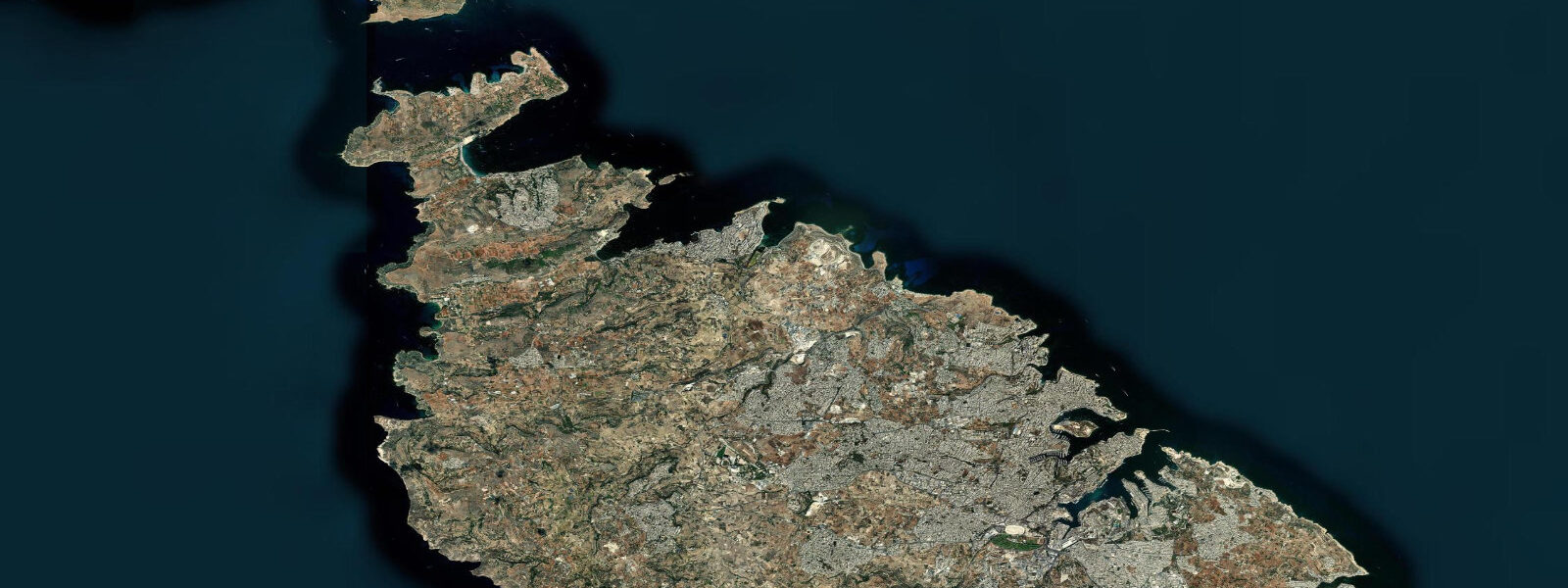
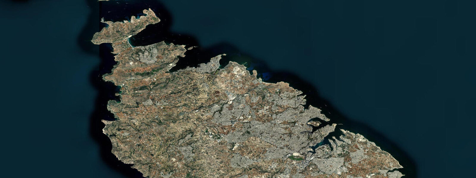
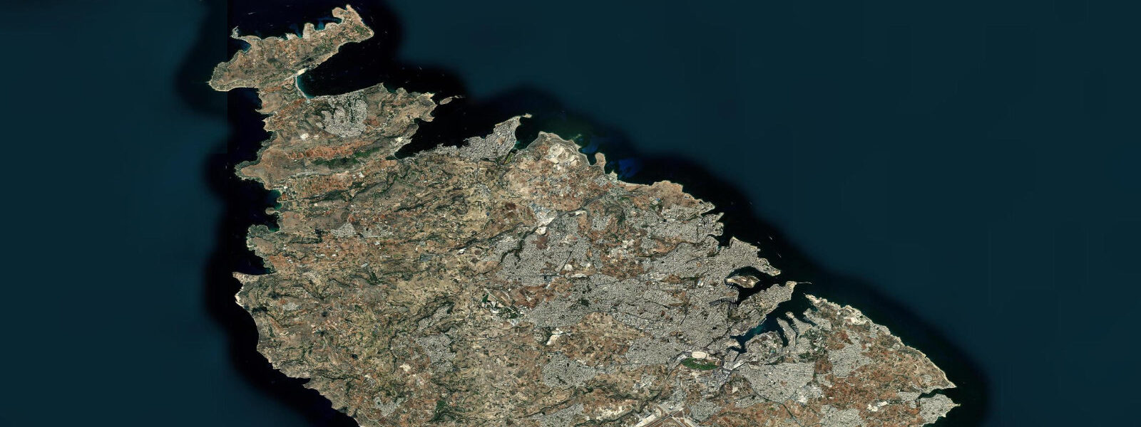
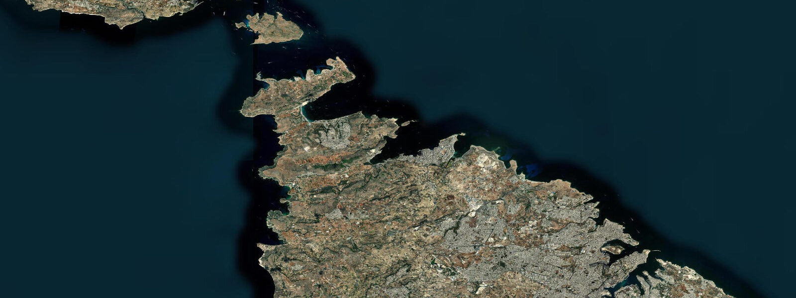
St. Julian's occupies the northwest coast of Malta between Sliema to the south and Paceville and the St. George's Bay inlet to the north, a coastal strip of hotels, restaurants, and the rocky shoreline promenade that runs around Spinola Bay.
Spinola Bay is the geographic centre of the St. Julian's seafront: a small sheltered inlet with traditional Maltese luzzu fishing boats moored at the quay, the characteristic painted eyes on the bows, and the waterfront restaurants that face the boats across a narrow strip of water. The bay opens northwest into Balluta Bay and the wider coastal exposure, and the rock platforms below the Paceville district — the concentrated bar and nightlife district to the northeast — step down to the sea on the Marsamxett Harbour side.
St. George's Bay, the only sandy beach of any size in the St. Julian's area, curves around behind a headland to the north, sheltered enough to be the main swimming beach for the area when the swell is from the south or west but exposed to the northeast fetch when the Grigal blows.
The tidal regime at St. 3 metres on the highest spring tides. The Mediterranean's nodal zone means the astronomical forcing is minimal at this latitude and longitude.
Whether the predicted tide is at its high or low makes no perceptible difference to swimming depth at St. George's Bay, to the depth of the rock entry at the platform below the Westin Dragonara, or to the keel clearance of the luzzu boats moored in Spinola Bay. What does affect water level is the weather.
The Grigal, the northeast wind that runs down the Adriatic and across the central Mediterranean, wraps around the north end of Malta and builds a short, steep swell that runs into Balluta Bay and St. George's Bay, making both sites uncomfortable and on occasion dangerous for swimmers within a few hours of the wind freshening. The sea-level effect of a sustained Grigal adds 10 to 30 centimetres of setup to the northern Malta coast.
The Xlokk, the hot southeasterly from Libya and Tunisia, produces swell on the southeastern coasts while leaving St. Julian's and the northern shore relatively protected. In summer, St.
Julian's mornings are calm — flat water before the sea breeze builds around midday — and that window, regardless of tidal state, is when the snorkellers work the rocky reef below the St. Julian's Point and the coastal strip between Spinola Bay and Balluta Bay. The reef here is limestone, heavily fished, but holds two-banded seabream, white seabream, salema, and wrasse in the low-relief crevice habitat.
Visibility is best after several days of calm weather and degrades fast after rain, which carries silt and runoff off the dense Malta limestone plateau into the coastal zone. Kayakers circumnavigating the northern Malta coast — Sliema to St. Julian's to St.
George's Bay and around the Qawra Point into St. Paul's Bay — plan the passage around wind and swell rather than tidal state, because the tidal current contribution along this coast is negligible. The crossing from the St.
Julian's area to Comino and Gozo, the two other islands in the Maltese archipelago, is more exposed: the Gozo Channel between Malta and Comino is open to the northwest and generates short, steep waves in a moderate northwesterly. That crossing is a weather-window decision, not a tidal-state decision. For photographers, St.
Julian's offers the best combination of accessible coastal foreground and visual depth in Malta: the luzzu boats in Spinola Bay in low morning light, the bastion walls at Sliema across the water to the south, and the rocky platform foreground below the Paceville nightlife district. The light at golden hour from the east catches the painted eyes on the luzzu bows and the limestone facades of the waterfront buildings. The predictions on this page come from Open-Meteo Marine, a gridded global ocean model.
3 metres on height — model-derived, not a local gauge. At St. 2 metres, the model's height uncertainty is the same order as the tidal signal itself.
Use the predictions for tidal phase awareness — rising or falling — not for precise water-level planning.
Tide questions about St. Julian's
Quick answers to the most common questions about tide times, range, and water access at St. Julian's.
When is the next high tide at St. Julian's?
The hero block at the top of this page shows the next predicted high at St. Julian's in Malta local time (CET in winter, CEST in summer, UTC+1/UTC+2). St. Julian's is semidiurnal — two highs and two lows per day, roughly 12 hours 25 minutes apart — but the astronomical range is minimal, 0.1 to 0.2 metres mean, with spring tides rarely exceeding 0.3 metres. The predicted high and low have very limited bearing on swimming conditions or beach access at Spinola Bay or St. George's Bay. Wind direction and swell state govern conditions here far more than tide state.
What is the typical tidal range at St. Julian's?
Mean astronomical range at St. Julian's is around 0.1 to 0.2 metres — one of the smallest tidal ranges on any populated European coastline. Malta sits near a nodal zone in the Mediterranean tidal oscillation, where the tidal signal is close to its minimum. Spring tides at new and full moons might push the total swing to 0.3 metres; neap tides at the quarter moons can be as little as 5 to 10 centimetres. The water level at Spinola Bay and St. George's Bay is driven far more by atmospheric pressure and wind setup — particularly the Grigal northeast wind — than by the astronomical tide.
Where do these tide predictions come from?
Open-Meteo Marine, a free gridded global ocean model. The model estimates tidal height from oceanographic equations applied across a geographic grid, not from harmonic analysis of a dedicated St. Julian's gauge record. Accuracy is typically within plus or minus 45 minutes on timing and 0.2 to 0.3 metres on height — model-derived, not a local gauge. At St. Julian's, the model's height uncertainty is comparable to, or larger than, the entire predicted astronomical signal. The Transport Malta Ports and Yachts Directorate holds the authoritative gauge records for the Maltese coast.
Is St. George's Bay safe for swimming, and does tide affect it?
St. George's Bay is the main sandy swimming beach in the St. Julian's area and is generally calm in southerly and westerly conditions. The tide state has negligible effect on swimming depth or beach width, given the 0.1 to 0.2 metre mean range. What matters is wind direction: the Grigal northeast wind sends short, steep swell directly into the bay, and when it blows at 20 knots or more the beach conditions deteriorate fast regardless of tidal prediction. In summer, the morning window before the sea breeze builds is the flattest and most comfortable time. Check the current marine forecast rather than the tide table for day-to-day planning.
Can I use tide predictions for kayaking between St. Julian's and Comino?
The tidal current contribution along the northern Malta coast and in the Gozo Channel is negligible — the range is too small to generate meaningful tidal flow. Kayaking between St. Julian's and Comino or Gozo is a weather-window decision, not a tidal-state decision. The Gozo Channel is open to the northwest and generates short steep waves in a moderate northwesterly. Check the current Maltese Meteorological Office marine forecast for wind and swell before departure. Open-Meteo Marine tide predictions here reflect astronomical phase only and carry no information about tidal current, which is in any case minimal on this coast.
8-day tide table — St. Julian's
Heights relative to MSL. Predictions: Open-Meteo Marine (MeteoFrance SMOC, 0.08° grid) — heights relative to MSL (not chart datum / LAT). Model-derived.
| Day | Type | Time | Height |
|---|---|---|---|
| Fri 31 Jul | Low | 22:45 | -0.5m |
| Sat 01 Aug | High | 04:50 | -0.3m |
| Low | 10:50 | -0.5m | |
| High | 17:00 | -0.3m | |
| Low | 23:10 | -0.5m | |
| Sun 02 Aug | High | 05:10 | -0.3m |
| Mon 03 Aug | Low | 12:00 | -0.5m |
| High | 17:50 | -0.3m | |
| Tue 04 Aug | Low | 00:00 | -0.5m |
| High | 06:00 | -0.3m | |
| Wed 05 Aug | Low | 01:00 | -0.5m |
| Thu 06 Aug | High | 09:00 | -0.3m |
| Fri 07 Aug | Low | 01:00 | -0.4m |