Bugibba, Northern Harbour District tide times
Bugibba, Northern Harbour District tide forecast — heights relative to MSL.
Today's tide times for Bugibba, Northern Harbour District
Tide times at Bugibba, Northern Harbour District on Friday, 19 June 2026: first low tide at 02:00am, first high tide at 06:10am, second low tide at 12:10pm. Sunrise 05:45am, sunset 08:21pm.
Tide chart for Bugibba, Northern Harbour District
24-hour cosine-interpolated curve around the present moment. Heights relative to MSL. Predictions: Predictions: Open-Meteo Marine (MeteoFrance SMOC, 0.08° grid).
Sun, moon and conditions on Fri 19 Jun
Snapshot at build time — refreshes daily. Sea state from Open-Meteo Marine.
Highs and lows next 7 days
Every predicted high and low for the next week, with the daily tidal coefficient (0–120; higher = bigger swing, > 95 means stronger currents).
Other spots nearby
The three closest curated TideTurtle locations to Bugibba, Northern Harbour District, measured by great-circle distance.
Today's solunar windows
Solunar tradition: major periods are the ≈3h windows around moon transit and opposition; minor are ≈2h around moonrise and moonset. Pair with the local tide stage and wind for the best read.
About tides at Bugibba, Northern Harbour District
A short guide to the coastline at Bugibba, Northern Harbour District — geography, sea state, and what the tide is actually doing under your feet.
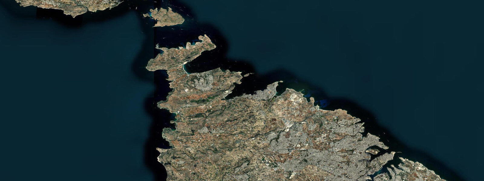
Bugibba sits on the south shore of St. Paul's Bay, the largest bay on Malta's north coast, roughly 12 km northwest of Valletta. The bay is named for a shipwreck. In 60 CE, a grain ship carrying the apostle Paul as a prisoner en route to Rome ran aground on Malta — Acts 27-28 gives the account in enough navigational detail that the landfall has been debated by maritime historians for two centuries. The most accepted site is the reef off the northern entrance to St. Paul's Bay. St. Paul's Island (Il-Gżira ta' San Pawl), a small limestone islet 500 m offshore from Bugibba, carries a white marble statue of the apostle, erected in 1845 and visible clearly from the Bugibba waterfront on any clear day. The island itself is uninhabited, inaccessible except by boat, and about 100 m in diameter.
The tidal setting is straightforward: Mediterranean microtidal, mean spring range 0.2-0.3 m at the northern bay, neap range 0.1-0.2 m. Slightly more range than Malta's southeastern harbours, still entirely insignificant for water access or navigation. The bay is wide and relatively deep; the bottom at the Bugibba waterfront drops to 3-5 m within 30 m of the limestone ledge edge. St. Paul's Bay as a whole is calm in most conditions except a sustained Gregale (northeast), which drives directly into the bay.
The MV Rozi is the dive site that brings most non-Maltese underwater visitors to Bugibba. The Rozi was a 36-metre retired tugboat, deliberately sunk in 1991 as an artificial reef, located about 800 m northwest of Bugibba's dive quarter. The wreck sits upright on a sandy bottom at 36 m maximum depth — the deck is at around 28 m — and has had 30 years to develop into a full artificial reef ecosystem: grouper, moray eels, amberjack, and in season, barracuda hold around the superstructure. The entry depth makes it a dive requiring Open Water certification at minimum, Advanced recommended for the deeper sections. Multiple dive centres in Bugibba offer guided dives and instruction. The tidal range of 0.1-0.3 m has no operational effect on the Rozi dive; entry timing is based on boat schedule and surface conditions, not tidal windows.
St. Paul's Island aside, the bay offers two distinct diving and snorkelling environments: the sandy-bottom shallows east of Bugibba, where stingrays occasionally bury themselves at 4-6 m, and the rocky reef system along the northern edge of the bay toward Qawra Point. The limestone reef at Qawra holds dense populations of saddled bream, damselfish, and in winter, Mediterranean cormorants working the surface above the fish schools. Visibility in St. Paul's Bay is typically 15-25 m in settled summer conditions.
For shore fishing, the Bugibba waterfront park runs roughly 600 m along the bay edge and gives access to limestone ledges at a consistent 1.5-2 m above water. Octopus is a genuinely common catch here — the rocky substrate along the bay margins is classic habitat, and local fishermen target them with jig lures or traditional lines with weighted hooks. Saddled bream, two-banded bream, and grey mullet are the main fish species. Morning fishing is recommended before the tourist traffic on the waterfront becomes heavy. The ledge fishing is productive regardless of tidal state; the 0.2 m range does not create meaningful current or feeding windows.
Salina Bay, 2 km to the east, is a sheltered inlet that was historically used for salt production — the salt pans are still visible and are now a nature reserve hosting flamingo in winter. The bay between Bugibba and Salina is sheltered from most wind directions and is used by kayakers as a gentler alternative to the open bay. The Malta Kayak Club uses St. Paul's Bay for training; the calm morning conditions from April through October are reliable for flatwater paddling.
Families visiting Bugibba typically use the waterfront park and the seasonal swimming lidos along the bay edge. There is no significant sandy beach in the Bugibba core; the tourist beach at Bugibba is a small, maintained sandy patch about 300 m east of the main waterfront square. The swimming is predominantly from limestone steps. Water temperatures in St. Paul's Bay reach 27-28°C in August and hold above 20°C through November, extending the swimming season well beyond what most northern Europeans expect.
The St. Paul's Bay shipwreck site itself — the historically proposed reef at the northern bay entrance — is a dive for the historically curious rather than the reef-seeking diver. The reef is shallow (5-8 m), rocky, and does not hold significant fish populations. The MV Rozi is the definitive dive here. But the context matters: standing on the Bugibba waterfront watching a north-coast weather system build across St. Paul's Bay is a direct line to 60 CE, when another vessel watched the same horizon and did not make it out.
Tide data for Bugibba comes from the Open-Meteo Marine API, a gridded model product. Timing accuracy is ±45 minutes, height accuracy ±0.3 m — usable for trip planning, not for navigation.
Tide questions about Bugibba, Northern Harbour District
Quick answers to the most common questions about tide times, range, and water access at Bugibba, Northern Harbour District.
What is the MV Rozi and how do I dive it from Bugibba?
The MV Rozi was a 36-metre tugboat deliberately sunk in 1991 approximately 800 m northwest of Bugibba's dive quarter to create an artificial reef. The wreck sits upright on a sandy bottom with the hull reaching 36 m depth and the deck at around 28 m. It has had three decades to develop a substantial reef ecosystem: grouper, moray eels, and amberjack are resident, with barracuda common in summer. Multiple dive centres in Bugibba offer guided boat dives, equipment hire, and PADI instruction. Advanced Open Water certification is recommended for the deeper sections; Open Water is sufficient for the upper deck. The dive is a boat entry from the centres in the Bugibba harbour area; shore entry is not practical at this distance. Tidal conditions have no effect on dive planning — entry timing is based on boat schedules and surface weather.
What is the connection between Bugibba and the apostle Paul?
Acts 27-28 records that a grain ship carrying Paul as a prisoner to Rome ran aground on Malta in approximately 60 CE after a severe Mediterranean storm. The text gives navigational specifics — the ship's crew sounded depths of 20 fathoms and then 15 fathoms before grounding, consistent with the reef approaches on the northern side of St. Paul's Bay. The most widely accepted identification places the wreck site at the reef off the bay's northern entrance. St. Paul's Island (Il-Gżira ta' San Pawl), 500 m offshore from Bugibba, marks the traditional site with a white marble statue erected in 1845. The island is uninhabited and accessible by boat only. Most dive centres in Bugibba offer trips to the island.
Does the tidal range at Bugibba affect diving or swimming?
No, not in any practical way. The mean tidal range at Bugibba is 0.1-0.3 m. At 36 m depth on the MV Rozi wreck, a 0.3 m tidal oscillation is unmeasurable. In the shallows, the same range shifts the waterline at the limestone lido steps by a few centimetres. There are no tidal currents of consequence in St. Paul's Bay generated by this range. Dive entry and exit timing is based on the boat operator's schedule and surface weather. Swimming access from the limestone steps and the small beach areas is available at all tide states. Plan around wind and swell conditions — particularly the Gregale from the northeast — not the tide chart.
Where can I go octopus fishing from the Bugibba waterfront?
The limestone ledges along the Bugibba waterfront park give direct access to rocky substrate over 2-4 m of water — classic octopus habitat. Fish from the quieter western end of the waterfront in the early morning before foot traffic builds. Octopus can be targeted with a small jig lure worked slowly along the bottom, or with a traditional weighted hook with a piece of fish or shrimp. The rocky margins east toward Qawra Point and west toward St. Paul's Island also produce octopus. Local fishermen use hand lines and patience. Tidal state does not significantly affect octopus behaviour at this range. Be aware of fishing regulations: recreational fishing in Malta requires a licence for certain methods; check the Malta Environment and Resources Authority guidelines before fishing.
Is kayaking or paddleboarding suitable at St. Paul's Bay from Bugibba?
St. Paul's Bay is one of the better paddling venues in Malta, protected from most wind directions except the Gregale (northeast). The sheltered eastern section of the bay near Salina Bay is particularly calm and used by the Malta Kayak Club for flatwater training. Morning conditions from April through October are typically flat. A sustained Gregale above 15 knots drives directly into the open bay from the north — check the forecast and avoid those days. Launch from the small beach areas east of the Bugibba waterfront square or from Salina Bay. Tidal currents are negligible. The 800 m paddle to the St. Paul's Island area is manageable in calm conditions but stay clear of the dive boat lanes near the MV Rozi site.
7-day tide table — Bugibba, Northern Harbour District
Heights relative to MSL. Predictions: Open-Meteo Marine (MeteoFrance SMOC, 0.08° grid) — heights relative to MSL (not chart datum / LAT). Model-derived.
| Day | Type | Time | Height |
|---|---|---|---|
| Fri 19 Jun | Low | 02:00 | -0.5m |
| High | 06:10 | -0.4m | |
| Low | 12:10 | -0.6m | |
| Sat 20 Jun | — | ||
| Sun 21 Jun | — | ||
| Mon 22 Jun | — | ||
| Tue 23 Jun | — | ||
| Wed 24 Jun | — | ||
| Thu 25 Jun | High | 13:00 | -0.4m |