Ramena Beach, Madagascar tide times
Ramena Beach, Madagascar tide forecast — heights relative to MSL.
Today's tide times for Ramena Beach, Madagascar
Tide times at Ramena Beach, Madagascar on Friday, 19 June 2026: first low tide at 03:00am, first high tide at 06:16am, second low tide at 12:15pm, second high tide at 06:34pm. Sunrise 06:01am, sunset 05:26pm.
Tide chart for Ramena Beach, Madagascar
24-hour cosine-interpolated curve around the present moment. Heights relative to MSL. Predictions: Predictions: Open-Meteo Marine (MeteoFrance SMOC, 0.08° grid).
Sun, moon and conditions on Fri 19 Jun
Snapshot at build time — refreshes daily. Sea state from Open-Meteo Marine.
Highs and lows next 7 days
Every predicted high and low for the next week, with the daily tidal coefficient (0–120; higher = bigger swing, > 95 means stronger currents).
Other spots nearby
The three closest curated TideTurtle locations to Ramena Beach, Madagascar, measured by great-circle distance.
Today's solunar windows
Solunar tradition: major periods are the ≈3h windows around moon transit and opposition; minor are ≈2h around moonrise and moonset. Pair with the local tide stage and wind for the best read.
Cycle dates near Ramena Beach, Madagascar
Last spring tide on Fri 19 Jun (range 2.2m). Next neap on Thu 25 Jun.
Spring tides cluster around new and full moons (biggest swings). Neap tides land on quarter moons (smallest swings). See the spring tide and neap tide glossary entries for the why.
About tides at Ramena Beach, Madagascar
A short guide to the coastline at Ramena Beach, Madagascar — geography, sea state, and what the tide is actually doing under your feet.
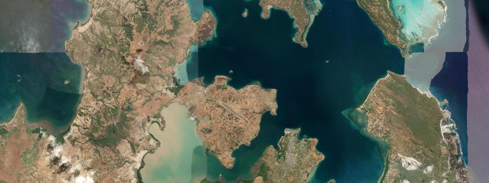
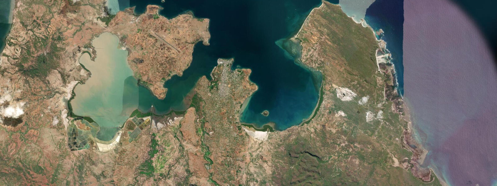
Ramena is a beach village on the Baie du Courrier, 18 km northeast of Antsiranana along a rough coastal track that winds past the base of the La Montagne des Français ridge. The village sits inside the Bay of Antsiranana — Diego Suarez Bay — one of the largest natural harbours on Earth. The bay runs approximately 30 km north to south and up to 10 km across, enclosed by headlands on the northern tip of Madagascar. The entrance channel, the Baie du Courrier, is 3 km wide. What that geometry does to the tide is significant.
The open Indian Ocean off Madagascar's northern coast has a mixed semidiurnal tide with a mean spring range around 2.0–2.5 m. Inside the Bay of Antsiranana, the funnel narrows the tidal wave and amplifies it: the mean spring range at Ramena reaches 3.0–4.5 m. The practical difference between high and low spring water is measured in hundreds of metres of exposed beach. At low spring water, the tidal flat in front of Ramena Beach extends 200–400 m from the normal waterline — firm sandy-mud, walkable, active with wading birds working the edge of the receding water. The flat itself is broad and nearly level, so even a 0.5 m rise in water level floods 50–80 m of it. The tidal cycle governs beach access fundamentally: at high spring water, the sea reaches the first coconut palms. At low spring, the flat is a kilometre of open space.
The Baie du Courrier entrance channel sees the greatest tidal current: 1–3 knots on spring tides as the massive volume of water filling and draining the 300-km² bay passes through the 3-km gap. Vessels exiting Antsiranana heading northeast work this current carefully — local fishing boats time their departure to ride the ebb out and the flood back. The current also affects the kitesurfers operating from Ramena, though most ride the bay-side chop rather than the open channel.
Kitesurfing is the activity that has put Ramena on the international map. The Diana Region of northern Madagascar is classified by kite-travel specialists as one of the most consistent wind destinations in the Indian Ocean. The austral winter trade winds (June through September) funnel through the gap between the Ankarana massif to the west and the northern coast, producing a reliable south-southeast flow of 18–28 knots across Ramena Bay. Wind days are consecutive, not intermittent: a two-week kite trip in July can expect 10–12 flyable days. The Baie de Sahambava, around the Ankarana headland north of Antsiranana, is considered the elite spot in the region, but Ramena itself delivers consistent side-shore conditions with a sandy beach launch and a large flat-water zone behind the reef at mid-to-high tide.
The La Montagne des Français ridge rises directly south of the bay entrance — a limestone ridge that runs roughly northeast to southwest, reaching 402 m at its highest point. The ridge was a French defensive position during the 1942 Battle of Diego Suarez (Operation Ironclad), when British forces took the harbour to deny it to the Japanese navy. The French held the ridge for several days before being outflanked. The caves in the limestone contain rock art attributed to Malagasy ancestors, and the summit gives a panoramic view of the bay, the entrance channel, and the ocean beyond. It is a 2–3 hour return hike from the trailhead on the road between Antsiranana and Ramena.
For beach photographers, the low-spring-tide window at Ramena produces a flat mirror of exposed sand that reflects the ridge and sky. Shoot between 06:30 and 08:00 before the wind builds and breaks the flat's surface. The wading birds — egrets, plovers, and occasional African spoonbill — work the retreating water line and are within 50 m of shore for the first 30 minutes of the ebb. At high spring water, the palms frame a narrow, deeper-blue bay with the ridge backdrop — the tighter frame suits telephoto work on the fishing pirogues.
Antsiranana city, 18 km southwest, has the region's main market, fuel, and medical facilities. The road between Antsiranana and Ramena is sealed for most of its length but degrades at the northern end — a standard saloon car handles it in dry season, but a high-clearance vehicle is advised in the wet season (November through April).
Tide data for Ramena Beach, Madagascar comes from the Open-Meteo Marine API, a gridded model product. Timing accuracy is ±45 minutes, height accuracy ±0.3 m — usable for trip planning, not for navigation.
Tide questions about Ramena Beach, Madagascar
Quick answers to the most common questions about tide times, range, and water access at Ramena Beach, Madagascar.
Why is the tidal range so large at Ramena Beach?
The Bay of Antsiranana acts as a tidal amplifier. The open Indian Ocean delivers a mean spring range of roughly 2.0–2.5 m to the northern tip of Madagascar, but the bay's funnel geometry — 30 km long, narrowing from 10 km to a 3 km entrance channel — compresses that tidal volume and raises the spring range at Ramena to 3.0–4.5 m. The Baie du Courrier entrance channel sees tidal currents of 1–3 knots on spring tides as the bay fills and drains. This amplification effect is common in large embayments; the Bay of Fundy in Canada is an extreme example of the same physics. At Ramena, the practical result is 200–400 m of exposed tidal flat at low spring water.
When is the best time of year for kitesurfing at Ramena?
June through September is peak kite season. The austral winter trade winds funnel through the Diana Region's northern topography, producing a consistent south-southeast flow of 18–28 knots across Ramena Bay. July and August are the most reliable months — two consecutive weeks in July typically yields 10–12 flyable days. The wind is side-shore at Ramena's beach, which suits intermediate and advanced riders. The flat-water zone behind the reef is rideable at mid-to-high tide; at low spring water the flat is shallow and exposed. October through May is the wet season and monsoon period — wind is irregular and rainfall is frequent. The Baie de Sahambava north of Antsiranana is considered the elite spot in the region for advanced riders seeking stronger and more consistent conditions.
What can I see on the tidal flat at low water?
At low spring water, the flat in front of Ramena Beach extends 200–400 m and exposes firm sandy-mud active with wading birds. Egrets, sandpipers, and plovers work the retreating water edge within 50 m of the beach. The flat is walkable — firm enough underfoot to explore without sinking — and offers a close view of the intertidal invertebrates the birds are hunting. The first 30 minutes of the ebb are the most bird-active as the flat surface is still wet and prey are concentrated. By mid-ebb the birds have followed the water out 150–200 m from shore. Photographers get the best flat-mirror reflections in the hour after low water when the wet surface is calm before the wind builds.
How does the tidal current in the Baie du Courrier affect boat trips?
The Baie du Courrier entrance channel, 3 km wide, sees 1–3 knots of tidal current on spring tides as the large bay volume fills and drains. Heading northeast out of Antsiranana on the ebb, the current runs with you; return on the flood for the same advantage. Against a spring ebb, a slow fishing boat loses 1–2 knots of speed over ground — an 18 km trip to Ramena can take 45 minutes longer than expected. Kitesurfers crossing from Ramena to the Baie de Sahambava on organised trips are dropped by speedboat and the current timing is factored into departure schedules by experienced operators. Ask your operator which direction the tide is running before any open-water boat crossing in this bay.
Is the hike up La Montagne des Français worth doing?
La Montagne des Français is a 402 m limestone ridge between Antsiranana and Ramena with a 2–3 hour return hike from the road trailhead. The summit view takes in the full Bay of Antsiranana, the Baie du Courrier entrance channel, the Ramena beach settlement, and the Indian Ocean horizon — the tidal state below is visible: at low spring water the flat stretches wide and pale in front of the beach. The ridge has historical significance as a French defensive position in the 1942 Battle of Diego Suarez, and the limestone caves in the lower section contain ancestral rock art. Bring water — there is no shade on the upper section and the Diana Region sun is direct from 09:00 onward. The trailhead is approximately 8 km southwest of Ramena on the Antsiranana road.
8-day tide table — Ramena Beach, Madagascar
Heights relative to MSL. Predictions: Open-Meteo Marine (MeteoFrance SMOC, 0.08° grid) — heights relative to MSL (not chart datum / LAT). Model-derived.
| Day | Type | Time | Height |
|---|---|---|---|
| Fri 19 Jun | Low | 03:00 | 0.3m |
| High | 06:16 | 1.4m | |
| Low | 12:15 | -0.4m | |
| High | 18:34 | 1.7m | |
| Sat 20 Jun | Low | 01:00 | -0.5m |
| High | 07:08 | 1.4m | |
| Low | 13:08 | -0.3m | |
| High | 19:21 | 1.5m | |
| Sun 21 Jun | Low | 01:45 | -0.4m |
| High | 08:03 | 1.3m | |
| Low | 14:10 | -0.1m | |
| High | 20:14 | 1.2m | |
| Mon 22 Jun | Low | 02:36 | -0.3m |
| High | 09:07 | 1.2m | |
| Low | 15:16 | 0.0m | |
| Tue 23 Jun | High | 10:18 | 1.2m |
| Wed 24 Jun | Low | 04:42 | -0.0m |
| High | 11:21 | 1.2m | |
| Low | 17:57 | 0.1m | |
| High | 23:48 | 0.9m | |
| Thu 25 Jun | Low | 05:45 | -0.0m |
| Fri 26 Jun | High | 00:57 | 0.9m |