Ifaty, Madagascar tide times
Ifaty, Madagascar tide forecast — heights relative to MSL.
Today's tide times for Ifaty, Madagascar
Tide times at Ifaty, Madagascar on Friday, 19 June 2026: first low tide at 01:41pm, first high tide at 08:00pm. Sunrise 06:45am, sunset 05:28pm.
Tide chart for Ifaty, Madagascar
24-hour cosine-interpolated curve around the present moment. Heights relative to MSL. Predictions: Predictions: Open-Meteo Marine (MeteoFrance SMOC, 0.08° grid).
Sun, moon and conditions on Fri 19 Jun
Snapshot at build time — refreshes daily. Sea state from Open-Meteo Marine.
Highs and lows next 7 days
Every predicted high and low for the next week, with the daily tidal coefficient (0–120; higher = bigger swing, > 95 means stronger currents).
Other spots nearby
The three closest curated TideTurtle locations to Ifaty, Madagascar, measured by great-circle distance.
Today's solunar windows
Solunar tradition: major periods are the ≈3h windows around moon transit and opposition; minor are ≈2h around moonrise and moonset. Pair with the local tide stage and wind for the best read.
Cycle dates near Ifaty, Madagascar
Last spring tide on Fri 19 Jun (range 2.2m). Next neap on Wed 24 Jun.
Spring tides cluster around new and full moons (biggest swings). Neap tides land on quarter moons (smallest swings). See the spring tide and neap tide glossary entries for the why.
About tides at Ifaty, Madagascar
A short guide to the coastline at Ifaty, Madagascar — geography, sea state, and what the tide is actually doing under your feet.
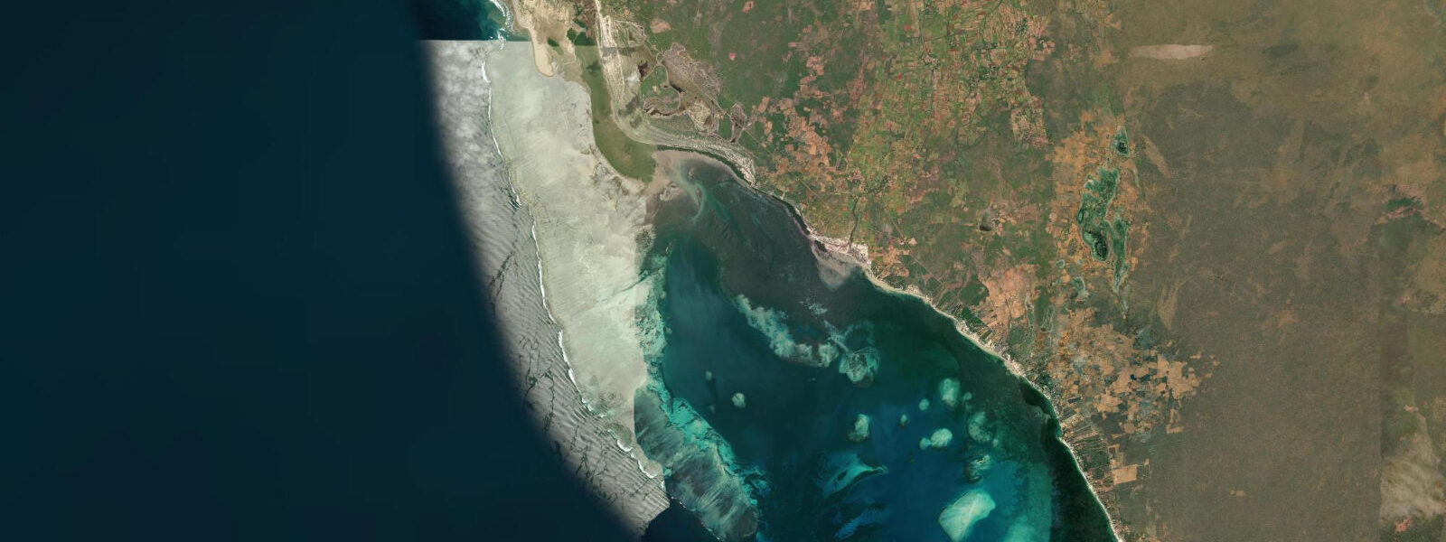
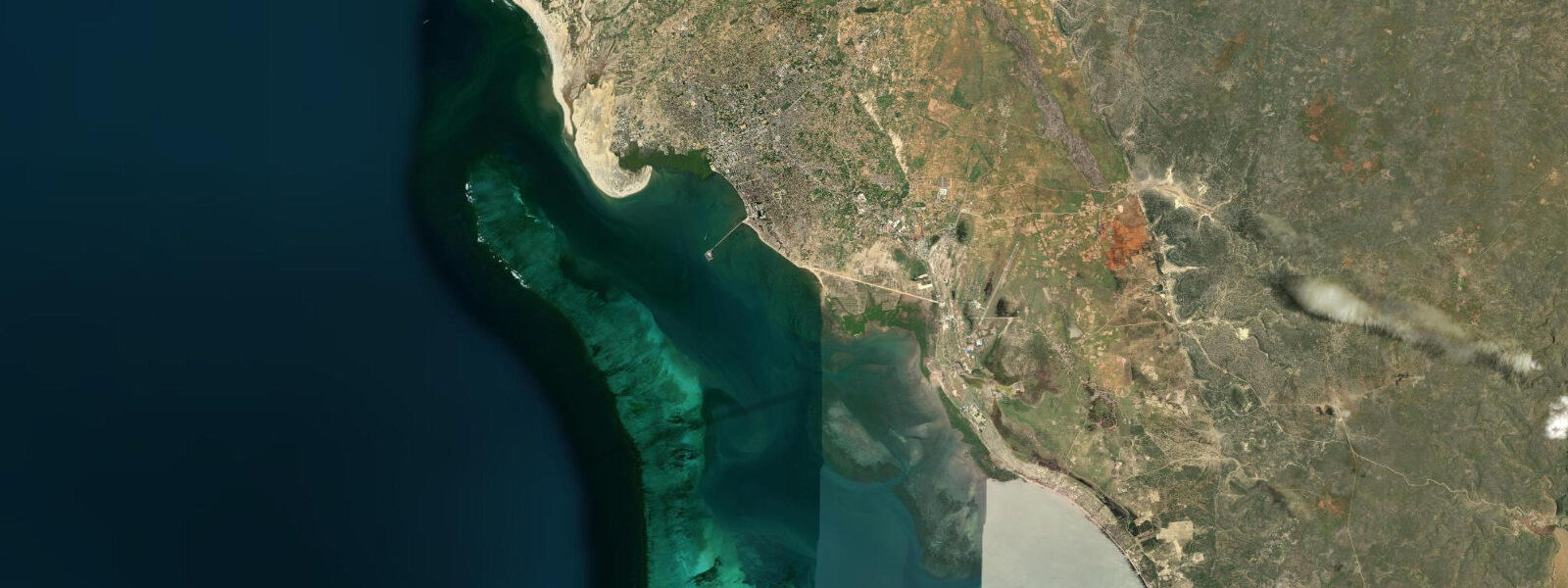
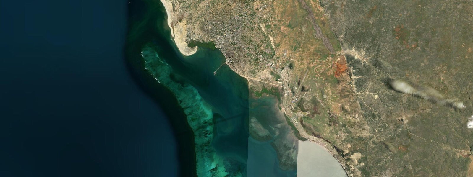
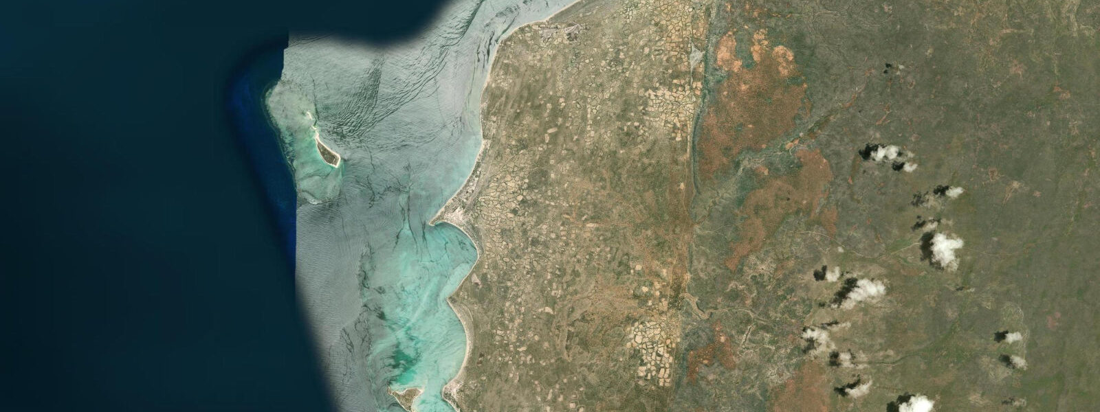
Ifaty is a Vezo fishing village 27 km north of Toliara (Tuléar) on Madagascar's southwest coast, in the Atsimo-Andrefana region. The coast here faces west into the Mozambique Channel, and the Indian Ocean tidal range is among the more significant on the island: mean spring range of 2.0–3.5 m, with higher high waters reaching around 3.0 m above chart datum and lower lows exposing the full extent of the reef flat. This is not a Mediterranean micro-tide — the 30-minute change in water depth before and after a spring low is measurable on foot.
The reef system offshore from Ifaty is the northern section of the Grand Récif de Toliara, one of the largest barrier reef systems in the Indian Ocean. The reef runs roughly parallel to the coast 500–800 m offshore. Between the reef crest and the beach, the lagoon sits at 1–3 m depth at high water and drains to around 0.5 m at low water — a flat, sandy-bottomed stretch of water that changes character completely with the tide. At low spring water, the beach extends 80–150 m beyond the normal high-water line, and the reef flat itself — the platform between the lagoon and the ocean — is exposed at depths of 0.2–0.5 m. You can walk the reef flat at low spring, with care: the limestone substrate is rough, sea urchins cluster in any depression that holds water, and fire coral patches sit flush with the surface. Reef shoes are not optional.
The Vezo people are the defining human presence on this coast. They are not tied to a fixed territory in the traditional Malagasy sense — the Vezo identity is defined by the sea, and the same family may camp along different coastal sections across a season, following fish. Their lakana, traditional outrigger pirogues, are built from a single hollowed timber hull with an outrigger float lashed on one side by crossbars — the rigging is asymmetric, and the boat is sailed heeled toward the outrigger to keep the float on the water. Vezo navigators read the current and wave refraction pattern to locate fish schools without instruments. From Ifaty beach you will see them launch into the surf at dawn, using the outgoing tidal flow to clear the reef passage, and return in the afternoon riding the flood and the sea breeze.
Fishing from the Ifaty lagoon is tide-dependent in a straightforward way. At high water, the lagoon is deep enough to hold fish across its full width, and Vezo fishers work the inner reef face with hand lines and cast nets. At low water, fish concentrate in the channels and holes that retain depth on the flat — a smaller search area. Visiting anglers fishing from the beach or wading the lagoon edge do best targeting the two hours either side of high water, when the tide is moving and fish are actively feeding rather than holding in reduced-oxygen pockets on the flat.
Beyond the water, the landscape around Ifaty is unlike anywhere else in the Indian Ocean. The spiny forest begins almost at the beach edge — a dry, deciduous ecosystem of endemic Didiereaceae species that grow nowhere else on Earth. Alluaudia procera, the octopus tree, reaches 15 m on a diet of minimal rainfall and calcium-rich limestone soil, its cylindrical stems studded with paired thorns and small leaves that appear briefly after rain. The forest floor holds radiated tortoises, Astrochelys radiata — heavy-domed, slow-moving, endemic to this corner of Madagascar and critically endangered in the wild. They graze on fallen leaves in the morning, retreat to shade in the afternoon heat, and emerge again in the evening. The Tsimanampetsotsa National Park, which encompasses the spiny forest ecosystem inland from the coast, formalises protection for the habitat.
For beach families, Ifaty at high water is a calm, shallow lagoon suitable for children. The reef passage to seaward buffers swell, and the water temperature holds around 26–28°C through the austral summer. At low water, children old enough to walk reef flats without difficulty find tidal pools holding sea urchins, small reef fish, and occasionally octopus in the shallower depressions. The exposed reef flat at low spring is the most visually dramatic element of the Ifaty tidal cycle — the scale of what the ocean hides and reveals in 3 m of range is immediately apparent standing on a dry reef crest that was under water two hours earlier.
Tide data for Ifaty, Madagascar comes from the Open-Meteo Marine API, a gridded model product. Timing accuracy is ±45 minutes, height accuracy ±0.3 m — usable for trip planning, not for navigation.
Tide questions about Ifaty, Madagascar
Quick answers to the most common questions about tide times, range, and water access at Ifaty, Madagascar.
How far does the reef flat at Ifaty expose at low spring tide, and is it safe to walk?
At low spring water, the Ifaty reef flat (part of the Grand Récif de Toliara) is exposed at depths of 0.2–0.5 m for a width of several hundred metres between the lagoon and the outer reef crest. The beach extends 80–150 m beyond the normal high-water line. Walking the flat is possible but requires reef shoes — the limestone substrate is sharp, sea urchins cluster in any depression that holds water, and fire coral patches sit flush with the surface. The mean spring range here is 2.0–3.5 m, so the difference between low and high water is significant. Plan reef walks within 90 minutes of the predicted low; the tide turns quickly on this coast.
What are the Vezo people and what is the best way to interact with the fishing community at Ifaty?
The Vezo are the traditional seafaring fishing people of Madagascar's southwest coast. Their identity is defined by the sea rather than by fixed territory, and their lakana — single-hulled outrigger pirogues — are sailed using direct knowledge of currents, wave refraction, and wind patterns rather than instruments. At Ifaty, Vezo fishers launch at dawn on the outgoing tide to clear the reef passage and return in the afternoon. The beach at Ifaty is where the boats are drawn up and fish are sorted and sold in the late afternoon. Respectful observation at the beach is acceptable; pirogue trips into the lagoon can be arranged directly with fishers, though no formal operator infrastructure exists — approach through your accommodation host who will have existing contacts.
When is the best time to visit Ifaty for snorkelling in the Grand Récif de Toliara lagoon?
Snorkelling the inner lagoon at Ifaty works best at high water, when depth across the lagoon runs 1–3 m and the reef flat to seaward is submerged — giving access to the coral on the reef face. At low water the lagoon shallows to around 0.5 m and the reef flat is largely exposed. For snorkelling the outer reef wall (beyond the reef crest), a pirogue is necessary; the passage through the reef is navigable at most tidal stages but is rougher at low water when the wave energy is less buffered. The sea is calmest from May to October (austral winter, dry season), with the southeast trade winds producing reliable afternoon wind but calm mornings.
Where can I see radiated tortoises near Ifaty, and is the Tsimanampetsotsa National Park accessible from the village?
Radiated tortoises (Astrochelys radiata) live in the spiny forest that begins at the beach edge around Ifaty and extends inland. They are most active in the morning when temperatures allow foraging and in the late afternoon. Small groups can sometimes be seen within walking distance of the village in the spiny forest fringe. The Tsimanampetsotsa National Park protects the broader spiny forest ecosystem and requires an entry permit arranged through a licensed guide — Toliara, 27 km south, is the base for guide hire. A half-day trip from Ifaty to the park boundary and back is feasible. The spiny forest is denser and more intact further inland; the coastal fringe near the village has some disturbance from charcoal harvesting.
Is the Ifaty lagoon suitable for children at different tidal stages?
At high water, the Ifaty lagoon is calm, sandy-bottomed, and 1–3 m deep — well within comfortable range for children who can swim, with no significant current and water temperature around 26–28°C. The reef passage to seaward reduces swell entering the lagoon. At low water the lagoon shallows to around 0.5 m and transitions into a tidal flat walk, which works for older children (8 and up) in reef shoes. The exposed reef flat at low spring tide holds small tidal pools with sea urchins, reef fish, and occasionally octopus — interesting for children with adult supervision. Avoid letting children step barefoot on the flat; sea urchin spines are the main hazard.
8-day tide table — Ifaty, Madagascar
Heights relative to MSL. Predictions: Open-Meteo Marine (MeteoFrance SMOC, 0.08° grid) — heights relative to MSL (not chart datum / LAT). Model-derived.
| Day | Type | Time | Height |
|---|---|---|---|
| Fri 19 Jun | Low | 13:41 | -0.7m |
| High | 20:00 | 1.5m | |
| Sat 20 Jun | Low | 02:15 | -0.5m |
| High | 20:43 | 1.2m | |
| Sun 21 Jun | Low | 03:03 | -0.5m |
| High | 09:06 | 1.0m | |
| Low | 15:18 | -0.5m | |
| High | 21:33 | 1.0m | |
| Mon 22 Jun | Low | 03:56 | -0.4m |
| High | 10:04 | 0.8m | |
| Low | 16:12 | -0.3m | |
| High | 22:34 | 1.0m | |
| Tue 23 Jun | Low | 05:00 | -0.2m |
| High | 11:13 | 0.9m | |
| Low | 17:25 | -0.1m | |
| High | 23:46 | 0.9m | |
| Wed 24 Jun | Low | 06:13 | -0.1m |
| High | 12:35 | 0.9m | |
| Low | 18:50 | -0.0m | |
| Thu 25 Jun | High | 13:51 | 1.0m |
| Low | 20:04 | -0.1m | |
| Fri 26 Jun | High | 02:00 | 1.0m |