Beirut tide times
Beirut tide forecast — heights relative to MSL.
Today's tide times for Beirut
Tide times at Beirut on Saturday, 27 June 2026: first low tide at 03:00am, first high tide at 08:50am. Sunrise 05:28am, sunset 07:52pm.
Tide chart for Beirut
24-hour cosine-interpolated curve around the present moment. Heights relative to MSL. Predictions: Predictions: Open-Meteo Marine (MeteoFrance SMOC, 0.08° grid).
Sun, moon and conditions on Sat 27 Jun
Snapshot at build time — refreshes daily. Sea state from Open-Meteo Marine.
Highs and lows next 7 days
Every predicted high and low for the next week, with the daily tidal coefficient (0–120; higher = bigger swing, > 95 means stronger currents).
Other spots nearby
The three closest curated TideTurtle locations to Beirut, measured by great-circle distance.
Today's solunar windows
Solunar tradition: major periods are the ≈3h windows around moon transit and opposition; minor are ≈2h around moonrise and moonset. Pair with the local tide stage and wind for the best read.
Cycle dates near Beirut
Next spring tide on Thu 02 Jul (range 0.3m). Last neap on Sat 27 Jun.
Spring tides cluster around new and full moons (biggest swings). Neap tides land on quarter moons (smallest swings). See the spring tide and neap tide glossary entries for the why.
About tides at Beirut
A short guide to the coastline at Beirut — geography, sea state, and what the tide is actually doing under your feet.
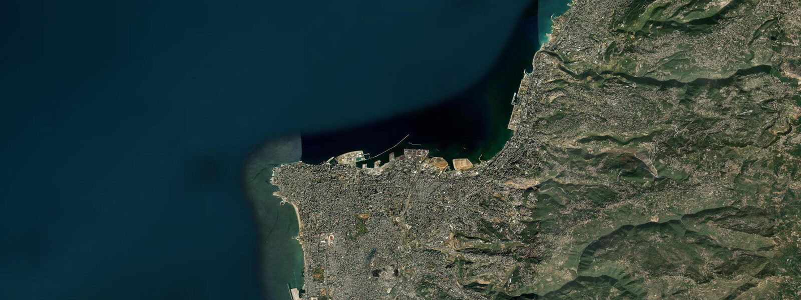
Beirut faces the eastern Mediterranean on Lebanon's central coast, with a waterfront that has been rebuilt, damaged, and rebuilt again across generations of conflict and development. The Corniche — the 4.8-km seafront promenade from the Ain el-Mreisseh fishing harbour in the west to the Manara lighthouse — is the city's most democratic public space, used around the clock by walkers, fishermen, elderly men with cards, and families. The St. George Bay on the east side of the Corniche and the Pigeon Rocks sea stacks at the southwest end of Ras Beirut are the most photographed features of the coast.
The tidal regime in the eastern Mediterranean is microtidal: spring range at Beirut is 0.3–0.4 m, semidiurnal with significant seiches. Seiches are standing-wave oscillations in the sea basin caused by atmospheric disturbances — they operate independently of the astronomical tide and have periods of 10–40 minutes with amplitudes up to 0.3–0.5 m in the eastern Mediterranean. A seiche event at Beirut presents as a rapid rise and fall of 0.2–0.4 m over 20–30 minutes with no preceding meteorological warning visible at the surface. This is the primary unpredictable water-level variable on the Beirut coast, affecting the safety of swimmers, fishermen standing on low rocks, and small boats at harbour moorings.
The Corniche fishermen — a permanent fixture at the concrete railing — fish from the promenade wall 3–6 m above the normal waterline. At low spring water, the rocks at the base of the Corniche seawall are fully exposed and provide additional fishing access. At high spring water, those rocks are submerged by the combined effect of the 0.3–0.4 m tide and any seiche component. Night fishing from the Corniche railing for octopus, sea bass, and mullet is productive year-round. The mullet concentrate under the Corniche lights after dark.
For sea swimmers, Beirut's Corniche has no sandy beach — the coastline here is either sea wall or cut-rock platforms (private beach clubs have imported some sand). The rock platforms at Ain el-Mreisseh and at the base of the sea stacks near Raouché are accessible at low water for shore entry. The water is 24–28 °C in summer and 17–19 °C in winter. The Mediterranean here is relatively clear in calm conditions; after rain events, Beirut's storm water drains discharge directly onto the coast and dramatically reduce water quality for 24–48 hours. The coastal pollution situation is well-documented; check the BORED diving association's water quality reports before ocean swimming.
The Pigeon Rocks (Raouché) sea stacks are one of Beirut's iconic natural features: two large limestone arches rising 20–25 m from the sea, 150–200 m offshore. The stacks are accessible only by small boat — motorised dinghies and paddleboards make the transit from the small beach at the Raouché promenade. At low spring water, the sea level is 0.3–0.4 m lower and more of the rock base is exposed; at high water the stacks appear to rise directly from the sea surface without a visible rock platform. Kayakers can paddle through the arches in calm conditions; swell from the west and northwest can create surge in the arch passages at 0.5 m or more and requires caution.
For photographers, the Pigeon Rocks at golden hour are a strong subject from the Corniche promenade above. Early morning, before 07:00 in summer, provides east-facing light that illuminates the rock face. The view of the rocks from the sea by kayak or small boat provides compositions unavailable from the promenade. The Corniche itself — long exposures of the promenade at night with the city skyline and the sea below — is a classic subject.
All tide predictions for Beirut come from the Open-Meteo Marine gridded model. Timing accuracy is ±45 minutes; height accuracy is ±0.3 m above Chart Datum. Note that seiches — the dominant water level variable on this coast in calm weather — are not captured by the model.
Tide questions about Beirut
Quick answers to the most common questions about tide times, range, and water access at Beirut.
What is the tidal range in Beirut and are there any unusual water-level events to know about?
Beirut's astronomical spring tidal range is 0.3–0.4 m — microtidal by Atlantic standards. The more important water-level phenomenon on this coast is the meteorological seiche: a standing-wave oscillation in the eastern Mediterranean basin that produces rapid water level swings of 0.2–0.4 m over 20–30 minutes, independent of the astronomical tide. Seiches can occur in calm conditions without surface warning. They affect swimmers on low rocks, fishermen at the Corniche railing, and small boats at harbour moorings. The Open-Meteo tide predictions for Beirut show the astronomical signal only; seiches are not modelled. Height accuracy of the predictions is ±0.3 m, and timing accuracy is ±45 minutes.
Is swimming off Beirut's Corniche safe from a water-quality perspective?
The Beirut Corniche coast has documented water quality issues. Storm water drains and combined sewer overflow points discharge onto the coast at multiple points; after rain events, bacterial contamination makes coastal swimming unsafe for 24–48 hours. The BORED diving association and other Lebanese environmental groups publish periodic water quality reports for the Beirut coast. The cleanest water on the immediate Beirut coast is at the rock platforms near Ain el-Mreisseh in calm weather, well away from storm drain outfalls. Beach clubs along the Corniche have their own filtration systems for any seawater they use in pools; open-water swimming quality depends on current pollution loads.
Can you kayak to the Pigeon Rocks sea stacks at Raouché?
The Pigeon Rocks are 150–200 m offshore from the Raouché promenade and reachable by kayak or paddleboard from the small beach at the Raouché waterfront in calm conditions. The paddle through the rock arches is straightforward when swell is under 0.3 m; at 0.5 m or more, surge in the arch passages accelerates and unpredictable wave reflection off the rock faces creates hazards for small craft. The tidal component of water level is small (0.3–0.4 m spring range) but seiches can add rapid 0.2–0.4 m variation without warning. At low spring water, more of the rock base is exposed and the arch passage is wider; at high water the passage entrance can feel tighter. Always paddle with a partner and have an abort plan for building swell.
Where and when do anglers fish from the Beirut Corniche?
The Corniche promenade railing is an open, 24-hour fishing platform. Anglers use drop lines and spinning gear over the seawall, 3–6 m above normal waterline. At spring low water, accessible rock platforms appear at the base of the seawall at several points and expand the casting range. Target species are mullet (year-round, concentrate under the Corniche lights at night), octopus (autumn–winter, jigged from the rocks), and sea bass (nocturnal, spring–summer). The Ain el-Mreisseh fishing harbour is a social centre for Beirut's fishing community; the boats that operate from there provide the best source of local knowledge on what is running and from where.
What is the sea temperature in Beirut and when is the swimming season?
Beirut's Mediterranean sea temperature ranges from 17–19 °C in the coldest months (January–February) to 28–30 °C in late August. The swimming season for most people runs May through October; July and August are peak swimming months with water temperatures that feel genuinely warm. The temperature is relatively homogeneous along the surface — there are no significant upwelling events or cold freshwater plumes affecting the Beirut coast directly. Note that high summer water temperature combined with elevated nutrient loads from coastal discharges can promote jellyfish blooms and surface scum; these are episodic and local, but worth checking before a planned swim.
8-day tide table — Beirut
Heights relative to MSL. Predictions: Open-Meteo Marine (MeteoFrance SMOC, 0.08° grid) — heights relative to MSL (not chart datum / LAT). Model-derived.
| Day | Type | Time | Height |
|---|---|---|---|
| Sat 27 Jun | Low | 03:00 | -0.4m |
| High | 08:50 | -0.2m | |
| Sun 28 Jun | Low | 16:00 | -0.5m |
| High | 22:10 | -0.2m | |
| Mon 29 Jun | Low | 03:45 | -0.4m |
| High | 10:00 | -0.1m | |
| Tue 30 Jun | Low | 17:15 | -0.5m |
| High | 23:15 | -0.2m | |
| Wed 01 Jul | Low | 04:50 | -0.4m |
| High | 11:15 | -0.1m | |
| Low | 17:45 | -0.5m | |
| Thu 02 Jul | High | 11:45 | -0.1m |
| Low | 18:18 | -0.4m | |
| Fri 03 Jul | — | ||
| Sat 04 Jul | High | 01:00 | -0.2m |