Liepāja tide times
Liepāja tide forecast — heights relative to MSL.
Today's tide times for Liepāja
Tide times at Liepāja on Saturday, 4 July 2026: first high tide at 03:00am, first low tide at 02:00pm. Sunrise 04:52am, sunset 10:27pm.
Tide chart for Liepāja
24-hour cosine-interpolated curve around the present moment. Heights relative to MSL. Predictions: Predictions: Open-Meteo Marine (MeteoFrance SMOC, 0.08° grid).
Sun, moon and conditions on Sat 04 Jul
Snapshot at build time — refreshes daily. Sea state from Open-Meteo Marine.
Highs and lows next 7 days
Every predicted high and low for the next week, with the daily tidal coefficient (0–120; higher = bigger swing, > 95 means stronger currents).
Other spots nearby
The three closest curated TideTurtle locations to Liepāja, measured by great-circle distance.
Today's solunar windows
Solunar tradition: major periods are the ≈3h windows around moon transit and opposition; minor are ≈2h around moonrise and moonset. Pair with the local tide stage and wind for the best read.
About tides at Liepāja
A short guide to the coastline at Liepāja — geography, sea state, and what the tide is actually doing under your feet.
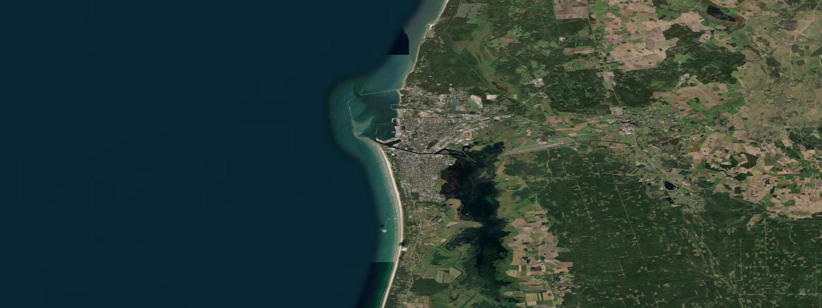
Liepāja is Latvia's third-largest city, set on a narrow spit of land between the Baltic Sea to the west and Liepāja Lake to the east, the lake connected to the sea by a dredged channel that forms the city's port entrance. The Baltic coast at Liepāja is the open sea — not the sheltered Gulf of Riga that most visitors associate with Latvian beach culture, but the exposed western Baltic proper, with a longer fetch from the southwest and northwest and marginally larger wave and tidal conditions than the gulf side.
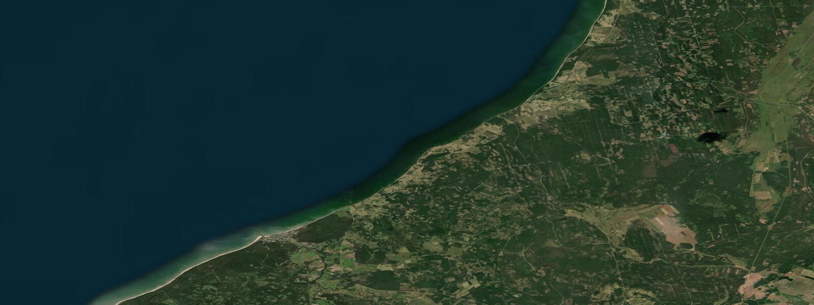
The Piejūras Park (Coastal Park) stretches north of the city centre along the beach for several kilometres: pine forest immediately behind a wide sandy beach, the trees trimmed by the prevailing Baltic winds into a distinctive low canopy that angles inland. The beach itself faces west-northwest and catches the afternoon light and the southwest sea breeze that makes Liepāja one of the windier cities in Latvia. Kite-surfing sessions run from the beach when the southwest is up — the open sea exposure and the moderate Baltic swell combine to give a different experience from the flat-water lagoon kiting further north and south.
Karosta (literally 'war port') is the district that makes Liepāja distinctive on any Baltic itinerary. Built by Tsar Nicholas II from 1890 as a naval base, expanded through both World War periods, and then a closed Soviet military zone until 1994, Karosta is now a functioning neighbourhood of 7,000 people living in the grand derelict barracks, the Tsarist officers' quarters, and the rebuilt Orthodox Cathedral of St Nicholas. The Karosta Prison operates as a museum and occasional overnight experience; the Northern Forts, a series of massive Soviet-era concrete artillery emplacements on the northern beach, are abandoned and open for exploration. This is Cold War coastal archaeology on an unusual scale.
The Baltic Sea at Liepāja is semidiurnal with a modest spring range of 0.3 to 0.6 m — larger than the Gulf of Riga (0.2 to 0.4 m) because the western Baltic has more direct tidal exchange with the North Sea through the Danish straits. The range is real enough to produce a visible ebb and flood on the beach, though the astronomical signal is easily masked by wind setup and storm surge during Baltic weather events. Autumn and winter westerly storms drive water onto the western coast and raise sea level 0.5 m or more above the predicted.
Liepāja's identity as Latvia's rock capital has roots in the 1980s when the city, partly due to its isolation and military-zone status, developed an underground music scene that became the origin point for several significant Latvian rock bands. The Summer Sound festival held in late July at the beach is among the larger Baltic music events.
Predictions on this page come from Open-Meteo Marine, a gridded global ocean model. Accuracy is typically within plus or minus 45 minutes on timing and 0.2 to 0.3 m on height — at the 0.3 to 0.6 m spring range of this coast, the height uncertainty is a moderate fraction of the total signal. Latvian coast tide data is published by the Latvian Environment, Geology and Meteorology Centre (LVĢMC), which operates sea-level gauges at Liepāja and other Baltic ports.
Tide questions about Liepāja
Quick answers to the most common questions about tide times, range, and water access at Liepāja.
When is the next high tide at Liepāja?
The hero block at the top of this page shows the next predicted high at Liepāja in local Eastern European Time (EET/EEST, UTC+2/UTC+3). Liepāja has a Baltic semidiurnal tide with a spring range of 0.3 to 0.6 m — slightly larger than the Gulf of Riga because the western Baltic coast has more direct exchange with North Sea tidal energy through the Danish straits. Wind and storm surge dominate water-level variation. The Latvian Environment, Geology and Meteorology Centre (LVĢMC) operates the sea-level gauge at Liepāja and publishes the authoritative data.
What is the tidal range at Liepāja?
Mean spring range is 0.3 to 0.6 m on the western Latvian Baltic coast — modest but perceptible, and larger than the Gulf of Riga's typical 0.2 to 0.4 m. Neap range compresses to 0.1 to 0.3 m. Wind-driven setup during Baltic storms can add or subtract 0.5 m or more from the predicted level, making the astronomical tide a secondary driver of water-level conditions at Liepāja. Westerly storm surges are the events that matter for beach and harbour planning here.
Where do these tide predictions come from?
Open-Meteo Marine, a free gridded global ocean model. At Liepāja's spring range of 0.3 to 0.6 m, the model's typical accuracy (plus or minus 45 minutes on timing, 0.2 to 0.3 m on height) is a significant fraction of the total signal. For authoritative Latvian Baltic coast sea-level data, the Latvian Environment, Geology and Meteorology Centre (LVĢMC) operates gauges at Liepāja and publishes tide tables and storm-surge warnings.
What is Karosta and is it worth visiting?
Karosta is the former Tsarist and Soviet naval base district of Liepāja, built from 1890 onward and closed to the public until 1994. It is now a neighbourhood of 7,000 people living in derelict Tsarist barracks, alongside the functioning St Nicholas Orthodox Cathedral and the Karosta Prison museum. The Northern Forts — Soviet-era concrete coastal artillery emplacements on the northern beach — are abandoned and accessible. Guided tours of the prison operate daily in summer; the overnight 'prison experience' is available by booking. The district's scale — over 500 historic structures — makes it one of the most significant surviving examples of Russian Imperial and Soviet military architecture on the Baltic coast.
Is this safe to use for navigation?
No. TideTurtle is a planning tool for recreational coastal activity, not a navigation resource. Liepāja has an active commercial port and yacht harbour; approach channels require standard chart navigation. The Latvian Maritime Administration publishes charts and Notices to Mariners for Latvian waters. Tidal streams off the Liepāja coast are modest but present during spring tide ebb and flood. Open-Meteo Marine gridded predictions do not replace authoritative navigation sources.
3-day tide table — Liepāja
Heights relative to MSL. Predictions: Open-Meteo Marine (MeteoFrance SMOC, 0.08° grid) — heights relative to MSL (not chart datum / LAT). Model-derived.
| Day | Type | Time | Height |
|---|---|---|---|
| Sat 04 Jul | High | 03:00 | 0.2m |
| Low | 14:00 | 0.2m | |
| Sun 05 Jul | Low | 13:00 | 0.2m |
| Mon 06 Jul | High | 21:00 | 0.3m |