Kuwait City tide times
Kuwait City tide forecast — heights relative to MSL.
Today's tide times for Kuwait City
Tide times at Kuwait City on Saturday, 27 June 2026: first low tide at 03:00am, first high tide at 09:17am, second low tide at 04:43pm, second high tide at 11:57pm. Sunrise 04:50am, sunset 06:51pm.
Tide chart for Kuwait City
24-hour cosine-interpolated curve around the present moment. Heights relative to MSL. Predictions: Predictions: Open-Meteo Marine (MeteoFrance SMOC, 0.08° grid).
Sun, moon and conditions on Sat 27 Jun
Snapshot at build time — refreshes daily. Sea state from Open-Meteo Marine.
Highs and lows next 7 days
Every predicted high and low for the next week, with the daily tidal coefficient (0–120; higher = bigger swing, > 95 means stronger currents).
Other spots nearby
The three closest curated TideTurtle locations to Kuwait City, measured by great-circle distance.
Today's solunar windows
Solunar tradition: major periods are the ≈3h windows around moon transit and opposition; minor are ≈2h around moonrise and moonset. Pair with the local tide stage and wind for the best read.
Cycle dates near Kuwait City
Next spring tide on Thu 02 Jul (range 3.2m). Last neap on Sat 27 Jun.
Spring tides cluster around new and full moons (biggest swings). Neap tides land on quarter moons (smallest swings). See the spring tide and neap tide glossary entries for the why.
About tides at Kuwait City
A short guide to the coastline at Kuwait City — geography, sea state, and what the tide is actually doing under your feet.
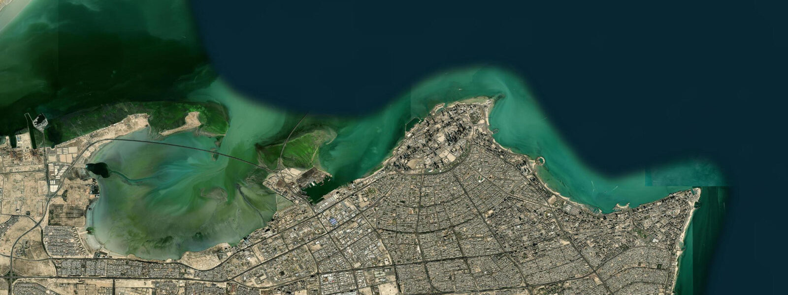
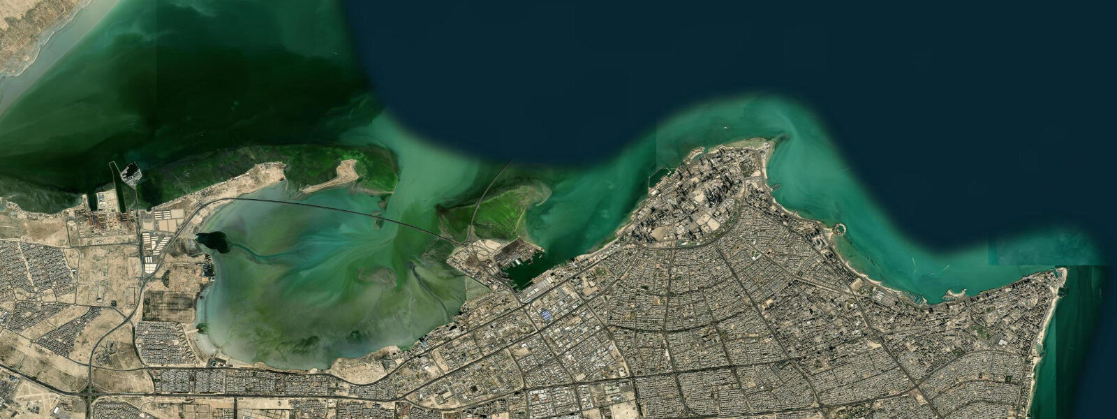
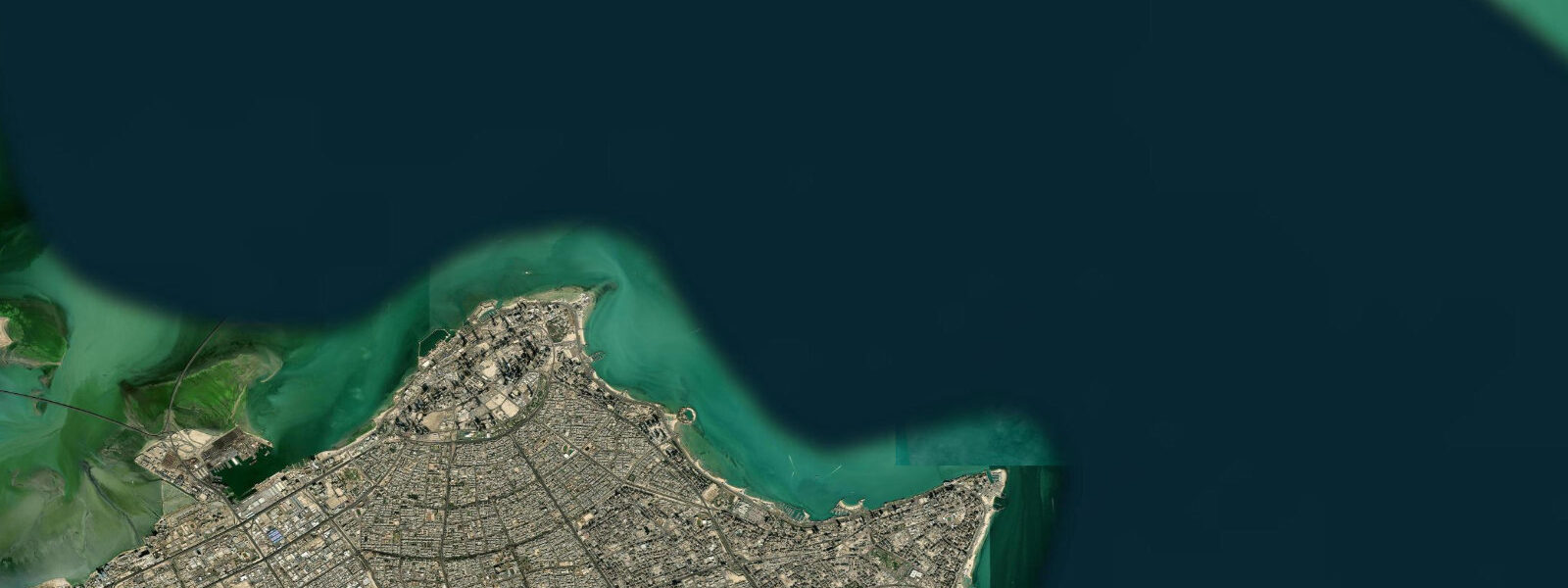
Kuwait City occupies the south shore of Kuwait Bay, the large semi-enclosed embayment on Kuwait's northeast coast. The city is primarily a commercial and administrative capital — the Kuwait Towers, the Grand Mosque, and the Souk Al-Mubarakiya define its identity, not beaches. The waterfront on the bay-facing shore is a mix of corniche promenade, the old souk quarter near the Dhow Harbour, and port facilities. The Dhow Harbour at the north end of the Kuwait City corniche is the most evocative maritime remnant: traditional wooden dhows still built and maintained here, the fishing fleet operating alongside the wooden cargo dhows that have plied these waters for centuries.
The tidal regime in the Arabian Gulf at Kuwait is mixed semidiurnal with strong diurnal inequality. Spring range at Kuwait City is 2.0–2.2 m; neap range narrows to 0.8–1.0 m. The Gulf is shallow — mean depth in Kuwait Bay is 5–8 m — and the semi-enclosed geometry amplifies the tidal range compared to the open Indian Ocean. Diurnal inequality is pronounced: on some days one high water or one low water per day dominates, with the secondary tide weak or nearly absent (diurnal day). On those days the bay behaves like a once-daily tidal system with a range close to 2.0 m.
The combination of Kuwait Bay's semi-enclosed geometry and the shallow Gulf bathymetry makes surge a significant variable. A sustained southerly wind pushes Gulf water northward and stacks it against Kuwait's coast; surges of 0.5–1.0 m above predicted high water have been recorded during strong shamal (northwesterly) and southerly wind events. The bay's low topography and extensive intertidal flats mean that surge events can push water well inland over the reclaimed coastal areas near the Dhow Harbour.
For the Dhow Harbour and fishing fleet, the tide's practical effect is felt most on spring low water. The harbour basin is in 2.0–3.0 m at mean water; at spring low water (approximately 0.0–0.2 m CD at Kuwait), the inner basin depth drops to 0.8–1.5 m — grounding risk for dhows drawing 1.2 m or more. Traditional wooden dhows at Kuwait are built to ground softly in the muddy harbour bottom; the practice of working on a boat grounded on the low tide is an established part of Gulf maritime tradition. Access to the harbour wall for photography is best at low spring water when the full hull lines of the grounded dhows are visible above the waterline.
For fishing, Kuwait Bay's shallow tidal flats are productive for a distinctive Gulf fishery. Hamour (orange-spotted grouper) hold in the 3–6 m zone off the bay's edge at all tidal states but feed most actively on the ebb when the falling tide concentrates prey on the flat edges. Zobaidi (silver pomfret) school over the flats on the flood as temperature-stratified shallow water warms in the Gulf sun. The Shuwaikh fishing port, 3 km west of the Dhow Harbour, is the commercial fishing hub; the morning fish market there opens at 05:00 and is the best source of local intelligence on species and locations.
For photography, the Kuwait Towers — three towers at the point of the corniche, the main one holding a revolving restaurant — are lit at night and best photographed from the bay at golden hour. The Dhow Harbour at low tide, with working wooden vessels grounded or being careened, is industrial in a traditional maritime sense.
All tide predictions for Kuwait City come from the Open-Meteo Marine gridded model. Timing accuracy is ±45 minutes; height accuracy is ±0.3 m above Chart Datum. The Gulf's strong wind-surge response means wind forecasts from Kuwait Meteorological Department (met.gov.kw) should be checked alongside the tide prediction for any shore or small-boat activity.
Tide questions about Kuwait City
Quick answers to the most common questions about tide times, range, and water access at Kuwait City.
What is the tidal range at Kuwait City and how does it affect the Dhow Harbour?
Kuwait City's Arabian Gulf spring tidal range is 2.0–2.2 m, mixed semidiurnal with pronounced diurnal inequality. The Dhow Harbour basin is in 2.0–3.0 m at mean water; at spring low water (approximately 0.0–0.2 m CD), inner basin depth drops to 0.8–1.5 m. Traditional wooden dhows drawing 1.2 m or more may ground on spring lows — a normal part of Gulf maritime practice, as the muddy harbour bottom is soft. Vessels drawing over 1.5 m should plan harbour entry to arrive 2 hours before predicted high water on spring tides. On some days, Kuwait Bay's strong diurnal inequality produces only one significant tidal cycle per day; checking the full hourly prediction is necessary to identify these diurnal days.
What species do anglers catch in Kuwait Bay and what tidal state is best?
Hamour (orange-spotted grouper, Epinephelus coioides) and zobaidi (silver pomfret, Pampus argenteus) are the primary targets in Kuwait Bay. Hamour hold on the 3–6 m edges of the tidal flats and feed most actively on the ebb as prey concentrates at the retreating flat edge — the 90-minute window around mid-ebb is the most productive. Zobaidi school over the warming shallow flats on the flood tide in summer. Zubaidi (grouper) are also caught by jigging from boat at the 8–12 m contour outside the bay. The Shuwaikh fish market opens at 05:00 and local fishermen there are the best current source on species and ground locations. A fishing permit is required; contact the Kuwait Environment Public Authority.
Does the wind affect water levels in Kuwait Bay significantly?
Yes. Kuwait Bay is semi-enclosed, shallow (5–8 m mean depth), and oriented so that southerly winds drive Gulf water northward against the Kuwait City shore. Sustained southerlies can add 0.5–1.0 m above predicted high water — a significant fraction of the 2.0 m spring range. The northwesterly shamal wind, which blows strongly in December–March, can lower Kuwait Bay levels 0.3–0.5 m below predicted low water during sustained events. Wind-surge forecasts from Kuwait Meteorological Department (met.gov.kw) should be checked alongside the Open-Meteo tide prediction for any activity near the waterline. The compound of spring low tide and a shamal northwesterly produces the lowest water levels in the bay.
Is the Kuwait City corniche safe for swimming?
The Kuwait City corniche is a promenade and leisure waterfront, not a beach. There are no public sandy beaches on the Kuwait Bay side of the city; the shore is either reclaimed land, concrete corniche, or port infrastructure. Private beach clubs on Kuwait's coast do operate with managed swimming access, primarily on the Gulf coast south of the city (Arabian Gulf Street direction). Water temperatures in the Gulf at Kuwait peak at 35–36 °C in August — warm enough to be uncomfortable for extended swimming — and drop to 15–17 °C in January–February. The shallow Gulf has low dissolved oxygen in summer at depth; surface water quality near urban storm drains should be checked before any open-water swimming.
What is the best time of day to photograph the Dhow Harbour?
The Dhow Harbour at Kuwait City is best photographed at low spring water, when the full hull lines of working dhows are visible above the waterline — either grounded in the mud or at full low-water exposure. Morning golden hour (06:00–08:00 in summer) provides warm directional light from the east hitting the harbour face. The harbour faces northwest, so morning light rakes across the hull curves. At high water, the dhows float high and the harbour edges are submerged, reducing visual access to the traditional hull forms. Evening light from the bay is blocked by the urban waterfront. Night photography of the Kuwait Towers from the bay approach is best from 30 minutes after sunset.
8-day tide table — Kuwait City
Heights relative to MSL. Predictions: Open-Meteo Marine (MeteoFrance SMOC, 0.08° grid) — heights relative to MSL (not chart datum / LAT). Model-derived.
| Day | Type | Time | Height |
|---|---|---|---|
| Sat 27 Jun | Low | 03:00 | 0.3m |
| High | 09:17 | 1.5m | |
| Low | 16:43 | -1.0m | |
| High | 23:57 | 1.0m | |
| Sun 28 Jun | Low | 04:11 | 0.5m |
| High | 09:54 | 1.6m | |
| Low | 17:25 | -1.1m | |
| Mon 29 Jun | High | 00:39 | 1.1m |
| Low | 05:05 | 0.4m | |
| High | 10:35 | 1.6m | |
| Low | 18:05 | -1.3m | |
| Tue 30 Jun | High | 01:04 | 0.9m |
| Low | 05:36 | 0.3m | |
| High | 11:09 | 1.6m | |
| Low | 18:44 | -1.5m | |
| Wed 01 Jul | High | 01:35 | 1.0m |
| Low | 06:19 | 0.3m | |
| High | 11:46 | 1.6m | |
| Low | 19:16 | -1.5m | |
| Thu 02 Jul | High | 02:08 | 1.1m |
| Low | 07:01 | 0.3m | |
| High | 12:22 | 1.6m | |
| Low | 19:48 | -1.5m | |
| Fri 03 Jul | High | 02:27 | 1.1m |
| Low | 07:38 | 0.2m | |
| High | 12:53 | 1.6m | |
| Low | 20:18 | -1.5m | |
| Sat 04 Jul | High | 02:00 | 1.1m |