Al Ahmadi tide times
Al Ahmadi tide forecast — heights relative to MSL.
Today's tide times for Al Ahmadi
Tide times at Al Ahmadi on Saturday, 27 June 2026: first low tide at 03:00am, first high tide at 08:35am. Sunrise 04:50am, sunset 06:50pm.
Tide chart for Al Ahmadi
24-hour cosine-interpolated curve around the present moment. Heights relative to MSL. Predictions: Predictions: Open-Meteo Marine (MeteoFrance SMOC, 0.08° grid).
Sun, moon and conditions on Sat 27 Jun
Snapshot at build time — refreshes daily. Sea state from Open-Meteo Marine.
Highs and lows next 7 days
Every predicted high and low for the next week, with the daily tidal coefficient (0–120; higher = bigger swing, > 95 means stronger currents).
Other spots nearby
The three closest curated TideTurtle locations to Al Ahmadi, measured by great-circle distance.
Today's solunar windows
Solunar tradition: major periods are the ≈3h windows around moon transit and opposition; minor are ≈2h around moonrise and moonset. Pair with the local tide stage and wind for the best read.
Cycle dates near Al Ahmadi
Next spring tide on Wed 01 Jul (range 2.4m). Last neap on Sat 27 Jun.
Spring tides cluster around new and full moons (biggest swings). Neap tides land on quarter moons (smallest swings). See the spring tide and neap tide glossary entries for the why.
About tides at Al Ahmadi
A short guide to the coastline at Al Ahmadi — geography, sea state, and what the tide is actually doing under your feet.
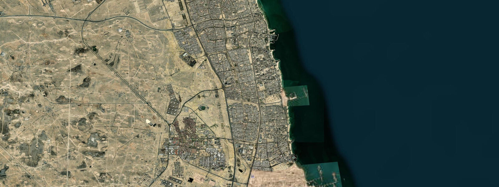
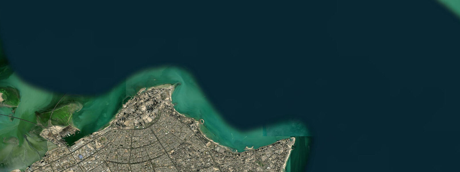
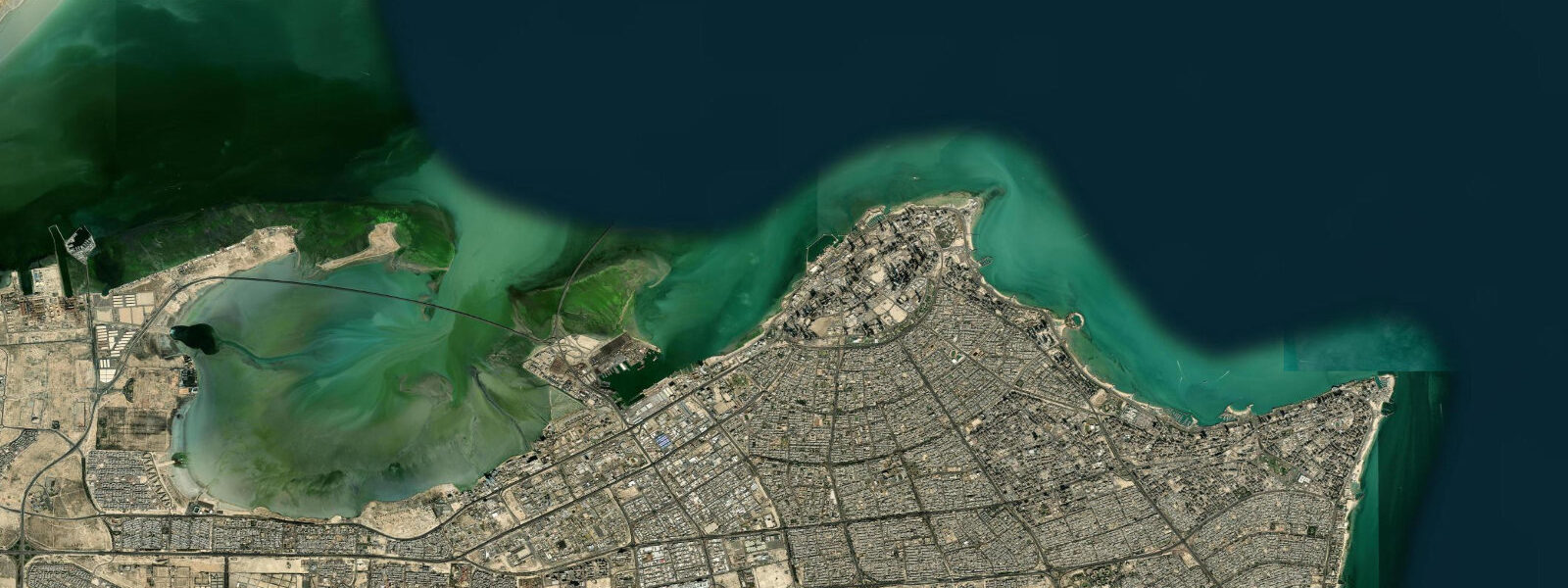
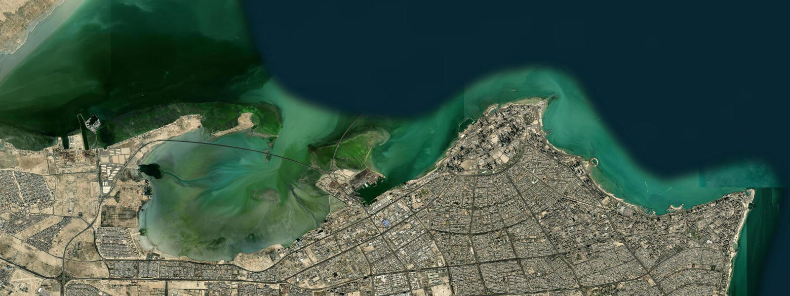
Al Ahmadi is Kuwait's major oil port and industrial city, 30 km south of Kuwait City on the southern shore of Kuwait Bay. The city was purpose-built by the Kuwait Oil Company (KOC) in the 1940s to house the workers and infrastructure of Kuwait's oil industry; the name means 'the Ahmadi' in Arabic, referencing Sir Ahmad al-Jabir Al-Sabah, the Emir who oversaw early oil development. The port of Mina al-Ahmadi handles the export of Kuwait's crude oil and refined products — one of the largest petroleum export terminals in the world. This is not a beach destination.
The tidal regime at Al Ahmadi is Kuwait Bay mixed semidiurnal: spring range 2.0–2.2 m, pronounced diurnal inequality. The southern end of Kuwait Bay at Al Ahmadi is shallower than the northern end at Kuwait City; extensive intertidal mudflats are exposed at spring low water to the east of the port infrastructure, extending 1–2 km from the charted land edge. These flats are ecologically significant — they form part of the intertidal feeding habitat used by migratory shorebirds on the East Atlantic Flyway through the Gulf.
For the port operations at Mina al-Ahmadi, the tidal range is operationally significant. The oil export terminal handles very large crude carriers (VLCCs) drawing 20–22 m fully loaded; the deepwater berths are in 22–25 m at mean water and have adequate depth at all tidal states for these vessels. The inshore approaches through Kuwait Bay are not used by VLCCs — they load at offshore single-point moorings (SPMs) in the deeper water of the outer Gulf where depth is not a constraint. Coastal vessels and supply boats serving the port operate in 5–10 m approach channels; a spring tidal drop of 2.0 m is significant in these shallower approaches.
For nature observers and photographers, the intertidal mudflats south of Mina al-Ahmadi at the eastern shore of Kuwait Bay are one of the best shorebird observation sites in Kuwait, particularly during spring (March–May) and autumn (August–October) migration. Dunlin, curlew sandpiper, bar-tailed godwit, Eurasian whimbrel, and spotted redshank are recorded in significant numbers. The most productive observation window is the 2 hours before high water, when rising water concentrates foraging shorebirds at the advancing tide edge — a dense, moving line of birds accessible with a telescope from the berm above the flat.
The Kuwait Bay coast at Al Ahmadi is also a winter haunt for greater flamingos, which feed on the intertidal invertebrates at low water. Flocks of 200–500 birds are recorded on the southern Kuwait Bay flats in November–March. They feed by wading in 0.3–0.8 m of water and move with the tidal edge — the 2 hours around low water provides the most extensive shallow wading area and the highest flamingo activity on the exposed flat.
For anglers, Al Ahmadi's industrial character limits accessible shore fishing to the industrial periphery. The bay's tidal flats south of the port infrastructure attract mullet and bream that follow the flood-tide edge onto the flat. Some fishing from the rocky sections of the coastal berm south of the KOC housing areas is possible at low water. The main fishing access is from small boat; the bay's productive hamour and zubaidi grounds are best reached from Salmiya or Kuwait City's fishing harbour rather than from Al Ahmadi directly.
The Al Ahmadi Golf Course, developed by KOC and irrigated with treated wastewater, borders the coastal area to the west of the port. The juxtaposition of a maintained golf course with petrochemical infrastructure and migratory shorebird habitat is one of the more surreal coastal landscapes on the Gulf.
All tide predictions for Al Ahmadi come from the Open-Meteo Marine gridded model. Timing accuracy is ±45 minutes; height accuracy is ±0.3 m above Chart Datum.
Tide questions about Al Ahmadi
Quick answers to the most common questions about tide times, range, and water access at Al Ahmadi.
Are there shorebirds at Al Ahmadi and how does the tide affect viewing?
The intertidal mudflats on the eastern shore of Kuwait Bay south of Mina al-Ahmadi are among Kuwait's best shorebird sites. Dunlin, curlew sandpiper, bar-tailed godwit, Eurasian whimbrel, and spotted redshank concentrate here during spring (March–May) and autumn (August–October) migration. The peak viewing window is the 2 hours before high water, when the rising tide compresses foraging birds into a dense advancing line at the water edge — accessible with a telescope from the berm above the flat. At full high water, birds flush to roosting areas. Greater flamingos feed on the same flats in November–March, most active at low water when the tidal flat is fully exposed.
Can flamingos be seen at Al Ahmadi and when is the best time?
Greater flamingos (Phoenicopterus roseus) winter on the southern Kuwait Bay tidal flats, with flocks of 200–500 birds recorded from November through March. They feed by wading in 0.3–0.8 m of water, filtering invertebrates from the mudflat surface. The most productive viewing window is the 2 hours around low water on spring tides, when the tidal flat is fully exposed and the flamingos spread across the shallow wading zone. On spring high water, they may withdraw from the flooded flat to roosting areas on slightly elevated ground. Early morning light from the east lights the pink plumage from behind the observer on the western berm — the optimal photography position.
How does the 2.0 m tidal range affect the Al Ahmadi port operations?
Mina al-Ahmadi's deepwater VLCC berths are in 22–25 m at mean water — the 2.0 m spring tidal range is a small fraction of total depth and is not a constraint for vessels drawing 20–22 m. Oil loading at offshore single-point moorings (SPMs) in the deeper outer Gulf is entirely depth-unconstrained. The tidal range does affect coastal supply vessel and small-craft operations in the 5–10 m approach channels of the bay: a 2.0 m spring drop brings charted depths of 3.0 m down to 1.0 m in the shallowest approach zones. Small craft serving the port use the bay's tidal window — arriving on the flood, departing before the lowest spring water — in shallow inshore sections.
Is there any public beach access near Al Ahmadi?
Al Ahmadi is primarily an industrial and residential oil-company city; public beach infrastructure is minimal. The KOC company beach is accessible to KOC employees and their guests. Public coastal access exists along the rocky berm sections south of the port infrastructure, but these are industrial margins rather than recreational beaches. The nearest public beach access is at Fintas and Mangaf, 10–15 km north on the Gulf Road, where the coast is more accessible and the water quality is better away from the port discharge zones. Swimming near industrial port infrastructure is not recommended due to hydrocarbon contamination risk in nearshore sediments.
What is the intertidal flat ecosystem at Al Ahmadi like?
The intertidal mudflats on Kuwait Bay's southern shore at Al Ahmadi are a high-productivity benthic ecosystem typical of shallow Gulf intertidal zones. The substrate is fine silt and mud, rich in polychaete worms, bivalves, and small crustaceans — the invertebrate community that supports the shorebird and flamingo assemblages. The flat is covered at high spring tide to approximately 1.5–2.0 m and exposed for 4–6 hours around low water on a typical tidal day. Oil contamination from historical spills (particularly the 1991 Gulf War discharge, which deposited thick oil on coastal flats) has partially recovered in the 30+ years since; biological monitoring shows partial but incomplete ecosystem recovery compared to pre-war baseline surveys.
8-day tide table — Al Ahmadi
Heights relative to MSL. Predictions: Open-Meteo Marine (MeteoFrance SMOC, 0.08° grid) — heights relative to MSL (not chart datum / LAT). Model-derived.
| Day | Type | Time | Height |
|---|---|---|---|
| Sat 27 Jun | Low | 03:00 | 0.5m |
| High | 08:35 | 1.3m | |
| Sun 28 Jun | Low | 03:10 | 0.6m |
| High | 09:08 | 1.4m | |
| Low | 17:12 | -0.7m | |
| Mon 29 Jun | High | 00:38 | 0.8m |
| Low | 04:00 | 0.6m | |
| High | 09:51 | 1.3m | |
| Low | 17:50 | -0.9m | |
| Tue 30 Jun | High | 01:12 | 0.7m |
| Low | 18:23 | -1.0m | |
| Wed 01 Jul | High | 01:43 | 0.7m |
| Low | 05:10 | 0.5m | |
| High | 11:07 | 1.4m | |
| Low | 18:55 | -1.0m | |
| Thu 02 Jul | High | 02:12 | 0.8m |
| Low | 05:54 | 0.5m | |
| High | 11:46 | 1.4m | |
| Low | 19:24 | -1.0m | |
| Fri 03 Jul | High | 12:22 | 1.3m |
| Low | 19:53 | -1.0m | |
| Sat 04 Jul | High | 02:00 | 0.8m |