South Tarawa, Kiribati tide times
South Tarawa, Kiribati tide forecast — heights relative to MSL.
Tide chart for South Tarawa, Kiribati
24-hour cosine-interpolated curve around the present moment. Heights relative to MSL. Predictions: Predictions: Open-Meteo Marine (MeteoFrance SMOC, 0.08° grid).
Sun, moon and conditions on Mon 06 Jul
Snapshot at build time — refreshes daily. Sea state from Open-Meteo Marine.
Highs and lows next 7 days
Every predicted high and low for the next week, with the daily tidal coefficient (0–120; higher = bigger swing, > 95 means stronger currents).
Other spots nearby
The three closest curated TideTurtle locations to South Tarawa, Kiribati, measured by great-circle distance.
Today's solunar windows
Solunar tradition: major periods are the ≈3h windows around moon transit and opposition; minor are ≈2h around moonrise and moonset. Pair with the local tide stage and wind for the best read.
Cycle dates near South Tarawa, Kiribati
Last spring tide on Sat 04 Jul (range 1.3m). Next spring tide on Fri 10 Jul (range 1.1m). Next neap on Wed 08 Jul.
Spring tides cluster around new and full moons (biggest swings). Neap tides land on quarter moons (smallest swings). See the spring tide and neap tide glossary entries for the why.
About tides at South Tarawa, Kiribati
A short guide to the coastline at South Tarawa, Kiribati — geography, sea state, and what the tide is actually doing under your feet.
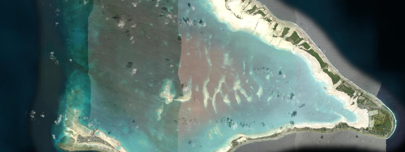
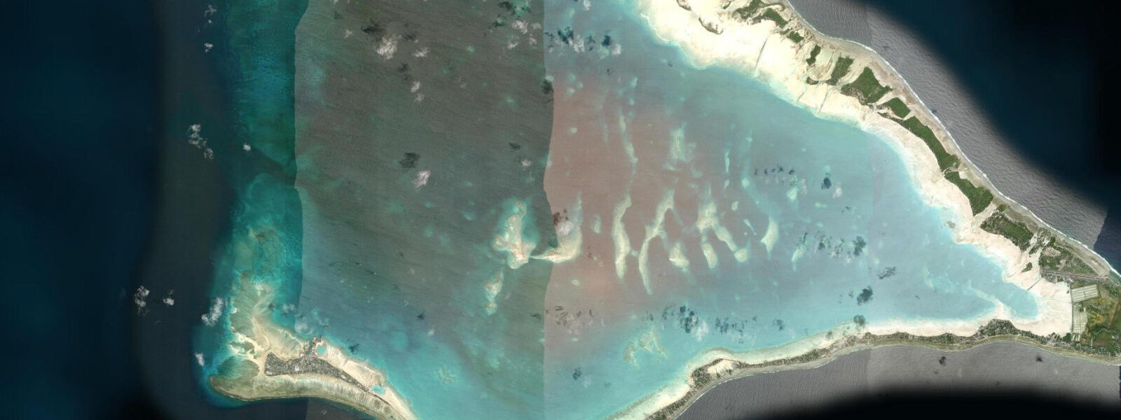
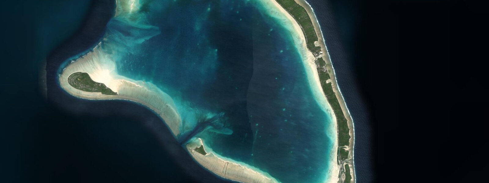
South Tarawa is the capital of Kiribati — a chain of islets connected by causeways running 35 kilometres from Betio in the west to Bonriki in the east. The urban strip holds around 63,000 people on a total land area of roughly 16 square kilometres, with population density in some wards exceeding 15,000 per square kilometre. By that measure it is one of the most densely populated places on Earth, on land averaging less than 2 metres above sea level.
The tidal regime at South Tarawa is mixed semidiurnal with a spring range of 0.8 to 1.5 metres. The diurnal inequality is moderate: the two daily highs and two daily lows differ in height, with the dominant tide driven by the M2 component and modified by the K1 and O1 diurnal constituents typical of the central Pacific. At spring peak high water, the ocean surface sits within centimetres of the road level on the lowest causeways and foreshore sections. King tides — perigean springs occurring two to four times per year — already flood roads, wells, and gardens across South Tarawa. This is not a theoretical risk; it is a regular event documented by the Kiribati Meteorological Service.
Tide data for South Tarawa comes from Open-Meteo Marine, a global gridded ocean model. Accuracy is typically ±45 minutes on timing and ±0.2 to 0.3 metres on height. At South Tarawa's elevation, that ±0.2 to 0.3 metre model uncertainty represents the difference between a dry road and a flooded one on a high spring tide. For inundation risk and infrastructure planning, consult Kiribati Meteorological Service tide gauge records rather than the model prediction used here.
The Battle of Tarawa was fought on Betio in November 1943 — a 76-hour US Marine assault on a heavily fortified Japanese position that resulted in over 1,000 American and 4,500 Japanese deaths on a 150-hectare island. The Tarawa War Cemetery (CWGC) on Betio holds 22 identified Commonwealth graves and a memorial to 38 unidentified. The American Battle Monuments Commission maintains a separate memorial. Japanese coastal defence guns — 8-inch naval rifles installed by the garrison — remain in place on Betio's southwestern seawall, at the water's edge. At high water the base of the seawall platform is washed; at low water a narrow reef flat is exposed between the guns and the lagoon. The visual drama of these guns against the open ocean is strongest at the turn of a high spring tide.
For visitors navigating South Tarawa on foot or bicycle, the causeway system is the only land route between islets. The main causeways are 3 to 5 metres above sea level at their crowns but taper at the abutments to near sea level. During a spring high tide, the causeway shoulders are the first sections to take water; the road surface remains passable. During a king tide combined with a westerly swell surge, the lowest causeway sections can be briefly covered. Travellers on the islet chain during predicted king-tide events should confirm road access with local contacts.
Fishing from the South Tarawa lagoon shore and the reef passages is a subsistence activity for most of the population — not sport. The main species targeted from the inner lagoon shore are milkfish (ikari), reef snapper, and bonefish on the tidal flats. Bonefish feeding runs move onto the reef flat on the flood tide — approximately two hours after the predicted low — and retreat as the water shallows on the ebb. Casting small shrimp or crab imitations into the advancing flood edge is the standard technique. Bonefish on Tarawa's flats are wild and lightly fished; the population is healthy by atoll standards, though not widely known to international fly-fishing visitors.
Sea-level rise projections for Kiribati under the IPCC AR6 moderate emissions scenario indicate 0.3 to 0.5 metres of additional mean sea level rise by 2100 relative to the 2005 baseline. Against a current spring tidal range of 0.8 to 1.5 metres, an additional 0.3 to 0.5 metres of mean level raises the king-tide surface by the same amount — carrying the inundation frequency and extent that currently occurs a few times per year to near-permanent during high-tide periods on the lowest land. The I-Kiribati government has made bilateral migration agreements with Fiji, Australia, and New Zealand as one strand of adaptation strategy; the government's official position is that it will continue to fight for the territory's viability, not assume abandonment.
Tide questions about South Tarawa, Kiribati
Quick answers to the most common questions about tide times, range, and water access at South Tarawa, Kiribati.
What is the tidal range at South Tarawa and why does it matter more here than at most coastal locations?
South Tarawa's spring tidal range is 0.8 to 1.5 metres — a moderate Pacific range — but the atoll averages less than 2 metres above mean sea level. The spring high tide brings the ocean surface to within centimetres of the lowest road and foreshore sections. King tides (perigean springs) already flood roads, freshwater wells, and gardens two to four times per year. The Open-Meteo Marine model used here carries ±45-minute timing and ±0.2 to 0.3-metre height uncertainty — at South Tarawa's freeboard, that height uncertainty is material. For inundation risk assessment, Kiribati Meteorological Service gauge records provide more precise local data.
What WWII sites can I visit in South Tarawa?
The Battle of Tarawa sites are concentrated on Betio islet at the western end of the causeway chain. Japanese 8-inch coastal defence guns remain in place on the southwestern seawall — visible from the road, at the water's edge with wave wash at high tide. The Tarawa War Cemetery (CWGC) on Betio holds 22 identified Commonwealth graves; the American Battle Monuments Commission operates a separate memorial nearby. Rusting landing craft and anti-tank obstacles remain on and around Orange Beach, the Marines' primary landing site. The sites are accessible by bicycle or on foot from the main Betio road — no tide timing required for the land access, but the gun positions against the ocean are most visually dramatic at the turn of a high spring tide.
What is the sea-level rise risk for South Tarawa and is the island being abandoned?
IPCC AR6 moderate emissions projections indicate 0.3 to 0.5 metres of additional mean sea level rise by 2100 relative to the 2005 baseline. Against South Tarawa's 0.8 to 1.5 metre spring tidal range and average elevation below 2 metres, that additional rise extends the frequency and area of king-tide inundation significantly. The Kiribati government has made bilateral migration agreements with Fiji, Australia, and New Zealand as adaptive options, while maintaining an official position of defending territorial viability rather than planning abandonment. The population is not currently evacuating; the question is the timeline and conditions under which parts of the atolls become uninhabitable.
Is bonefish flats fishing accessible at South Tarawa?
The tidal reef flats of South Tarawa hold healthy bonefish populations — lightly fished by international visitors despite being a legitimate fishery. Bonefish move onto the flat on the flood tide, approximately two hours after the predicted low, and feed across the shallow sand as the water deepens. They retreat ahead of the ebb. The standard approach is to wade the advancing flood edge with light spinning or fly gear, casting ahead of visible tailing fish. The best flats are on the lagoon-facing edges of the inner islets away from the main harbour traffic. A local guide is advisable for first-time visitors — the flat geography changes seasonally and local knowledge on feeding corridors is valuable.
Are the South Tarawa causeways safe to drive during high tides?
During standard spring tides the causeway road surfaces remain passable — the shoulders may take water at the lowest abutment sections but the crown is above flood level. During king tides (perigean springs, typically twice per year at predicted 'highest astronomical tide' events) combined with westerly swell surge, the lowest causeway sections can be briefly covered. Local radio and the Kiribati Meteorological Service announce anticipated king-tide events in advance. Travellers planning to move between Betio and Bonriki during a predicted king-tide window should check road status with their accommodation or the National Disaster Risk Management Office before departure.
7-day tide table — South Tarawa, Kiribati
Heights relative to MSL. Predictions: Open-Meteo Marine (MeteoFrance SMOC, 0.08° grid) — heights relative to MSL (not chart datum / LAT). Model-derived.
| Day | Type | Time | Height |
|---|---|---|---|
| Mon 06 Jul | Low | 00:26 | 0.1m |
| High | 06:51 | 1.4m | |
| Low | 13:12 | 0.0m | |
| High | 19:21 | 1.2m | |
| Tue 07 Jul | Low | 01:11 | 0.2m |
| High | 07:26 | 1.3m | |
| Low | 13:51 | 0.1m | |
| High | 20:06 | 1.2m | |
| Wed 08 Jul | Low | 02:02 | 0.3m |
| High | 08:15 | 1.2m | |
| Low | 14:45 | 0.2m | |
| High | 21:06 | 1.1m | |
| Thu 09 Jul | Low | 03:12 | 0.3m |
| High | 09:23 | 1.1m | |
| Low | 15:42 | 0.3m | |
| High | 22:18 | 1.2m | |
| Fri 10 Jul | Low | 04:36 | 0.4m |
| High | 10:42 | 1.1m | |
| Low | 16:54 | 0.3m | |
| High | 23:36 | 1.2m | |
| Sat 11 Jul | Low | 06:12 | 0.3m |
| High | 12:12 | 1.0m | |
| Low | 18:16 | 0.2m | |
| Sun 12 Jul | High | 00:55 | 1.3m |