Betio, Kiribati tide times
Betio, Kiribati tide forecast — heights relative to MSL.
Tide chart for Betio, Kiribati
24-hour cosine-interpolated curve around the present moment. Heights relative to MSL. Predictions: Predictions: Open-Meteo Marine (MeteoFrance SMOC, 0.08° grid).
Sun, moon and conditions on Mon 06 Jul
Snapshot at build time — refreshes daily. Sea state from Open-Meteo Marine.
Highs and lows next 7 days
Every predicted high and low for the next week, with the daily tidal coefficient (0–120; higher = bigger swing, > 95 means stronger currents).
Other spots nearby
The three closest curated TideTurtle locations to Betio, Kiribati, measured by great-circle distance.
Today's solunar windows
Solunar tradition: major periods are the ≈3h windows around moon transit and opposition; minor are ≈2h around moonrise and moonset. Pair with the local tide stage and wind for the best read.
Cycle dates near Betio, Kiribati
Last spring tide on Sat 04 Jul (range 1.3m). Next spring tide on Fri 10 Jul (range 1.1m). Next neap on Wed 08 Jul.
Spring tides cluster around new and full moons (biggest swings). Neap tides land on quarter moons (smallest swings). See the spring tide and neap tide glossary entries for the why.
About tides at Betio, Kiribati
A short guide to the coastline at Betio, Kiribati — geography, sea state, and what the tide is actually doing under your feet.
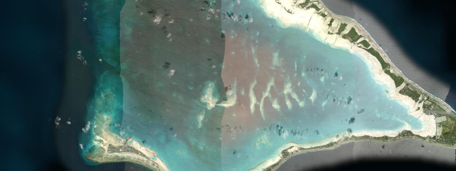
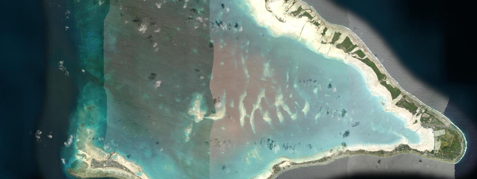
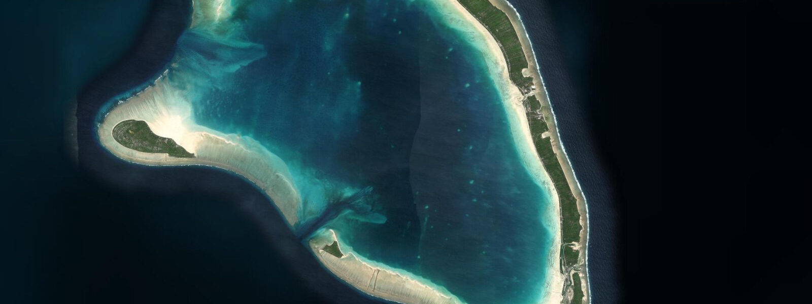
Betio is the westernmost islet of South Tarawa — 150 hectares of low-lying coral at the tip of the causeway chain, holding Kiribati's main port, the largest commercial concentration on the atoll, and the most significant Second World War battlefield in the central Pacific. The 76-hour Battle of Tarawa fought here in November 1943 cost over 1,000 American Marine lives and essentially the entire Japanese garrison of approximately 4,500 — among the highest casualty rates per area of any Pacific War engagement.
The tidal regime at Betio is identical to South Tarawa: mixed semidiurnal, spring range 0.8 to 1.5 metres. The port operates across the full tidal range — Betio Harbour is the deepest water access on the atoll, used by inter-island freighters, the fishing fleet, and occasional research vessels. At low water springs the approach channel reads 4 to 6 metres depth over the bar; at high water springs the same section is 5 to 7.5 metres. The channel is not tidal-critical for the vessels currently using it, but the outer anchorage ground beyond the passage reef is affected by sea state on the exposed westward fetch. Tide data for Betio comes from Open-Meteo Marine — accuracy ±45 minutes on timing, ±0.2 to 0.3 metres on height.
The WWII guns on Betio's seawall are the centrepiece of any historical visit. The Japanese installed four 8-inch coastal defence guns (Vickers Mk I, captured from the British in Singapore) on concrete platforms on the southwestern corner of the island. The guns are positioned at the water's edge; at high spring tide, the base of the concrete platforms is washed by the sea. At low water the surrounding reef flat is exposed to 30 to 50 metres seaward of the platform — the same flat the Marines waded across under fire in November 1943, when the assault was mistimed against an unfavourable neap tide that left the reef too shallow for landing craft. The landing craft grounded on the reef flat 300 to 700 metres from shore; troops waded in under fire across the same flat now exposed at low tide. Walking that flat at low water today makes the tactical problem of November 1943 immediately legible.
The Tarawa War Cemetery is administered by the Commonwealth War Graves Commission and contains 22 identified graves of Commonwealth servicemen, plus a memorial to 38 unidentified. The American Battle Monuments Commission memorial is nearby. Neither site is tide-dependent for access. The main Orange Beach — the primary US Marine landing site on Betio's northern lagoon shore — faces the lagoon rather than the ocean; the beach is accessible at any tidal state, with a slightly wider sand exposure at low water.
The port of Betio is the functional heart of inter-island shipping for Kiribati. The MV Nei Mataroa and other inter-island vessels load and depart from the main wharf; schedules are published by the Kiribati Shipping Services but are subject to weather and cargo delays. Berthing at the main wharf is at any tidal state due to the harbour depth. The wharf experience is one of the more vivid working-port encounters in the Pacific: copra sacks, fishing gear, returnee passengers, and deck cargo for the outer islands all share the same concrete dock. Observation is possible from the dock perimeter; photography is generally accepted but confirmation with port security is courteous.
For the limited cohort of international visitors who reach Betio specifically for WWII history, the combination of the gun platforms, the adjacent reef flat, and the war cemeteries makes a three-hour walking itinerary that benefits from beginning at low water: the reef flat is exposed, the gun platforms are at their most visually complete with the flat extending before them, and the beach landing geometry is most readable. Rising tide in the late morning gives a second useful phase — the water returning across the flat is a direct enactment of what the landing craft would have experienced had they arrived on a different tidal cycle.
Sea-level context is unavoidable at Betio. The port, the WWII gun platforms, the war cemeteries, and the dense residential areas are all below 2 metres above mean sea level. King tides already reach the base of the gun platform steps. Under IPCC AR6 projections, a further 0.3 to 0.5 metres of mean sea level rise increases the inundation frequency and area of the platforms themselves. The physical evidence of the 1943 battle — the guns, the concrete, the reef — sits in a landscape where the sea is slowly reclaiming the ground where the battle was fought.
Tide questions about Betio, Kiribati
Quick answers to the most common questions about tide times, range, and water access at Betio, Kiribati.
Why did the Battle of Tarawa's tidal timing cause such high casualties in 1943?
The assault on Betio on 20 November 1943 was planned for a 'dodging' or low neap tide — a period when the range was unusually small and the reef flat shallower than the mean. Landing craft required roughly 1.2 metres of water over the reef flat to clear it; the actual tide at landing was 0.6 to 0.9 metres, stranding the craft 300 to 700 metres offshore. Marines waded that distance under direct fire across the same flat exposed at low tide today. The tidal miscalculation — compounded by disagreement among tide experts and poor pre-landing reconnaissance — is cited in post-battle analysis as a primary contributor to the first-wave casualty rate. Walking the flat at low water now makes the tactical problem immediately concrete.
What WWII guns remain at Betio and where exactly are they?
Four 8-inch Vickers Mk I coastal defence guns — captured by the Japanese from the British at Singapore in 1942 — are mounted on concrete platforms on Betio's southwestern seawall corner. The platforms sit at the water's edge; at high spring tide the base of the concrete is washed by the sea, and at low water the surrounding reef flat is exposed 30 to 50 metres seaward. The guns are accessible by foot from the main coastal road at any tidal state. Two additional smaller-calibre gun positions are visible further along the seawall. Japanese bunker remains, ammunition storage, and anti-tank obstacles are distributed across the western end of the island, also accessible on foot.
Is Betio Harbour safe to enter by yacht or small vessel at low tide?
Betio Harbour's main approach channel reads approximately 4 to 6 metres depth at low water springs — sufficient for most visiting yachts. The outer anchorage on the exposed western side is affected by the open fetch toward the prevailing trade-wind swell; the anchorage inside the lagoon passage is significantly calmer. Kiribati port authority requires yacht entry permits; contact the Port Authority of Kiribati in advance. Tide data from Open-Meteo Marine carries ±45-minute timing and ±0.2 to 0.3-metre height accuracy — cross-reference with the Kiribati Meteorological Service gauge for current depths on the bar if the vessel draft is close to the margin.
How does sea-level rise affect the WWII gun platforms at Betio?
The Japanese coastal defence gun platforms on Betio's southwestern seawall already sit at the water's edge; king tides wash the base of the concrete steps. Under IPCC AR6 moderate emissions projections, 0.3 to 0.5 metres of additional mean sea level rise by 2100 would bring the platforms themselves into regular inundation range during spring tides. The reef flat in front of the guns — the same flat Marines crossed in 1943 — is predicted to be permanently submerged at mean sea level within decades under higher emissions trajectories. The physical battlefield is eroding at the same pace as the inhabited land around it.
What is the best route and timing for a walking tour of the Betio WWII sites?
Begin the walk at low water (check the tide prediction for the day's morning low) at the southwestern gun platforms. The reef flat in front of the guns is exposed, the platforms are at their most accessible, and the landing geometry from the lagoon side is visible. Walk east along the seawall to the secondary gun positions and bunker remains — 30 to 45 minutes. Continue to Orange Beach (the northern lagoon shore, 20 minutes) and the American and Commonwealth war cemeteries. Return by the central road to the starting point. Total walking time is 2.5 to 3.5 hours. The rising tide from mid-morning onward brings the seawall area back to high-water state; if time allows, compare the gun platforms at both tidal extremes within the same visit.
7-day tide table — Betio, Kiribati
Heights relative to MSL. Predictions: Open-Meteo Marine (MeteoFrance SMOC, 0.08° grid) — heights relative to MSL (not chart datum / LAT). Model-derived.
| Day | Type | Time | Height |
|---|---|---|---|
| Mon 06 Jul | Low | 00:26 | 0.1m |
| High | 06:51 | 1.4m | |
| Low | 13:12 | 0.0m | |
| High | 19:21 | 1.2m | |
| Tue 07 Jul | Low | 01:11 | 0.2m |
| High | 07:26 | 1.3m | |
| Low | 13:51 | 0.1m | |
| High | 20:06 | 1.2m | |
| Wed 08 Jul | Low | 02:02 | 0.3m |
| High | 08:15 | 1.2m | |
| Low | 14:45 | 0.2m | |
| High | 21:06 | 1.1m | |
| Thu 09 Jul | Low | 03:12 | 0.3m |
| High | 09:23 | 1.1m | |
| Low | 15:42 | 0.3m | |
| High | 22:18 | 1.2m | |
| Fri 10 Jul | Low | 04:36 | 0.4m |
| High | 10:42 | 1.1m | |
| Low | 16:54 | 0.3m | |
| High | 23:36 | 1.2m | |
| Sat 11 Jul | Low | 06:12 | 0.3m |
| High | 12:12 | 1.0m | |
| Low | 18:16 | 0.2m | |
| Sun 12 Jul | High | 00:55 | 1.3m |