Nyali Beach tide times
Nyali Beach tide forecast — heights relative to MSL.
Today's tide times for Nyali Beach
Tide times at Nyali Beach on Sunday, 21 June 2026: first low tide at 03:00am, first high tide at 08:20am. Sunrise 06:26am, sunset 06:19pm.
Tide chart for Nyali Beach
24-hour cosine-interpolated curve around the present moment. Heights relative to MSL. Predictions: Predictions: Open-Meteo Marine (MeteoFrance SMOC, 0.08° grid).
Sun, moon and conditions on Sun 21 Jun
Snapshot at build time — refreshes daily. Sea state from Open-Meteo Marine.
Highs and lows next 7 days
Every predicted high and low for the next week, with the daily tidal coefficient (0–120; higher = bigger swing, > 95 means stronger currents).
Other spots nearby
The three closest curated TideTurtle locations to Nyali Beach, measured by great-circle distance.
Today's solunar windows
Solunar tradition: major periods are the ≈3h windows around moon transit and opposition; minor are ≈2h around moonrise and moonset. Pair with the local tide stage and wind for the best read.
Cycle dates near Nyali Beach
Last spring tide on Sun 21 Jun (range 2.0m). Next spring tide on Sat 27 Jun (range 2.2m). Next neap on Wed 24 Jun.
Spring tides cluster around new and full moons (biggest swings). Neap tides land on quarter moons (smallest swings). See the spring tide and neap tide glossary entries for the why.
About tides at Nyali Beach
A short guide to the coastline at Nyali Beach — geography, sea state, and what the tide is actually doing under your feet.
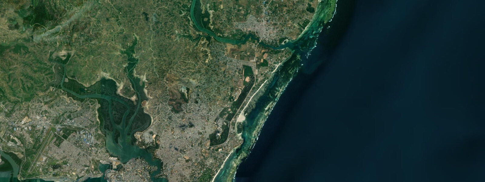
Nyali Beach is the closest beach suburb north of Mombasa Island, 3 kilometres from the Nyali Bridge that crosses the Tudor Creek and connects the island to the northern mainland suburbs. The beach runs roughly east-northeast along the coast for approximately 4 kilometres, protected by the same continuous fringing reef system that runs south toward Diani. The reef keeps the lagoon water clear and calm; the Mombasa skyline is visible to the south across Tudor Creek mouth and the open Kilindini harbour approach.
The tidal range at Nyali is consistent with the Kenya Ports Authority Mombasa gauge — the nearest authoritative tide station — with spring range running 3.2 to 3.8 metres and neap range around 1.7 metres. At spring low water, the reef flat at Nyali exposes for 200 to 250 metres from the beach waterline, and the seagrass beds in the mid-lagoon section become visible — extensive meadows of halophila and thalassia seagrass that are productive feeding habitat for green turtles and dugong (dugong dugon), both recorded in the wider Mombasa reef system. The Nyali lagoon at high water sits 1.5 to 2.5 metres deep across most of its width; the channel behind the reef maintains adequate depth for small motorboats at all tidal states.
Nyali is one of the oldest resort areas on the Kenya coast. The Nyali Beach Hotel (now operating as Voyager Beach Resort under Heritage Hotels) was one of the first coastal hotels in Kenya; the original building dates from the 1950s. The beach has retained its character as a mid-range resort destination — less developed than Diani to the south, more accessible to Mombasa city centre, and quieter in the shoulder seasons when the international resort market is thin. The beach hotels run from the Tudor Creek mouth at the southern end to the Mkomani headland at the eastern end.
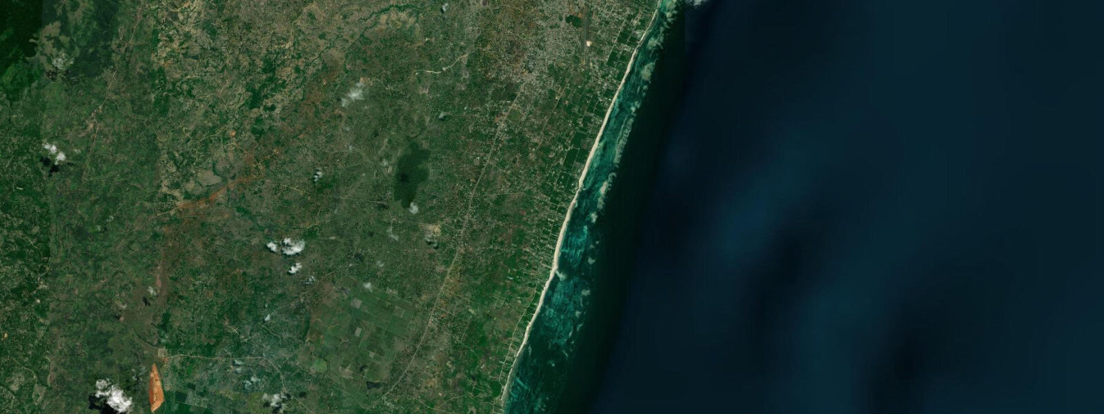
The Mkomani rock outcrops at the eastern end of Nyali Beach are the main shore-fishing platform on this stretch of coast. The rocks are accessible on foot at low water — exposed coral shelf and cemented beach rock that provides stable fishing platforms 1 to 3 metres above the low-water mark. The outgoing ebb exposes new ledges progressively through the low-water period; fish the low-water slack and the first hour of flood from these rocks for the best snapper and emperor results. Local anglers also use the rock outcrops for casting lures along the reef face during the ebb — kingfish and barracuda are present along the outer reef line and can be taken on surface lures in the early morning.
The seagrass beds in the Nyali lagoon are a formal research site for the Kenya Marine and Fisheries Research Institute (KMFRI), headquartered in Mombasa. KMFRI has monitored the Mombasa reef system since the 1970s and the Nyali lagoon seagrass is part of the long-term coastal ecology dataset. The beds are visible from the beach at low spring water as darker patches against the sandy lagoon floor — seagrass is darker green-brown than the pale white-grey of the exposed sand.
For families, Nyali Beach at low to mid water is the most comfortable swimming environment on this stretch: the lagoon is clear and calm behind the reef, depth is 0.5 to 1.5 metres in the inner lagoon section, and the sandy bottom is firm. At high spring tide, the inner lagoon depth reaches 2.5 metres and the beach narrows, reducing the shallow wading area. The main caution is the tidal current through the gap in the reef — at springs, the current through the main reef entrance channel can reach 1.5 to 2 knots. Swim inside the buoyed swimming area maintained by the beach hotels; avoid the reef gap even at neap tides.
Tide predictions for Nyali Beach come from Open-Meteo Marine, a gridded global ocean model. Accuracy is typically plus or minus 45 minutes on timing and 0.2 to 0.3 metres on height. The Kenya Ports Authority Mombasa gauge is the authoritative tidal reference for this location; KPA publishes annual tide tables. These predictions are not for navigation.
Tide questions about Nyali Beach
Quick answers to the most common questions about tide times, range, and water access at Nyali Beach.
When is the best time to swim at Nyali Beach?
Nyali Beach is sheltered behind a continuous fringing reef that keeps the lagoon calm at almost all tidal states and wind conditions. The most comfortable swimming window is mid-flood to mid-ebb — roughly from 2 hours after low water to 2 hours after high water — when the inner lagoon depth is 1 to 2 metres and water clarity is at its best. At low spring water, the inner lagoon shallows to 0.3 to 0.7 metres in places and comfortable swimming requires moving further toward the reef edge where depth is greater. Avoid the reef entrance channel at any tidal state: spring tidal currents through the gap reach 1.5 to 2 knots. Swim within the hotel buoy lines, which are set inside the calm section of the lagoon.
Is there good shore fishing at Nyali Beach?
The Mkomani rock outcrops at the eastern end of Nyali Beach are the best shore-fishing platform — exposed coral shelf and beach rock that provides stable ledges 1 to 3 metres above low water. Target species from the rocks include snapper (lutjanidae), emperor fish (lethrinidae), and occasional kingfish and barracuda on lures cast along the outer reef face. The most productive window is the low-water slack and first 2 hours of flood, when the tidal current is beginning to run and baitfish concentrate on the rock edges. For night fishing at the Mkomani rocks, squid on a weighted rig produces snapper and grunter from the reef ledges; the best night window is from 2 hours after sunset to midnight on incoming tides.
What is the seagrass visible in the Nyali lagoon at low tide?
The dark patches visible in the Nyali lagoon at spring low water are seagrass beds — primarily halophila stipulacea and thalassia hemprichii, two species common in the Indian Ocean reef lagoon environment. The beds appear darker (green-brown) against the pale sandy lagoon floor. These seagrass meadows are monitored by KMFRI (Kenya Marine and Fisheries Research Institute) as part of a long-term coastal ecology programme. They provide feeding habitat for green turtles (chelonia mydas) — turtles are occasionally seen grazing in the lagoon at low to mid water — and shelter for juvenile fish and invertebrates. Dugong (dugong dugon) have been recorded in the wider Mombasa reef system; sightings in the Nyali lagoon are rare but not unknown. The seagrass is fragile; do not walk through it if wading on the flat.
How do I get to Nyali Beach from Mombasa city centre?
Nyali Beach is 3 kilometres north of Mombasa Island, across the Nyali Bridge that spans Tudor Creek. By matatu (shared minibus) from Mombasa town, take the Nyali route from the main terminus near Moi Avenue; the journey to the Nyali Beach road is 15 to 25 minutes depending on traffic. By taxi from Mombasa town centre or Mombasa Moi International Airport, allow 20 to 30 minutes. The beach hotels are signposted from the main Nyali Road. The beach itself is accessible without a hotel stay — walk through the hotel grounds during daylight hours, or access via the public beach access track at the southern Nyali end. There is no formal parking fee but tip the informal attendants who watch vehicles.
Where do the tide predictions for Nyali Beach come from?
Open-Meteo Marine, a gridded global ocean model that estimates tidal height from a geographic grid rather than from harmonic analysis of a local gauge. Accuracy is typically plus or minus 45 minutes on timing and 0.2 to 0.3 metres on height. The authoritative tide reference for Nyali Beach is the Kenya Ports Authority (KPA) Mombasa gauge, approximately 3 kilometres south at the Kilindini harbour entrance. KPA publishes annual tide tables used by all commercial vessels and port operations; the Nyali lagoon tidal timing closely tracks the Mombasa gauge with a lag of under 10 minutes. These predictions are not for navigation or commercial vessel operations.
8-day tide table — Nyali Beach
Heights relative to MSL. Predictions: Open-Meteo Marine (MeteoFrance SMOC, 0.08° grid) — heights relative to MSL (not chart datum / LAT). Model-derived.
| Day | Type | Time | Height |
|---|---|---|---|
| Sun 21 Jun | Low | 03:00 | -0.6m |
| High | 08:20 | 1.4m | |
| Mon 22 Jun | Low | 02:46 | -0.6m |
| High | 09:20 | 1.3m | |
| Tue 23 Jun | Low | 03:43 | -0.4m |
| High | 10:26 | 1.3m | |
| Low | 16:48 | -0.2m | |
| High | 22:47 | 0.9m | |
| Wed 24 Jun | Low | 04:48 | -0.3m |
| High | 11:37 | 1.3m | |
| Low | 18:10 | -0.2m | |
| Thu 25 Jun | High | 00:08 | 0.8m |
| Low | 05:56 | -0.3m | |
| High | 12:43 | 1.3m | |
| Low | 19:19 | -0.4m | |
| Fri 26 Jun | High | 01:19 | 0.8m |
| Low | 07:00 | -0.3m | |
| High | 13:40 | 1.4m | |
| Low | 20:14 | -0.5m | |
| Sat 27 Jun | High | 02:14 | 0.9m |
| Low | 07:54 | -0.4m | |
| High | 14:24 | 1.6m | |
| Low | 20:54 | -0.6m | |
| Sun 28 Jun | High | 02:00 | 0.9m |