Shela Beach tide times
Shela Beach tide forecast — heights relative to MSL.
Today's tide times for Shela Beach
Tide times at Shela Beach on Sunday, 21 June 2026: first low tide at 03:00am, first high tide at 08:22am. Sunrise 06:18am, sunset 06:17pm.
Tide chart for Shela Beach
24-hour cosine-interpolated curve around the present moment. Heights relative to MSL. Predictions: Predictions: Open-Meteo Marine (MeteoFrance SMOC, 0.08° grid).
Sun, moon and conditions on Sun 21 Jun
Snapshot at build time — refreshes daily. Sea state from Open-Meteo Marine.
Highs and lows next 7 days
Every predicted high and low for the next week, with the daily tidal coefficient (0–120; higher = bigger swing, > 95 means stronger currents).
Other spots nearby
The three closest curated TideTurtle locations to Shela Beach, measured by great-circle distance.
Today's solunar windows
Solunar tradition: major periods are the ≈3h windows around moon transit and opposition; minor are ≈2h around moonrise and moonset. Pair with the local tide stage and wind for the best read.
Cycle dates near Shela Beach
Last spring tide on Sun 21 Jun (range 1.9m). Next spring tide on Sat 27 Jun (range 2.1m). Next neap on Tue 23 Jun.
Spring tides cluster around new and full moons (biggest swings). Neap tides land on quarter moons (smallest swings). See the spring tide and neap tide glossary entries for the why.
About tides at Shela Beach
A short guide to the coastline at Shela Beach — geography, sea state, and what the tide is actually doing under your feet.
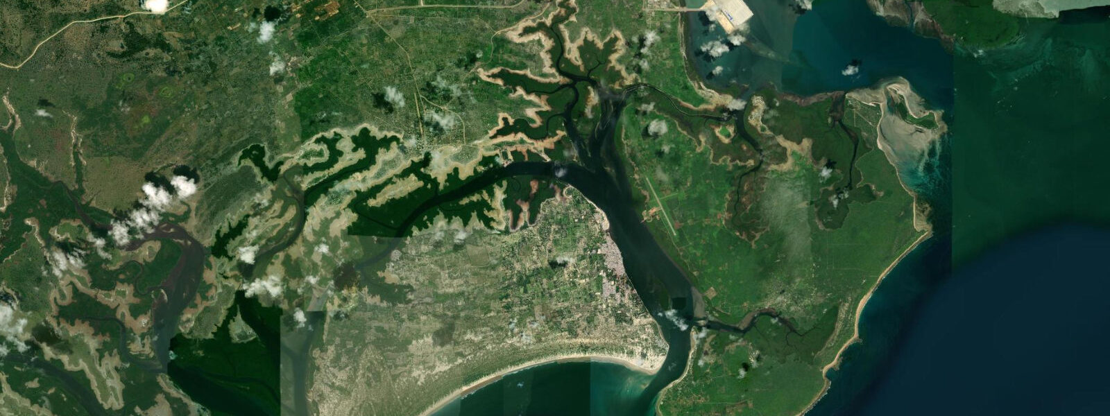
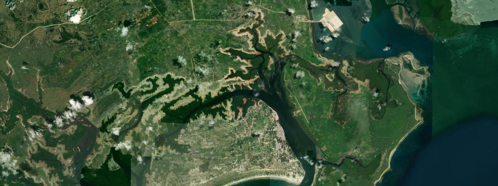
Shela Beach begins at the small village of Shela, 3 kilometres south of Lamu Town on the southern coast of Lamu Island, and runs for 12 kilometres to the southeast into the open Indian Ocean. Behind the beach, sand dunes rise to 20 metres and more, partially vegetated with sand-binding grasses (ipomoea pescaprae, canavalia rosea) and sparse coastal scrub; the dunes are otherwise bare white sand that shifts in the kusi wind. It is one of the longest undeveloped beach stretches in East Africa.
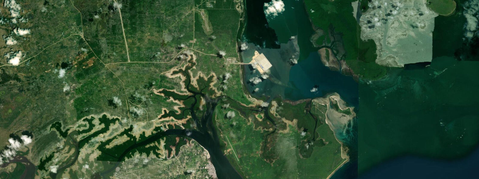
The village of Shela is small — a few hundred residents, a handful of guesthouses and private villas owned by long-term international residents, the Peponi Hotel at the waterfront (in operation since 1967, the original barefoot-luxury reference on this coast). The village waterfront faces west onto the Lamu Channel rather than south onto the open beach; the beach proper begins at the south end of the village where the channel opens and the Indian Ocean swell arrives unobstructed.
The tidal range at Shela follows the Lamu Archipelago pattern: spring range approximately 3.0 metres, neap range around 1.5 metres, semidiurnal with diurnal inequality. The expression of this range on the open beach is different from the sheltered waterfront at Lamu Town. On the ocean-facing beach, the low-water exposure produces a wide, flat sand surface rather than a mud flat — the beach gradient is shallow and the low-water terrace at springs is 60 to 100 metres wide and firm underfoot. The water temperature on the shallow flat warms through the afternoon sun, reaching 28 to 30 degrees Celsius on the outer skin of standing water in the late-afternoon low-water period. The very early morning spring low — when low water falls between 05:00 and 07:00 — produces the widest and coolest beach of the day, before the sand heats up.
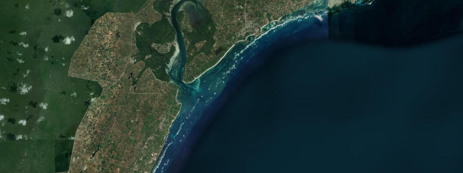
The beach is used for walking, swimming (on the ocean side, where depth increases rapidly from the beach edge at mid-flood and above), and camping by the rare traveller who makes it this far down the beach by foot. The 12-kilometre walk from Shela village to the far southern end of the beach — the point where the sand disappears into the mangrove creeks at the inlet of Mto wa Pwani — takes 3 to 4 hours at low water on the firm wet sand; at high water, the walk is possible on the dry sand above the high-water line but is slower and more tiring in the soft surface.
For photographers, Shela's combination of height (the dunes give vantage points 15 to 20 metres above the beach) and length (12 kilometres of unbroken sand visible from the dune crests) produces landscape compositions that require no telephoto work — the long curve of the beach to the horizon is visible in standard wide-angle framing from the dune tops. The best light falls in the early morning, when the low sun rakes across the dune faces from the east and the shadows of the dune ridges define the topography. At spring low tide in the early morning, the wet sand of the beach terrace adds a reflective mirror surface to the foreground.
The wind pattern at Shela is consistent and seasonal. The SE kusi (May to October) blows strong and steady from the south, funnelling along the beach and lifting sand from the dry dune face into the air — the dune movement at Shela is active and the beach profile changes measurably between the kusi and kaskazi seasons. The NE kaskazi (December to March) is lighter and more variable; the beach is calmer and the dunes settle. The tidal flat on the beach south of Shela village is the only section of Lamu ocean coast where the combination of consistent wind, flat water at low tide, and clean deep water at high tide makes kitesurfing viable — but there is no commercial kite school here and reaching the beach requires either a 45-minute walk from Shela village or a water-taxi drop on the beach.
Tide predictions for Shela Beach come from Open-Meteo Marine, a gridded global ocean model. Accuracy is typically plus or minus 45 minutes on timing and 0.2 to 0.3 metres on height. KMFRI (Kenya Marine and Fisheries Research Institute) at Mombasa is the regional oceanographic reference; the Lamu Archipelago tidal hydrography is complex enough that local timing can differ from the Open-Meteo prediction by more than the stated accuracy envelope, particularly in the transition zone between the channel and the open ocean at the south end of Lamu Island. These predictions are not for navigation.
Tide questions about Shela Beach
Quick answers to the most common questions about tide times, range, and water access at Shela Beach.
How long is Shela Beach and can I walk the full length at low tide?
Shela Beach runs approximately 12 kilometres from the south end of Shela village to the inlet of Mto wa Pwani at the far southern end. The full length is walkable at low water on the firm wet sand terrace, which at spring tides is 60 to 100 metres wide and solid underfoot. The walk takes 3 to 4 hours in each direction — a full day's walking if done as an out-and-back. The low-water window for the firm sand is centred on the predicted low water time on this page, with a usable margin of about 2 hours either side at springs. Start the walk at least 3 hours before low water to reach the far end during the low-water window and have time to walk back before the flood covers the terrace. At high water, the walk is possible on the dry dune sand but is slower and softer underfoot.
Is it safe to swim at Shela Beach on the open ocean side?
Shela Beach faces the open Indian Ocean with no reef protection along its 12-kilometre length. At low water, the beach is very shallow for 50 to 100 metres from the waterline — wading depth rather than swimming depth. At mid-flood to high water, depth increases rapidly from the beach edge and swimming in 1.5 to 2 metres of water is possible for competent swimmers 30 to 50 metres from shore. The main hazard is the tidal current running along the beach: at spring tides the longshore current can reach 1 knot, which is sufficient to carry a swimmer 100 metres along the beach per 10 minutes of swimming. Do not swim against the current; if carried along the beach, swim at an angle toward shore rather than directly into the current. There are no lifeguards on the open beach south of Shela village.
When is the best time for photography at Shela Beach?
Early morning is the best light at Shela — from 06:00 to 09:00, when the low sun rakes across the dune faces from the east, defining the dune topography in shadow and highlight. From the dune crests 15 to 20 metres above the beach, the full 12-kilometre curve of the beach is visible on a clear day. Spring low tides in the early morning (low water between 05:30 and 08:00) add the widest wet sand terrace and the strongest reflective foreground to the composition. The afternoon light falls on the dune faces from the west and is productive for a second hour between 16:30 and 18:00 before the sun drops behind the dune ridge. There is no artificial light on the beach south of the village; night photography on the dune tops on clear nights is possible when the moon is adequate.
How do I get from Lamu Town to Shela Beach?
Three options. By water taxi from Lamu Town jetty: 15 minutes, departures throughout the day, fare negotiated at the jetty (the standard rate is posted by the Lamu County government; pay the posted rate). By foot on the inland track: 30 to 45 minutes on a well-defined unpaved track through the palm groves and village periphery, passable at any tidal state. By foot on the waterfront route: possible at low water only, when the tidal creek at the south end of Lamu Town is fordable (ankle to knee deep at spring low, waist deep at mid-tide, impassable at high water). The water taxi is the most practical option for a full beach day; the inland walk is fine for the morning. There is no motorised vehicle access to Shela — the island has no vehicles except the government tractor.
Where do the tide predictions for Shela Beach come from?
Open-Meteo Marine, a gridded global ocean model. The model estimates tidal height from a geographic grid rather than from local gauge harmonic analysis. Accuracy is typically plus or minus 45 minutes on timing and 0.2 to 0.3 metres on height. Shela Beach sits at the transition between the sheltered Lamu Channel (where tidal timing is influenced by the multi-channel archipelago hydrography) and the open Indian Ocean (where the tidal signal is more straightforward). The Open-Meteo prediction for the open ocean section of the beach is likely more accurate than for the channel end near Shela village. KMFRI (Kenya Marine and Fisheries Research Institute) in Mombasa holds the authoritative coastal dataset for this region. These predictions are not for navigation.
8-day tide table — Shela Beach
Heights relative to MSL. Predictions: Open-Meteo Marine (MeteoFrance SMOC, 0.08° grid) — heights relative to MSL (not chart datum / LAT). Model-derived.
| Day | Type | Time | Height |
|---|---|---|---|
| Sun 21 Jun | Low | 03:00 | -0.6m |
| High | 08:22 | 1.3m | |
| Mon 22 Jun | Low | 02:48 | -0.5m |
| High | 09:20 | 1.3m | |
| Tue 23 Jun | Low | 03:44 | -0.4m |
| High | 22:47 | 0.8m | |
| Wed 24 Jun | Low | 04:48 | -0.3m |
| High | 11:38 | 1.2m | |
| Low | 18:14 | -0.2m | |
| Thu 25 Jun | High | 00:11 | 0.7m |
| Low | 05:58 | -0.3m | |
| High | 12:44 | 1.3m | |
| Low | 19:22 | -0.4m | |
| Fri 26 Jun | High | 01:22 | 0.8m |
| Low | 07:01 | -0.3m | |
| High | 13:40 | 1.4m | |
| Low | 20:16 | -0.5m | |
| Sat 27 Jun | High | 02:16 | 0.9m |
| Low | 07:54 | -0.4m | |
| High | 14:24 | 1.5m | |
| Low | 20:58 | -0.6m | |
| Sun 28 Jun | High | 02:00 | 0.9m |