Manda Island tide times
Manda Island tide forecast — heights relative to MSL.
Today's tide times for Manda Island
Tide times at Manda Island on Sunday, 21 June 2026: first low tide at 03:00am, first high tide at 08:22am. Sunrise 06:18am, sunset 06:17pm.
Tide chart for Manda Island
24-hour cosine-interpolated curve around the present moment. Heights relative to MSL. Predictions: Predictions: Open-Meteo Marine (MeteoFrance SMOC, 0.08° grid).
Sun, moon and conditions on Sun 21 Jun
Snapshot at build time — refreshes daily. Sea state from Open-Meteo Marine.
Highs and lows next 7 days
Every predicted high and low for the next week, with the daily tidal coefficient (0–120; higher = bigger swing, > 95 means stronger currents).
Other spots nearby
The three closest curated TideTurtle locations to Manda Island, measured by great-circle distance.
Today's solunar windows
Solunar tradition: major periods are the ≈3h windows around moon transit and opposition; minor are ≈2h around moonrise and moonset. Pair with the local tide stage and wind for the best read.
Cycle dates near Manda Island
Last spring tide on Sun 21 Jun (range 1.9m). Next spring tide on Sat 27 Jun (range 2.1m). Next neap on Tue 23 Jun.
Spring tides cluster around new and full moons (biggest swings). Neap tides land on quarter moons (smallest swings). See the spring tide and neap tide glossary entries for the why.
About tides at Manda Island
A short guide to the coastline at Manda Island — geography, sea state, and what the tide is actually doing under your feet.
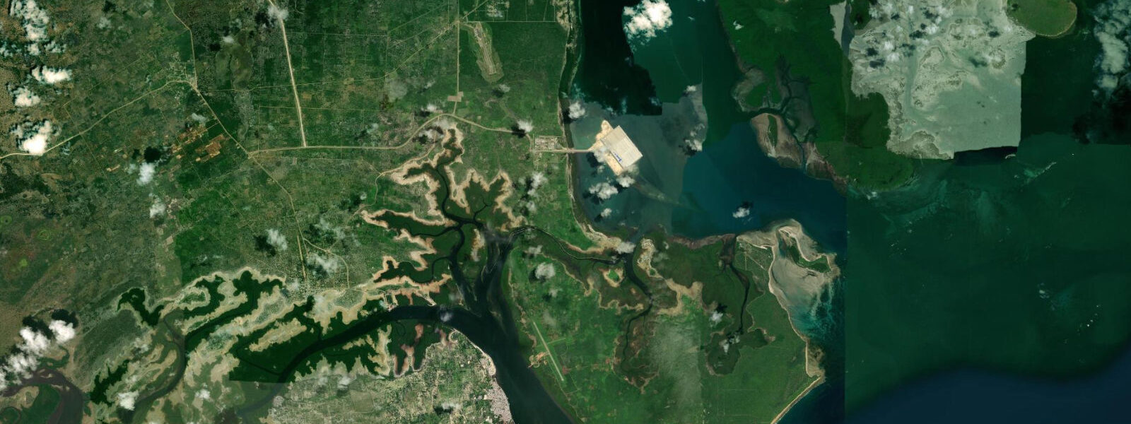
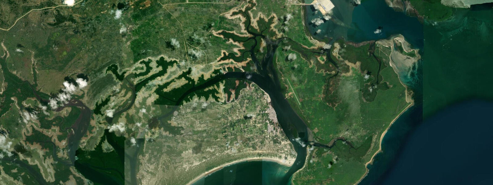
Manda Island lies directly across the Lamu Channel from Lamu Town — 600 metres of water from the Lamu waterfront to the Manda mangrove fringe, close enough to see the carved wooden doors of the old town from the island shore. The crossing by small motorboat takes 10 minutes; the water taxi departs from Lamu Town jetty throughout the day. Despite the proximity, Manda has a completely different character from Lamu: beyond the domestic airport strip on the island's northwestern flank, the island is mangrove forest, tidal flat, and open savannah — largely uninhabited except for the airport staff and a handful of resort properties.
The tidal character of Manda is defined by its position in the archipelago. The Lamu Channel on the west side of the island runs fast — 2 to 3 knots at spring peaks — as the tidal wave moves through the narrow passage between Lamu and Manda. The eastern side of Manda, facing the open Indian Ocean at Ras Kitau, is more exposed and the tidal currents along the eastern shore are driven by the open-ocean tidal pattern rather than the channel geometry. The spring range is approximately 3.0 metres at the western channel side, consistent with Lamu Town; the eastern beach at Ras Kitau runs on a similar range but with slightly different timing due to the difference in water depth and exposure.
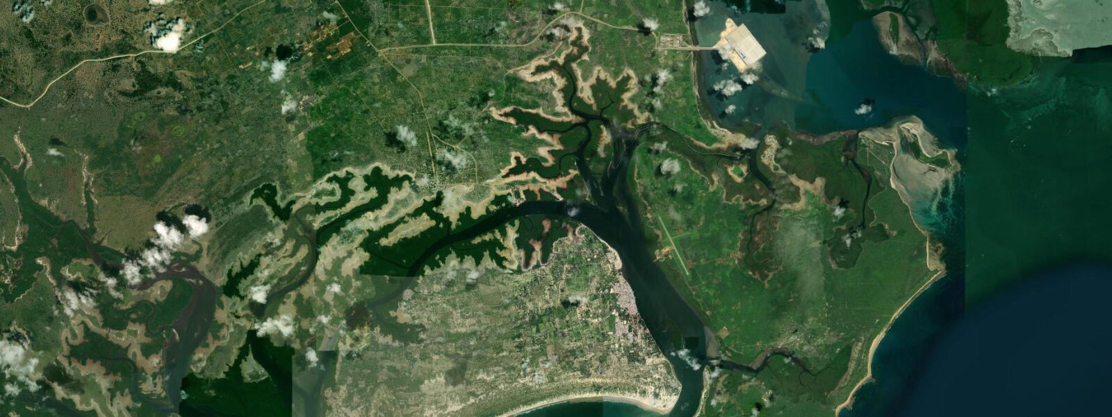
The Takwa ruins on the west side of Manda Island are the main cultural draw. Takwa was a thriving Swahili town from the 15th to the 17th century; the ruins — a mosque, a pillar tomb, and the foundations of stone houses over an area of several hectares — are a National Monument and protected site. Reaching the Takwa ruins requires approaching by boat through the mangrove creeks on the western shore of Manda Island. This approach is tide-dependent: the mangrove creek that leads to the Takwa landing is navigable only at high water, when the water depth in the creek is sufficient to float a small motorboat. At spring low water, the creek entrance is exposed mud and the approach is impassable for boats. The standard excursion runs on high-water timing — typically departing from Lamu Town on the flood tide, visiting Takwa during the high-water slack, and returning on the early ebb before the creek becomes too shallow.
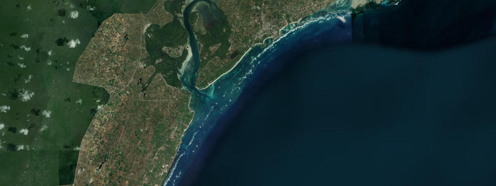
Ras Kitau Beach on the eastern tip of Manda Island faces the open Indian Ocean. The beach is a white sand spit that forms where the mangrove-fringed interior of the island meets the open water; at high spring tide the spit narrows to a few metres of sand above the waterline, while at spring low water it widens to a beach 60 to 80 metres wide. The water off Ras Kitau is clear and deeper than the lagoon on the Lamu Channel side; snorkelling on the fringing reef at the eastern edge of the spit is possible at mid-flood and above. The beach is accessible only by boat; no land route connects the airport area to Ras Kitau through the mangrove interior.
Birdwatching on Manda Island is productive year-round, particularly in the mangrove and tidal flat environments on the western and southern shores. At low water, the tidal flat adjacent to the mangrove fringe holds wading birds — crab plovers (dromas ardeola), whimbrel (numenius phaeopus), grey herons, and on passage, various sandpiper and plover species. The crab plover is the most distinctive — large, black-and-white, with an oversized bill adapted for crushing crabs — and the Lamu Archipelago tidal flats are one of the best places in East Africa to observe this species at close range. The most productive low-water birdwatching window at the Manda tidal flat is from 06:30 to 09:00, when the flat is fully exposed and the birds are actively feeding.
The crossing between Lamu and Manda is the strongest tidal-current section of the archipelago for most visitors. At spring peak ebb, the motorboat crossing takes 12 to 15 minutes rather than the usual 10, as the helmsman angles up-current to compensate for the drift. At spring peak flood, the crossing in the current direction is faster — 7 to 8 minutes — but the approach to the Manda side requires adjusting the angle to avoid overshooting the landing. This is part of standard archipelago seamanship and the local boatmen handle it automatically; passengers should simply hold on during the stronger crossings in choppy conditions.
Tide predictions for Manda Island come from Open-Meteo Marine, a gridded global ocean model. Accuracy is typically plus or minus 45 minutes on timing and 0.2 to 0.3 metres on height. The multi-channel tidal hydrography of the Lamu Archipelago means local timing and current patterns can vary significantly from the Open-Meteo grid prediction; KMFRI (Kenya Marine and Fisheries Research Institute) at Mombasa is the regional oceanographic reference. These predictions are not for navigation or vessel operations in the Lamu Channel.
Tide questions about Manda Island
Quick answers to the most common questions about tide times, range, and water access at Manda Island.
Can I visit the Takwa ruins on Manda Island, and does the tide affect access?
The Takwa ruins — a 15th to 17th century Swahili town, National Monument — are accessible by boat from Lamu Town through the mangrove creeks on the western shore of Manda Island. The creek approach is navigable only at high water; at spring low water, the creek entrance is exposed mud and the route is impassable. The standard excursion departs from Lamu Town on the incoming flood tide (roughly 2 hours before predicted high water), visits Takwa during the high-water slack, and returns on the early ebb. The total excursion is 3 to 4 hours. Check the predicted high water time on this page and work backward to find the departure window. Boats and guides are available from the Lamu waterfront; Kenya National Museums entry fees apply at the site.
What is the crossing like between Lamu Town and Manda Island?
The Lamu Channel between Lamu Town waterfront and Manda Island is 600 metres wide. At spring tides, tidal current in the channel reaches 2 to 3 knots, running westward on the ebb and eastward on the flood. The standard crossing by motorised water taxi takes 10 minutes on a neap or slack tide; at peak spring current, the helmsman angles up-current and the crossing takes 12 to 15 minutes. In choppy conditions (SE wind at 15+ knots against the ebb current), the crossing produces a short, steep chop; hold on and stay seated. The crossing is entirely routine for local boatmen and has a long safety record, but any individual with seasickness concerns should time the crossing for slack water — the 30-minute window around the tidal turn — when the current is at its weakest and the chop is minimal.
Is there snorkelling at Manda Island?
The best snorkelling accessible from Manda Island is at Ras Kitau Beach on the eastern tip — a white sand spit facing the open Indian Ocean with a fringing reef at its eastern edge. The reef is diveable from mid-flood to high water, when depth over the reef flat reaches 1.5 to 2 metres and water clarity is at its best. Ras Kitau is accessible only by boat; the journey from Lamu Town is approximately 20 to 25 minutes via the channel north of Manda. The Lamu Channel side of Manda has some coral at the channel edge, but the visibility in the channel water is lower than at Ras Kitau due to the suspended sediment stirred by the tidal current. Snorkelling gear is available for hire from dive operators based in Lamu Town.
What birds can I see on the Manda Island tidal flat?
The tidal flat on the western and southern shores of Manda Island — exposed at spring low water — is one of the best locations in the Lamu Archipelago for shorebirds. The most distinctive species is the crab plover (dromas ardeola): a large, black-and-white wading bird with an outsized black bill built for crushing mangrove and beach crabs. Crab plovers are resident in the archipelago year-round and concentrate on the exposed tidal flat at low water. Other regular species at the Manda flat include whimbrel, common greenshank, little stint (on southward passage, August to October), and grey heron at the mangrove edge. The best viewing window is 06:30 to 09:30 at spring low water, when the flat is fully exposed and the birds are most active in the lower ambient temperature before the midday heat.
Where do the tide predictions for Manda Island come from?
Open-Meteo Marine, a gridded global ocean model. The model estimates tidal height from a geographic grid. Accuracy is typically plus or minus 45 minutes on timing and 0.2 to 0.3 metres on height. The multi-channel hydrography of the Lamu Archipelago produces local tidal timing variations that can exceed the Open-Meteo baseline accuracy — the timing at the Manda tidal flat may differ from the timing at the Lamu channel crossing by 15 to 25 minutes at springs, and both may differ from the Open-Meteo grid prediction. KMFRI (Kenya Marine and Fisheries Research Institute) in Mombasa holds the authoritative tidal and current dataset for the Lamu Archipelago. For planning the Takwa creek approach, which requires accurate high-water timing, cross-reference with a KMFRI or Kenya Ports Authority tide table if available. These predictions are not for navigation.
8-day tide table — Manda Island
Heights relative to MSL. Predictions: Open-Meteo Marine (MeteoFrance SMOC, 0.08° grid) — heights relative to MSL (not chart datum / LAT). Model-derived.
| Day | Type | Time | Height |
|---|---|---|---|
| Sun 21 Jun | Low | 03:00 | -0.6m |
| High | 08:22 | 1.3m | |
| Mon 22 Jun | Low | 02:48 | -0.5m |
| High | 09:20 | 1.3m | |
| Tue 23 Jun | Low | 03:44 | -0.4m |
| High | 22:47 | 0.8m | |
| Wed 24 Jun | Low | 04:48 | -0.3m |
| High | 11:38 | 1.2m | |
| Low | 18:14 | -0.2m | |
| Thu 25 Jun | High | 00:11 | 0.7m |
| Low | 05:58 | -0.3m | |
| High | 12:44 | 1.3m | |
| Low | 19:22 | -0.4m | |
| Fri 26 Jun | High | 01:22 | 0.8m |
| Low | 07:01 | -0.3m | |
| High | 13:40 | 1.4m | |
| Low | 20:16 | -0.5m | |
| Sat 27 Jun | High | 02:16 | 0.9m |
| Low | 07:54 | -0.4m | |
| High | 14:24 | 1.5m | |
| Low | 20:58 | -0.6m | |
| Sun 28 Jun | High | 02:00 | 0.9m |