Aomori tide times
Aomori tide forecast — heights relative to MSL.
Today's tide times for Aomori
Tide times at Aomori on Sunday, 21 June 2026: first high tide at 09:00, first low tide at 13:18, second high tide at 19:15. Sunrise 04:05, sunset 19:11.
Tide chart for Aomori
24-hour cosine-interpolated curve around the present moment. Heights relative to MSL. Predictions: Predictions: Open-Meteo Marine (MeteoFrance SMOC, 0.08° grid).
Sun, moon and conditions on Sun 21 Jun
Snapshot at build time — refreshes daily. Sea state from Open-Meteo Marine.
Highs and lows next 7 days
Every predicted high and low for the next week, with the daily tidal coefficient (0–120; higher = bigger swing, > 95 means stronger currents).
Other spots nearby
The three closest curated TideTurtle locations to Aomori, measured by great-circle distance.

Today's solunar windows
Solunar tradition: major periods are the ≈3h windows around moon transit and opposition; minor are ≈2h around moonrise and moonset. Pair with the local tide stage and wind for the best read.
Cycle dates near Aomori
Last spring tide on Sun 21 Jun (range 0.4m). Next spring tide on Fri 26 Jun (range 0.4m). Next neap on Wed 24 Jun.
Spring tides cluster around new and full moons (biggest swings). Neap tides land on quarter moons (smallest swings). See the spring tide and neap tide glossary entries for the why.
About tides at Aomori
A short guide to the coastline at Aomori — geography, sea state, and what the tide is actually doing under your feet.
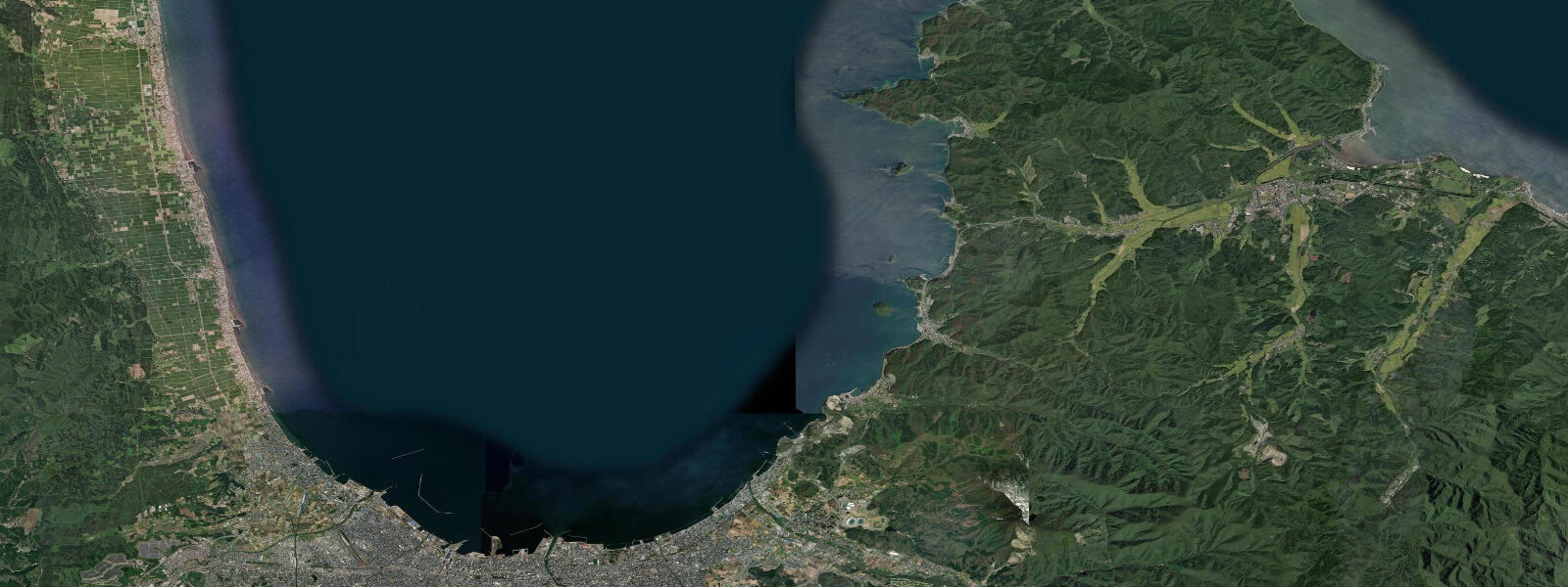
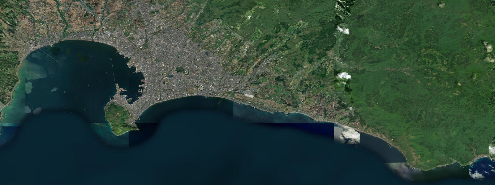
Aomori city sits at the southern end of Mutsu Bay — a deep, nearly enclosed bay in the northernmost part of Honshu, where the Shimokita and Tsugaru peninsulas bracket the water on east and west. The enclosed geometry of Mutsu Bay amplifies tidal range relative to the open coast: mean range is approximately 1.5 to 2.0 metres above MLLW, noticeably larger than the ~1.3 metres typical along the more exposed Tohoku Pacific coast to the south. Spring tides in the bay can push high water to around 2.0 metres above MLLW at Aomori city. The bay is calm, with limited wave action in most conditions, which makes the tidal cycle the dominant influence on coastal margins rather than swell.
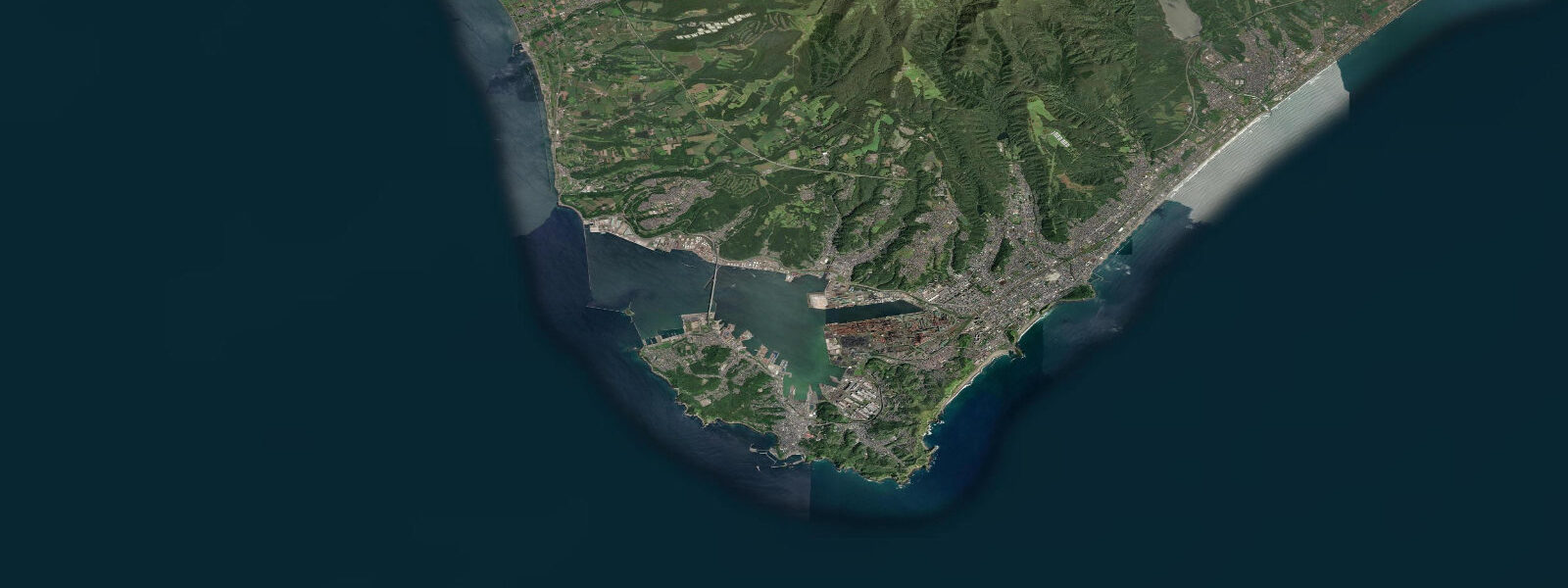
Aomori ferry terminal is the primary crossing point for vehicles and passengers between Honshu and Hokkaido via Tsugaru Strait, supplementing the Seikan Tunnel rail link. The ferry route to Hakodate (3.5 to 4 hours) passes through the strait where the Pacific and Sea of Japan water masses converge — a transition visible in the sea colour and surface texture on clearer crossings. The bay's protected water keeps ferry operations consistent through most weather conditions that would affect open-coast crossings.
Mutsu Bay's sheltered, productive water supports significant scallop (hotate) aquaculture. Aomori Prefecture is the top scallop-producing region in Japan; the flat-bottomed aquaculture boats and rope systems are visible across the bay. The annual scallop harvest contributes substantially to the regional economy and to restaurant menus city-wide. Fresh hotate at the Aomori Gyosai Center (the city's main fish market, near the waterfront) is the most direct access point for visitors.
The Nebuta Festival (August 2–7 annually) transforms the city: enormous illuminated float sculptures — nebuta — are paraded through the streets to the sound of taiko drums and haneto dancers. The festival draws 3 to 4 million visitors in one week. The Warasse Nebuta Museum on the waterfront maintains full-scale nebuta through the year for off-season viewing.
The city's famous apple connection (Aomori Prefecture produces approximately 60% of Japan's apple crop) is inland and agricultural rather than coastal, but the Auga Market by the station sells them alongside the seafood. The coast itself is bay shore rather than dramatic headland — the peninsula tips (Shimokita to the east, with volcanic Osorezan; Tsugaru to the west) have more dramatic coastal scenery than the city waterfront.
Tide predictions on this page come from Open-Meteo Marine, a gridded global ocean model. Accuracy is typically within plus or minus 45 minutes on timing and 0.2 to 0.3 metres on height — model-derived, not from a local pressure gauge. For authoritative Japanese tide tables, consult the Japan Meteorological Agency at jma.go.jp. JMA operates Japan's tsunami warning system; see the FAQ below for the essential distinction between tidal prediction and tsunami warning.
Tide questions about Aomori
Quick answers to the most common questions about tide times, range, and water access at Aomori.
Why is the tidal range in Mutsu Bay larger than the Tohoku Pacific coast?
Mutsu Bay's semi-enclosed geometry amplifies the tidal signal relative to the open coast. The bay is roughly 75 km north–south and 65 km east–west, opening through a relatively narrow mouth toward Tsugaru Strait. This constricted opening acts as a partial resonance trap — incoming tidal energy fills the bay faster than it drains, pushing high water up. Mean range at Aomori is approximately 1.5 to 2.0 metres above MLLW versus roughly 1.3 metres on the open Miyagi coast further south. The amplification is modest compared to macro-tidal bays like Fundy or the Severn, but it is enough to make the tidal margin in the bay noticeably wider than on the open coast.
What is Aomori's Nebuta Festival?
The Aomori Nebuta Festival (August 2–7) is one of Japan's three major summer festivals. Enormous illuminated papier-mâché float sculptures — nebuta — depicting mythological and historical figures are pulled through the city streets after dark. The floats can reach 9 metres high and 7 metres wide; dozens are built each year by competing teams. Haneto dancers in traditional costume circle the floats while taiko drums and flutes drive the procession. The festival draws 3 to 4 million visitors across the six days. The Warasse Nebuta Museum (open year-round, on the Aomori waterfront) displays full-scale award-winning nebuta from recent years for visitors outside the August window.
What should I know about tsunami risk in this area?
This is an important distinction. Tide predictions on this page show astronomical tides — the regular, predictable rise and fall of sea level. These are forecastable days in advance. Tsunamis are entirely different events, generated by sudden seafloor displacement — earthquakes, submarine landslides — and completely unrelated to the tidal cycle. The 2011 Tōhoku earthquake (magnitude 9.1) caused devastating tsunami inundation along the Pacific coast of Tohoku; nearly 20,000 people died. Aomori city and Mutsu Bay face west/south rather than directly to the Pacific, and their exposure to 2011-type events differs from the directly exposed coast — but Tsugaru Strait and the open sea remain seismically active regions. No tide prediction forecasts a tsunami. The Japan Meteorological Agency (JMA) operates Japan's nationwide tsunami warning system, entirely separate from tidal prediction, issuing alerts within approximately 3 minutes of a significant triggering earthquake. When a strong earthquake is felt near any Japanese coast, move to higher ground immediately without waiting for a formal warning.
What seafood is Aomori known for?
Mutsu Bay scallop (hotate) is the flagship product — Aomori Prefecture produces roughly 60% of Japan's scallop harvest, and the aquaculture systems in the bay are visible from the waterfront. The Aomori Gyosai Center (fish market) near the waterfront sells fresh hotate alongside squid (ika), sea urchin (uni), and salmon. The Tsugaru Strait between Honshu and Hokkaido is a migration corridor for tuna and other pelagic species; offshore boat fishing targets these in season. The morning market at the fish market centre is the best access point for visitors — opening around 6 to 7 a.m. most days.
Are the tide predictions on this page official?
No. Predictions here come from Open-Meteo Marine, a gridded global ocean model that estimates tidal heights and timing from astronomical inputs. Accuracy is typically within plus or minus 45 minutes on timing and 0.2 to 0.3 metres on height relative to observed levels. For safety-critical decisions — ferry navigation, commercial fishing, coastal construction — use the Japan Meteorological Agency's official tide tables at jma.go.jp. JMA publishes verified predictions for reference stations across Mutsu Bay and the Aomori coast. This page is a planning and reference tool, not a substitute for official data.
8-day tide table — Aomori
Heights relative to MSL. Predictions: Open-Meteo Marine (MeteoFrance SMOC, 0.08° grid) — heights relative to MSL (not chart datum / LAT). Model-derived.
| Day | Type | Time | Height |
|---|---|---|---|
| Sun 21 Jun | High | 09:00 | 0.3m |
| Low | 13:18 | 0.1m | |
| High | 19:15 | 0.5m | |
| Mon 22 Jun | Low | 14:00 | 0.1m |
| High | 19:50 | 0.4m | |
| Tue 23 Jun | Low | 03:10 | 0.1m |
| High | 09:00 | 0.3m | |
| Low | 15:00 | 0.1m | |
| High | 20:50 | 0.3m | |
| Wed 24 Jun | Low | 04:00 | 0.0m |
| High | 10:50 | 0.3m | |
| Thu 25 Jun | Low | 05:00 | 0.0m |
| High | 23:10 | 0.4m | |
| Fri 26 Jun | Low | 05:54 | 0.1m |
| High | 13:10 | 0.5m | |
| Sat 27 Jun | Low | 06:54 | 0.1m |
| High | 13:45 | 0.5m | |
| Low | 19:45 | 0.2m | |
| Sun 28 Jun | High | 00:50 | 0.5m |