Fukuoka tide times
Fukuoka tide forecast — heights relative to MSL.
Today's tide times for Fukuoka
Tide times at Fukuoka on Friday, 31 July 2026: first high tide at 09:58, first low tide at 16:26, second high tide at 22:47. Sunrise 05:29, sunset 19:20.
Tide chart for Fukuoka
24-hour cosine-interpolated curve around the present moment. Heights relative to MSL. Predictions: Predictions: Open-Meteo Marine (MeteoFrance SMOC, 0.08° grid).
Sun, moon and conditions on Fri 31 Jul
Snapshot at build time — refreshes daily. Sea state from Open-Meteo Marine.
Highs and lows next 7 days
Every predicted high and low for the next week, with the daily tidal coefficient (0–120; higher = bigger swing, > 95 means stronger currents).
Other spots nearby
The three closest curated TideTurtle locations to Fukuoka, measured by great-circle distance.
Today's solunar windows
Solunar tradition: major periods are the ≈3h windows around moon transit and opposition; minor are ≈2h around moonrise and moonset. Pair with the local tide stage and wind for the best read.
Cycle dates near Fukuoka
Last spring tide on Fri 31 Jul (range 1.6m). Next neap on Thu 06 Aug.
Spring tides cluster around new and full moons (biggest swings). Neap tides land on quarter moons (smallest swings). See the spring tide and neap tide glossary entries for the why.
About tides at Fukuoka
A short guide to the coastline at Fukuoka — geography, sea state, and what the tide is actually doing under your feet.
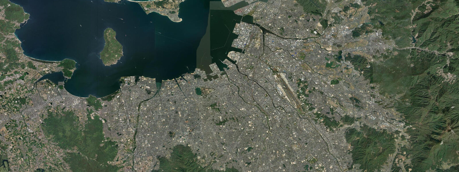
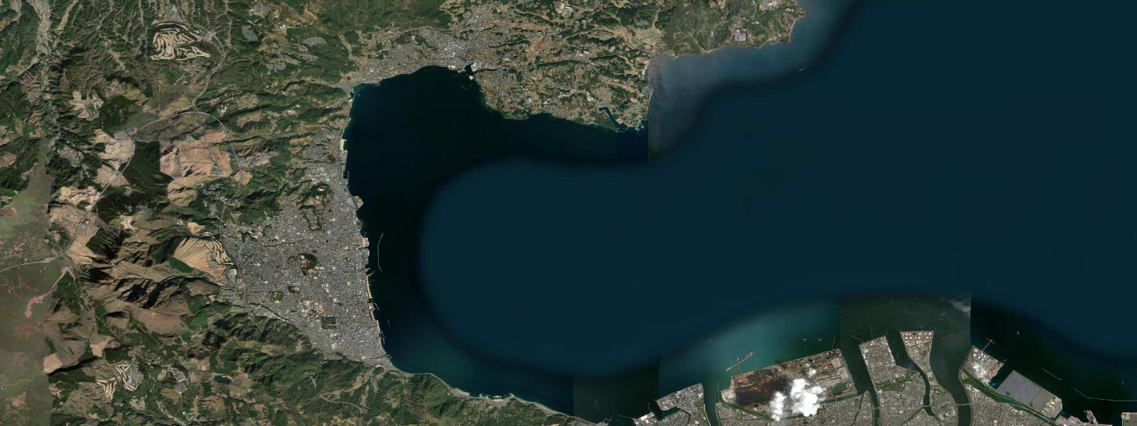
Fukuoka faces north across Hakata Bay from the flat coastal lowland of northern Kyushu, with the Genkai Sea beyond the bay's mouth and the Iki and Tsushima island chains strung out toward Korea in the distance. The bay is roughly 15 km across and enclosed on three sides by the Fukuoka coastal plain; the Shikanoshima sand tombolo runs northeast from the Umi district to Shikanoshima Island, closing off the bay from the Genkai Sea to the east. That enclosed, shallow geometry amplifies the tide: mean range in Hakata Bay runs approximately 2.0 to 2.5 m, the highest of any major Japanese city on the Sea of Japan side, with a mixed semidiurnal character — two unequal highs and two unequal lows per day, driven by the complex interaction of Korea Strait and Tsushima Strait tidal forcing.
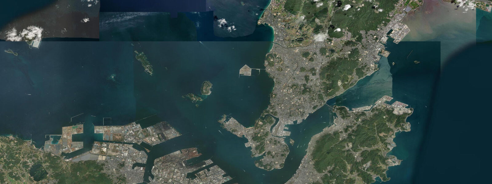
The Tsushima Current, the northeastern branch of the Kuroshio, runs through the Korea Strait between Kyushu and the Korean Peninsula and up the Sea of Japan coast; it carries warm water from the tropics and drives the northward heat transport that moderates the Kyushu climate. The current interacts with tidal flow in the Genkai Sea and the outer approaches to Hakata Bay, producing a coast where both background current and tidal phase matter to mariners. The tidal streams inside the bay are moderate by global standards but real: the narrows between Shikanoshima Island and the Shingu coast at the bay's eastern entrance run at a knot or so on spring tides.
The Uminonakamichi park — its name translates roughly as 'road through the sea' — runs along the Shikanoshima sand spit on the northern arm of the bay, accessible from Fukuoka station by the JR Kagoshima Line and the Kaijin Line ferry. The park holds beaches on both the bay and Genkai Sea sides, cycling paths, flower gardens, and an aquarium on the bay shore. The Genkai Sea beach faces open water and catches swell from the northwest in winter; the bay beach is sheltered and calm. Families use the bay beach year-round for low-intensity coastal recreation; the 2.0 to 2.5 m tidal range means the beach width varies visibly between high and low, with the low-water sand flat extending several dozen metres further than at high tide.
Shingu, northeast of Fukuoka on the coast between Hakata Bay and the open Genkai Sea, is the area most associated with sea kayaking in the Fukuoka region. The rocky coastline around Shingu and the adjacent Tsuyazaki coast has pocket beaches, sea caves, and an offshore reef system that rewards paddlers on calm-day exploration. The tidal window matters here: the narrow passages between the rocky islets are navigable at mid and high tide but become shallow or dry at low water, and the tidal current through the channels accelerates on the ebb. Local paddlers use a two-hour-either-side-of-high window for the sea cave route at Tsuyazaki.
Canal City Hakata, in the middle of the city centre, takes its name from the Naka River and canal system historically connecting inland Fukuoka to the bay. The river is now a regulated urban waterway with weirs and flood-control gates that disconnect it from direct tidal influence at the canal city stretch, though the lower Naka approaches the bay close enough that the tidal transition is visible on an incoming spring flood below the Hakata waterfront bridge. Shore fishing from the Fukuoka breakwaters at Onahama, the piers at Chuo Futou, and the rocky shore at Momochi along the western bay edge produces small black seabream, horse mackerel, and sand flathead; the best windows are the two hours flanking the tide change when the current slackens briefly before reversing.
Fukuoka is also historically the closest major Japanese city to the Korean Peninsula — roughly 200 km by sea to Busan — and the ferry from Hakata Port to Busan has run for decades. The Genkai Sea crossing is a practical marine commute in good weather; in the winter westerlies and during typhoon approach from the south, the sea state changes fast and the tidal current in the Korea Strait becomes a secondary concern behind wind and swell.
Predictions on this page come from Open-Meteo Marine, a gridded global ocean model. Accuracy is typically within plus or minus 45 minutes on timing and 0.2 to 0.3 m on height — model-derived, not a local gauge. The Japan Coast Guard and Japan Meteorological Agency maintain the authoritative Hakata tide record. For navigation in Hakata Bay and the Genkai Sea approaches, official JMA predictions apply.
Tide questions about Fukuoka
Quick answers to the most common questions about tide times, range, and water access at Fukuoka.
What is the tidal range in Hakata Bay at Fukuoka?
Mean astronomical range in Hakata Bay runs approximately 2.0 to 2.5 m, the highest among the major cities on Japan's Sea of Japan coast. The tide is mixed semidiurnal: two unequal highs and two unequal lows per day, driven by the Korea Strait and Tsushima Strait tidal forcing interacting with the bay's enclosed geometry. Spring tides push toward or above the upper end of that range; neap tides two weeks later are noticeably smaller. The diurnal inequality means the two daily highs often differ by 0.3 to 0.6 m depending on lunar phase — worth reading the full tide table rather than assuming two equal highs each day.
Where is the best sea kayaking near Fukuoka?
The Shingu and Tsuyazaki coast northeast of Fukuoka, on the boundary between Hakata Bay and the open Genkai Sea, is the primary sea kayak area. The rocky shoreline has sea caves, islets and reef passages that reward exploration on calm days. The tidal window matters: sea cave passages are best at mid to high tide, and the ebb current through narrow islet channels accelerates noticeably on spring tides. The Uminonakamichi park beach on the sheltered bay side of the Shikanoshima spit is a calmer option for beginners. Neither area has a dedicated outfitter at all times — check local paddling clubs for guided trips and current access.
Can I fish from shore in Fukuoka?
Shore fishing is well-established along the Fukuoka coast. The breakwaters at Onahama port, the Chuo Futou piers on the central waterfront, and the rocky Momochi shore on the western bay edge all hold small black seabream, horse mackerel, flathead, and occasional large Japanese seaperch. The two-hour window around each tide change, when current slackens before reversing, is a conventional local choice for the best bite. The Genkai Sea-facing coast at Shingu and Tsuyazaki adds rockfish, and the offshore jigging from small charter boats targets amberjack and yellowtail in the Genkai Sea current zone. A fishing licence is not required for recreational shore fishing in Japan.
How does the Tsushima Current affect tides and conditions in Hakata Bay?
The Tsushima Current, the northeastern branch of the Kuroshio, moves through the Korea Strait and up the Sea of Japan coast year-round, carrying warm water from lower latitudes. In the Genkai Sea approaches to Hakata Bay, this background flow interacts with tidal current and wind-driven surface currents to produce conditions that are more variable than tidal prediction alone suggests. A strong northerly winter wind against a spring ebb creates a short steep chop in the outer bay. The current also sets the water temperature regime — Fukuoka's coastal water is notably warmer than equivalent latitudes on the Pacific coast due to this Tsushima influence.
Where do these tide predictions come from?
Open-Meteo Marine, a free gridded global ocean model. Accuracy is typically within plus or minus 45 minutes on timing and 0.2 to 0.3 m on height — model-derived, not a local gauge. For Hakata Bay, where the mean range is 2.0 to 2.5 m, the model's timing uncertainty is a meaningful planning consideration for time-critical activities like sea cave kayaking or navigating the tidal narrows at Shikanoshima. The Japan Coast Guard and Japan Meteorological Agency maintain the authoritative Hakata tide gauge record and issue storm surge advisories for typhoon approach.
8-day tide table — Fukuoka
Heights relative to MSL. Predictions: Open-Meteo Marine (MeteoFrance SMOC, 0.08° grid) — heights relative to MSL (not chart datum / LAT). Model-derived.
| Day | Type | Time | Height |
|---|---|---|---|
| Fri 31 Jul | High | 09:58 | 1.4m |
| Low | 16:26 | -0.2m | |
| High | 22:47 | 1.2m | |
| Sat 01 Aug | Low | 04:26 | 0.1m |
| High | 10:33 | 1.4m | |
| Low | 16:56 | -0.2m | |
| High | 23:15 | 1.2m | |
| Sun 02 Aug | Low | 05:03 | 0.1m |
| High | 11:08 | 1.3m | |
| Low | 17:22 | -0.2m | |
| High | 23:44 | 1.2m | |
| Mon 03 Aug | Low | 05:38 | 0.0m |
| High | 11:45 | 1.2m | |
| Low | 17:56 | -0.1m | |
| Tue 04 Aug | High | 00:15 | 1.2m |
| Low | 06:16 | 0.0m | |
| Wed 05 Aug | High | 00:52 | 1.1m |
| Low | 07:05 | 0.1m | |
| High | 13:20 | 1.0m | |
| Low | 19:00 | 0.2m | |
| Thu 06 Aug | High | 01:34 | 1.1m |
| Low | 08:03 | 0.1m | |
| Fri 07 Aug | High | 02:18 | 1.2m |
| Low | 08:00 | 0.3m |