
Kamakura tide times
Kamakura tide forecast — heights relative to MSL.
Today's tide times for Kamakura
Tide times at Kamakura on Friday, 19 June 2026: first high tide at 09:00, first low tide at 13:15, second high tide at 20:24. Sunrise 04:26, sunset 18:59.
Tide chart for Kamakura
24-hour cosine-interpolated curve around the present moment. Heights relative to MSL. Predictions: Predictions: Open-Meteo Marine (MeteoFrance SMOC, 0.08° grid).
Sun, moon and conditions on Fri 19 Jun
Snapshot at build time — refreshes daily. Sea state from Open-Meteo Marine.
Highs and lows next 7 days
Every predicted high and low for the next week, with the daily tidal coefficient (0–120; higher = bigger swing, > 95 means stronger currents).
Other spots nearby
The three closest curated TideTurtle locations to Kamakura, measured by great-circle distance.
Today's solunar windows
Solunar tradition: major periods are the ≈3h windows around moon transit and opposition; minor are ≈2h around moonrise and moonset. Pair with the local tide stage and wind for the best read.
Cycle dates near Kamakura
Last spring tide on Fri 19 Jun (range 1.2m). Next spring tide on Wed 24 Jun (range 0.9m). Next neap on Mon 22 Jun.
Spring tides cluster around new and full moons (biggest swings). Neap tides land on quarter moons (smallest swings). See the spring tide and neap tide glossary entries for the why.
About tides at Kamakura
A short guide to the coastline at Kamakura — geography, sea state, and what the tide is actually doing under your feet.
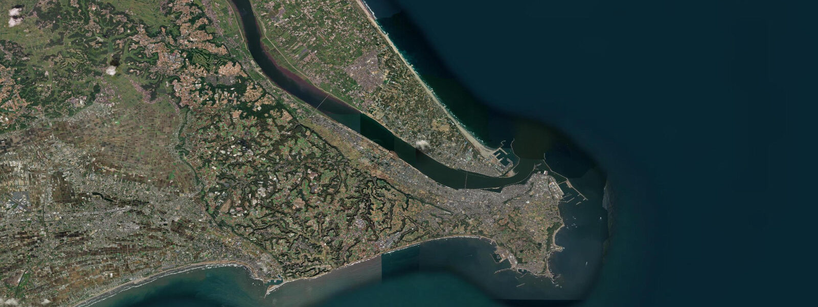
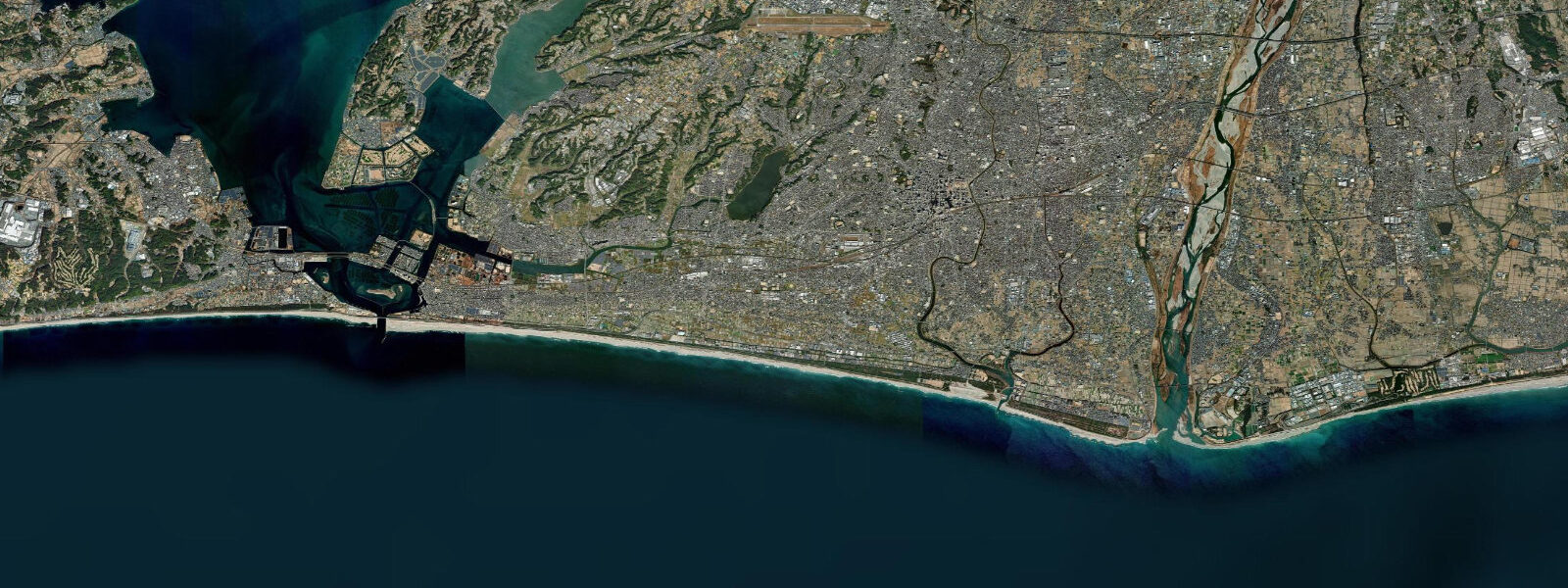
Kamakura is 50 kilometres southwest of Tokyo on Sagami Bay, a former medieval capital (1185–1333) that now functions as Tokyo's nearest surf coast. The Kamakura hills roll down to Yuigahama and Zaimokuza beaches; behind the beaches the town contains over 70 temples and shrines, including the Kōtoku-in (the Great Buddha, 13.35 metres, cast in 1252). Tidal pattern is semidiurnal with a mean spring range of about 1.6 metres. The Pacific face of the bay catches south and southeast groundswell from the Pacific and from typhoon swell systems approaching Japan from the south.
Yuigahama Beach is the main Kamakura surf beach, running 1 kilometre west of the town centre. Beach break peaks form across the length of the beach in 2 to 4 foot south swell; the wave quality varies with sand bar position but the beach picks up swell consistently from June through October when typhoon-generated swell organises the Pacific. Autumn (September through November) is the best season — post-typhoon groundswell, offshore morning winds, and no summer crowd. The beach is extremely crowded in July and August when beachgoing by train from Tokyo makes it one of the most-visited beaches in Japan.
Shachihata (Shachi) and Inamuragasaki points west of Kamakura have reef and point break sections that handle larger swell more cleanly than the beach. Inamuragasaki, a volcanic rock headland, produces a left-hand reef break in south to southwest swell that draws experienced surfers from Tokyo on swell days.
For non-surfers, the Enoshima island (7 km northwest) is a compact volcanic island with sea caves, lighthouse, aquarium, and a tidal causeway that submerges at high water. The tidal window for walking the causeway dry-shod is roughly 2 hours either side of low water; at high water the island is connected only by the paved bridge. The sea caves (Iwaya Caves) are accessible from the island interior.
Fishing from Kamakura's coastal rocks targets sea bream, black sea bream (kurodai), and yellowtail (hamachi) in the shoals that move through Sagami Bay in autumn. The rocky shore south of Inamuragasaki is accessible at low water; a Japanese fishing licence is not required for shore fishing in saltwater.
Predictions on this page come from Open-Meteo Marine, a gridded global ocean model. Accuracy is typically within plus or minus 45 minutes on timing and 0.2 to 0.3 metres on height — model-derived, not from a local gauge. For authoritative Japanese tide data, consult the Japan Meteorological Agency at jma.go.jp.
Tide questions about Kamakura
Quick answers to the most common questions about tide times, range, and water access at Kamakura.
What is the tidal range at Kamakura?
Kamakura has semidiurnal tides with a mean spring range of about 1.6 metres. Sagami Bay is exposed to the Pacific south, so swell size and typhoon swell systems have more influence on beach conditions than the modest tidal range. The tidal state matters for surfing — the beach breaks at Yuigahama are generally best at mid-tide when neither too shallow nor too deep over the sand bars.
When is the best time to surf at Kamakura?
September through November is the best surf season. Late summer typhoons (August through October) generate south and southeast groundswell that organises Yuigahama's beach break into rideable waves. The crowd from summer beach season thins significantly after September — the same swell that brings the best waves also comes with less competition. Morning sessions before the sea breeze fills in give the clearest conditions. Summer is consistent but crowded; winter has occasional south swell but cold water (14 to 16°C, requiring a 4/3mm wetsuit).
Can I visit the Enoshima sea caves?
Yes — the Iwaya Caves on Enoshima island are accessible from the island's western rocky shore at low to mid-tide. The walk to the cave entrance from the bridge takes about 20 minutes through the island's commercial centre. The caves extend 150 metres into the volcanic rock; a nominal entry fee applies. The tidal causeway that was historically the only access to the island at low water is now supplemented by a permanent bridge, but the causeway experience (walkable 2 hours either side of low water) is still available.
Is the Great Buddha worth visiting with a beach trip?
Yes — the Kōtoku-in temple and the Daibutsu (Great Buddha) is 20 minutes walk from Yuigahama Beach through the Kamakura hills. Combining a morning surf session or beach walk with an afternoon temple circuit is the standard Tokyo day-trip structure. Kamakura has over 70 temples and shrines reachable by trail from the central train station. The Daibutsu is open until 5:30 p.m. (to 7 p.m. in summer); modest entry fee applies.
How do I get to Kamakura from Tokyo?
Kamakura is on the JR Yokosuka Line from Tokyo Station (55 minutes, approximately ¥940). The Shonan-Shinjuku Line also connects Shinjuku directly to Kamakura in about 60 minutes. Yuigahama Beach is 10 minutes walk from Kamakura Station; the Enoden tram connects to Enoshima (20 minutes, ¥280). The beach is extremely crowded on summer weekends — weekday visits are notably calmer.
7-day tide table — Kamakura
Heights relative to MSL. Predictions: Open-Meteo Marine (MeteoFrance SMOC, 0.08° grid) — heights relative to MSL (not chart datum / LAT). Model-derived.
| Day | Type | Time | Height |
|---|---|---|---|
| Fri 19 Jun | High | 09:00 | 0.2m |
| Low | 13:15 | -0.6m | |
| High | 20:24 | 0.6m | |
| Sat 20 Jun | Low | 01:38 | 0.1m |
| High | 06:56 | 0.5m | |
| Low | 13:54 | -0.5m | |
| High | 21:07 | 0.6m | |
| Sun 21 Jun | Low | 02:20 | 0.2m |
| High | 08:00 | 0.6m | |
| Low | 14:37 | -0.1m | |
| High | 21:36 | 0.6m | |
| Mon 22 Jun | Low | 04:04 | 0.0m |
| High | 09:18 | 0.3m | |
| Low | 15:18 | -0.1m | |
| High | 22:15 | 0.5m | |
| Tue 23 Jun | Low | 05:04 | -0.1m |
| High | 11:15 | 0.3m | |
| Low | 16:15 | 0.1m | |
| High | 22:47 | 0.5m | |
| Wed 24 Jun | Low | 06:12 | -0.3m |
| High | 23:38 | 0.5m | |
| Thu 25 Jun | Low | 07:07 | -0.4m |