Hamamatsu tide times
Hamamatsu tide forecast — heights relative to MSL.
Today's tide times for Hamamatsu
Tide times at Hamamatsu on Saturday, 27 June 2026: first high tide at 16:46, first low tide at 21:55. Sunrise 04:37, sunset 19:06.
Tide chart for Hamamatsu
24-hour cosine-interpolated curve around the present moment. Heights relative to MSL. Predictions: Predictions: Open-Meteo Marine (MeteoFrance SMOC, 0.08° grid).
Sun, moon and conditions on Sat 27 Jun
Snapshot at build time — refreshes daily. Sea state from Open-Meteo Marine.
Highs and lows next 7 days
Every predicted high and low for the next week, with the daily tidal coefficient (0–120; higher = bigger swing, > 95 means stronger currents).
Other spots nearby
The three closest curated TideTurtle locations to Hamamatsu, measured by great-circle distance.

Today's solunar windows
Solunar tradition: major periods are the ≈3h windows around moon transit and opposition; minor are ≈2h around moonrise and moonset. Pair with the local tide stage and wind for the best read.
Cycle dates near Hamamatsu
Next spring tide on Wed 01 Jul (range 1.5m). Last neap on Sat 27 Jun. Next neap on Fri 03 Jul.
Spring tides cluster around new and full moons (biggest swings). Neap tides land on quarter moons (smallest swings). See the spring tide and neap tide glossary entries for the why.
About tides at Hamamatsu
A short guide to the coastline at Hamamatsu — geography, sea state, and what the tide is actually doing under your feet.
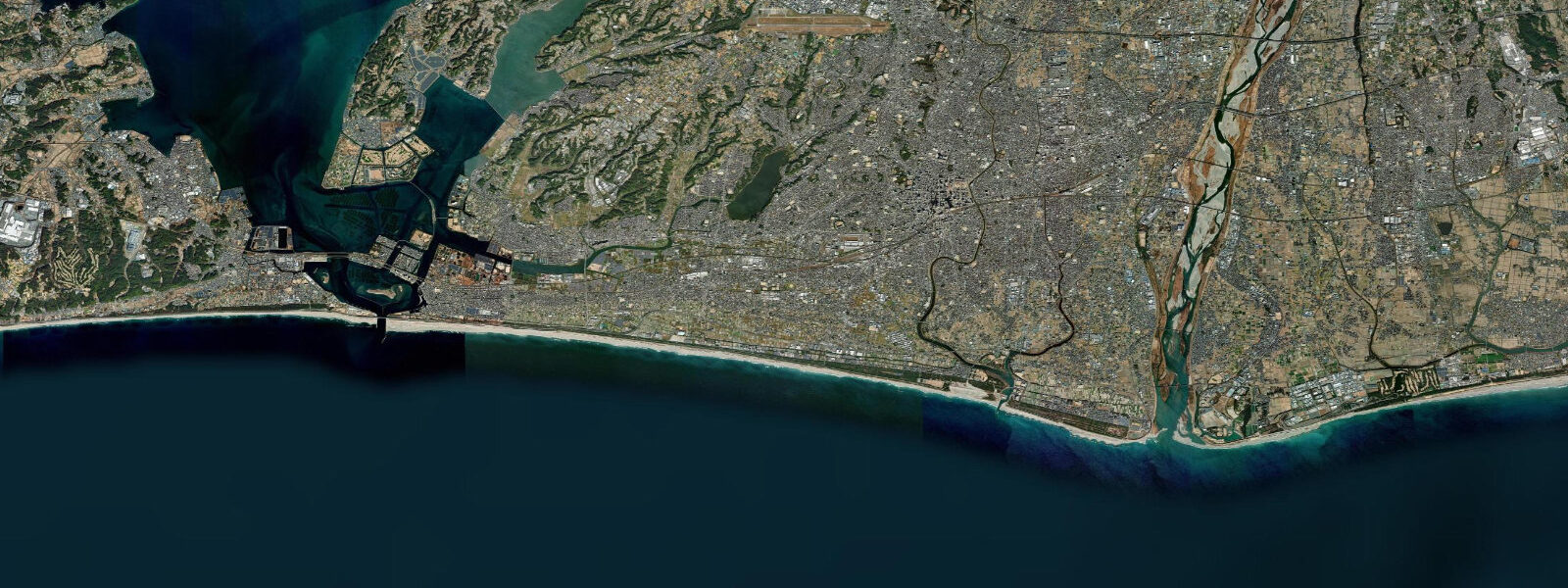
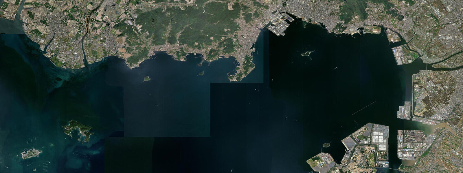
Hamamatsu is the largest city in Shizuoka Prefecture, on the Pacific coast between Nagoya and Tokyo where the Enshuhada (Enshu coast) sweeps southeast in a long exposed arc. The city's defining coastal feature is Lake Hamana (Hamamatsu-ko) — a large brackish lagoon of 65 km² connected to the Pacific by the Imagire inlet. Historically the lake was freshwater, but the 1498 Meiō earthquake triggered a tsunami that broke the barrier and created a permanent tidal connection. The lake has been brackish and tidal ever since — a seismically created tidal waterbody with over 500 years of history as a marine resource.
The tidal regime at Hamamatsu's Pacific coast (Enshuhama beach) is semidiurnal with a spring range of approximately 1.5 m above Chart Datum. Mean high water springs is around 1.1 m; mean low water springs around 0.4 m. Neap range narrows to 0.6–0.8 m. Inside Lake Hamana, the tidal signal attenuates through the narrow Imagire inlet — the lake interior spring range is 0.6–0.8 m, roughly half the outside range, and the tidal wave is delayed 30–60 minutes relative to the outer coast. The current through the Imagire inlet peaks at 2.0–3.0 knots on spring tides, making it a significant hazard for any vessel attempting to transit without tidal knowledge.
Lake Hamana is one of the most productive aquaculture waterbodies in Japan. Eel (unagi) farming and oyster cultivation are the dominant industries; Hamamatsu unagi is a nationally recognized brand. The Imagire inlet's tidal flushing exchanges lake water with the Pacific twice daily, maintaining salinity and dissolved oxygen levels suitable for cultivation. Spring tide exchange is twice the volume of the neap; eel farm operators monitor tidal state closely.
For recreational anglers, Lake Hamana offers year-round fishing for black sea bream (kurodai), mullet, flatfish, and sea bass (suzuki). The Imagire inlet is the prime sea bass location — fish hold in the current on both sides, feeding on baitfish swept through on the ebb and flood. The best bass windows at Imagire are the 90 minutes around peak ebb, when current through the narrow is strongest. Lure fishing with heavy jigs (20–40 g) handles the fast current better than bait.
The Enshuhama beach on the Pacific side extends 35 km from the Imagire inlet mouth east toward the Oigawa River — one of the longest natural sand beaches in Japan, facing directly into the Pacific swell window from the southeast. Swell averages 0.8–1.5 m outside typhoon season. The 1.5 m tidal range has a noticeable effect on beach break quality: the best bank form is on the middle portion of the tide, when water depth over the sandbars allows waves to jack and peel rather than close out flat.
For families, Lake Hamana's sheltered interior beaches — particularly around Benzaiten-jima island in the middle of the lake — offer calm, shallow water with attenuated tidal range of 0.6–0.8 m and lake temperatures reaching 26–28 °C in July–August, warmer than the Pacific coast.
All tide predictions for Hamamatsu come from the Open-Meteo Marine gridded model. Timing accuracy is ±45 minutes; height accuracy is ±0.3 m above Chart Datum.
Tide questions about Hamamatsu
Quick answers to the most common questions about tide times, range, and water access at Hamamatsu.
What is the tidal range at Hamamatsu and how does it differ between the Pacific coast and Lake Hamana?
Hamamatsu's Pacific coast has a semidiurnal spring tidal range of approximately 1.5 m above Chart Datum. Inside Lake Hamana, the tidal signal attenuates through the narrow Imagire inlet to a spring range of 0.6–0.8 m — roughly half the outside range — and is delayed 30–60 minutes relative to the outer coast. The Imagire inlet current peaks at 2.0–3.0 knots on spring tides; vessels transiting this narrow passage must time the transit at slack water. Tide predictions carry ±45 minutes timing uncertainty and ±0.3 m height uncertainty.
Why is Lake Hamana a tidal lake and how does it affect aquaculture?
Lake Hamana became tidal in 1498 when the Meiō earthquake and associated tsunami breached the sand barrier separating the lake from the Pacific, creating the Imagire inlet. The tidal flushing exchanges lake water with the Pacific twice daily, maintaining salinity (15–25 ppt) and dissolved oxygen suitable for eel and oyster cultivation. Spring tides exchange roughly twice the volume of neap tides. Eel (unagi) farm operators monitor tidal state as a water-quality management variable. Hamamatsu unagi is a nationally recognized brand.
Where is the best sea bass fishing near Hamamatsu?
The Imagire inlet connecting Lake Hamana to the Pacific is the prime sea bass (suzuki) location. Sea bass hold in the tidal current on both sides, feeding on baitfish swept through on the ebb and flood. The most productive window is the 90 minutes around the peak ebb, when current through the narrows is strongest. Lure fishing with heavy jigs (20–40 g) handles the fast current better than bait. Shore casting from the inlet edges is possible; the steep banks on the Pacific side require careful footing. Lake Hamana interior bays also hold sea bass on the flooding tide in spring and autumn.
Is Enshuhama beach suitable for surfing and how does tide affect the break?
Enshuhama beach, 35 km of Pacific sand beach east of Imagire, is one of the longest surfable beach breaks in Japan. Average swell is 0.8–1.5 m outside typhoon season; Pacific typhoon swells from the southeast reach 3–5 m in August–October. The 1.5 m tidal range affects bank shape noticeably: the best conditions for formed, peeling waves are on the middle portion of the tide. At spring high water the banks can be overloaded and waves close out; at spring low water the sandbars are too exposed for most skill levels. The middle ebb — 1–3 hours after high water — is the most consistent window.
What family activities are available on Lake Hamana in summer?
The sheltered beaches around Benzaiten-jima island in Lake Hamana are the main family swimming destination: calm, shallow water, attenuated tidal range of 0.6–0.8 m, and lake temperatures reaching 26–28 °C in July–August — warmer than the Pacific coast. Stand-up paddleboard and kayak rentals are available at the eastern lake shore near Hamamatsu station. Fishing for black sea bream (kurodai) from the lake shore is popular with children using float rigs. The Hamamatsu unagi restaurants on the eastern shore provide the classic post-swim lunch.
8-day tide table — Hamamatsu
Heights relative to MSL. Predictions: Open-Meteo Marine (MeteoFrance SMOC, 0.08° grid) — heights relative to MSL (not chart datum / LAT). Model-derived.
| Day | Type | Time | Height |
|---|---|---|---|
| Sat 27 Jun | High | 16:46 | 0.8m |
| Low | 21:55 | 0.3m | |
| Sun 28 Jun | High | 02:54 | 0.7m |
| Low | 10:10 | -0.6m | |
| High | 17:12 | 0.7m | |
| Mon 29 Jun | Low | 10:46 | -0.7m |
| High | 17:48 | 0.7m | |
| Low | 23:03 | 0.1m | |
| Tue 30 Jun | High | 04:18 | 0.7m |
| Low | 11:18 | -0.7m | |
| Wed 01 Jul | High | 04:51 | 0.7m |
| Low | 11:52 | -0.7m | |
| High | 18:55 | 0.8m | |
| Thu 02 Jul | Low | 00:06 | 0.2m |
| High | 05:25 | 0.8m | |
| Low | 12:26 | -0.6m | |
| High | 19:20 | 0.8m | |
| Fri 03 Jul | Low | 00:46 | 0.2m |
| High | 06:02 | 0.8m | |
| Low | 12:58 | -0.6m | |
| High | 19:57 | 0.8m | |
| Sat 04 Jul | Low | 01:19 | 0.1m |
| High | 06:42 | 0.7m |