Norman Manley Blvd, Kingston tide times
Norman Manley Blvd, Kingston tide forecast — heights relative to MSL.
Today's tide times for Norman Manley Blvd, Kingston
Tide times at Norman Manley Blvd, Kingston on Saturday, 4 July 2026: first low tide at 12:00am, first high tide at 05:00am. Sunrise 10:36am, sunset 11:46pm.
Tide chart for Norman Manley Blvd, Kingston
24-hour cosine-interpolated curve around the present moment. Heights relative to MSL. Predictions: Predictions: Open-Meteo Marine (MeteoFrance SMOC, 0.08° grid).
Sun, moon and conditions on Sat 04 Jul
Snapshot at build time — refreshes daily. Sea state from Open-Meteo Marine.
Highs and lows next 7 days
Every predicted high and low for the next week, with the daily tidal coefficient (0–120; higher = bigger swing, > 95 means stronger currents).
Other spots nearby
The three closest curated TideTurtle locations to Norman Manley Blvd, Kingston, measured by great-circle distance.
Today's solunar windows
Solunar tradition: major periods are the ≈3h windows around moon transit and opposition; minor are ≈2h around moonrise and moonset. Pair with the local tide stage and wind for the best read.
About tides at Norman Manley Blvd, Kingston
A short guide to the coastline at Norman Manley Blvd, Kingston — geography, sea state, and what the tide is actually doing under your feet.
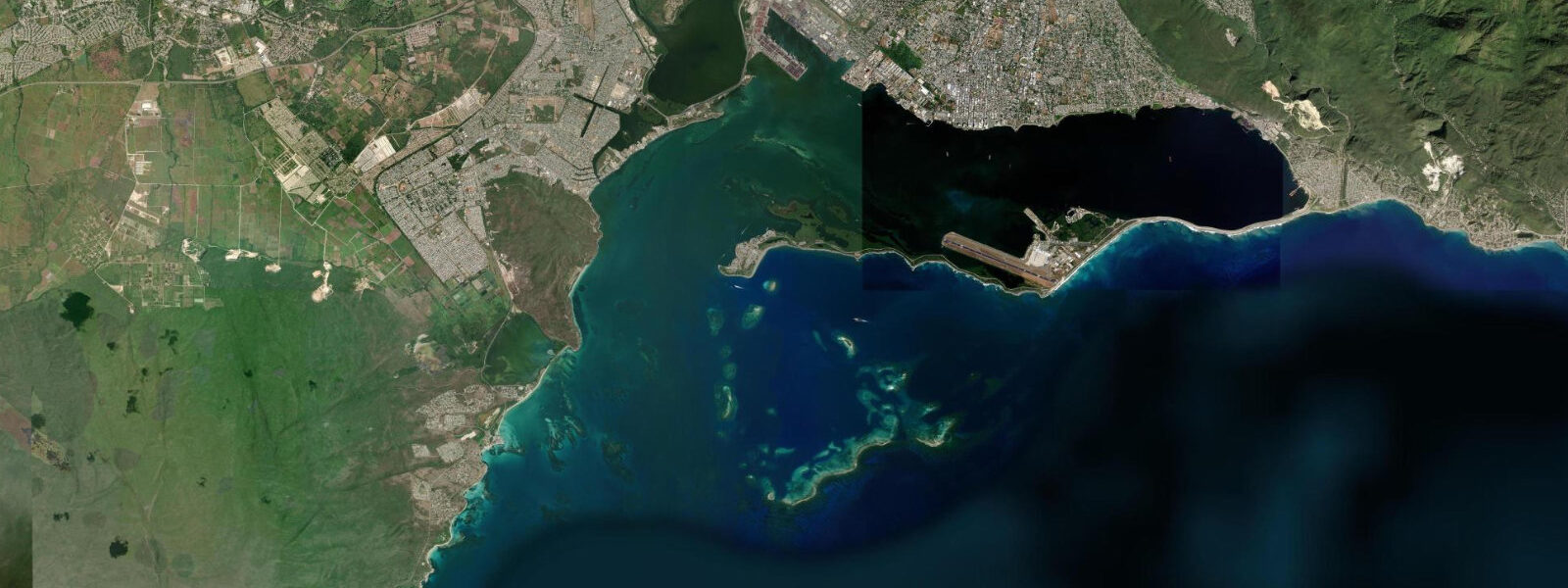
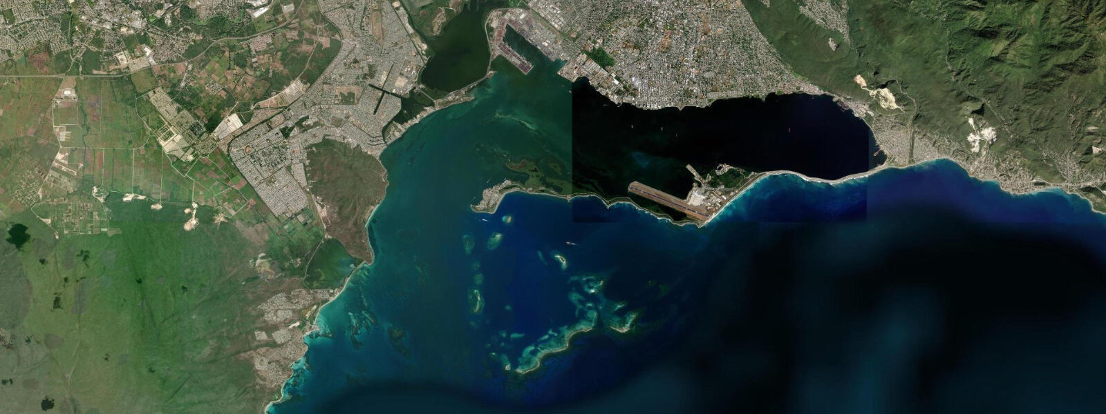
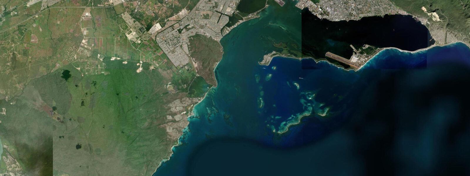
Norman Manley Boulevard is the road that runs along the Palisadoes tombolo between Kingston Harbour and the open Caribbean Sea, connecting Kingston to the Norman Manley International Airport and, beyond it, to Port Royal at the tip. The strip is perhaps 400 metres wide at its broadest — Kingston Harbour on the north side, the open Caribbean on the south — and the boulevard road runs close to the Caribbean-facing shore. The south-facing beach along the boulevard is a local recreational beach used primarily by Kingston residents; it is not a resort destination and there are no hotel facilities, which gives it a character almost entirely absent from Jamaica's tourist-facing north coast.
The tidal regime at the Palisadoes coast is Caribbean mixed semidiurnal, with a slightly different character on each side of the tombolo. On the south (Caribbean) face where the boulevard beach is located, the spring range is approximately 0.4 to 0.6 metres and the beach is exposed to whatever swell can reach across the Caribbean before being deflected by the alignment of the Palisadoes. On the north (harbour) face, the water is calmer and the range is similar but the swell is blocked by the Palisadoes itself. The two coastlines within walking distance of each other are the practical demonstration of how a narrow barrier separates a working harbour from an open sea.
The beach along Norman Manley Boulevard is used by Kingston families at weekends and public holidays. Fishing from the beach and from the concrete groynes that run into the sea at intervals along the south face is a daily local activity. The groynes hold small reef fish, snapper, and the occasional barracuda at the outer ends; shore casting with shrimp or jigs on the incoming flood is the standard approach. Food vendors and jerk stands operate along the boulevard on weekends, particularly in the stretch between the Causeway Junction and the airport.
The mangrove fringe on the harbour-facing north side of the Palisadoes is a nursery habitat for various juvenile fish species and a feeding area for wading birds including great blue heron, snowy egret, and tricoloured heron. The mangrove stretch is visible from the road and accessible in places along the hard shoulder; the harbour side has no beach — it is mangrove fringe directly at the water line.
The approach road to the airport runs through this same narrow Palisadoes strip. Aircraft approach Norman Manley International low over the harbour from the east; the intersection of the approach path, the causeway road, and the harbour channel is audible and visible from the boulevard. For the Kingston waterfront proper — the recently redeveloped Ocean Boulevard area — the view across from the Palisadoes gives the most useful geographic overview of the harbour's scale.
For families wanting a beach close to Kingston without driving to the north coast, the Norman Manley Boulevard south-facing beach is the closest practical option. Water quality is variable; the harbour's drainage input affects the south coast beach after heavy rain. The clearest water conditions are in the dry season from January through May, at least 48 hours after any significant rainfall.
Tide predictions for this area come from Open-Meteo Marine, a global gridded ocean model. Accuracy is typically within plus or minus 45 minutes on timing and 0.2 to 0.3 metres on height.
The Palisadoes' natural history is as significant as its military and commercial role. The tombolo was formed by longshore drift accumulating material between the main island and what was originally an offshore barrier reef system; the process has been ongoing for thousands of years and the current configuration — a strip 400 metres wide at its broadest — is a dynamic rather than fixed feature. The mangrove fringe on the north harbour-facing side is one of the remaining intact mangrove systems within the Kingston Metropolitan Area and functions as a fish nursery and sediment trap for the harbour.
Tide questions about Norman Manley Blvd, Kingston
Quick answers to the most common questions about tide times, range, and water access at Norman Manley Blvd, Kingston.
What is the tide range at Norman Manley Boulevard?
Caribbean microtidal — mixed semidiurnal, spring range 0.4 to 0.6 metres on the south (Caribbean) face of the Palisadoes. The harbour-facing north side has similar range but completely different swell characteristics: the harbour is flat and sheltered, the south face is exposed to whatever Caribbean swell reaches the Palisadoes alignment. Two unequal highs and two unequal lows per day. Tide predictions come from Open-Meteo Marine — accuracy within plus or minus 45 minutes on timing and 0.2 to 0.3 metres on height.
Is the Norman Manley Boulevard beach safe for swimming?
The beach is swimmable in good conditions, but water quality is variable. The harbour drainage system discharges into Kingston Harbour on the north side; storm runoff after heavy rain can affect the south-facing beach. Clearest conditions are in the dry season from January through May, at least two days after any significant rainfall. There is no lifeguard and no formal beach management. The beach is used regularly by Kingston residents, which provides a practical indicator of current conditions: if the beach is busy with families swimming, conditions are acceptable. If it is empty, ask before entering.
Where can I eat on the Norman Manley Boulevard?
Food vendors and jerk stands operate along the boulevard on weekends and public holidays, concentrated between the Causeway Junction and the airport junction — roughly the middle section of the Palisadoes road. Jerk chicken and pork cooked on oil-drum grills, fried fish, festival, and cold Red Stripe are the standard offer. Weekday options are more limited; a few permanent kiosks operate near the airport end. For a full restaurant meal, the Kingston waterfront restaurant strip on Ocean Boulevard is accessible by road from the Palisadoes Junction (20-minute drive) or by water taxi from Port Royal pier.
Can I walk or cycle along Norman Manley Boulevard?
Yes. The boulevard is a broad two-lane road with wide shoulders, and the flat Palisadoes terrain makes it a natural cycling route. Kingsonians use the early morning hours before traffic builds for cycling and jogging; the stretch between the Causeway Junction and the airport is the most popular running section. The views of Kingston Harbour to the north and the Caribbean to the south are distinctive. Cycling the full Palisadoes from Kingston to Port Royal is approximately 20 kilometres round trip; the surface is good tarmac throughout. Carry water; there are no facilities until Port Royal.
How far is Norman Manley Boulevard from central Kingston?
The Causeway Junction where the Palisadoes road begins is approximately 8 kilometres from the central Kingston waterfront on Ocean Boulevard, a 20 to 35 minute drive depending on traffic. The airport junction is roughly 14 kilometres from central Kingston; Port Royal at the tip is approximately 20 kilometres. Traffic on the Palisadoes road is heaviest during airport peak hours and on weekend afternoons when families are returning from the beach. The water taxi from Victoria Pier to Port Royal pier (20 minutes, running through the day) bypasses the Palisadoes road entirely for those heading directly to Port Royal.
7-day tide table — Norman Manley Blvd, Kingston
Heights relative to MSL. Predictions: Open-Meteo Marine (MeteoFrance SMOC, 0.08° grid) — heights relative to MSL (not chart datum / LAT). Model-derived.
| Day | Type | Time | Height |
|---|---|---|---|
| Sat 04 Jul | Low | 00:00 | 0.5m |
| High | 05:00 | 0.7m | |
| Sun 05 Jul | — | ||
| Mon 06 Jul | — | ||
| Tue 07 Jul | — | ||
| Wed 08 Jul | — | ||
| Thu 09 Jul | — | ||
| Fri 10 Jul | Low | 15:50 | 0.3m |
| High | 23:00 | 0.7m | |