Kingston Waterfront, Jamaica tide times
Kingston Waterfront, Jamaica tide forecast — heights relative to MSL.
Today's tide times for Kingston Waterfront, Jamaica
Tide times at Kingston Waterfront, Jamaica on Saturday, 4 July 2026: first low tide at 12:00am, first high tide at 05:00am. Sunrise 10:36am, sunset 11:46pm.
Tide chart for Kingston Waterfront, Jamaica
24-hour cosine-interpolated curve around the present moment. Heights relative to MSL. Predictions: Predictions: Open-Meteo Marine (MeteoFrance SMOC, 0.08° grid).
Sun, moon and conditions on Sat 04 Jul
Snapshot at build time — refreshes daily. Sea state from Open-Meteo Marine.
Highs and lows next 7 days
Every predicted high and low for the next week, with the daily tidal coefficient (0–120; higher = bigger swing, > 95 means stronger currents).
Other spots nearby
The three closest curated TideTurtle locations to Kingston Waterfront, Jamaica, measured by great-circle distance.
Today's solunar windows
Solunar tradition: major periods are the ≈3h windows around moon transit and opposition; minor are ≈2h around moonrise and moonset. Pair with the local tide stage and wind for the best read.
About tides at Kingston Waterfront, Jamaica
A short guide to the coastline at Kingston Waterfront, Jamaica — geography, sea state, and what the tide is actually doing under your feet.
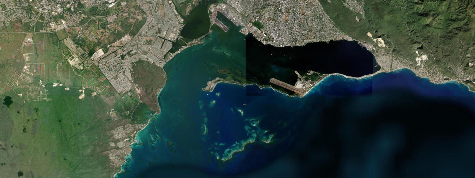
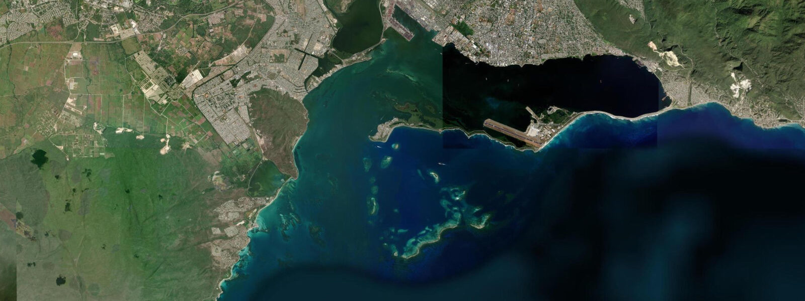
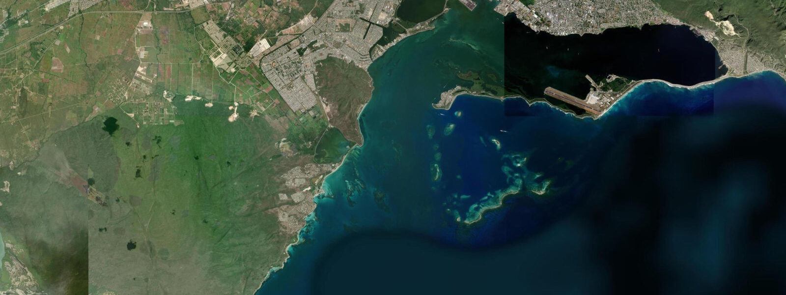
Kingston Harbour is the largest natural harbour in the Caribbean by area — roughly 200 square kilometres of sheltered water enclosed by the Palisadoes tombolo on the south and the Blue Mountains, rising to 2,256 metres, immediately behind the city to the north. The harbour has been the commercial heart of Jamaica for four centuries; the Kingston waterfront on the northern shore is the modern face of that history, with the Ocean Boulevard redevelopment strip running along the base of the city's downtown district. The historic context lives at Port Royal, on the tip of the Palisadoes 12 km to the south.
Port Royal was, in the third quarter of the 17th century, the most prosperous English city in the Americas — a trading, privateer, and navy base of such economic importance that it was called 'the wickedest city on earth' in the contemporary pamphlet literature, a phrase that seems to have referred to its wealth rather than its morals specifically. The earthquake of June 7, 1692 liquefied the sandy fill on which the western third of the town was built and dropped it into the harbour in approximately two minutes. Contemporary accounts describe the land tilting and buildings sliding into the sea in sequence.
The submerged section — warehouses, wharves, taverns, a fort — lies in 4 to 6 metres of water and constitutes one of the most intact 17th-century archaeological sites in the western hemisphere. The above-water Port Royal today is a small fishing community, Fort Charles (still standing), the Giddy House, and a boat service to the Kingston waterfront. The Palisadoes road and the Norman Manley International Airport at the far tip of the spit produce the thin linear geography that defines the harbour's southern boundary.
7 metres — somewhat larger than the fully enclosed inner harbours further west because Kingston Harbour is wide and open to the tidal signal entering from the Caribbean between the Palisadoes and the mainland at the harbour mouth. 5 knots on a spring ebb, noticeable for small boats transiting between the harbour and the open sea. 5 knots across most of the basin.
Kayakers launching from the Kingston waterfront and paddling toward Port Royal work the flood tide for the outbound leg; the ebb back to Kingston requires less effort but the afternoon trade wind across the 12-km fetch produces a chop that makes the return harder from mid-afternoon onward. Shore anglers fish the Palisadoes road banks on the evening flood for jacks and snapper. The Port Royal ruins dive site is managed by the Jamaica National Heritage Trust; permits and documentation are required for archaeological dives, and recreational diving on the site without a licensed operator is prohibited.
3 metres on height.
Tide questions about Kingston Waterfront, Jamaica
Quick answers to the most common questions about tide times, range, and water access at Kingston Waterfront, Jamaica.
What happened at Port Royal in 1692?
On June 7, 1692, an earthquake of approximately magnitude 7.5 struck Jamaica and liquefied the sandy fill on which the western third of Port Royal was built. The land subsided by 1.5 to 2 metres and the sea flooded the collapsed sections in minutes; contemporary accounts describe buildings sliding into the water in sequence. Approximately 2,000 people died immediately and a similar number died subsequently from disease. The submerged portion — warehouses, wharves, taverns, fort sections — lies in 4 to 6 metres of water and is managed by the Jamaica National Heritage Trust as an archaeological site. It is one of the most intact 17th-century colonial sites ever documented.
Can I dive the Port Royal underwater ruins?
Archaeological diving on the Port Royal site requires a permit from the Jamaica National Heritage Trust and must be conducted with a licensed operator who has the relevant permit. Recreational diving on the site without a licensed operator is not permitted under Jamaican heritage law. The visibility in the harbour is variable — typically 3 to 6 metres inside the harbour — and the site requires navigation among the fragile archaeological material. Several Kingston-based dive operators hold the permits for educational and research dives; contact the Jamaica National Heritage Trust or the Jamaica Tourist Board for the current list.
What is the tide range at Kingston Harbour?
Mixed semidiurnal, spring range roughly 0.5 to 0.7 metres. The harbour mouth current runs up to 1.5 knots on a spring ebb; inside the harbour the tidal current is gentle, under 0.5 knots. The current at the harbour mouth between the Palisadoes and the mainland is the relevant factor for small boat and kayak transits in and out of the harbour. Spring tides coincide with new and full moons.
Where do the tide predictions for Kingston come from?
Open-Meteo Marine, a free gridded global ocean model. Accuracy is typically within plus or minus 45 minutes on timing and 0.2 to 0.3 metres on height. Kingston Harbour is the reference port for Jamaica's south coast tide data; the Jamaica Meteorological Service publishes marine forecasts for the harbour and the surrounding waters. The Kingston tide gauge data is the most accurate harmonic reference for the south Jamaica coast.
Is this safe to use for navigation?
No. Kingston Harbour is a working commercial port with daily container and bulk vessel traffic, ferry operations between the waterfront and Port Royal, and the Norman Manley International Airport approach corridor above the Palisadoes. The harbour mouth current and the shoals on the Palisadoes inner side require chart navigation. For vessel navigation in Kingston Harbour, use the current Caribbean charts from the Caribbean Hydrographic Institute and consult the Port Authority of Jamaica. Open-Meteo Marine gridded predictions are not authoritative navigational data.
7-day tide table — Kingston Waterfront, Jamaica
Heights relative to MSL. Predictions: Open-Meteo Marine (MeteoFrance SMOC, 0.08° grid) — heights relative to MSL (not chart datum / LAT). Model-derived.
| Day | Type | Time | Height |
|---|---|---|---|
| Sat 04 Jul | Low | 00:00 | 0.5m |
| High | 05:00 | 0.7m | |
| Sun 05 Jul | — | ||
| Mon 06 Jul | — | ||
| Tue 07 Jul | — | ||
| Wed 08 Jul | — | ||
| Thu 09 Jul | — | ||
| Fri 10 Jul | Low | 15:50 | 0.3m |
| High | 23:00 | 0.7m | |