
Genoa tide times
Genoa tide forecast — heights relative to MSL.
Today's tide times for Genoa
Tide times at Genoa on Friday, 31 July 2026: first high tide at 02:00, first low tide at 15:50. Sunrise 06:08, sunset 20:51.
Tide chart for Genoa
24-hour cosine-interpolated curve around the present moment. Heights relative to MSL. Predictions: Predictions: Open-Meteo Marine (MeteoFrance SMOC, 0.08° grid).
Sun, moon and conditions on Fri 31 Jul
Snapshot at build time — refreshes daily. Sea state from Open-Meteo Marine.
Highs and lows next 7 days
Every predicted high and low for the next week, with the daily tidal coefficient (0–120; higher = bigger swing, > 95 means stronger currents).
Other spots nearby
The three closest curated TideTurtle locations to Genoa, measured by great-circle distance.
Today's solunar windows
Solunar tradition: major periods are the ≈3h windows around moon transit and opposition; minor are ≈2h around moonrise and moonset. Pair with the local tide stage and wind for the best read.
About tides at Genoa
A short guide to the coastline at Genoa — geography, sea state, and what the tide is actually doing under your feet.
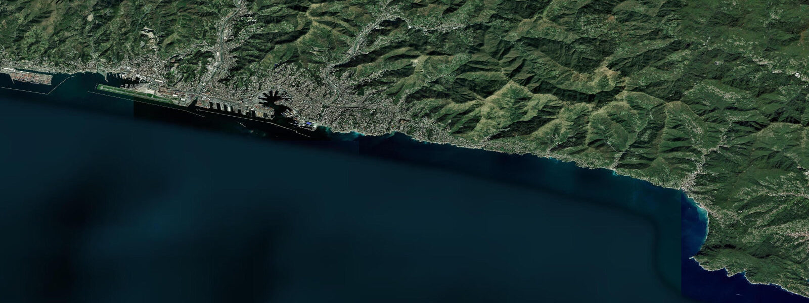
Genoa sits at the apex of the Golfo di Genova, the deepest indentation in the northern Ligurian coastline, with the Apennines rising steeply inland within a few kilometres of the waterfront and the sea opening southwest toward the open Ligurian Basin. It is a city shaped almost entirely by its relationship with the harbour — the medieval merchant republic of Genoa, the Superba, controlled trade routes across the western Mediterranean from the 12th to the 17th centuries, and the old town that earned its UNESCO listing in 2006 runs from the waterfront up through the densely packed caruggi (alleyways) to the Palazzi dei Rolli, the aristocratic palace network where foreign dignitaries lodged on rotation. 15 metres.
In absolute terms, this barely registers as a tide at all compared to Cadiz or Santander on Spain's Atlantic coast — the astronomical tide at Genoa is smaller than the height of a typical beach step. This is not an oversight in the data; it is the character of the Mediterranean. The Ligurian Sea is a semi-enclosed basin within a semi-enclosed sea.
The Atlantic tidal signal enters the Mediterranean through the Strait of Gibraltar 2,000 kilometres to the southwest, and by the time it reaches the Gulf of Genoa at the far northern end of the Ligurian Sea, the signal has been attenuated by the basin geometry to the values observed. What actually moves water at Genoa — what determines whether the waterfront is higher or lower than expected — is not the astronomical tide but meteorological forcing. 6 metres above the predicted astronomical tide — more than the entire tidal range.
A strong Tramontane from the Alps can drive the opposite effect, pushing water offshore and dropping the level below prediction. Mediterranean seiches — standing wave oscillations in the enclosed basin driven by rapid atmospheric pressure changes — can produce rapid water level oscillations of 10 to 30 centimetres over periods of a few hours that have no relationship to the tidal schedule. All of this means that for practical coastal planning at Genoa, the tide table is background context, not the operating variable.
The Porto Antico — the old harbour redesigned by Renzo Piano for the 1992 Columbus quincentenary celebrations — is the leisure face of Genoa's waterfront: the Bigo crane structure, the glass-and-steel Biosfera sphere containing a tropical garden, the Acquario di Genova (the largest public aquarium in Italy), and the ferry terminals where services depart for Sardinia, Sicily, Corsica, and Barcelona. The working port to the east is one of the busiest in the Mediterranean, handling container, bulk, and ro-ro traffic. 4 metre astronomical tide; harbour operations here are governed by vessel draft, berth availability, and wind, not by tidal state.
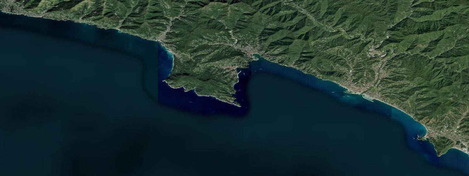
East of Genoa, the Riviera di Levante runs through Nervi, Bogliasco, Camogli, and Santa Margherita Ligure before reaching the Portofino headland and the protected marine area that surrounds it. Portofino's anchorage is small and sought after by yacht crews working the Italian coast, and the calm protected water behind the headland holds good dive conditions — octopus, grouper, scorpionfish, and occasional lobster — because the Marine Protected Area since 1999 has rebuilt fish populations on the submarine rock formations. The MPA boundaries are fixed and do not vary with tide.
Further east, the Cinque Terre villages sit on cliff faces with no road connection and limited beach access. The tiny landing stages below Riomaggiore, Manarola, and Vernazza are operational only in calm weather, and the determining variable for boat access is sea state and swell, not tide height. The predictions on this page come from Open-Meteo Marine, a gridded global ocean model.
3 metres on height. 3 metres is roughly equal to the entire tidal range — the model output is still useful as a reference for the astronomical signal, but actual water level at any given moment is driven as much by wind and pressure as by tide. The authoritative Italian sea-level record is maintained by ISPRA (Istituto Superiore per la Protezione e la Ricerca Ambientale), which operates the national tide gauge network; the Genoa gauge is one of the most complete Mediterranean sea-level records in existence.
Tide questions about Genoa
Quick answers to the most common questions about tide times, range, and water access at Genoa.
What is the tide range at Genoa?
Mean tidal range at Genoa is approximately 0.2 to 0.4 metres — one of the smallest astronomical tide ranges on any inhabited coastline in Europe. Spring tides around new and full moons occasionally reach 0.5 metres; neap tides can drop to 0.1 metres or less. This is the normal character of the northern Mediterranean, where the Atlantic tidal signal has been attenuated by the basin geometry over 2,000 kilometres from the Strait of Gibraltar. ISPRA (Istituto Superiore per la Protezione e la Ricerca Ambientale) operates the Genoa gauge, one of the longest sea-level records in the Mediterranean.
If the tide is so small, what actually changes water level at Genoa?
Meteorological forcing, primarily. Sirocco events — southerly winds from low-pressure systems tracking northeast from North Africa — can raise water level at Genoa by 0.3 to 0.6 metres above the predicted astronomical tide, which is more than the entire tidal range. The Tramontane or strong northerly winds push the opposite direction, drawing water offshore. Mediterranean seiches (basin oscillations triggered by rapid pressure changes) can drive 10 to 30 centimetre water level fluctuations over a few hours. For practical planning at Genoa, sea state and wind setup matter far more than the tide table.
Is the Porto Antico or the Acquario di Genova tidal-access dependent?
No. The Porto Antico, the Acquario di Genova, and the ferry terminals along the Genoa waterfront are not meaningfully affected by the 0.2 to 0.4 metre astronomical tide. Vessel operations at the ferry terminals are governed by draft, berth geometry, and wind conditions — not tidal state. The Acquario's public access and the Porto Antico leisure area operate on standard opening hours with no tide dependency. The only coastal access that varies with water level at Genoa is the occasional low-water exposure of rocks at the base of the seawall on calm, low-pressure neap tides.
How does diving at Portofino Marine Protected Area relate to tides?
Dive conditions at the Portofino MPA (designated 1999) are governed primarily by sea state and visibility, not tidal height. At 0.2 to 0.4 metres, the astronomical tide does not produce meaningful current through the dive sites — the tidal flow is too weak to affect buoyancy control or site selection. Wind-driven surge on the surface can affect entry and exit at certain sites; dive operators at Santa Margherita and Portofino village schedule sites based on swell direction, not tide state. Visibility inside the protected area is best when the sea is calm and there is no storm runoff from the coastal streams.
Where do these tide predictions come from, and how accurate are they?
Open-Meteo Marine, a free gridded global ocean model. Accuracy is typically within plus or minus 45 minutes on timing and 0.2 to 0.3 metres on height — model-derived, not a local gauge. At Genoa, the height uncertainty is roughly equivalent to the entire tidal range, so the predictions capture the astronomical signal but actual water level on any given day depends heavily on wind and pressure. For authoritative sea-level data, ISPRA operates the Genoa gauge and publishes the Italian national sea-level bulletin. For research or operational use, ISPRA's historical Genoa record extends back to the 19th century.
8-day tide table — Genoa
Heights relative to MSL. Predictions: Open-Meteo Marine (MeteoFrance SMOC, 0.08° grid) — heights relative to MSL (not chart datum / LAT). Model-derived.
| Day | Type | Time | Height |
|---|---|---|---|
| Fri 31 Jul | High | 02:00 | -0.5m |
| Low | 15:50 | -0.6m | |
| Sat 01 Aug | High | 23:10 | -0.3m |
| Sun 02 Aug | Low | 17:00 | -0.6m |
| Mon 03 Aug | High | 12:00 | -0.4m |
| Low | 17:50 | -0.5m | |
| Tue 04 Aug | High | 00:10 | -0.3m |
| Low | 07:00 | -0.5m | |
| Wed 05 Aug | — | ||
| Thu 06 Aug | High | 15:00 | -0.4m |
| Low | 21:00 | -0.5m | |
| Fri 07 Aug | High | 01:00 | -0.4m |