Naples (Bay) tide times
Naples (Bay) tide forecast — heights relative to MSL.
Today's tide times for Naples (Bay)
Tide times at Naples (Bay) on Sunday, 26 July 2026: first low tide at 13:15, first high tide at 20:06. Sunrise 05:52, sunset 20:25.
Tide chart for Naples (Bay)
24-hour cosine-interpolated curve around the present moment. Heights relative to MSL. Predictions: Predictions: Open-Meteo Marine (MeteoFrance SMOC, 0.08° grid).
Sun, moon and conditions on Sun 26 Jul
Snapshot at build time — refreshes daily. Sea state from Open-Meteo Marine.
Highs and lows next 7 days
Every predicted high and low for the next week, with the daily tidal coefficient (0–120; higher = bigger swing, > 95 means stronger currents).
Other spots nearby
The three closest curated TideTurtle locations to Naples (Bay), measured by great-circle distance.
Today's solunar windows
Solunar tradition: major periods are the ≈3h windows around moon transit and opposition; minor are ≈2h around moonrise and moonset. Pair with the local tide stage and wind for the best read.
Cycle dates near Naples (Bay)
Next spring tide on Fri 31 Jul (range 0.4m). Last neap on Sun 26 Jul. Next neap on Sat 01 Aug.
Spring tides cluster around new and full moons (biggest swings). Neap tides land on quarter moons (smallest swings). See the spring tide and neap tide glossary entries for the why.
About tides at Naples (Bay)
A short guide to the coastline at Naples (Bay) — geography, sea state, and what the tide is actually doing under your feet.
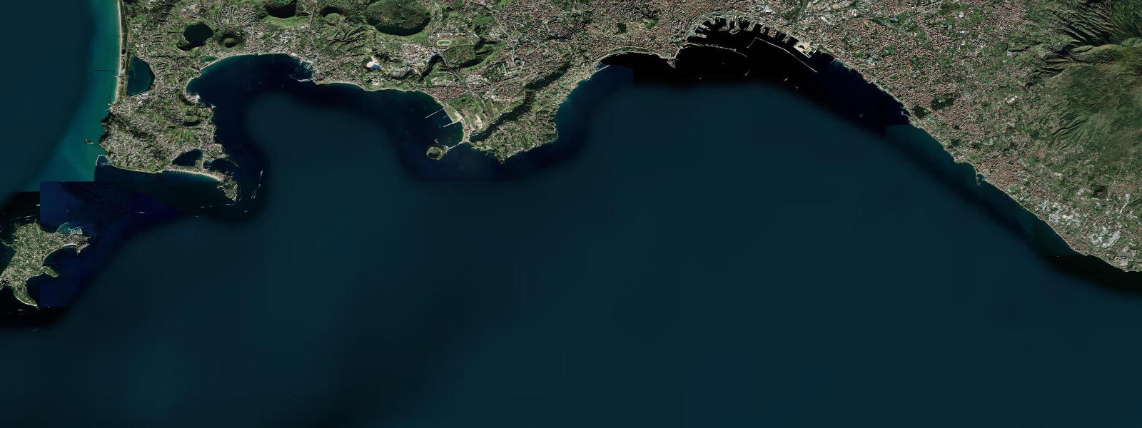
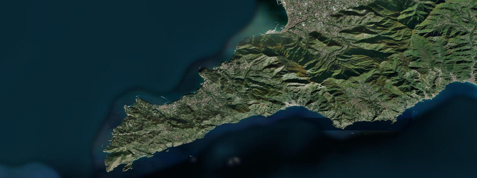
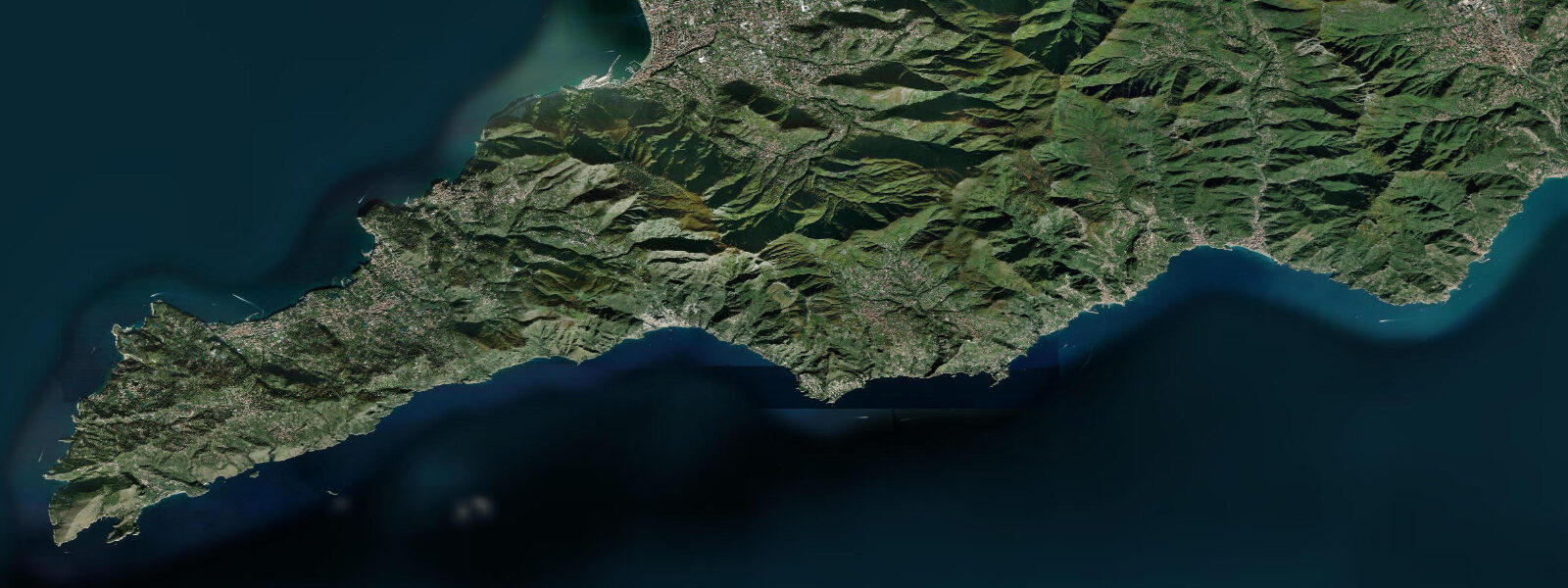
Naples sits at the head of one of the most photographed bays in the Mediterranean, ringed by the Sorrentine Peninsula to the south, Capri at the seaward edge, and the Phlegraean Fields and the islands of Procida and Ischia to the west. Vesuvius dominates the eastern shore and the volcanic geology of the bay reaches under the seafloor and into the inland Campi Flegrei caldera. 4 and neaps near flat.
Most days the height swing barely registers in the harbour because pressure changes from passing weather systems and wind setup from the local sea-breeze regime each shift water level by similar amounts. The volcanic geometry adds a slow vertical land-motion signal — bradyseism in the Phlegraean Fields, the same phenomenon that flooded the Roman ruins at Pozzuoli over centuries. The bay's coastal cliffs, the deep underwater profile that drops quickly to several hundred metres, and the islands at the seaward edge make the bay much more sensitive to swell, wind, and pressure than to the lunar tide.
Fishers working the Capri grottoes, sailors crossing to Procida and Ischia, swimmers at the Sorrento marinas, and snorkellers at the Faraglioni rocks at Capri all read the wider weather pattern more than the tide table. Open-Meteo Marine drives the gridded predictions on this page; ISPRA's Mareografico Nazionale runs the historic Naples gauge.
Tide questions about Naples (Bay)
Quick answers to the most common questions about tide times, range, and water access at Naples (Bay).
When is the next high tide at Naples?
The hero block shows the next high tide in the Bay of Naples in local Rome time. The 7-day table covers all four daily extremes — though for the Tyrrhenian Sea the swing is small enough that the secondary high or low often barely registers above the noise.
What's the typical tide range at Naples?
Mean range at the Naples gauge is about 0.3 metres. Spring tides push close to 0.4 metres around new and full moons, neaps drop close to flat. The Tyrrhenian Sea runs the small Mediterranean signal — the open Atlantic tide cannot propagate cleanly through the Strait of Gibraltar and the basin is too small to host its own significant astronomical tide.
What is bradyseism and how does it affect the coast at Naples?
Bradyseism is slow vertical ground motion driven by magma and hydrothermal activity beneath the Phlegraean Fields caldera west of Naples. Over the historic period the Roman market at Pozzuoli has alternated between submerged and exposed as the ground sinks and rises by several metres on decade-to-century timescales. It does not affect daily tide predictions, but the apparent tide range at long-record gauges has shifted noticeably over the centuries because of it.
Where do these tide predictions come from?
Open-Meteo Marine, a global ocean-grid model. Useful for general planning around the bay and the islands, though for the small Tyrrhenian signal the gridded resolution sometimes shows more noise than swing. For authoritative Italian tide data, ISPRA Mareografico Nazionale runs the official gauge network including the historic Naples and Civitavecchia stations.
Is this safe to use for navigation?
No. For piloting in or out of Naples harbour, crossing to Capri, Ischia, or Procida, or working the Sorrentine cliff coast use ISPRA's authoritative tide tables, the Istituto Idrografico della Marina chart products, and the latest Capitaneria di Porto notices. The Tyrrhenian sees occasional Mediterranean meteotsunamis under the right pressure-wave conditions, and those override normal tidal predictions.
7-day tide table — Naples (Bay)
Heights relative to MSL. Predictions: Open-Meteo Marine (MeteoFrance SMOC, 0.08° grid) — heights relative to MSL (not chart datum / LAT). Model-derived.
| Day | Type | Time | Height |
|---|---|---|---|
| Sun 26 Jul | Low | 13:15 | -0.5m |
| High | 20:06 | -0.3m | |
| Mon 27 Jul | Low | 02:00 | -0.5m |
| High | 08:00 | -0.3m | |
| Low | 14:10 | -0.6m | |
| High | 20:45 | -0.3m | |
| Tue 28 Jul | Low | 14:45 | -0.6m |
| Wed 29 Jul | High | 09:10 | -0.4m |
| Low | 15:10 | -0.7m | |
| High | 21:50 | -0.3m | |
| Thu 30 Jul | Low | 15:45 | -0.7m |
| Fri 31 Jul | High | 10:15 | -0.4m |
| Low | 16:15 | -0.6m | |
| High | 23:00 | -0.3m | |
| Sat 01 Aug | Low | 05:10 | -0.6m |
| High | 11:00 | -0.3m | |
| Low | 16:54 | -0.6m |