Haifa Bay tide times
Haifa Bay tide forecast — heights relative to MSL.
Today's tide times for Haifa Bay
Tide times at Haifa Bay on Sunday, 21 June 2026: first high tide at 15:50, first low tide at 22:00. Sunrise 05:32, sunset 19:51.
Tide chart for Haifa Bay
24-hour cosine-interpolated curve around the present moment. Heights relative to MSL. Predictions: Predictions: Open-Meteo Marine (MeteoFrance SMOC, 0.08° grid).
Sun, moon and conditions on Sun 21 Jun
Snapshot at build time — refreshes daily. Sea state from Open-Meteo Marine.
Highs and lows next 7 days
Every predicted high and low for the next week, with the daily tidal coefficient (0–120; higher = bigger swing, > 95 means stronger currents).
Other spots nearby
The three closest curated TideTurtle locations to Haifa Bay, measured by great-circle distance.
Today's solunar windows
Solunar tradition: major periods are the ≈3h windows around moon transit and opposition; minor are ≈2h around moonrise and moonset. Pair with the local tide stage and wind for the best read.
About tides at Haifa Bay
A short guide to the coastline at Haifa Bay — geography, sea state, and what the tide is actually doing under your feet.
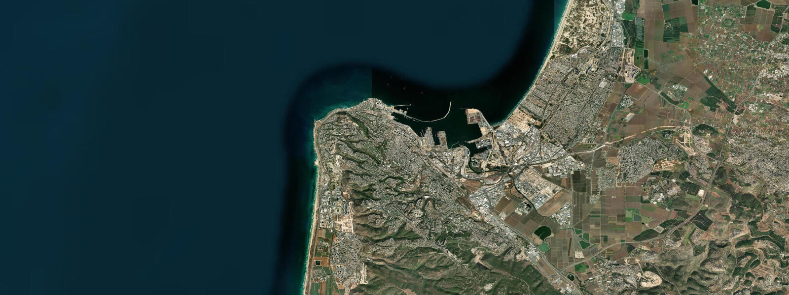
Haifa Bay is the main port bay on Israel's northern Mediterranean coast, a broad, south-facing embayment sheltered to the north and west by the Mt. Carmel ridge and the Carmel headland. The city of Haifa climbs the Carmel hillside above the industrial port; the bay proper extends north toward the Acre (Akko) plain. The National Institute of Oceanography (IOLR) is located on the Carmel coast, within the bay system.
The Mediterranean tide at Haifa is genuinely microtidal. Astronomical range is approximately 15–30 cm — at the lower end even of Mediterranean tidal signals, which are already among the smallest of any oceanic basin. The narrow Gibraltar connection to the Atlantic means that the ocean tidal signal reaching the eastern Mediterranean has been progressively dissipated over thousands of kilometres. What moves the water level at Haifa's beaches and port is almost entirely non-astronomical: atmospheric pressure (the inverse barometer effect adds about 1 cm of water level for every 1 hPa of pressure drop below the regional mean) and meteorological seiches in the eastern Mediterranean basin.
The eastern Mediterranean supports a regional seiche at a period of approximately 2–5 days that can raise or lower water levels by 0.2–0.5 m at Haifa above or below the predicted astronomical level. These anomalies are driven by the passing of synoptic weather systems — lows and highs that cross the Levant on the mid-latitude westerly wave pattern. IOLR and the Israel Meteorological Service monitor sea level continuously at Haifa and publish storm-surge advisories for significant events. For the typical beach visitor, the practical implication is that the predicted tide is nearly irrelevant to the actual water level; weather conditions govern more.
Haifa Port is the largest commercial port in Israel; the industrial character of the inner bay is not conducive to recreational beach use at the port itself. The main bathing beaches in the Haifa area are on the Carmel coast south of the port — Dado beach and Bat Galim beach are the most used. These face west into the Mediterranean and receive swell from the W and NW quarter; the most significant wave events at these beaches are during winter storms when W and NW depressions cross the eastern Mediterranean and drive swell directly into the bay.
Fishing from the Haifa breakwaters and the Bat Galim promenade targets sea bream (Diplodus species, denise), grey mullet (Mugil cephalus), and various Eastern Mediterranean reef fish. At this microtidal location, tide state is not the primary driver of feeding activity; water temperature (17–28°C seasonally) and the Mediterranean's bimodal productivity cycle (spring and autumn) govern fish presence more than the 15–30 cm tidal swing. Predictions here: Open-Meteo Marine, ±45 min / ±0.2–0.3 m. For authoritative Israeli sea-level data, use IOLR or IMS (Israel Meteorological Service).
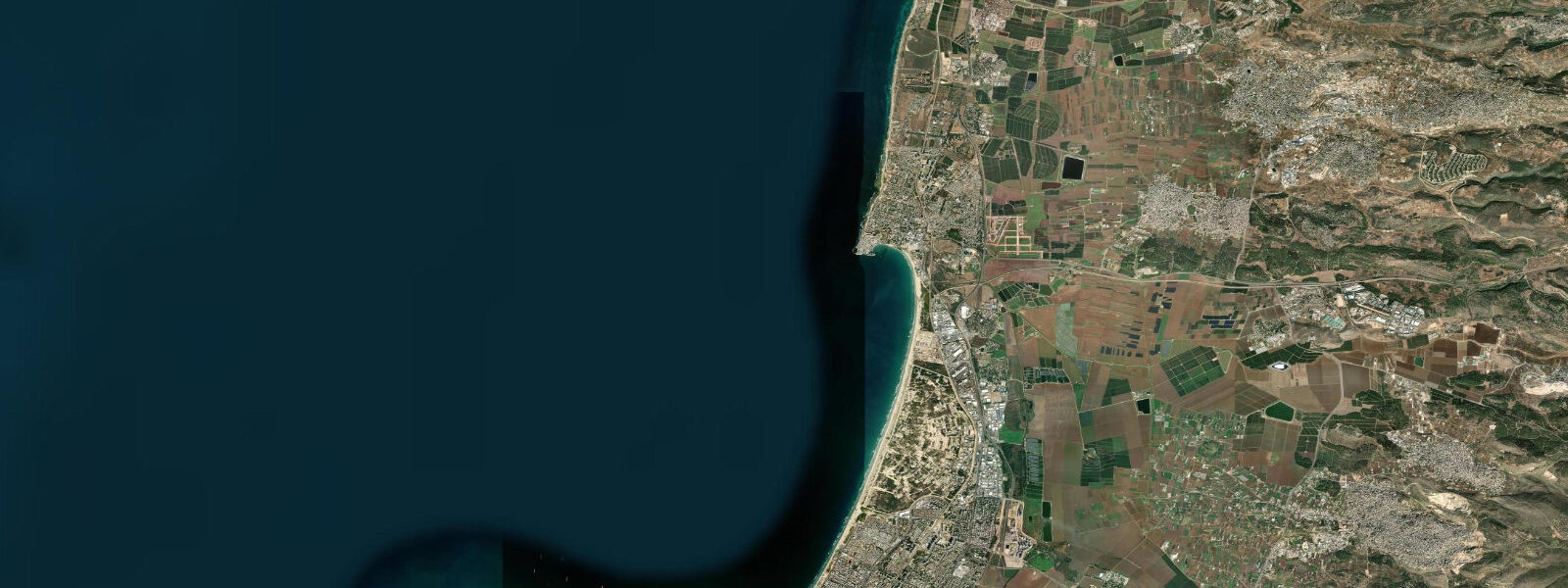
The Carmel National Park, immediately south and above the city, extends to the coast at the Carmel headland; the rocky Carmel cliffs south of Bat Galim beach offer an accessible coastal walk at a height above sea level where the Mediterranean below is visible in its entirety from the cape to the Haifa Bay opening. The Dado beach section, 3 km south of the port, is the largest and most popular Haifa beach; the sand is artificially maintained and the beach nourishment programme compensates for the net southward littoral drift that tends to erode the northern sections.
The Israeli coastal management framework designates Haifa Bay as a dual-use zone: industrial and commercial (the port and the petrochemical facilities on the Krayot coast north of the city) and recreational (the Dado and Bat Galim beaches south of the port). The two uses exist in uncomfortable proximity; the air quality in the bay area is affected by industrial emissions from the Haifa Bay refineries, and the visual experience from the Carmel coast overlooks both the industrial complex and the Mediterranean simultaneously. The Israel Environmental Protection Ministry monitors air and water quality in the bay on a continuous basis.
Tide questions about Haifa Bay
Quick answers to the most common questions about tide times, range, and water access at Haifa Bay.
Is the astronomical tide meaningful at Haifa Bay?
Barely. The Mediterranean Sea is nearly enclosed; the tidal signal at Haifa is only 15–30 cm astronomical range — at the lower end of any oceanic body. What moves the water level at Haifa's beaches is primarily atmospheric pressure and meteorological seiches in the eastern Mediterranean, not the moon. A winter depression crossing the Levant can raise or lower the water level 0.3–0.5 m — more than the full astronomical tidal range. The tide prediction on this page is directionally correct, but for precise water-level planning, the weather forecast is the more relevant document. The inverse barometer effect and meteorological seiches can produce water-level anomalies at Haifa that are 10–15 times the astronomical tidal range; a pressure drop of 20 hPa produces a 20 cm surge independent of wind.
Where do the tide predictions on this page come from?
Open-Meteo Marine, a free gridded global ocean model. Accuracy is typically ±45 minutes on timing and ±0.2–0.3 m on height. At Haifa's 15–30 cm tidal range, the model accuracy class covers or exceeds the full tidal signal; the prediction is most useful as an indication of the dominant tidal phase (rising or falling) rather than as a precise height figure. The National Institute of Oceanography (IOLR) at Haifa and the Israel Meteorological Service are the authoritative sources for Israeli coastal sea-level data. This page is not for navigation. IOLR (National Institute of Oceanography) publishes Israeli coastal sea-level data and research on Mediterranean storm-surge climatology; their office is on the Carmel coast at Haifa.
What are the best beaches near Haifa?
Dado Beach (Zamir Beach) and Bat Galim Beach on the Carmel coast south and west of the port are the main public beaches. Both face west into the Mediterranean; Bat Galim is more exposed to NW winter swell. In summer (June–September) the sea is calm (17 m/s average wind), warm (26–28°C), and the beaches are active from early morning. The bathing water quality is monitored by the Ministry of Health; results are published online. The Carmel Beach area extends south from Bat Galim for 3–4 km with several named beach sections. The Dado beach section of the Carmel coast is the Israeli Navy's traditional beach area; the Dado beach facilities are well-maintained and monitored by the Haifa municipality.
Is Haifa Bay suitable for sea kayaking?
The inner bay north of the port is sheltered and generally appropriate for kayaking in calm conditions; the microtidal Mediterranean means tidal current is not a significant consideration. The main hazards are commercial shipping traffic in the port approaches (stay well clear of the shipping lanes) and the afternoon NW sea breeze that builds from around 12:00–13:00 and can make the return paddle strenuous. Paddling south along the Carmel coast outside the port zone gives access to the rocky Carmel cliffs; sea caves are accessible by kayak at all tidal states given the negligible range. The Haifa port approaches are controlled waterway; kayakers must stay clear of the port entrance and commercial shipping lanes.
When is the best season for fishing from Haifa's breakwaters?
The most productive shore fishing at Haifa breakwaters and the Bat Galim promenade is in spring (March–May) and autumn (September–November), coinciding with the eastern Mediterranean's bimodal productivity cycle when upwelling and cooling mix nutrients to the surface. Winter storms also concentrate feeding fish along the exposed breakwater faces. Sea bream (Diplodus species), grey mullet, and sea bass (Dicentrarchus labrax) are the main targets. At this microtidal location, the 15–30 cm tidal cycle is not the governing factor in fish feeding patterns; water temperature and seasonal productivity matter more. Mediterranean sea bream (Diplodus sargus) are the most frequently caught species from the Haifa breakwaters by shore anglers in autumn and spring.
8-day tide table — Haifa Bay
Heights relative to MSL. Predictions: Open-Meteo Marine (MeteoFrance SMOC, 0.08° grid) — heights relative to MSL (not chart datum / LAT). Model-derived.
| Day | Type | Time | Height |
|---|---|---|---|
| Sun 21 Jun | High | 15:50 | -0.3m |
| Low | 22:00 | -0.5m | |
| Mon 22 Jun | — | ||
| Tue 23 Jun | High | 05:10 | -0.3m |
| Low | 11:50 | -0.4m | |
| High | 18:00 | -0.3m | |
| Wed 24 Jun | Low | 13:00 | -0.4m |
| Thu 25 Jun | — | ||
| Fri 26 Jun | High | 08:10 | -0.2m |
| Low | 14:50 | -0.4m | |
| Sat 27 Jun | High | 09:00 | -0.2m |
| Sun 28 Jun | Low | 02:00 | -0.4m |