Caesarea tide times
Caesarea tide forecast — heights relative to MSL.
Today's tide times for Caesarea
Tide times at Caesarea on Sunday, 21 June 2026: first low tide at 09:10, first high tide at 15:50, second low tide at 22:10. Sunrise 05:33, sunset 19:50.
Tide chart for Caesarea
24-hour cosine-interpolated curve around the present moment. Heights relative to MSL. Predictions: Predictions: Open-Meteo Marine (MeteoFrance SMOC, 0.08° grid).
Sun, moon and conditions on Sun 21 Jun
Snapshot at build time — refreshes daily. Sea state from Open-Meteo Marine.
Highs and lows next 7 days
Every predicted high and low for the next week, with the daily tidal coefficient (0–120; higher = bigger swing, > 95 means stronger currents).
Other spots nearby
The three closest curated TideTurtle locations to Caesarea, measured by great-circle distance.
Today's solunar windows
Solunar tradition: major periods are the ≈3h windows around moon transit and opposition; minor are ≈2h around moonrise and moonset. Pair with the local tide stage and wind for the best read.
About tides at Caesarea
A short guide to the coastline at Caesarea — geography, sea state, and what the tide is actually doing under your feet.
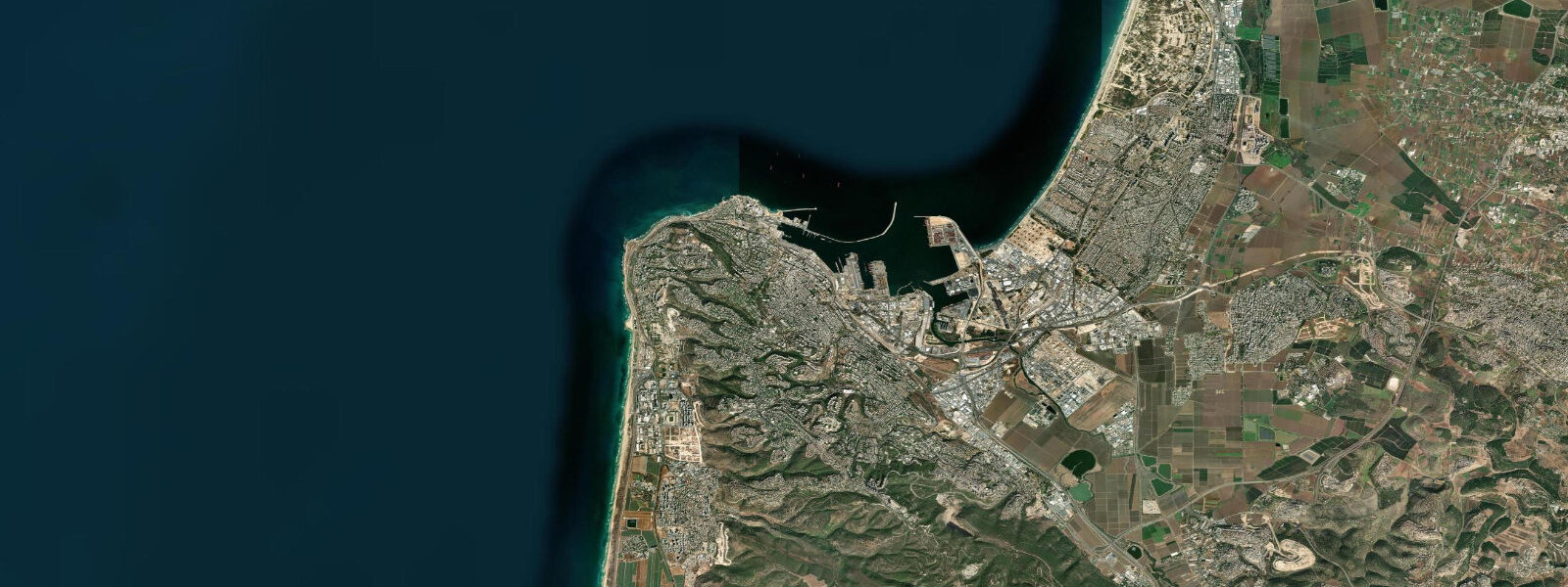
Caesarea Maritima is the site of the Roman-era capital of Judea, built by Herod the Great starting around 22 BCE and for centuries one of the most important ports of the eastern Mediterranean. The ancient harbour — Sebastos, as it was named — was an engineering achievement of the early Roman Imperial period: a breakwater constructed from hydraulic pozzolana concrete in deep water, one of the first large-scale uses of this construction technique. What remains today is the partially submerged archaeological site of the harbour stones, the Roman theatre, the hippodrome, the aqueduct, and the Crusader-era town walls that surround the ancient core.
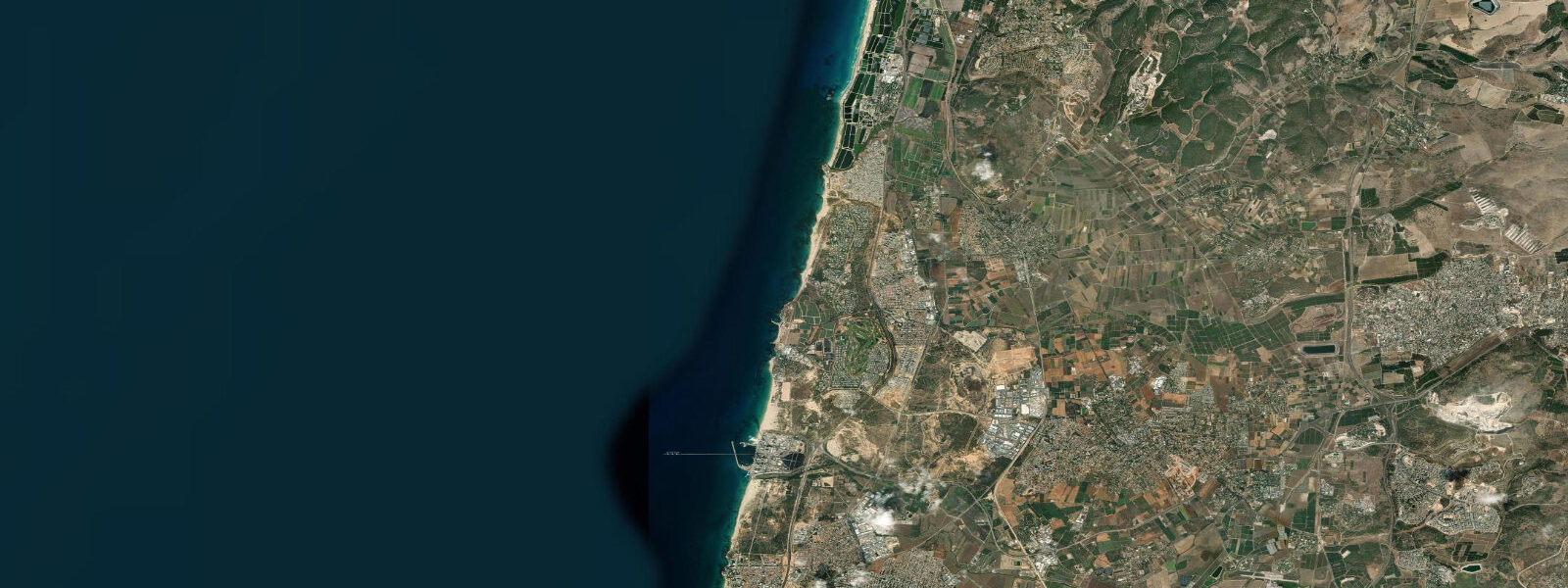
The coast at Caesarea is the modern national park (Caesarea National Park), managed by the Israel Nature and Parks Authority. The beach south of the archaeological site is a white sand beach that is also accessible for swimming; to the north of the ancient harbour ruins the beach continues toward the Caesarea Harbour Amphitheatre (a modern performance venue). The Mediterranean tide here is the same as at Haifa and Akko: astronomical range 15–30 cm, with weather-driven anomalies dominating the actual water level.
The ancient Sebastos harbour is now partially submerged — the harbour stones lie 2–3 m below present sea level, a combination of post-Roman sea-level rise (the Mediterranean has risen approximately 1.5–2.0 m since the Roman period), localised land subsidence, and the settlement of the original concrete breakwater under its own weight. This 2,000-year sea-level proxy is one of the most precisely dated examples of combined sea-level rise and coastal land subsidence in the Mediterranean. IOLR researchers have used the Sebastos harbour as a natural tide gauge: comparing the Roman-era construction datum with the current sea level gives a long-term subsidence rate for the Caesarea site.
The underwater archaeological site is accessible to snorkellers and divers from the beach immediately below the ancient harbour walls. The submerged harbour stones, column drums, and Roman-era artifacts are visible at 1–5 m depth. Caesarea Dive Centre operates from the national park and is authorised to provide guided dive access; the site is within a protected archaeological zone and collection is prohibited. The best visibility is in summer (June–September) when easterly and NE winds have kept the sea calm; winter NW storms reduce visibility to 2–4 m. Predictions here: Open-Meteo Marine, ±45 min / ±0.2–0.3 m. IOLR sea-level monitoring is the authoritative reference for Israeli coastal water levels.
The Caesarea National Park archaeological site encompasses the ancient theatre (capacity 3,500, still used for open-air concerts), the hippodrome (ancient chariot racing track, the outline visible from above), the Roman aqueduct section along the beach 2 km north, and the Crusader-era moat and gate. The underwater harbour is a separate zone accessed via the Caesarea Dive Centre. The combination of Roman archaeology, the functioning ancient theatre, and the accessible underwater site makes Caesarea one of the most archaeologically rich coastal locations in the eastern Mediterranean.
The Roman aqueduct at Caesarea, built by Herod to bring fresh water from the Carmel springs 15 km to the north, runs along the beach north of the national park and is accessible on foot. The aqueduct arches are partially buried in the beach sand at the lower sections; at high (beach) sand levels in winter the arches are covered to their caps, while in summer after longshore drift has moved sand south the arches are more exposed. The sand level variation on the beach at the aqueduct is governed by seasonal littoral drift rather than tidal state; it changes over weeks, not hours. The Roman theatre at Caesarea, still used for summer concerts under the open sky, gives the site a living quality that purely museum-context ruins lack; the combination of archaeology, beach, and performance venue on the same stretch of Mediterranean coast is genuinely unusual.
Tide questions about Caesarea
Quick answers to the most common questions about tide times, range, and water access at Caesarea.
Can I snorkel over the ancient Caesarea harbour ruins?
Yes. The submerged harbour stones, column drums, and Roman-era structures are at 1–5 m depth, accessible to snorkellers from the beach below the ancient harbour wall. The site is within the Caesarea National Park underwater archaeological zone; Caesarea Dive Centre is authorised to provide guided access and equipment rental. Collecting artifacts is strictly prohibited. Best visibility is June–September (5–10 m) when the sea is calm; winter visits can see visibility drop to 2–4 m after NW storm swell. The microtidal Mediterranean (15–30 cm range) means the site is accessible at all tidal states; water level at the entry point changes by only 10–20 cm between high and low. Entry to the underwater snorkel zone at Caesarea requires coordination with the dive centre; they manage the archaeological zone access permit.
Why is the ancient harbour now underwater?
The Sebastos harbour stones lie 2–3 m below present sea level — the result of three processes acting over 2,000 years. First, post-Roman sea-level rise: the Mediterranean has risen approximately 1.5–2.0 m since the Roman period due to global ice melt and thermal expansion. Second, local land subsidence: the Caesarea coastal geology has been sinking at an estimated rate of 0.5–1.0 mm per year. Third, the original Roman concrete breakwater settled under its own mass into the sandy sea floor. The combination produces the 2–3 m submergence observed today. The IOLR research on Sebastos harbour uses standardised sea-level benchmarks; the 2–3 m submergence figure has been verified by multiple independent archaeological surveys.
Where do the tide predictions on this page come from?
Open-Meteo Marine, a free gridded global ocean model. Accuracy is typically ±45 minutes on timing and ±0.2–0.3 m on height. At Caesarea's 15–30 cm tidal range, the model accuracy class covers most of the full signal; the tide prediction indicates whether the water is rising or falling, not a precise height. The National Institute of Oceanography (IOLR) at Haifa is the authoritative source for Israeli coastal sea-level data. This page is not for navigation. IOLR's official Israeli coastal sea-level data is available at the PSMSL (Permanent Service for Mean Sea Level) archive under the Haifa station record.
Is the Caesarea National Park beach suitable for swimming?
Yes. The sand beach south of the ancient harbour ruins and the beach to the north are both open for swimming in the park season (April–October). The water is clear Mediterranean with temperatures from 19–20°C in April to 28–29°C in August. Lifeguards operate in summer. The beach faces west and is exposed to NW winter swell; outside the May–September calm season the wave conditions can be 1.0–2.0 m and the beach is rough. The beach entry and the depth profile do not change significantly with the 15–30 cm Mediterranean tidal range. Winter NW storm conditions at Caesarea can make swimming unsafe (2–3 m swell directly onto the exposed beach); defer swimming visits to the May–September calm season.
Is Caesarea accessible as a day trip from Tel Aviv or Haifa?
Yes from both cities. From Tel Aviv: approximately 55 km north on Route 2; 50–60 minutes by car, or by rail to Binyamina station followed by a 5 km taxi or organised shuttle. From Haifa: approximately 40 km south on Route 2; 40–50 minutes by car. The national park site takes 2–4 hours for a thorough visit including the harbour ruins, theatre, hippodrome, and aqueduct section. Guided snorkel or dive at the underwater site requires advance booking with Caesarea Dive Centre. Combine with swimming at the national park beach; the beach is open until late in summer. The Binyamina train station on the coastal rail line is 5 km from the Caesarea park entrance; a pre-arranged taxi or the seasonal park shuttle covers the final distance.
8-day tide table — Caesarea
Heights relative to MSL. Predictions: Open-Meteo Marine (MeteoFrance SMOC, 0.08° grid) — heights relative to MSL (not chart datum / LAT). Model-derived.
| Day | Type | Time | Height |
|---|---|---|---|
| Sun 21 Jun | Low | 09:10 | -0.5m |
| High | 15:50 | -0.3m | |
| Low | 22:10 | -0.5m | |
| Mon 22 Jun | — | ||
| Tue 23 Jun | — | ||
| Wed 24 Jun | — | ||
| Thu 25 Jun | High | 20:10 | -0.3m |
| Fri 26 Jun | Low | 14:50 | -0.4m |
| Sat 27 Jun | High | 09:00 | -0.2m |
| Sun 28 Jun | Low | 02:00 | -0.4m |