Howth, Leinster tide times
Howth, Leinster tide forecast — heights relative to MSL.
Today's tide times for Howth, Leinster
Tide times at Howth, Leinster on Friday, 19 June 2026: first low tide at 01:00, first high tide at 02:45, second low tide at 08:28. Sunrise 04:55, sunset 21:55.
Tide chart for Howth, Leinster
24-hour cosine-interpolated curve around the present moment. Heights relative to MSL. Predictions: Predictions: Open-Meteo Marine (MeteoFrance SMOC, 0.08° grid).
Sun, moon and conditions on Fri 19 Jun
Snapshot at build time — refreshes daily. Sea state from Open-Meteo Marine.
Highs and lows next 7 days
Every predicted high and low for the next week, with the daily tidal coefficient (0–120; higher = bigger swing, > 95 means stronger currents).
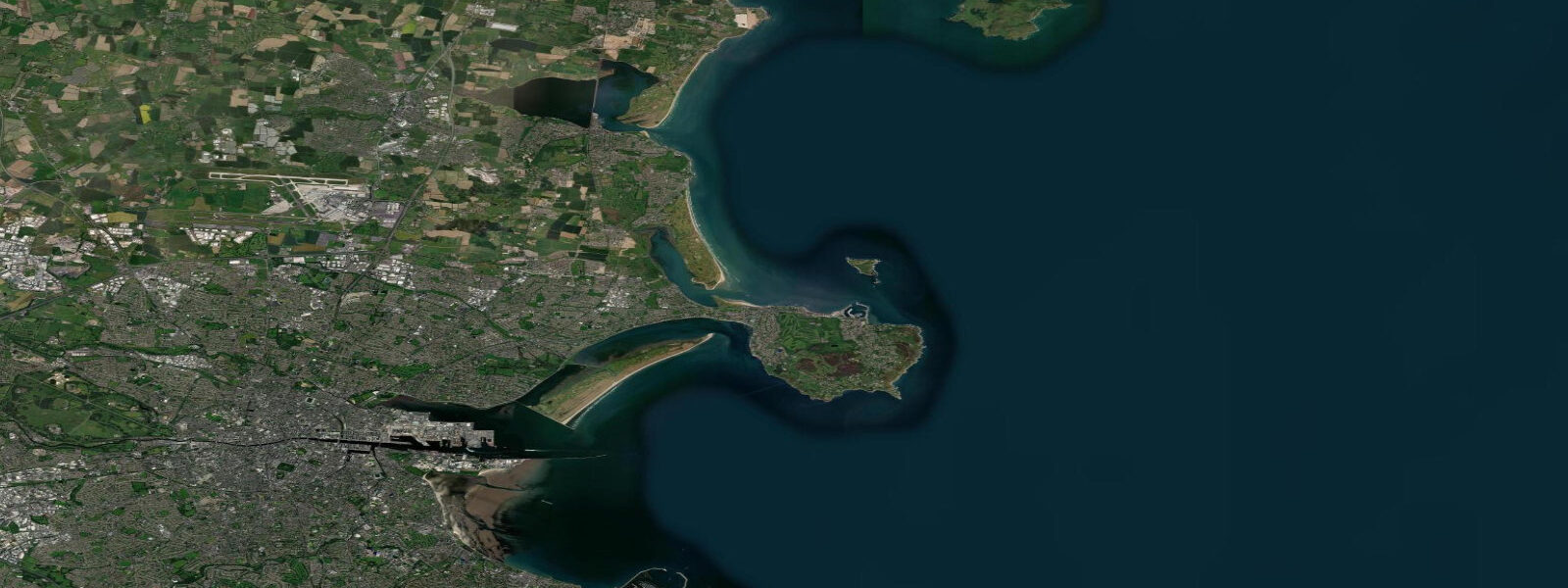
Other spots nearby
The three closest curated TideTurtle locations to Howth, Leinster, measured by great-circle distance.

Today's solunar windows
Solunar tradition: major periods are the ≈3h windows around moon transit and opposition; minor are ≈2h around moonrise and moonset. Pair with the local tide stage and wind for the best read.
Cycle dates near Howth, Leinster
Last spring tide on Fri 19 Jun (range 3.7m). Next neap on Thu 25 Jun.
Spring tides cluster around new and full moons (biggest swings). Neap tides land on quarter moons (smallest swings). See the spring tide and neap tide glossary entries for the why.
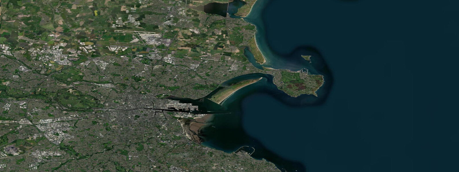
About tides at Howth, Leinster
A short guide to the coastline at Howth, Leinster — geography, sea state, and what the tide is actually doing under your feet.
Howth sits on a peninsula about 15 kilometres north of Dublin city centre, jutting into the Irish Sea like a blunt thumb. It is the dominant headland on the north side of Dublin Bay and the landmark that ships approaching Dublin Harbour have used for orientation for centuries. The Baily Lighthouse at the southeastern tip of the peninsula, built in 1814, marks the bay entrance and remains an active aid to navigation.
The tidal regime here is semidiurnal — two highs and two lows every 24 hours and 50 minutes. Mean spring range at Howth is 3.2 to 4.0 metres, driven by the Atlantic tidal pulse that funnels into the Irish Sea from the south, between Wales and Wexford. The Irish Sea is a relatively enclosed body of water, and its tidal behaviour is shaped by resonance effects: the amplitudes increase significantly toward the northern end (around Belfast Lough) and the southern end (around Carnsore Point). Howth sits in the middle range of this gradient.
The outer harbour shoals substantially at low water. Howth has one of the larger trawler fleets on the east coast — the harbour is active most mornings, with vessels departing on the first hours of the flood and returning before the ebb makes the outer approaches tricky. Anyone planning to meet a returning boat at the quayside, or to launch a RIB from the slipway on the east pier, needs to check the tide tables first. The inner harbour retains water at all states but the outer approaches are where depth becomes critical.
For walkers, the Howth Head cliff circuit is one of the better coastal walks accessible from Dublin. The full loop is approximately 10 kilometres, running above the tidal zone for most of its length, with cliff faces dropping to wave-cut platforms and rocky shelves below. The timing of the walk relative to the tide matters most at two points: the path near Balscadden Bay on the eastern side, and the sections south of the Baily Lighthouse where the path drops closest to the foreshore. At low water, the wave-cut platform is fully exposed — the geology of the quartzite and shale headland is best read from these lower angles. At high water, the same sections have sea washing to within a few metres of the path.
A seal colony occupies the rocks near the Baily Lighthouse at the southeastern tip. Low water gives access from the cliff path to the upper rocks where the seals haul out, though approaching too closely disturbs them. The colony is resident year-round; pup season is late autumn. The lighthouse itself is not open to visitors but the walk along the cliff above it gives clear sightlines to the lighthouse tower and the seal rocks below.
Ireland's Eye is a small uninhabited island 1.5 kilometres north of Howth Harbour. It holds a Martello tower, the ruins of an early Christian church, and a gannet colony on its northern cliffs. A seasonal ferry runs from the east pier — crossing times are short but the swell in the channel between Howth and the island can build quickly on northeasterly wind over tide. The ferry operators judge conditions continuously; the crossing is straightforward on calm days and genuinely rough on easterly blow-ins.
Sea anglers fish from the pier arms and from the rocks around the headland. Bass, pollock, and mackerel are the main targets depending on season. The ebb tide along the south face of the headland creates a productive current edge; the reef off the eastern cliffs holds pollock and wrasse. Kayakers use Howth as a base for the headland circumnavigation — the full circuit requires reading the tidal current through the gap between Howth Head and Ireland's Eye, where spring currents reach 1.5 knots on the ebb.
Photographers working the cliffs get the best light on the wave-cut platform in the two hours either side of low water on a clear morning. The southeast face catches the rising sun; the Baily Lighthouse and the stack rocks just south of it are framed cleanly from the cliff path above.
Tide data for Howth, Leinster comes from the Open-Meteo Marine API, a gridded model product. Timing accuracy is ±45 minutes, height accuracy ±0.3 m — usable for trip planning, not for navigation.
Tide questions about Howth, Leinster
Quick answers to the most common questions about tide times, range, and water access at Howth, Leinster.
What is the tidal range at Howth and why does it matter for the harbour?
Mean spring range at Howth runs 3.2 to 4.0 metres — firmly in the macrotidal category. The outer harbour and its approaches shoal significantly on the ebb, which constrains when trawlers and recreational vessels can safely use the outer pier area. The inner harbour retains water throughout the tidal cycle, but anyone launching from the east pier slipway or meeting a vessel at the outer quay should check that the tide is at or above half-flood before committing to the approach. Low water in the outer harbour leaves exposed shingle and rock that can strand a shallow-draft vessel.
When is the best time to walk the Howth Head cliff circuit?
The cliff walk is accessible at any state of tide for most of its 10-kilometre length, as the path runs well above the foreshore. The most interesting sections are in the two hours either side of low water, when the wave-cut platform below the cliff faces is fully exposed. The geology of the quartzite headland reads best from the low-tide platform angle. The path sections south of the Baily Lighthouse drop closest to sea level — at high spring water these can have splash risk on windy days. Morning light (southeast-facing cliffs) suits photography best.
How do I get to Ireland's Eye from Howth?
The seasonal ferry departs from the east pier of Howth Harbour. Crossing time is roughly 10 minutes each way. The channel between Howth and Ireland's Eye sees tidal current up to 1.5 knots on springs, and northeasterly swell can build quickly in the gap. Ferry operators assess conditions and cancel crossings when sea state makes landing on the island impractical — the island has no pier, just a rock landing. The crossing is reliable in settled summer conditions; plan a backup activity for days with east wind. The island has a Martello tower, early Christian church ruins, and a gannet colony on the northern cliffs.
Where do the seals haul out near Howth?
A resident grey seal colony uses the rocks immediately below the Baily Lighthouse at the southeastern tip of Howth Head. They are visible year-round; the colony is most active in autumn when pupping occurs. Low water gives the best view from the cliff path above, as the hauling rocks are fully exposed. The seals are habituated to walkers on the cliff path but disturb easily if approached on the rocks themselves — stay on the path and use binoculars rather than trying to descend to the platform. Numbers vary but 10 to 30 animals hauled out at once is typical on calm days.
Is sea angling from Howth pier productive, and does the tide affect it?
Howth's pier arms and the rocky ground around the headland produce bass, pollock, and mackerel through the warmer months, with cod and flounder in winter. The ebb tide along the south face of the headland creates a current edge that concentrates baitfish and brings predators up behind them — the two to three hours of the ebb from high water down to mid-tide is consistently the most productive window. The reef structure off the eastern cliffs holds pollock and wrasse on the flood. Pier anglers targeting bass at the harbour mouth find early flood (first two hours) most productive as the tide brings clean water over the shallow sill.
8-day tide table — Howth, Leinster
Heights relative to MSL. Predictions: Open-Meteo Marine (MeteoFrance SMOC, 0.08° grid) — heights relative to MSL (not chart datum / LAT). Model-derived.
| Day | Type | Time | Height |
|---|---|---|---|
| Fri 19 Jun | Low | 01:00 | 1.0m |
| High | 02:45 | 1.6m | |
| Low | 08:28 | -2.2m | |
| Sat 20 Jun | High | 03:36 | 1.4m |
| Low | 09:31 | -2.1m | |
| High | 16:26 | 0.9m | |
| Low | 21:45 | -1.7m | |
| Sun 21 Jun | High | 04:34 | 1.1m |
| Low | 10:39 | -2.1m | |
| High | 17:26 | 0.7m | |
| Low | 22:51 | -1.5m | |
| Mon 22 Jun | High | 05:35 | 1.1m |
| Low | 11:44 | -1.8m | |
| High | 18:25 | 0.8m | |
| Tue 23 Jun | Low | 00:06 | -1.4m |
| High | 06:41 | 0.9m | |
| Low | 12:50 | -1.6m | |
| Wed 24 Jun | High | 07:50 | 0.8m |
| Low | 13:48 | -1.6m | |
| High | 20:35 | 0.7m | |
| Thu 25 Jun | Low | 02:13 | -1.3m |
| High | 08:56 | 0.8m | |
| Low | 14:39 | -1.4m | |
| High | 21:33 | 0.9m | |
| Fri 26 Jun | Low | 00:00 | -0.1m |