Asaluyeh tide times
Asaluyeh tide forecast — heights relative to MSL.
Tide chart for Asaluyeh
24-hour cosine-interpolated curve around the present moment. Heights relative to MSL. Predictions: Predictions: Open-Meteo Marine (MeteoFrance SMOC, 0.08° grid).
Sun, moon and conditions on Fri 03 Jul
Snapshot at build time — refreshes daily. Sea state from Open-Meteo Marine.
Highs and lows next 7 days
Every predicted high and low for the next week, with the daily tidal coefficient (0–120; higher = bigger swing, > 95 means stronger currents).
Other spots nearby
The three closest curated TideTurtle locations to Asaluyeh, measured by great-circle distance.
Today's solunar windows
Solunar tradition: major periods are the ≈3h windows around moon transit and opposition; minor are ≈2h around moonrise and moonset. Pair with the local tide stage and wind for the best read.
About tides at Asaluyeh
A short guide to the coastline at Asaluyeh — geography, sea state, and what the tide is actually doing under your feet.
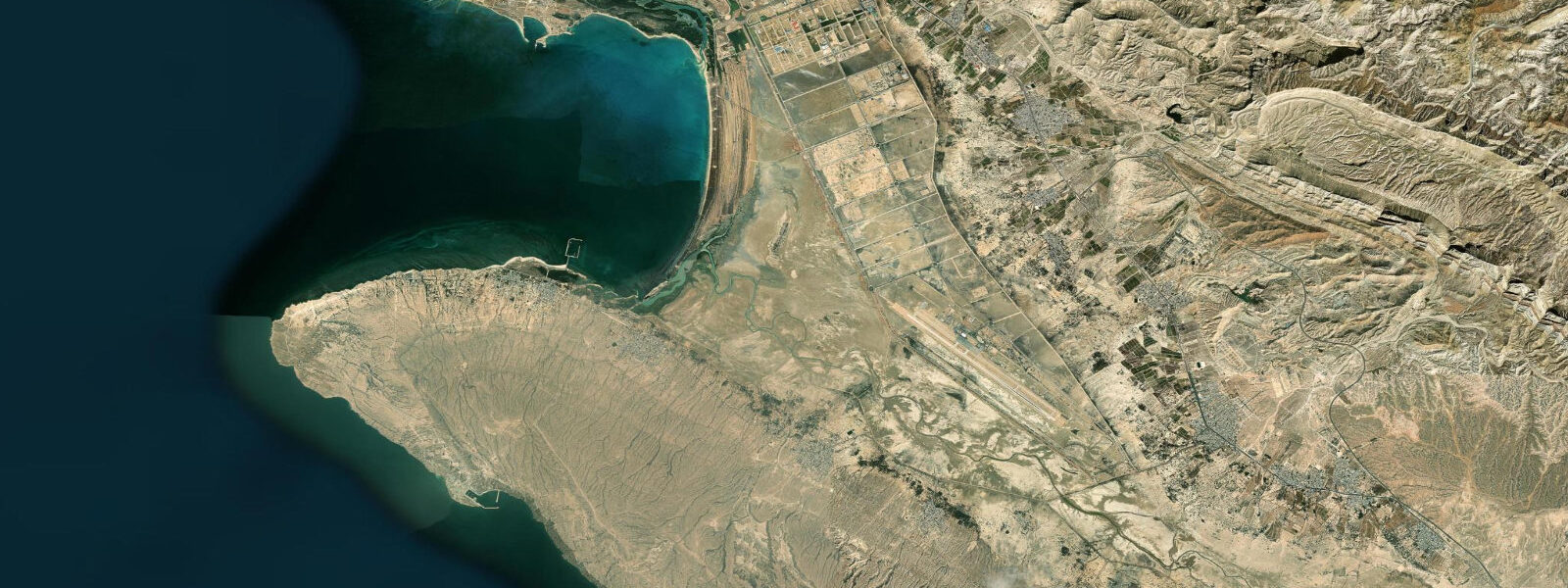
Asaluyeh is a coastal industrial town on the Iranian Gulf coast, the onshore hub for South Pars — the world's largest natural gas field, which Iran shares with Qatar across the maritime boundary (Qatar calls their side North Dome). The coast here is dominated by liquefied natural gas infrastructure: pipelines, processing plants, and offshore platforms visible from shore. This is not a leisure destination in the conventional sense, but the sea itself is real, and the tidal coast south and east of the industrial zone retains the character of the wider southeastern Iranian Gulf coast.
The tidal character at Asaluyeh is semi-diurnal with spring ranges of approximately 1.6-2.2 m — somewhat larger than Bushehr due to the southeastern Gulf's geometry and the increasing influence of open-water tidal dynamics as you approach the Strait of Hormuz. The coast here is a transition zone between the flat shallow western Gulf and the more complex bathymetry of the Hormuz approaches. Offshore depths increase more quickly south of Asaluyeh than north of it, which matters for fishing and diving access.
The water clarity, away from the industrial outfalls and the turbid inner western Gulf, is better than you find at the Bushehr and Kuwait sites. Visibility of 6-10 m in winter is achievable on the natural reef patches east of the industrial zone. The slightly deeper and clearer water supports a different species composition from the inner Gulf: more snapper, job fish, and reef species associated with moderately clear water rather than the turbid northern Gulf assemblage.
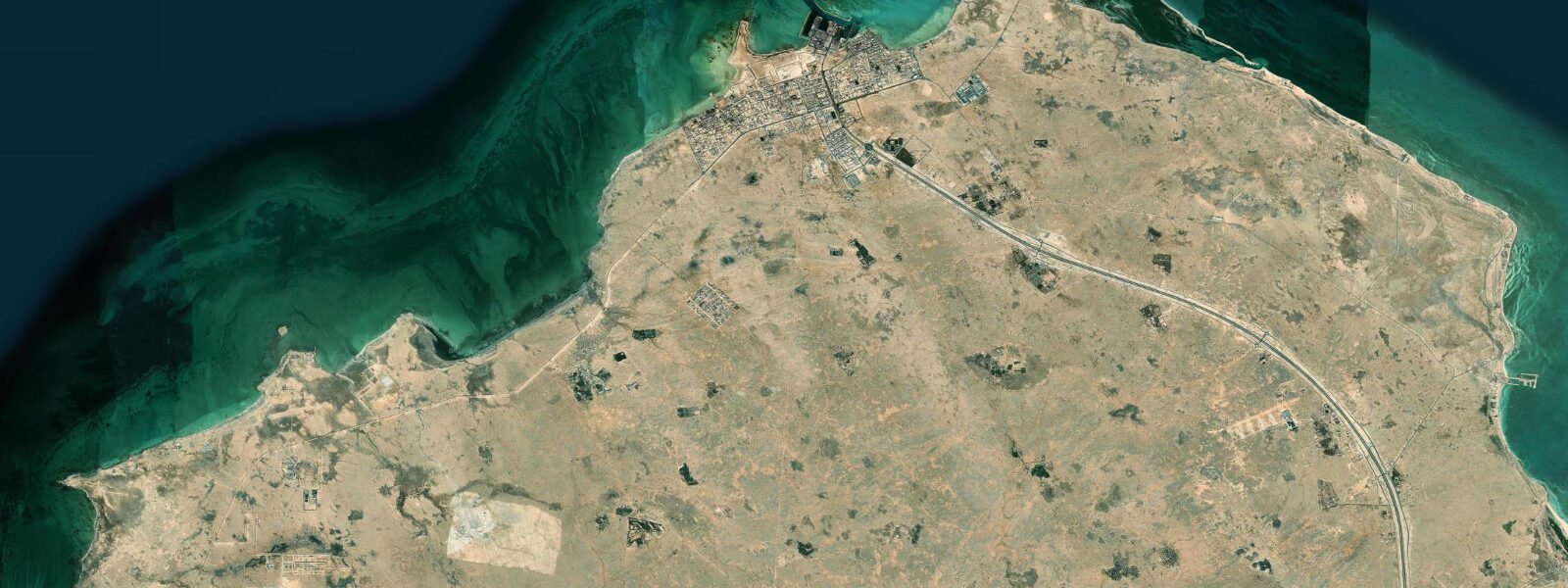
For a coastal visit, the areas of interest are east and west of the industrial zone where the natural coastline is undisturbed. Rocky headlands and small coves with sandy bottom break up the otherwise flat shoreline, and these give access points for shore fishing and snorkelling that are independent of the gas infrastructure. The local fishing community operates largely independently of the industrial complex, working inshore reef areas for hammour, seabream, and snapper from small fibreglass boats.
The Zagros Mountains visible inland — rising steeply from the coastal plain to heights over 3,000 m — give Asaluyeh's coastal setting a visual drama entirely missing from the flat northern Gulf coast. The mountain backdrop and the sea combine in a way that is distinctly different from Kuwait's or Qatar's featureless coastal horizons. In winter, snow on the upper Zagros peaks against a clear blue Gulf sky is a dramatic sight from the shoreline that you would not predict from the region's reputation for flat monotony. The coastal road east of Asaluyeh, where the Zagros meets the sea, is one of the more striking drives on the Iranian coast.
The contrast between the industrial gas infrastructure and the natural coastline immediately adjacent to it is one of the more striking juxtapositions on the Iranian Gulf coast. Pipeline corridors and LNG processing facilities visible to one side; a rocky headland with clear water and reef fish visible to the other. Iran's industrialisation of this coast has been rapid — South Pars development started in earnest in the 1990s — and the natural coastal system persists in the gaps, which is both a testament to the resilience of the Gulf marine environment and a reminder of what was there before the infrastructure arrived. The access road to the coastal sections east of the industrial zone passes through terrain that looks like the edge of the world — flat coastal plain, scrub vegetation, the Zagros wall rising behind, and the Gulf visible ahead — and this journey is part of the Asaluyeh experience rather than just the approach to it. The fishing village east of the industrial zone has a harbour wall that serves as an informal afternoon gathering point for the local community — boats coming in on the evening tide, the day's catch being sorted, and the Zagros light shifting through its colours behind the coastal plain as the sun drops toward the ridge.
Tide questions about Asaluyeh
Quick answers to the most common questions about tide times, range, and water access at Asaluyeh.
What are tides like at Asaluyeh?
Asaluyeh sits in the southeastern Iranian Gulf where tidal range is amplified relative to the inner Gulf. Spring ranges of 1.6-2.2 m are typical; the semi-diurnal pattern persists with two highs and two lows per day. The coast here has a somewhat more complex tidal structure than the flat western Gulf sites, influenced by the deeper water to the south and the coastal geometry of the Zagros-influenced shoreline. Tidal currents over the offshore reef patches and in the small headland-enclosed coves can run noticeably during spring tides. Open-Meteo gridded estimates apply (±45 min, ±0.3 m). The larger tidal range means low tide exposes more reef and rocky bottom than at the inner Gulf sites — a better window for rock-pooling and shore fishing.
Can I visit Asaluyeh for coastal activities?
Asaluyeh town is an industrial settlement primarily serving the South Pars gas operations, and the immediate coastal zone around the industrial facilities has restricted access areas. However, the coastline east and west of the industrial zone is natural and accessible. Iranian domestic visitors use the beaches and fishing spots south and east of town regularly. Foreign visitors need standard Iranian visa arrangements and should note that photography in and around industrial installations is strictly prohibited. The natural coastal sections — rocky headlands, small coves with sandy bottom — are free to access. There is basic food and accommodation in the town. The Zagros mountain backdrop and the combination of sea and mountain scenery make it a more visually interesting coastal stop than most of the flat western Gulf.
What makes Asaluyeh different from other Iranian Gulf sites?
The main differences are geographic and ecological. Asaluyeh is further southeast than Bushehr, which means slightly clearer water as you move away from the turbid inner Gulf, a larger tidal range, and the dramatic Zagros Mountains rising visibly behind the coast — a backdrop that Bushehr and the flat northern Gulf coast lack entirely. The species composition in the fishing catch shifts with the cleaner water: more snapper, job fish, and species associated with moderately clear water and harder bottom. The industrial context is the obvious contrasting element: South Pars dominates the local economy and visible landscape in a way that applies to no other Iranian coastal city. For travellers moving along the coast from Bushehr toward Bandar Abbas, Asaluyeh reveals the industrial-coastal duality of southeastern Iran.
What fishing is available at Asaluyeh?
The natural coastal sections near Asaluyeh have productive fishing on the rocky headlands and reef patches outside the restricted industrial zone. Shore fishing targets hammour (grouper), seabream, and snapper from the exposed rocky points. The slightly clearer and deeper water compared to northern Gulf sites means the species diversity is higher — barracuda, emperor fish, and occasional trevally are caught alongside the reef species. Local fishermen have access to the offshore reef areas via small boats from the coastal villages east of the industrial zone. No formal sport fishing operations are based at Asaluyeh; fishing is done by locals and the occasional Iranian domestic visitor who knows the area. The Southeast Gulf shrimp fishery is commercially important in these waters.
When is the best time to visit the Asaluyeh coast?
October to April is the optimal window. The Iranian Gulf coast at Asaluyeh (27°N latitude) has summers that are hot (35-42°C) but not quite as extreme as the head-of-Gulf sites. Winter temperatures are pleasant — 15-25°C air, 18-22°C water. The Zagros peaks behind the coast hold snow from December-February, giving the most dramatic mountain-and-sea views in this period. Sea conditions are calmest in winter when the Shamal has moderated from its summer intensity. Water clarity is best November-February. Spring (March-April) brings warmer water (22-25°C) and is excellent for fishing and snorkelling on the natural reef patches east of the industrial zone. Summer is technically manageable but the heat makes it the least desirable season for a coastal visit.
0-day tide table — Asaluyeh
Heights relative to MSL. Predictions: Open-Meteo Marine (MeteoFrance SMOC, 0.08° grid) — heights relative to MSL (not chart datum / LAT). Model-derived.
| Day | Type | Time | Height |
|---|