Konarak tide times
Konarak tide forecast — heights relative to MSL.
Today's tide times for Konarak
Tide times at Konarak on Saturday, 4 July 2026: first low tide at 04:33am, first high tide at 11:33am, second low tide at 05:40pm, second high tide at 10:52pm. Sunrise 04:42am, sunset 06:23pm.
Tide chart for Konarak
24-hour cosine-interpolated curve around the present moment. Heights relative to MSL. Predictions: Predictions: Open-Meteo Marine (MeteoFrance SMOC, 0.08° grid).
Sun, moon and conditions on Sat 04 Jul
Snapshot at build time — refreshes daily. Sea state from Open-Meteo Marine.
Highs and lows next 7 days
Every predicted high and low for the next week, with the daily tidal coefficient (0–120; higher = bigger swing, > 95 means stronger currents).
Other spots nearby
The three closest curated TideTurtle locations to Konarak, measured by great-circle distance.
Today's solunar windows
Solunar tradition: major periods are the ≈3h windows around moon transit and opposition; minor are ≈2h around moonrise and moonset. Pair with the local tide stage and wind for the best read.
Cycle dates near Konarak
Last spring tide on Sat 04 Jul (range 2.1m). Next spring tide on Fri 10 Jul (range 2.1m). Next neap on Tue 07 Jul.
Spring tides cluster around new and full moons (biggest swings). Neap tides land on quarter moons (smallest swings). See the spring tide and neap tide glossary entries for the why.
About tides at Konarak
A short guide to the coastline at Konarak — geography, sea state, and what the tide is actually doing under your feet.
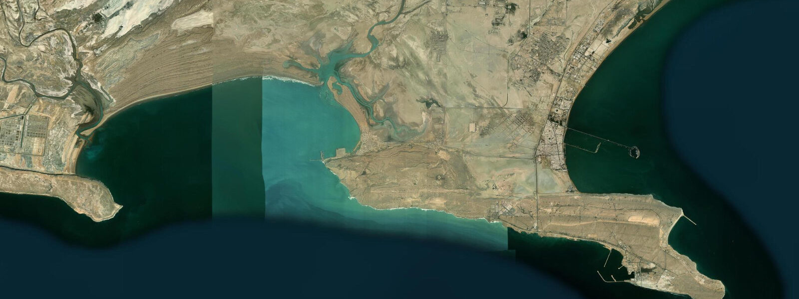
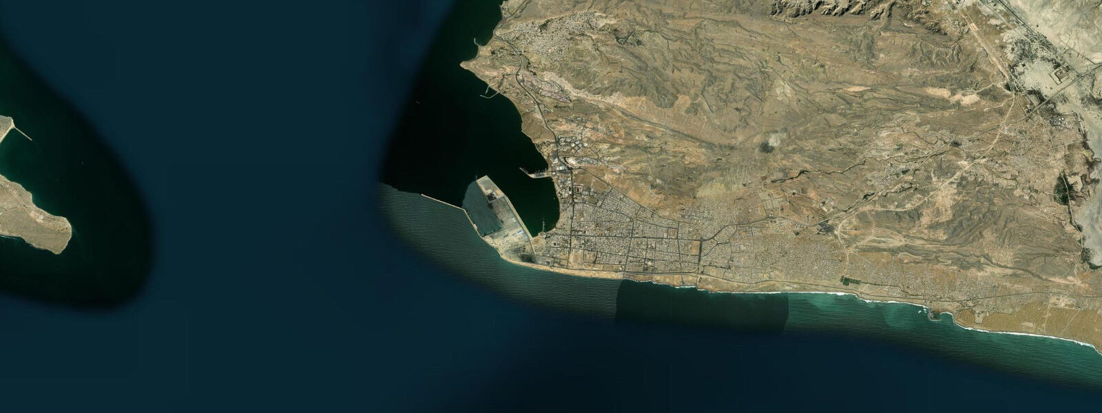
Konarak is a port town and fishing harbour on the Sea of Oman coast of southeastern Iran, approximately 45 kilometres west of Chabahar. It sits at the mouth of a seasonal river (the Konarak River) where the delta has created a sheltered coastal zone that has supported fishing communities for centuries. The harbour has been expanded in recent decades into one of the subsidiary ports of the Chabahar free-trade zone development.
The Makran coast here has the same geological character as the rest of southeastern Iran: uplifted marine terraces, mud-cliffs in shades of pale yellow and tan, beaches of dark coarse sand, and the startlingly clear blue of the Sea of Oman against a desert backdrop. Konarak's position west of Chabahar means it is slightly more sheltered from the northeast monsoon swell than the more exposed eastern sections of the Makran.
Tide predictions for Konarak come from Open-Meteo Marine's global model. Timing accuracy ±45 minutes, height accuracy ±0.2 to 0.3 metres. The Sea of Oman at Konarak has mixed semidiurnal tides with spring range of approximately 2.5 to 3.5 metres. The tidal range is a major factor in the harbour's operational cycles: at low spring tide, the river delta mouth shallows and larger vessels cannot use the inner harbour. The boat landing schedule at Konarak follows the tidal calendar closely.
For anglers, Konarak's harbour is the departure point for day fishing on the Sea of Oman shelf. The 20 to 40 metre depth contour is within 10 kilometres of the coast; grouper, snapper, and kingfish (Indo-Pacific king mackerel) are the main targets. Trolling for kingfish is productive along the colour-change line where river-influenced inshore water meets the clear offshore blue. Chabahar-based fishing tours sometimes use Konarak as an alternative launch point.
The town's market area is the commercial hub of the western Chabahar zone, with a fish market that sells the overnight sardine catch each morning from approximately 05:00 to 08:00. The catch distribution follows the tide: boats returning on the incoming tide in the early morning land at the harbour, and the market peaks within two hours of their arrival.
The Konarak Lighthouse, on the headland west of the harbour, marks the approach to the Chabahar bay system. It is visible from the offshore approach and is a useful navigational reference for boats coming from the west along the Makran coast. The light structure itself, a white tower on the uplifted terrace, is accessible by the coastal track from Konarak town.
The monsoon window applies: the southwest monsoon from June to September brings heavy swells from the Arabian Sea into the Sea of Oman. Konarak's slight western shelter means conditions are marginally more favourable than at Chabahar during transitional months, but the full monsoon season is not a practical time for small-boat activity.
The Konarak River delta that created the sheltered zone behind the town is a seasonal watercourse. For most of the year, the river channel is dry or carries minimal flow; the visible delta morphology dates from past high-discharge events and the slower geological process of coastal sediment redistribution. During the February and March rains in the coastal mountains behind Konarak, brief but intense discharge events carry sediment to the sea and occasionally modify the river mouth configuration. The harbour authority monitors mouth depth after significant rainfall events.
The coastal road west from Konarak toward the port of Bandar Deylam connects the Makran highway to the broader southern Iran transportation network. The road passes through a series of fishing villages, each with its own beach landing and boat fleet, creating a ribbon of coastal community along the base of the Makran coastal range. The mountains rise abruptly from the coast in some sections, leaving barely enough flat land for a road and a row of houses; in other sections, alluvial fans from the mountain streams create wider coastal plains where small-scale agriculture supplements the fishing economy.
The annual Nowruz holiday (Persian New Year, around March 21) brings an influx of visitors from Zahedan and the Sistan plateau to the Makran coast; coastal towns including Konarak see their highest domestic visitor numbers in the 10-day Nowruz period. Accommodation in small coastal towns fills during this period; advance booking or early arrival is recommended if visiting around the new year holiday.
Tide questions about Konarak
Quick answers to the most common questions about tide times, range, and water access at Konarak.
What is the tidal range at Konarak?
Konarak is on the Iranian Makran coast facing the Sea of Oman. Mixed semidiurnal tides with spring range of approximately 2.5 to 3.5 metres — macrotidal for the northwest Indian Ocean region. Neap range is 0.8 to 1.5 metres. Tide predictions here use Open-Meteo Marine's global model, with ±45 minutes timing accuracy and ±0.2 to 0.3 metres height accuracy. The large spring tidal range means the harbour approach shallows significantly at low water; vessels with draft over 1.5 metres should check predicted low-water depths before approaching the inner harbour.
How is Konarak related to the Chabahar free-trade zone?
Chabahar, 45 kilometres to the east, is the main free-trade zone and deep-water port development on the Iranian Makran coast. It has attracted international investment for its strategic position as Iran's only oceanic port (the Persian Gulf ports are in a semi-enclosed sea). Konarak is a subsidiary port in the same coastal corridor, handling some fishing fleet operations and serving as a secondary landing point for the western Chabahar zone. The road link between Konarak and Chabahar is a paved coastal highway; the journey takes 30 to 40 minutes. For travellers, Chabahar is the practical entry point and logistics hub, with Konarak accessible as a day trip.
What is the best time of day to visit Konarak's fish market?
The overnight sardine fleet returns on the incoming tide in the early morning hours. The market peaks between 05:00 and 08:00 as the catch is unloaded and sorted. Arrival before sunrise gives the best combination of activity, cool air temperature, and the early light on the harbour. The kingfish and grouper boats return at various times depending on the day's fishing; larger and more varied catch arrives between 07:00 and 10:00. By mid-morning the main selling activity is complete and the fish hall quietens. The market is most active on days following calm nights; after rough conditions at sea, the fleet may not go out and the market is correspondingly thin.
Is Konarak accessible for foreign tourists?
Konarak is in Sistan and Baluchestan Province, which requires special travel permits for foreign tourists in addition to a standard Iranian visa. The Chabahar free-trade zone has somewhat simplified entry for visitors arriving by sea or air directly to Chabahar; entry overland from other Iranian provinces or from Pakistan requires full provincial permits. Check the current permit requirements with the Iranian consulate in your country before travel planning. Within Chabahar zone, road access to Konarak is straightforward; a local guide or driver with knowledge of current checkpoint procedures is recommended for first-time visitors.
What is the seasonal sea condition at Konarak?
The Sea of Oman has a pronounced monsoon cycle. The southwest monsoon (June through September) drives heavy swells from the Arabian Sea; wave heights of 3 to 5 metres are common during peak monsoon months, and the harbour at Konarak can be rough. Small boats do not operate offshore in this period. October and May are transition months with variable conditions that can include residual monsoon swell. November through April is the settled season: calm to light seas, best fishing conditions, and comfortable air temperatures of 20 to 30°C. January and February are the coldest months, with occasional north wind events bringing temperatures to 15 to 18°C at night.
8-day tide table — Konarak
Heights relative to MSL. Predictions: Open-Meteo Marine (MeteoFrance SMOC, 0.08° grid) — heights relative to MSL (not chart datum / LAT). Model-derived.
| Day | Type | Time | Height |
|---|---|---|---|
| Sat 04 Jul | Low | 04:33 | -0.7m |
| High | 11:33 | 1.4m | |
| Low | 17:40 | 0.0m | |
| High | 22:52 | 0.8m | |
| Sun 05 Jul | Low | 05:06 | -0.6m |
| High | 23:48 | 0.8m | |
| Mon 06 Jul | Low | 05:41 | -0.4m |
| High | 12:28 | 1.3m | |
| Low | 19:09 | -0.2m | |
| Tue 07 Jul | High | 00:48 | 0.7m |
| Low | 19:56 | -0.4m | |
| Wed 08 Jul | High | 02:05 | 0.6m |
| Low | 07:12 | 0.0m | |
| High | 13:37 | 1.2m | |
| Low | 20:56 | -0.6m | |
| Thu 09 Jul | High | 03:36 | 0.7m |
| Low | 08:24 | 0.2m | |
| High | 14:21 | 1.1m | |
| Low | 21:52 | -0.8m | |
| Fri 10 Jul | High | 05:07 | 0.8m |
| Low | 09:48 | 0.3m | |
| High | 15:17 | 1.0m | |
| Low | 22:53 | -1.0m | |
| Sat 11 Jul | High | 02:30 | -0.1m |