Rameswaram, Tamil Nadu tide times
Rameswaram, Tamil Nadu tide forecast — heights relative to MSL.
Today's tide times for Rameswaram, Tamil Nadu
Tide times at Rameswaram, Tamil Nadu on Friday, 19 June 2026: first high tide at 05:30, first low tide at 09:30, second high tide at 16:10. Sunrise 05:53, sunset 18:33.
Tide chart for Rameswaram, Tamil Nadu
24-hour cosine-interpolated curve around the present moment. Heights relative to MSL. Predictions: Predictions: Open-Meteo Marine (MeteoFrance SMOC, 0.08° grid).
Sun, moon and conditions on Fri 19 Jun
Snapshot at build time — refreshes daily. Sea state from Open-Meteo Marine.
Highs and lows next 7 days
Every predicted high and low for the next week, with the daily tidal coefficient (0–120; higher = bigger swing, > 95 means stronger currents).
Other spots nearby
The three closest curated TideTurtle locations to Rameswaram, Tamil Nadu, measured by great-circle distance.
Today's solunar windows
Solunar tradition: major periods are the ≈3h windows around moon transit and opposition; minor are ≈2h around moonrise and moonset. Pair with the local tide stage and wind for the best read.
About tides at Rameswaram, Tamil Nadu
A short guide to the coastline at Rameswaram, Tamil Nadu — geography, sea state, and what the tide is actually doing under your feet.
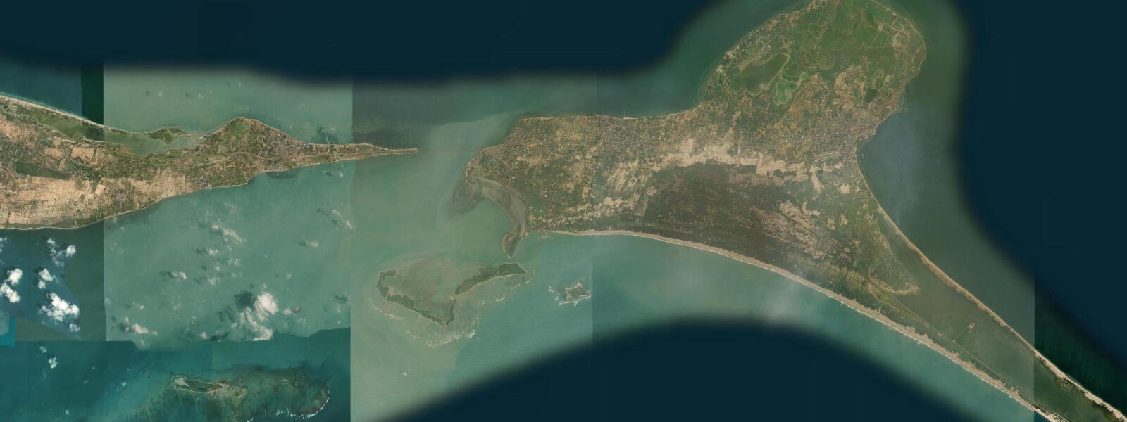
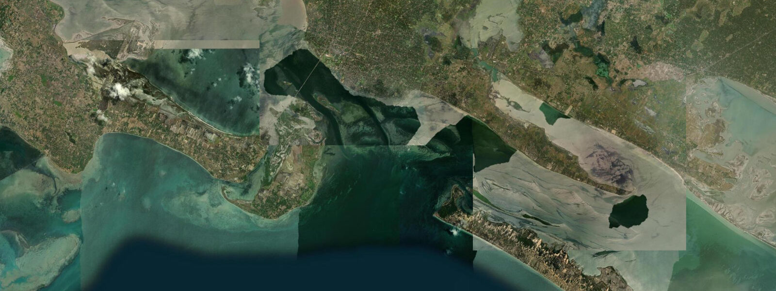
Rameswaram sits at the eastern tip of Pamban Island in the Palk Strait, connected to the Tamil Nadu mainland by two bridges and separated from Sri Lanka by 22 km of shallow water. It is one of the four Char Dham pilgrimage sites in Hinduism and draws millions of visitors each year to the Ramanathaswamy Temple, which dominates the island town. It is also the nearest point in India to Adam's Bridge — the chain of limestone shoals, banks, and small islands that extends toward Sri Lanka along the ancient route from Dhanushkodi.
The Palk Strait has a mixed semidiurnal tidal regime with a mean spring range of 0.5 m to 1.0 m — one of the smallest tidal ranges on the Indian coast. The strait is shallow throughout, rarely exceeding 10 m depth, and this restricted geometry dampens tidal exchange considerably. Two high tides and two low tides occur each day, but the inequality between them is significant: on many days, one of the daily highs is substantially larger than the other. The absolute water level difference between the highest high and the lowest low in a given day can be 0.7–0.9 m on a spring tide.
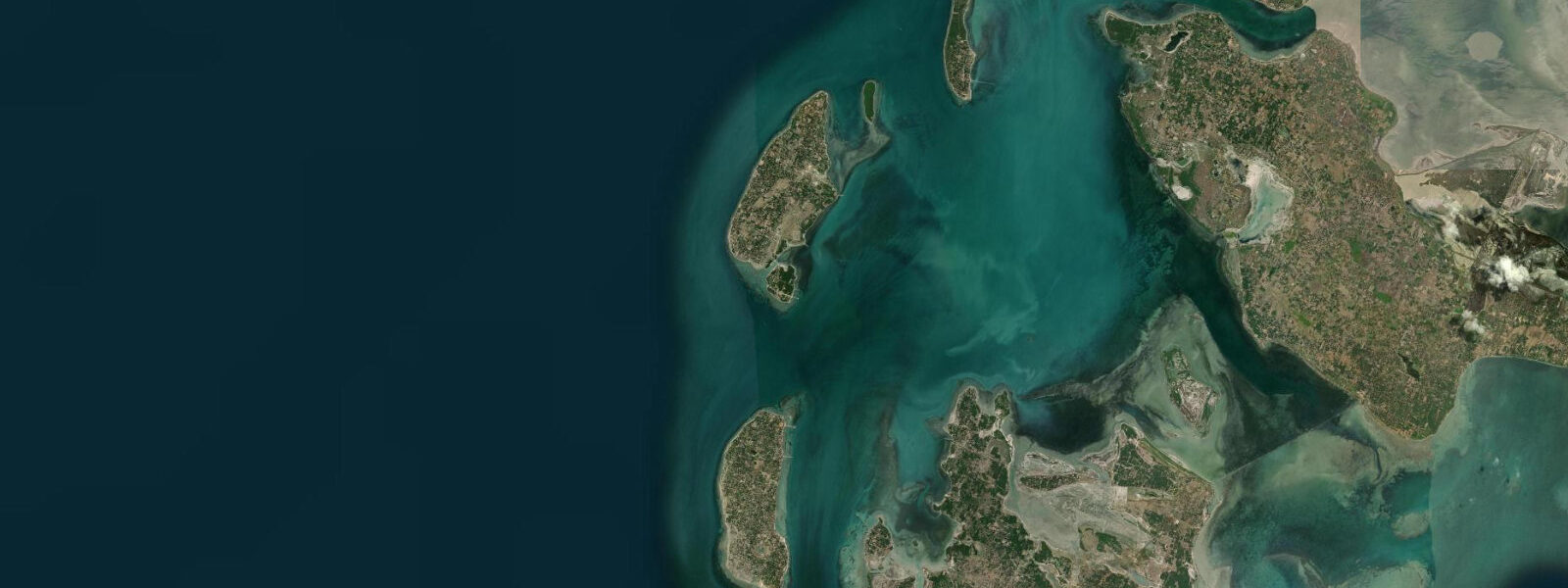
Adam's Bridge is the tidal feature that gives Rameswaram its most dramatic coastal characteristic. The chain of shoals begins at Dhanushkodi at the island's eastern tip and extends for roughly 48 km toward the Sri Lankan coast. The shoals are composed of limestone, coral, and sand, and lie at depths of 0.3 m to 1.0 m in most places. At the very lowest spring tides — when the predicted low-water height falls to its annual minimum — sections of the shoal chain are exposed as dry land or a few centimetres of water over rock and sand. Historically, before the 1480 cyclone that destroyed the original Dhanushkodi town and deepened parts of the channel, the shoal chain was reportedly crossable on foot during extreme low water events. That crossing is not possible today for most of its length, but the visual effect of the chain breaking the surface on a spring low tide is striking from the air or from high ground on Pamban Island.
Dhanushkodi, at the island's eastern tip, is a ghost town — destroyed by the 1964 Rameswaram cyclone, which killed over 200 people including all passengers of a passenger train that was swept off the track. The ruins of the station, church, and residential buildings remain on the sandy point. A road leads out from Rameswaram town to Dhanushkodi, about 18 km. At the tip, Sri Lanka is visible on a clear day 22 km across the strait, and the shoal chain of Adam's Bridge is visible as a lighter blue-green strip of shallow water extending northeast.
The Ramanathaswamy Temple is one of the largest temple complexes in India, with corridors that rank among the longest in the world — the main east-west corridor runs 197 m and the north-south corridors are similarly substantial. The temple's 22 theerthams (sacred wells or tanks) are a central part of the pilgrimage ritual; pilgrims bathe sequentially in each one before entering the main sanctum. The tidal relationship is indirect here — the water in the coastal theerthams is influenced by groundwater and occasional tidal intrusion in the lowest-lying sections of the island, but the temple itself is elevated above tidal reach.
The Pamban Bridge is the engineering landmark that connects Pamban Island to the mainland. The railway bridge, completed in 1914, was the first sea bridge in India and held that status for decades. It includes a bascule section — a rolling-lift drawbridge span that can be raised to allow ships through the channel below. The bascule has been raised only occasionally since construction; the channel is shallow enough that most vessel traffic no longer requires it. The adjacent road bridge, a later addition, carries highway traffic. Trains crossing the rail bridge slow to 10 km/h; the crossing is 2.3 km long and the view across the strait is unobstructed.
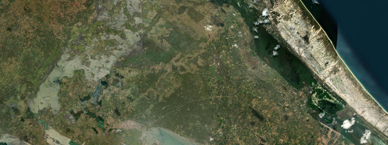
For anglers, the shallow flats of the Palk Strait around Pamban Island are productive ground for cast-netting and line fishing. Indian mackerel, mullet, and various reef fish are caught from the rocky shores of the island's northern and southern coastlines. The low tidal range means fishing access to the rocks and flats is consistent across the tidal cycle — you are not waiting hours for the water to drop enough to reach the productive zone. Local fishing boats operate from the Pamban fishing harbour on the western side of the island.
For beach families, Rameswaram's eastern beaches on the strait side are calmer and shallower than the open-ocean southern shore. The Palk Strait's sheltered geometry keeps wave heights low — typical conditions in the dry season (January–May) are 0.3–0.5 m, making it suitable for children. Water temperature in the strait stays around 27–29 °C year-round.
Tide data for Rameswaram, Tamil Nadu comes from the Open-Meteo Marine API, a gridded model product. Timing accuracy is ±45 minutes, height accuracy ±0.3 m — usable for trip planning, not for navigation.
Tide questions about Rameswaram, Tamil Nadu
Quick answers to the most common questions about tide times, range, and water access at Rameswaram, Tamil Nadu.
What is the tidal range at Rameswaram and the Palk Strait?
The Palk Strait at Rameswaram has one of the smallest tidal ranges on the Indian coast. Mean spring range is 0.5 m to 1.0 m, with significant inequality between the two daily high tides. The strait's shallow depth and restricted geometry limit tidal exchange from the open Bay of Bengal. The difference between the highest and lowest water in a single day rarely exceeds 0.9 m on the biggest spring tides. This low range means water depths over the Adam's Bridge shoals change only marginally through the tidal cycle, though the very lowest spring tides — occurring around new and full moon — produce the minimum water depths over the shoal chain. Heights and timings carry ±45 minutes and ±0.3 m accuracy from the Open-Meteo Marine model.
Can you walk across Adam's Bridge at low tide?
No — walking across Adam's Bridge from India to Sri Lanka is not possible today. The shoal chain lies at 0.3–1.0 m water depth through most of its length, even at the lowest spring tides. Some individual banks or shoal patches may briefly break the surface during the annual minimum low-water events, but there is no continuous dry-land crossing. Historically, before a major cyclone around 1480 that reshaped the channel, the shoals were reportedly shallower and crossing on foot during extreme low water was feasible. Dhanushkodi at the island's tip gives the closest view of the shoal chain — on a clear day the line of lighter, shallower water is visible extending toward Sri Lanka. Sri Lanka itself is 22 km away and visible from the eastern tip on clear days.
What is Dhanushkodi and how do I get there?
Dhanushkodi is the ghost town at the eastern tip of Pamban Island, destroyed in the 1964 Rameswaram cyclone. The ruins of a station, church, post office, and residential buildings remain on the sandy point. It is the nearest point in India to Sri Lanka (22 km) and to the Adam's Bridge shoal chain. A paved road runs from Rameswaram town to Dhanushkodi, about 18 km. Shared jeeps and private vehicles operate the route; the journey takes 30–45 minutes. Private vehicles are not permitted beyond a certain checkpoint — shared vehicles authorised for the route carry visitors the final stretch to the tip. The best light is in the morning; arrive before 09:00 to avoid midday heat and haze over the strait.
What is the Pamban bascule bridge and can I see it in operation?
The Pamban railway bridge (1914) crosses 2.3 km of the Palk Strait between the mainland and Pamban Island. It includes a Scherzer rolling-lift bascule span — a section of track that can be raised to allow ships to pass through the navigation channel below. The bascule was designed for regular use but has been raised only infrequently since construction; the shipping channel has silted and most vessel traffic no longer requires the clearance. As of 2026, scheduled openings are rare — the Indian Railways operates the bridge and the bascule is raised only for specific vessel movements with advance notice. Witnessing a bascule operation requires significant luck or specific trip planning based on vessel schedules. The bridge is visible from the road bridge alongside it, and trains crossing it slow to 10 km/h, making it a good vantage point for the strait.
What is the best time of year to visit Rameswaram?
October through March is the most comfortable period — temperatures run 24–30 °C, the northeast monsoon rains (which arrive October–December) are manageable rather than disruptive, and sea conditions in the Palk Strait are calm. January and February are peak pilgrimage months; the Ramanathaswamy Temple can be extremely crowded, especially during festival periods. April and May are hot (30–38 °C) but the strait is at its calmest for beach and water activities. The southwest monsoon (June–September) brings wind and occasional rough seas on the southern shore of the island, though the strait side stays sheltered. For photography of Adam's Bridge shoals at their most exposed, target the spring low tides occurring around November–January, when the annual minimum water levels coincide with winter clarity.
8-day tide table — Rameswaram, Tamil Nadu
Heights relative to MSL. Predictions: Open-Meteo Marine (MeteoFrance SMOC, 0.08° grid) — heights relative to MSL (not chart datum / LAT). Model-derived.
| Day | Type | Time | Height |
|---|---|---|---|
| Fri 19 Jun | High | 05:30 | 0.6m |
| Low | 09:30 | 0.3m | |
| High | 16:10 | 0.8m | |
| Sat 20 Jun | Low | 23:12 | 0.3m |
| Sun 21 Jun | — | ||
| Mon 22 Jun | High | 06:30 | 0.6m |
| Low | 11:24 | 0.4m | |
| High | 17:30 | 0.7m | |
| Tue 23 Jun | Low | 00:30 | 0.3m |
| High | 07:40 | 0.6m | |
| Wed 24 Jun | Low | 01:24 | 0.3m |
| Thu 25 Jun | High | 10:40 | 0.7m |
| Fri 26 Jun | Low | 03:30 | 0.3m |