Visakhapatnam tide times
Visakhapatnam tide forecast — heights relative to MSL.
Today's tide times for Visakhapatnam
Tide times at Visakhapatnam on Friday, 31 July 2026: first low tide at 15:15. Sunrise 05:35, sunset 18:31.
Tide chart for Visakhapatnam
24-hour cosine-interpolated curve around the present moment. Heights relative to MSL. Predictions: Predictions: Open-Meteo Marine (MeteoFrance SMOC, 0.08° grid).
Sun, moon and conditions on Fri 31 Jul
Snapshot at build time — refreshes daily. Sea state from Open-Meteo Marine.
Highs and lows next 7 days
Every predicted high and low for the next week, with the daily tidal coefficient (0–120; higher = bigger swing, > 95 means stronger currents).
Other spots nearby
The three closest curated TideTurtle locations to Visakhapatnam, measured by great-circle distance.
Today's solunar windows
Solunar tradition: major periods are the ≈3h windows around moon transit and opposition; minor are ≈2h around moonrise and moonset. Pair with the local tide stage and wind for the best read.
Cycle dates near Visakhapatnam
Next spring tide on Sat 01 Aug (range 1.3m). Next neap on Thu 06 Aug.
Spring tides cluster around new and full moons (biggest swings). Neap tides land on quarter moons (smallest swings). See the spring tide and neap tide glossary entries for the why.
About tides at Visakhapatnam
A short guide to the coastline at Visakhapatnam — geography, sea state, and what the tide is actually doing under your feet.
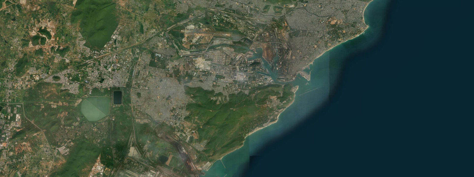
Visakhapatnam — Vizag to almost everyone who lives here — sits on the north Andhra Pradesh coast where the Eastern Ghats come down close to the sea and the Bay of Bengal pushes west into a natural harbour backed by the Kailasa and Dolphin's Nose headlands. The result is one of the few naturally sheltered deepwater anchorages on India's east coast, which is why this has been a working port for two millennia and why it now hosts India's Eastern Naval Command, one of the country's largest commercial ports, and a growing shipbuilding industry. The headlands also mean the city's beaches — Ramakrishna Beach, RK Beach, Rishikonda — face east into the open bay, taking the full fetch of the Bay of Bengal.
The tidal regime is semidiurnal: two high tides and two low tides per day, roughly six hours between each turn. Mean spring range along this coast runs approximately 1.0 to 1.5 m — moderate, in the low mesotidal bracket. The Bay of Bengal here is not a dramatically tidal sea; the range does not transform the visible shoreline the way a 4 m tide does. What it does is set the rhythm for the fishing fleet working out of Visakhapatnam's fishing harbour at Bheemunipatnam and the smaller landing stations along the coast: departure on the outgoing ebb, return on the flood, the boat-handling window at the harbour mouth governed by tide state.
The offshore geography is worth understanding for anyone reading tide times here. The Visakhapatnam Canyon is a deep submarine trench running broadly perpendicular to the coast, an underwater valley that starts just a few kilometres from the shore and drops into abyssal depths well offshore. Submarine canyons influence how oceanic swell propagates into the nearshore — the canyon acts as a waveguide that concentrates energy along its axis, which means that incoming swell from the northeast can arrive with more amplitude along certain approach angles than the surrounding coast would see. This is largely invisible in calm weather but becomes relevant when northeast monsoon swell and cyclone-generated seas are propagating from the same direction.
The cyclone context is the part that any honest tidal resource has to address on this coast. The Bay of Bengal's northern end is statistically one of the most cyclone-active bodies of water in the world. The sea surface temperature stays warm enough to support cyclone intensification late into the season, the funnel shape of the bay concentrates surge energy toward the coast, and the flat deltaic terrain further south offers little natural protection. Visakhapatnam has been hit by significant cyclones multiple times in recent decades — Cyclone Hudhud in October 2014 made landfall almost directly on the city, causing widespread damage and a storm surge that overwhelmed the coastal zone. During a severe cyclone event, sea levels at Visakhapatnam can exceed 3 to 5 m above the predicted astronomical tide: a number that makes the 1.0 to 1.5 m tidal range essentially irrelevant as a planning variable. The India Meteorological Department's cyclone warning system, which issues advisories at 72, 48, 24, and 12 hours before landfall, is the instrument that coastal residents, fishers, and port operators respond to during the active season.
Ramakrishna Beach, the main urban beach running south from the Submarine Museum, is the coast most residents interact with daily: a long east-facing strand with the Kailasa Hills visible to the south and the port cranes on the northern horizon. The beach is busiest in the early morning and evening, when the sea breeze that builds through the afternoon has dropped. Shore fishing from the groynes and rock points here produces queenfish, sardines, and small sharks on the ebb; the local handline fishers know the tidal rhythm as a matter of daily habit. Rishikonda Beach, 15 km north of the city, is a cleaner and less developed alternative with a government beach resort and calmer surf most of the year.
For kayakers and divers, the rocky headlands at Dolphin's Nose and the offshore reef structures near Bheemunipatnam offer the most interesting water. The submarine canyon approach to the coast concentrates both pelagic fish species and nutrient upwelling, which supports the reef life in the nearshore zone. Dive visibility and sea state are best between February and May, after the northeast monsoon has subsided and before the southwest monsoon builds.
Predictions on this page come from Open-Meteo Marine, a gridded global ocean model — typically within plus or minus 45 minutes on timing and 0.2 to 0.3 m on height under normal conditions. These are astronomical tide predictions only. Storm surge is a separate and potentially far larger water-level event that these predictions do not capture. For storm surge warnings and cyclone advisories on this coast, the India Meteorological Department's official bulletins apply. The National Centre for Coastal Research (NCCR) in Chennai publishes tide tables for Andhra Pradesh gauge stations.
Tide questions about Visakhapatnam
Quick answers to the most common questions about tide times, range, and water access at Visakhapatnam.
What is the tidal range at Visakhapatnam?
Mean spring tidal range at Visakhapatnam runs approximately 1.0 to 1.5 m, placing it in the low mesotidal bracket — moderate by global standards. The tide is semidiurnal: two high tides and two low tides per day, roughly six hours between each turn. The range is not dramatic enough to visibly transform the beach width at RK Beach or Rishikonda, but it governs the fishing fleet's departure and arrival windows at the harbour. Spring tides around new and full moons push toward the top of that range; neap tides two weeks later produce a smaller swing. The National Centre for Coastal Research (NCCR) publishes the official tide tables for this coast.
What is storm surge risk at Visakhapatnam, and how does it relate to the tide?
Storm surge is the dominant water-level hazard on this coast and can dwarf the background tidal range. During a severe cyclone — the Bay of Bengal's northern end is one of the most cyclone-active sea areas in the world — surge at Visakhapatnam can reach 3 to 5 m above the predicted tide level. Cyclone Hudhud in October 2014 made near-direct landfall on the city and generated surge that overwhelmed the coastal zone. The astronomical tide prediction on this page does not capture surge. During cyclone season (May to June and September to December), the India Meteorological Department's official cyclone and storm surge advisories are the relevant warning system — not the tide table.
Where do these tide predictions come from?
Open-Meteo Marine, a free gridded global ocean model — model-derived, not a local gauge. Accuracy under normal conditions is typically within plus or minus 45 minutes on timing and 0.2 to 0.3 m on height. These are astronomical tide predictions only and do not account for storm surge, which can add several metres above the predicted level during cyclone events. The National Centre for Coastal Research (NCCR) and the India Meteorological Department (IMD) maintain authoritative tide gauge data and storm surge warnings for the Andhra Pradesh coast.
When is the best season for diving or kayaking near Visakhapatnam?
February through May is the most reliable window: the northeast monsoon swell has eased, the southwest monsoon has not yet built, and the sea is at its calmest. Dive visibility at the nearshore reef structures near Bheemunipatnam and the rocky headlands around Dolphin's Nose is best during this period. Sea kayaking the rocky coast is feasible on calm days within the same window. Both activities need to account for the fishing fleet's movements in and out of the harbour — the fleet uses the tidal ebb and flood to plan departures and returns, so the working harbour approaches are busy at certain tide states. June through September (southwest monsoon) and October through December (northeast monsoon and cyclone season) are poor conditions for recreational water activities.
Is it safe to swim at RK Beach or Rishikonda?
Both beaches are used for swimming year-round by local residents, but neither is uniformly safe in all conditions. The Bay of Bengal coast builds swell rapidly during monsoon onset and during cyclone approach, and the beaches have no permanent lifeguard service across their full length. Rishikonda is generally calmer than RK Beach, which is more exposed to the northeast monsoon fetch. The tidal state matters mainly for identifying rip-current zones that activate on the ebb at certain beach geometries. The IMD publishes high-wave warnings for this coast during the monsoon and cyclone seasons; these are the relevant safety advisories, not the tide table alone. The Submarine Museum area at RK Beach has historically had some lifeguard presence; verify current arrangements locally before swimming outside calm-season conditions.
8-day tide table — Visakhapatnam
Heights relative to MSL. Predictions: Open-Meteo Marine (MeteoFrance SMOC, 0.08° grid) — heights relative to MSL (not chart datum / LAT). Model-derived.
| Day | Type | Time | Height |
|---|---|---|---|
| Fri 31 Jul | Low | 15:15 | -0.0m |
| Sat 01 Aug | High | 09:28 | 1.3m |
| Low | 15:42 | -0.0m | |
| High | 21:38 | 1.1m | |
| Sun 02 Aug | Low | 03:38 | -0.0m |
| High | 09:56 | 1.3m | |
| Low | 16:16 | -0.0m | |
| High | 22:17 | 1.1m | |
| Mon 03 Aug | Low | 04:12 | 0.0m |
| High | 10:25 | 1.2m | |
| Low | 16:44 | -0.0m | |
| High | 22:55 | 1.1m | |
| Tue 04 Aug | Low | 17:23 | 0.0m |
| High | 23:43 | 1.1m | |
| Wed 05 Aug | Low | 05:36 | 0.3m |
| High | 11:36 | 1.1m | |
| Low | 18:10 | 0.1m | |
| Thu 06 Aug | High | 00:38 | 1.0m |
| Low | 06:30 | 0.3m | |
| High | 12:24 | 1.0m | |
| Low | 19:06 | 0.1m | |
| Fri 07 Aug | High | 01:51 | 1.0m |
| Low | 04:30 | 0.7m |