Kakinada, Andhra Pradesh tide times
Kakinada, Andhra Pradesh tide forecast — heights relative to MSL.
Today's tide times for Kakinada, Andhra Pradesh
Tide times at Kakinada, Andhra Pradesh on Friday, 19 June 2026: first low tide at 05:30, first high tide at 11:04, second low tide at 17:37, second high tide at 23:36. Sunrise 05:28, sunset 18:36.
Tide chart for Kakinada, Andhra Pradesh
24-hour cosine-interpolated curve around the present moment. Heights relative to MSL. Predictions: Predictions: Open-Meteo Marine (MeteoFrance SMOC, 0.08° grid).
Sun, moon and conditions on Fri 19 Jun
Snapshot at build time — refreshes daily. Sea state from Open-Meteo Marine.
Highs and lows next 7 days
Every predicted high and low for the next week, with the daily tidal coefficient (0–120; higher = bigger swing, > 95 means stronger currents).
Other spots nearby
The three closest curated TideTurtle locations to Kakinada, Andhra Pradesh, measured by great-circle distance.
Today's solunar windows
Solunar tradition: major periods are the ≈3h windows around moon transit and opposition; minor are ≈2h around moonrise and moonset. Pair with the local tide stage and wind for the best read.
Cycle dates near Kakinada, Andhra Pradesh
Last spring tide on Fri 19 Jun (range 1.2m). Next neap on Wed 24 Jun.
Spring tides cluster around new and full moons (biggest swings). Neap tides land on quarter moons (smallest swings). See the spring tide and neap tide glossary entries for the why.
About tides at Kakinada, Andhra Pradesh
A short guide to the coastline at Kakinada, Andhra Pradesh — geography, sea state, and what the tide is actually doing under your feet.
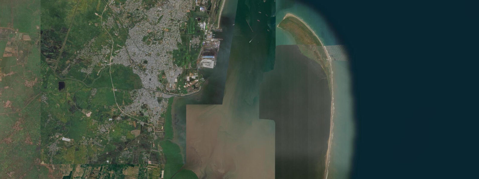
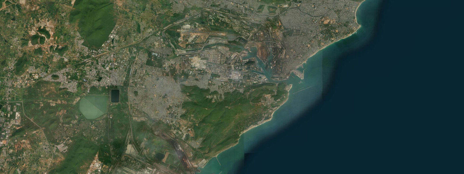
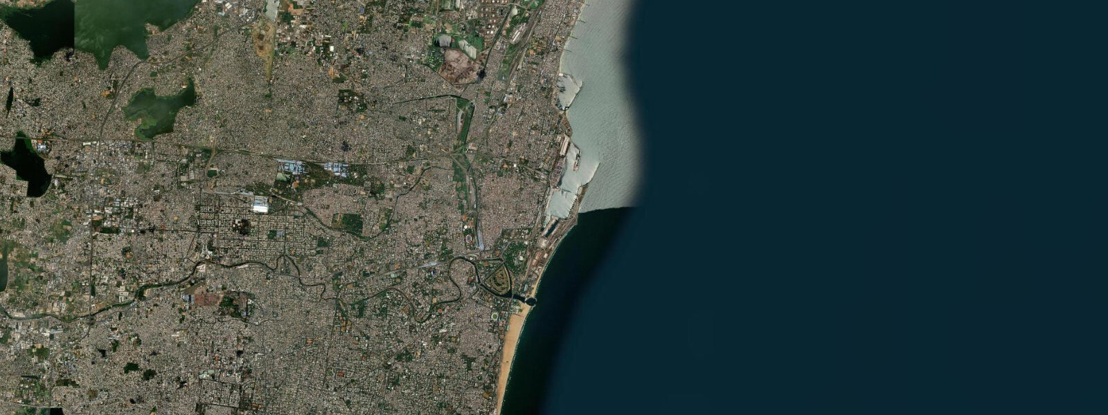
Kakinada sits on the Bay of Bengal coast at the eastern fringe of the Godavari delta, one of India's most productive and ecologically significant river systems. The city is Andhra Pradesh's second-largest port, and the tidal rhythms of Kakinada Bay shape almost every aspect of life along this stretch of coast — from the mechanised trawler fleet to the mangrove corridors that buffer the delta from monsoon storm surge.
The Bay of Bengal produces a semidiurnal tidal pattern here — two high waters and two low waters every 24 hours and 50 minutes. Mean tidal range at Kakinada runs 1.2 to 2.0 m, with the larger ranges during spring tides in the post-monsoon period. Because the bay opens to the south and southwest rather than directly to the open ocean, tidal heights are moderated by comparison with more exposed stretches of the Coromandel Coast. Low water typically exposes 80–120 m of flat sand and mud along the harbour foreshore.
Hope Island is the defining geographic feature of Kakinada Bay. This 25 km barrier spit runs roughly north–south, separating the sheltered bay from the open Bay of Bengal. The harbour entrance sits at Hope Island's southern tip, where the channel maintains enough depth for vessel traffic for roughly 3 hours either side of high water at spring tides. At neap tides, the window is wider but the approach requires more care. Captains of the mechanised trawler fleet know this channel by instinct — most departures happen on the ebb tide in the early hours of the morning, and return runs are timed to catch the evening flood so vessels arrive at the unloading jetty with a favourable current and sufficient water beneath the keel.
The harbour handles a large fleet of mechanised trawlers targeting prawn, croaker, and ribbon fish. The unloading sequence at Kakinada is tide-dependent: boats that miss the evening flood either wait offshore or accept additional harbour dues for a delayed berth. The morning market at Kakinada fish landing centre prices product that came in the previous evening — freshness is pegged directly to tidal timing.
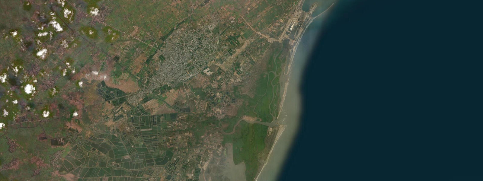
East and south of the harbour, the Godavari delta spreads across roughly 5,700 square kilometres before reaching the sea. The delta's distributary channels — the Vasishta Godavari, Gautami Godavari, and several smaller branches — discharge into the Bay of Bengal across a 70 km front. Tidal influence penetrates the lower reaches of these channels, creating brackish zones that support one of the most extensive mangrove systems in Asia. The Coringa Wildlife Sanctuary, covering approximately 235 square kilometres along the Gautami Godavari estuary southeast of Kakinada, contains around 24 of India's 35 mangrove species. Coringa is typically ranked as India's second-largest mangrove forest by area.
The mangroves function as both nursery habitat for the prawns and fish that sustain Kakinada's fishing economy, and as a physical buffer against cyclone storm surge — a significant function on a coast that sits in the Bay of Bengal cyclone belt. High water in mangrove channels can exceed 2.5 m above low water during spring tides, with additional surge during cyclonic events temporarily pushing levels 1–2 m above the normal high-water mark.
For anglers, Kakinada's estuary system offers productive fishing across most of the tidal cycle. Mud crab are most effectively worked at low water on the mangrove creek edges; barramundi and mullet move into the delta channels on the flood. Shore-based fishing from the Hope Island spit is possible when the channel is calm, though access requires a boat across the bay entrance. The trawler fleet targets deeper-water species offshore, but local boat operators run trips from the harbour for recreational anglers targeting prawns and croaker in the near-shore zone during the flood tide.
Kayakers and canoeists exploring the Coringa mangrove channels should plan their passage carefully. The creek network is extensive but the channels shallow out quickly at low water — a transit through the inner sanctuary needs to be timed to depart with the flood and turn back before the ebb leaves less than 0.5 m of water in the minor channels. The sanctuary entry point near Corur village gives access to the core mangrove area.
The Konaseema region, visible across the Godavari distributaries to the south from Kakinada's harbour waterfront, is a network of delta islands and paddy fields that sits barely above sea level. Coconut palms mark every island boundary; during spring high tides the road banks and bunds that separate paddy from water are easily overtopped. Residents here read the tide tables as much for flood management as for fishing access.
For beach visitors, the area immediately north of the harbour along the Hope Island spit provides the most accessible strand. The beach widens by 60–80 m between high and low water at spring tides — sufficient to find firm sand for a walk during mid-ebb, with the sand returned to water by the following high. The sea temperature along this coast runs 26–29°C for most of the year, dropping to around 23°C in January.
Tide data for Kakinada comes from the Open-Meteo Marine API, a gridded model product. Timing accuracy is ±45 minutes, height accuracy ±0.3 m — usable for trip planning, not for navigation.
Tide questions about Kakinada, Andhra Pradesh
Quick answers to the most common questions about tide times, range, and water access at Kakinada, Andhra Pradesh.
What is the tidal range at Kakinada and when is high water?
Kakinada has a semidiurnal tide — two high waters and two low waters each day. The mean tidal range is 1.2 to 2.0 m, with spring tides reaching the higher end of that range, typically in the post-monsoon months of October and November. High water times shift by roughly 50 minutes later each day. For the current day's tide times, check the tide chart at the top of this page. Open-Meteo model data gives timing accurate to within about 45 minutes and heights to within 0.3 m — adequate for planning a fishing trip or a beach walk, not for precise vessel navigation.
When can fishing boats enter and leave Kakinada harbour?
The main harbour channel at Hope Island's southern tip maintains workable depth for mechanised trawlers for roughly 3 hours either side of high water at spring tides. The mechanised fleet typically departs in the pre-dawn hours on the ebb, running offshore while the tide falls, and times its return to arrive on the evening flood — usually around 17:00 to 19:00 local time — to unload for the morning market. Smaller country boats and catamarans are less tide-sensitive and operate across most of the tidal cycle from the beach alongside the harbour.
Is Coringa Wildlife Sanctuary accessible at low tide?
The mangrove creek network inside Coringa Wildlife Sanctuary is most accessible on a rising or high tide. At low water, minor channels drop to less than 0.5 m depth and navigating by boat becomes difficult or impossible without local knowledge. Plan a visit from the Corur village entry point with a 2-hour window on either side of high water — this gives adequate depth in the inner channels and time to explore the core sanctuary area. The sanctuary is open to visitors with a Forest Department permit; boats are available from Corur. Avoid the monsoon months June through September when the channels run fast and visibility in the mangroves is limited.
What fish and shellfish are caught around Kakinada?
The mechanised trawler fleet targets prawn, ribbon fish, croaker, and pomfret in the near-shore Bay of Bengal. Recreational and subsistence fishing in the estuary channels focuses on mud crab — worked most effectively in the 2–3 hours around low water on mangrove creek edges — along with mullet and barramundi, which enter the delta channels on the flood tide. Shore-based casting from the Hope Island beach produces whiting and small croaker during the ebb. The prawn fishery is seasonal, peaking in the post-monsoon period when the Bay of Bengal near-shore zone is most productive.
What is Hope Island and how does it affect tides in Kakinada Bay?
Hope Island is a 25 km barrier spit that separates Kakinada Bay from the open Bay of Bengal. Its presence shelters the bay and harbour from direct ocean swell, and the narrow channel at the spit's southern tip concentrates tidal flow — creating a short period of strong current during the flood and ebb. The sheltered geometry of the bay moderates tidal range compared to more exposed sections of the Andhra Pradesh coast, producing the 1.2–2.0 m mean range seen at Kakinada rather than the 2–3 m ranges common further south on the Coromandel Coast. The island is accessible by ferry from the harbour for day visits; the beach on its Bay of Bengal side faces open ocean and receives consistent south-easterly swell.
8-day tide table — Kakinada, Andhra Pradesh
Heights relative to MSL. Predictions: Open-Meteo Marine (MeteoFrance SMOC, 0.08° grid) — heights relative to MSL (not chart datum / LAT). Model-derived.
| Day | Type | Time | Height |
|---|---|---|---|
| Fri 19 Jun | Low | 05:30 | 0.1m |
| High | 11:04 | 1.4m | |
| Low | 17:37 | 0.1m | |
| High | 23:36 | 1.0m | |
| Sat 20 Jun | Low | 05:28 | 0.1m |
| High | 11:55 | 1.2m | |
| Low | 18:33 | 0.1m | |
| Sun 21 Jun | High | 00:36 | 0.9m |
| Low | 06:18 | 0.3m | |
| High | 12:42 | 1.1m | |
| Low | 19:20 | 0.2m | |
| Mon 22 Jun | High | 01:37 | 0.9m |
| Low | 07:25 | 0.3m | |
| High | 13:37 | 1.0m | |
| Low | 20:13 | 0.2m | |
| Tue 23 Jun | High | 02:42 | 0.8m |
| Low | 08:33 | 0.4m | |
| High | 14:26 | 0.9m | |
| Low | 21:12 | 0.2m | |
| Wed 24 Jun | High | 03:51 | 0.9m |
| Low | 09:50 | 0.4m | |
| High | 15:34 | 0.8m | |
| Low | 22:07 | 0.2m | |
| Thu 25 Jun | — | ||
| Fri 26 Jun | High | 04:30 | 0.9m |