Savannah Bight, Guanaja tide times
Savannah Bight, Guanaja tide forecast — heights relative to MSL.
Today's tide times for Savannah Bight, Guanaja
Tide times at Savannah Bight, Guanaja on Friday, 3 July 2026: first low tide at 06:00pm, first high tide at 11:10pm. Sunrise 05:15am, sunset 06:20pm.
Tide chart for Savannah Bight, Guanaja
24-hour cosine-interpolated curve around the present moment. Heights relative to MSL. Predictions: Predictions: Open-Meteo Marine (MeteoFrance SMOC, 0.08° grid).
Sun, moon and conditions on Fri 03 Jul
Snapshot at build time — refreshes daily. Sea state from Open-Meteo Marine.
Highs and lows next 7 days
Every predicted high and low for the next week, with the daily tidal coefficient (0–120; higher = bigger swing, > 95 means stronger currents).
Other spots nearby
The three closest curated TideTurtle locations to Savannah Bight, Guanaja, measured by great-circle distance.
Today's solunar windows
Solunar tradition: major periods are the ≈3h windows around moon transit and opposition; minor are ≈2h around moonrise and moonset. Pair with the local tide stage and wind for the best read.
About tides at Savannah Bight, Guanaja
A short guide to the coastline at Savannah Bight, Guanaja — geography, sea state, and what the tide is actually doing under your feet.
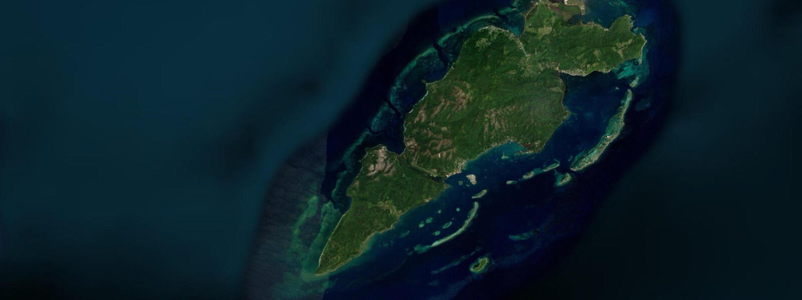
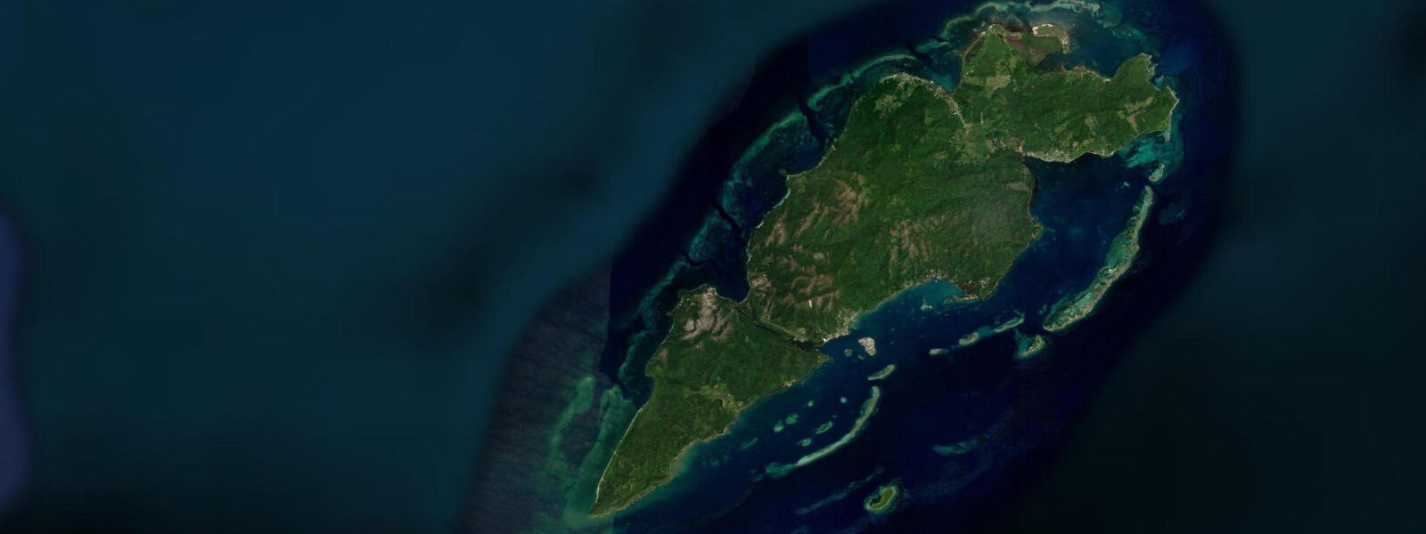
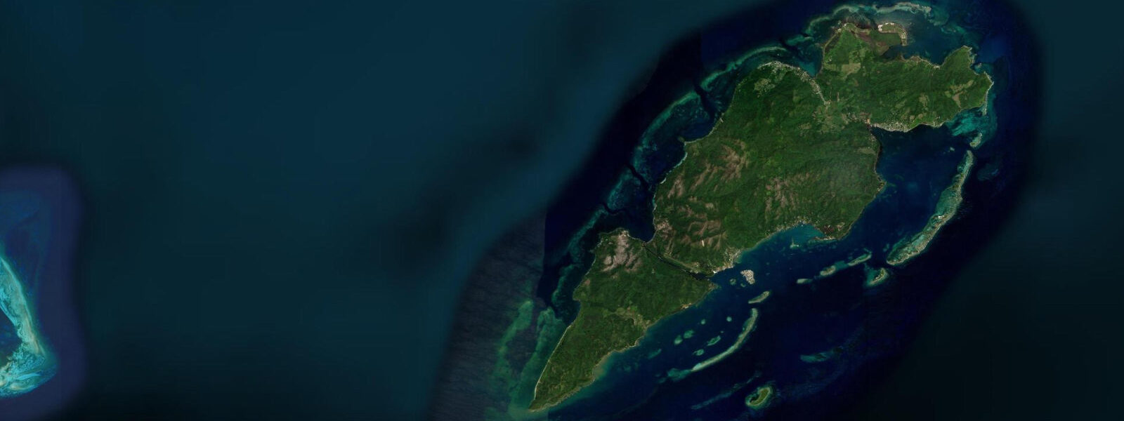
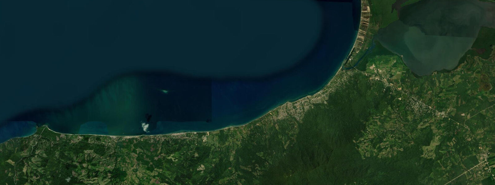
Savannah Bight sits on the eastern flank of Guanaja, the easternmost of Honduras's Bay Islands, accessible only by water taxi or private boat — there are no roads on the island. The village clusters around a protected embayment backed by steep pine-forested hills, with wooden houses on stilts extending over the shallows. The dock in front of the main settlement is the pulse point of daily life: fishing pangas return in the early morning, supplies arrive from the mainland by weekly freighter, and the water taxis that connect Savannah Bight to Bonacca (the main commercial island a few kilometres west) run through the afternoon.
The tidal pattern here is microtidal and mixed semidiurnal. Open-Meteo Marine provides the forecast data — accuracy is ±45 minutes on timing, ±0.2–0.3 m on height. Spring tidal range sits between 20 and 50 cm. That small range means water depth changes slowly and predictably, which matters most for kayakers and shallow-draft boat operators navigating the reef shallows east of the bight.
For anglers, the reef edge offshore drops from 3–5 m to 20 m within a short run from the dock. Snappers and grouper hold the drop; jack crevalle and barracuda follow the reef perimeter. The best fishing effort concentrates in the two hours before and after the higher low water, when bait fish stack against the reef wall. Bring your own gear — there are no tackle shops in the village.
Paddlers launching from the beach at Savannah Bight can work the eastern coastline of Guanaja with relative confidence. The Caribbean swell wraps around the eastern point but stays manageable outside of northers (November through March). The mangrove-fringed inlets north of the bight offer flat-water paddling, wildlife observation, and shade. Sea kayakers circumnavigating Guanaja typically overnight at Savannah Bight to stage the easternmost leg of the route.
Beach families will find calm, clear water inside the bight, with a sandy bottom and minimal boat traffic. The coral fringing the outer edge of the anchorage is within snorkelling distance from shore — mask, fins, and snorkel are worth packing from the mainland. Water temperature holds around 27–29°C year-round.
Photographers get the best light in the two hours after sunrise, when the pine hills behind the village catch warm light and the reflections in the still bight are sharp. The morning panga arrivals make for strong documentary images. At dusk, the silhouette of the ridge behind the settlement is clean against the eastern sky.
Tide timing note: the forecast reflects conditions at the sea surface off the east coast of Guanaja. Reef gaps and the narrow cuts between the island's outer cays will experience slightly faster tidal flow than the open bight, so allow extra margin when transiting shallow passages on a falling tide.
Tide questions about Savannah Bight, Guanaja
Quick answers to the most common questions about tide times, range, and water access at Savannah Bight, Guanaja.
How do I get to Savannah Bight from the mainland?
Most travellers fly from La Ceiba to Guanaja's small airstrip on the western side of the island, then take a water taxi east to Savannah Bight — the crossing takes around 20 minutes. Alternatively, a weekly ferry connects La Ceiba to Bonacca; from Bonacca, water taxis reach Savannah Bight in 15–20 minutes. There are no roads on Guanaja, so all movement between settlements is by boat. Confirm water taxi schedules locally as they vary by season and demand. Tidal state rarely affects the water taxi route under normal conditions.
What is the tidal range at Savannah Bight and does it affect reef access?
Spring tidal range is 20–50 cm — microtidal by global standards. The small range means reef shallows don't drain dramatically at low water, but the shallowest coral heads and sand flats do become exposed or very shallow at lower low water. Snorkellers should check the forecast before paddling out over the reef flat directly east of the bight. Tidal data comes from Open-Meteo Marine with ±45-minute timing accuracy and ±0.2–0.3 m height accuracy. The best snorkelling window is the two hours either side of the higher high water, when the reef flat has maximum cover.
What fish species are caught from Savannah Bight?
The reef edge directly east of the bight holds red snapper, yellowtail snapper, Nassau grouper (check current regulations — Nassau grouper is a protected species in Honduras during spawning periods), and mutton snapper. Pelagic species including barracuda, jack crevalle, and occasional Spanish mackerel patrol the deeper reef perimeter. Trolling along the drop from a panga is the standard local method. Fishing pressure is low compared to the more visited reefs around Utila and Roatán, which means fish populations are relatively healthy. No tackle or bait shops operate in the village — come fully equipped.
When do northers affect Savannah Bight?
Northers — cold fronts pushing south from North America — are the main weather hazard from November through March. They arrive with 2–4 hours warning as cloud builds to the north, wind shifts rapidly to the north or northeast, and seas build quickly. The bight itself offers some protection but the eastern exposure means swell wraps in. Water taxis and small pangas may be grounded for 12–36 hours during a strong norther. Check the 48-hour marine forecast before any open-water crossing and have a flexible schedule if travelling between November and March.
Is there accommodation in Savannah Bight?
Accommodation is basic and limited — a small number of guesthouses and locally run lodges operate in and near the village. Advance booking via phone or through Bay Islands tour operators on the mainland is recommended in the December–April high season. There are no large hotels or resort facilities. Most visitors use Savannah Bight as a base for reef diving, fishing, and kayaking rather than a beach resort destination. The dive sites off the eastern wall of Guanaja are among the least crowded in the Bay Islands and attract serious divers willing to accept the minimal amenity trade-off.
8-day tide table — Savannah Bight, Guanaja
Heights relative to MSL. Predictions: Open-Meteo Marine (MeteoFrance SMOC, 0.08° grid) — heights relative to MSL (not chart datum / LAT). Model-derived.
| Day | Type | Time | Height |
|---|---|---|---|
| Fri 03 Jul | Low | 18:00 | 0.0m |
| High | 23:10 | 0.1m | |
| Sat 04 Jul | Low | 17:00 | 0.0m |
| Sun 05 Jul | High | 00:00 | 0.1m |
| Low | 18:50 | 0.0m | |
| Mon 06 Jul | — | ||
| Tue 07 Jul | High | 15:10 | 0.1m |
| Low | 21:00 | 0.0m | |
| Wed 08 Jul | High | 02:00 | 0.1m |
| Low | 09:10 | -0.1m | |
| Thu 09 Jul | High | 03:10 | 0.1m |
| Low | 10:10 | -0.1m | |
| Fri 10 Jul | High | 04:10 | 0.1m |
| Low | 11:00 | -0.1m | |
| High | 17:00 | 0.2m | |