Ritidian Point tide times
Ritidian Point tide forecast — heights relative to MSL.
Today's tide times for Ritidian Point
Tide times at Ritidian Point on Saturday, 27 June 2026: first high tide at 10:00am. Sunrise 05:55am, sunset 06:51pm.
Tide chart for Ritidian Point
24-hour cosine-interpolated curve around the present moment. Heights relative to MSL. Predictions: Predictions: Open-Meteo Marine (MeteoFrance SMOC, 0.08° grid).
Sun, moon and conditions on Sat 27 Jun
Snapshot at build time — refreshes daily. Sea state from Open-Meteo Marine.
Highs and lows next 7 days
Every predicted high and low for the next week, with the daily tidal coefficient (0–120; higher = bigger swing, > 95 means stronger currents).
Other spots nearby
The three closest curated TideTurtle locations to Ritidian Point, measured by great-circle distance.
Today's solunar windows
Solunar tradition: major periods are the ≈3h windows around moon transit and opposition; minor are ≈2h around moonrise and moonset. Pair with the local tide stage and wind for the best read.
Cycle dates near Ritidian Point
Next spring tide on Thu 02 Jul (range 0.8m). Next neap on Sun 28 Jun.
Spring tides cluster around new and full moons (biggest swings). Neap tides land on quarter moons (smallest swings). See the spring tide and neap tide glossary entries for the why.
About tides at Ritidian Point
A short guide to the coastline at Ritidian Point — geography, sea state, and what the tide is actually doing under your feet.
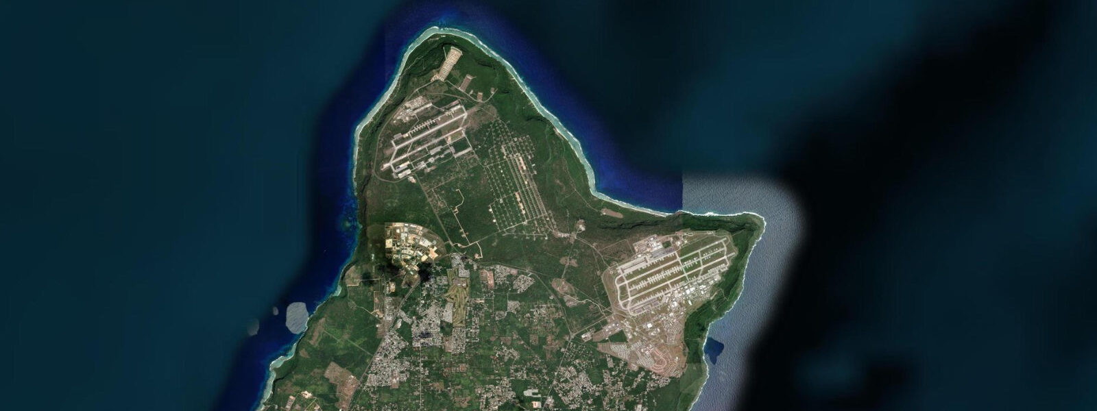
Ritidian Point is the northernmost tip of Guam — a US Fish & Wildlife Service refuge covering 250 hectares of limestone forest, white sand beach, and offshore reef. The point faces north and northeast into the open Pacific; there are no resort hotels, no jet ski rentals, and no restaurants. What Ritidian has is one of Guam's least-disturbed coral reef systems, a documented nesting beach for the critically endangered hawksbill turtle, a population of the Guam kingfisher (believed extinct in the wild, captive birds are slowly being reintroduced), and a set of ancient latte stone sites in the forest behind the beach.
The tidal conditions at Ritidian follow Guam's mixed semidiurnal signal with a spring range of 0.5–0.7 m. The exposure here is different from the protected western bays: Ritidian faces north-northeast into the prevailing NE trade-wind swell. Even on moderate trade days the beach sees 0.5–0.8 m of shore break, and at spring lower-low water the extensive reef flat north of the point — extending 200–300 m from shore before the reef edge — is exposed to 0.1–0.3 m depth. This is prime territory for shore anglers willing to wade the flat to the reef crest.
The reef flat at Ritidian is ecologically significant. It is one of the most intact reef-flat systems on Guam's northern coast, protected from fishing pressure and anchor damage by the Wildlife Refuge status. The coral coverage and fish density on this flat exceed anything accessible from Tumon Bay. Snorkellers and free-divers who visit at high water — when the flat is covered to 0.8–1.2 m and the outer reef slope drops to 5–15 m — encounter reef fish populations noticeably denser than at resort-adjacent sites.
For anglers, Ritidian's reef flat at spring lower-low is the opportunity. The 45–60 minute window when the flat is at its shallowest allows anglers to wade to the outer reef crest and fish the surge zone with lures or live bait. Giant trevally of 5–15 kg cruise the outer edge of this flat on the flood; bonefish work the sandy pockets between coral heads on the flat surface during the low-water window. This is specialist fishing — the access requires correct timing, wading ability, and respect for the refuge regulations (check current USFWS permit requirements before fishing; some sections of the refuge may require permits).
For photographers, Ritidian has two distinct visual environments. The beach itself — white sand, backed by limestone cliff and forest — gives a foreground for the dramatic reef and swell composition that the resort beaches further south cannot replicate. Dawn from the beach at Ritidian, when the sun rises directly behind the reef crest from the northeast, lights the breaking swell from behind with a backlit spray effect. This shot requires being on the beach at 05:50 in summer and 06:20 in winter. Low-water mornings extend the reef-flat foreground into the frame.
The latte stone sites in the forest behind the beach are archaeological features — stone pillar foundations of pre-contact Chamorro structures, their mushroom-cap capstones (tasa) still in place at the best-preserved sites at Ritidian. These are not managed tourist sites with signs and paths; they are authentic in-situ features in secondary forest. A USFWS permit is required to visit the refuge; the Fish & Wildlife office in Mangilao manages access. Entry is from the main gate off Marine Corps Drive.
For wildlife observers, the hawksbill turtle nesting season at Ritidian runs June through October, with individual nests scattered along the beach above the high-water line. Female turtles come ashore at night, typically on the high-water falling phase — the receding tide in the hours after high water provides sufficient depth for approach and a lower-energy exit. Observers must maintain 50 m distance from nesting turtles; flash photography is prohibited.
Swimming at Ritidian is possible at high water in the cove section where the beach meets the reef at the east end. At lower-water states the entry over the reef flat requires wading 50–100 m before reaching swimmable depth. The NE trade-wind swell creates a shore break that is manageable at 0.3–0.5 m but becomes uncomfortable above 0.8 m. The USFWS refuge hours restrict access; the beach is closed at dusk regardless of tidal state.
All tide predictions for Ritidian Point come from the Open-Meteo Marine gridded model. Timing accuracy is ±45 minutes; height accuracy is ±0.3 m above Chart Datum.
Tide questions about Ritidian Point
Quick answers to the most common questions about tide times, range, and water access at Ritidian Point.
What is the tidal range at Ritidian Point and how does it affect the reef flat?
Ritidian has a mixed semidiurnal spring range of 0.5–0.7 m. At spring lower-low water, the extensive reef flat north of the point shallows to 0.1–0.3 m over a 200–300 m wide area — accessible to wading anglers and wildlife observers. At spring high water the same flat has 0.8–1.2 m of cover, suitable for snorkelling over the intact coral. The diurnal inequality on Guam means one of the two daily lows produces this deep flat exposure and the other may not — check the specific day's tide curve for the lower-low water time. Model predictions carry ±45 minutes timing and ±0.3 m height uncertainty; build that margin into flat-wading timing to avoid being caught by a quicker-than-predicted flood.
Do you need a permit to visit Ritidian Point, and what are the access rules?
Yes. Ritidian Point is within the Guam National Wildlife Refuge managed by the US Fish and Wildlife Service. A permit is required to enter; applications are managed through the USFWS Guam office in Mangilao. The refuge is open during daylight hours only — access closes at dusk regardless of tidal state. Fishing within some sections may require separate permits; check current USFWS guidance before planning a fishing visit. The hawksbill turtle nesting beach is subject to additional restrictions June–October: 50 m minimum distance from nesting turtles, no flash photography, and no artificial lighting near the beach at night.
When do hawksbill turtles nest at Ritidian and how does the tide affect their activity?
Hawksbill nesting at Ritidian runs June through October. Females come ashore at night, most frequently in the hours after high water — the falling tide from the high-water peak provides sufficient approach depth and the receding water eases the exit after nesting. Clutch size is typically 130–180 eggs per nest; incubation takes 60 days at Guam's sand temperatures. Hatchlings emerge at night approximately 60 days after laying and orient to the sea using natural light gradients. Artificial lighting from vehicles or observers disrupts this orientation — all artificial light near the nesting beach is prohibited. The USFWS monitors nest sites; contact the refuge office for the current nesting-season visitor protocol.
What fishing is possible at Ritidian and what are the best tidal conditions?
Ritidian's reef flat at spring lower-low is one of Guam's best shore-fishing environments. The 45–60 minute window when the flat is shallowest allows wading to the outer reef crest, where giant trevally of 5–15 kg work the surge zone. Bonefish use sandy pockets on the flat surface during the low-water window; catching them on fly or light spinning gear requires a slow, quiet wading approach — the flat is clear enough that fish see the angler. The flood brings trevally back over the reef edge and makes the outer 50 m fish productively. All fishing at Ritidian is subject to USFWS permit requirements — confirm current rules before visiting.
When is the best time to photograph the reef and dawn light at Ritidian?
Ritidian faces northeast, and the sun rises roughly over the reef crest in the early morning. The backlit swell photography window — when the sun clears the horizon behind the breaking waves — is narrow: 05:50–07:00 in summer (June) and 06:20–07:30 in winter (December). A spring lower-low that falls in this window extends the reef flat into the frame, adding foreground texture and tide-pool reflections. The latte stone site in the forest behind the beach photographs best in the mid-morning (09:00–11:00) when the forest canopy gaps allow shafted light onto the stones without deep shadow. Bring a tripod for the latte stones — the forest light requires 1/30 s or slower without high ISO.
8-day tide table — Ritidian Point
Heights relative to MSL. Predictions: Open-Meteo Marine (MeteoFrance SMOC, 0.08° grid) — heights relative to MSL (not chart datum / LAT). Model-derived.
| Day | Type | Time | Height |
|---|---|---|---|
| Sat 27 Jun | High | 10:00 | 0.5m |
| Sun 28 Jun | Low | 12:12 | 0.4m |
| Mon 29 Jun | High | 05:00 | 1.1m |
| Low | 13:00 | 0.3m | |
| High | 20:50 | 1.1m | |
| Tue 30 Jun | Low | 13:38 | 0.3m |
| High | 21:18 | 1.1m | |
| Wed 01 Jul | Low | 14:12 | 0.3m |
| High | 22:00 | 1.1m | |
| Thu 02 Jul | Low | 02:45 | 0.9m |
| High | 06:45 | 1.1m | |
| Low | 14:47 | 0.3m | |
| High | 22:45 | 1.1m | |
| Fri 03 Jul | Low | 15:20 | 0.4m |
| High | 23:06 | 1.1m | |
| Sat 04 Jul | Low | 04:10 | 0.9m |
| High | 08:15 | 1.0m |