Anloga tide times
Anloga tide forecast — heights relative to MSL.
Today's tide times for Anloga
Tide times at Anloga on Saturday, 4 July 2026: first low tide at 12:00am, first high tide at 06:10am, second low tide at 11:53am, second high tide at 05:40pm. Sunrise 05:47am, sunset 06:14pm.
Tide chart for Anloga
24-hour cosine-interpolated curve around the present moment. Heights relative to MSL. Predictions: Predictions: Open-Meteo Marine (MeteoFrance SMOC, 0.08° grid).
Sun, moon and conditions on Sat 04 Jul
Snapshot at build time — refreshes daily. Sea state from Open-Meteo Marine.
Highs and lows next 7 days
Every predicted high and low for the next week, with the daily tidal coefficient (0–120; higher = bigger swing, > 95 means stronger currents).
Other spots nearby
The three closest curated TideTurtle locations to Anloga, measured by great-circle distance.
Today's solunar windows
Solunar tradition: major periods are the ≈3h windows around moon transit and opposition; minor are ≈2h around moonrise and moonset. Pair with the local tide stage and wind for the best read.
Cycle dates near Anloga
Last spring tide on Sat 04 Jul (range 1.2m). Next spring tide on Fri 10 Jul (range 1.1m). Next neap on Tue 07 Jul.
Spring tides cluster around new and full moons (biggest swings). Neap tides land on quarter moons (smallest swings). See the spring tide and neap tide glossary entries for the why.
About tides at Anloga
A short guide to the coastline at Anloga — geography, sea state, and what the tide is actually doing under your feet.
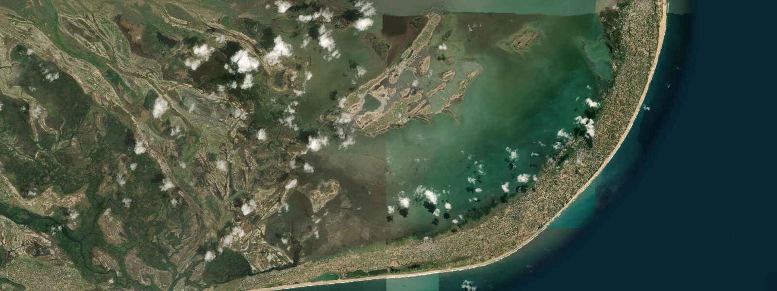
Anloga is a coastal town on the eastern edge of the Keta Lagoon, roughly 15 kilometres west of Keta along the narrow strip of land that separates the lagoon from the Atlantic. The town is the cultural and commercial centre of the Anlo Ewe people and the heart of Ghana's shallot-farming industry: the sandy, salt-tolerant soils of the Keta strip support intensive shallot cultivation, and Anloga's market is the main trading point for the crop across eastern Ghana.
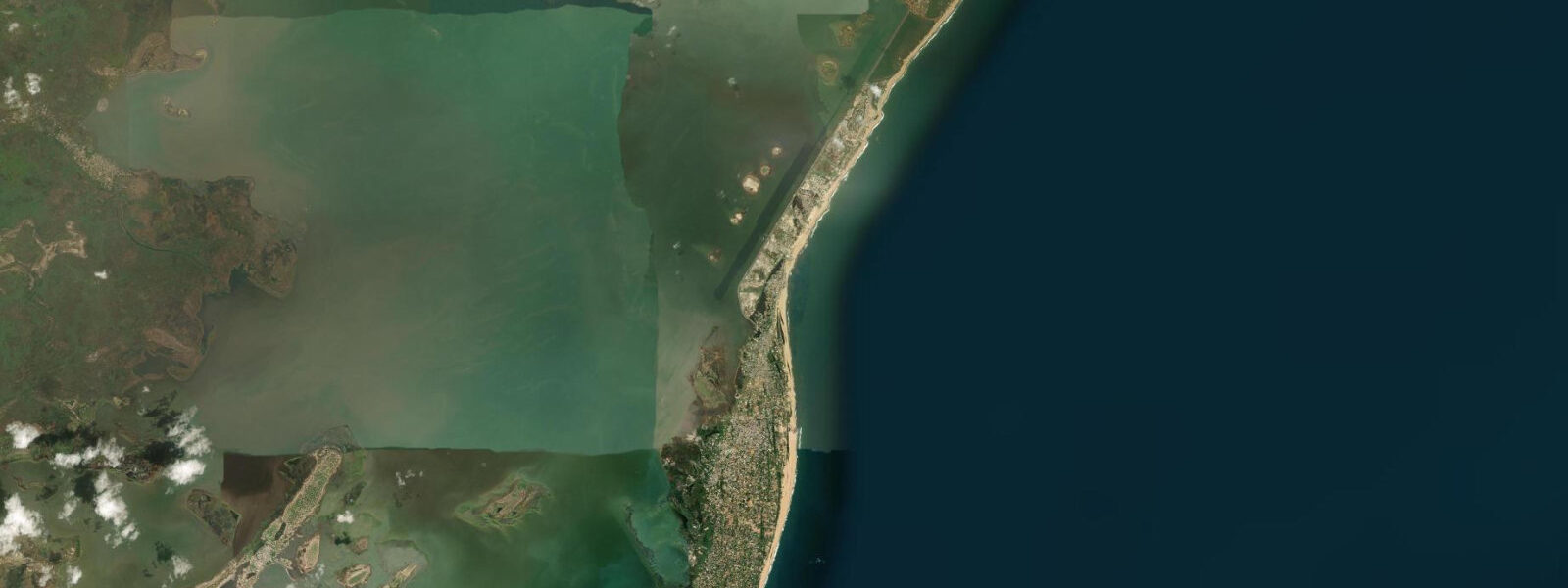
The physical setting is unusual even by the standards of the Ghana coast. Anloga sits on a sand ridge less than 500 metres wide, with the Atlantic on the south and the Keta Lagoon on the north. At its narrowest points between the two water bodies is less than 200 metres. The lagoon is tidal and connected to the Atlantic through several natural cuts and the Keta channel system, but the exchange is restricted enough that lagoon water levels lag the Atlantic tide by several hours and dampen significantly.
Tide data for Anloga comes from Open-Meteo Marine, a global gridded model. Timing accuracy is ±45 minutes; height accuracy is ±0.2 to 0.3 metres. The Atlantic face experiences semidiurnal tides with a spring range of approximately 0.8 to 1.2 metres. The lagoon side has a reduced tidal range — typically 0.3 to 0.6 metres at springs — due to the restricted connections with the open sea.
For fishing, Anloga has a long-standing canoe-fishing tradition on both the lagoon and the Atlantic. Lagoon fishing concentrates on tilapia, mullet, and crayfish in the shallows; canoes work the lagoon on falling tides when fish are pushed into shallow channels. Atlantic fishing from the beach uses the surf launch technique common along the Ghana coast, with hand-hauled seines and cast nets worked from the beach on incoming tides.
The Keta Lagoon is one of the largest coastal lagoons in West Africa, covering approximately 300 square kilometres and extending from near Keta westward to the Volta River mouth at Ada. It is a significant wetland for migratory birds: waders, herons, and terns use the shallow margins, and the lagoon supports commercial shrimp and crab populations harvested by local fishermen using traditional traps.
Coastal erosion at Anloga and along the entire Keta strip is severe. Sea level rise combined with the sediment starvation caused by reduced Volta River flood discharge has produced dramatic erosion rates: the town of Keta lost substantial built area to the sea in the 20th century, and the sea wall built in the 1980s by the Keta Sea Defence project protects what remains. At Anloga, the beach narrows at high spring tides and the sea wall sections show active wave impact. Visiting this coast provides a vivid illustration of the pressures facing low-lying coastal communities across the Gulf of Guinea.
Shallot farming is visible from the beach ridge: the cultivated plots extend to within metres of the Atlantic beach on the ocean-facing side, and the salt-tolerant varieties grown here are adapted to spray and occasional flooding. The farming calendar peaks in the dry season when the plots are most productive.
The shallot market at Anloga is the commercial heart of the Volta delta shallot trade. Market days draw traders from across eastern Ghana; the pungent smell of harvested shallots and the stacks of woven bags in the roadside market are a defining sensory experience of the town. The shallot harvest runs primarily from October to January; visiting during this period gives the fullest market activity. Outside the harvest season the market is quieter, though trading continues year-round as different plots come into production on staggered schedules.
The Anlo-Ewe cultural heritage of Anloga adds another layer to the coastal experience. The Anlo people are the dominant Ewe-speaking group of the Volta delta, and Anloga is their cultural capital. The Hogbetsotso Festival, held annually in November, celebrates the Anlo people's migration from the Notsie kingdom in Togo and draws participants from across the Anlo diaspora. The festival involves sea and lagoon ritual elements that reflect the community's relationship to the water. Visitors present during Hogbetsotso will encounter a coastal cultural event of unusual depth.
The community of Anlo fishermen on the Atlantic beach has adapted traditional netting techniques to the low-tidal-range Ghana coast conditions. Unlike the surf launch fisheries of west Ghana, here the beach seine — worked from both ends by groups of men pulling the net manually toward the beach — is the dominant technique. The net is set at dawn, worked for 2 to 3 hours, and hauled by 09:00 before the sun and heat build.
Tide questions about Anloga
Quick answers to the most common questions about tide times, range, and water access at Anloga.
What makes Anloga's coastal position unusual?
Anloga sits on one of the narrowest sections of the Keta sand spit — the strip of land between the Atlantic Ocean to the south and the Keta Lagoon to the north. At some points this strip is less than 200 metres wide, with the sea visible from both sides. This unusual double-water-body setting has shaped the local economy: shallot farming on the salt-tolerant sandy soils, fishing on both the lagoon and the Atlantic, and a persistent vulnerability to coastal flooding that has defined the area's modern history. The Keta Sea Defence project, constructed in the 1980s, protects much of the strip from direct Atlantic erosion.
What are the tidal conditions at Anloga?
The Atlantic coast at Anloga has semidiurnal tides with a spring range of 0.8 to 1.2 metres. The Keta Lagoon on the north side has a reduced tidal signal — spring range 0.3 to 0.6 metres — because tidal exchange through the restricted connections with the Atlantic is dampened and delayed. Water levels in the lagoon lag the Atlantic tide by several hours. Tide data here uses Open-Meteo Marine's global model, with ±45 minutes accuracy on timing and ±0.2 to 0.3 metres on heights. Storm surge from tropical systems can produce water-level anomalies several times larger than the normal tidal range.
What birds can I see at the Keta Lagoon near Anloga?
The Keta Lagoon is a significant wetland on the West African flyway. Wading birds — little egrets, grey herons, black-headed herons — are resident year-round in the shallow margins. Migratory waders arrive from the Palearctic between September and April: sandpipers, plovers, and stilts are common. Whiskered terns and African skimmers work the open lagoon surface. White-faced whistling ducks and garganey are present in the wet season. The best birding is on an outgoing tide, when falling water levels concentrate fish and invertebrates in the shallowing margins and trigger active feeding. Access to the lagoon edge is possible on foot from the Anloga market area or by canoe hired locally.
Is it safe to swim on the Atlantic beach at Anloga?
The Atlantic beach at Anloga has surf conditions typical of the Ghana coast: moderate swell, steep beach gradient at low tide, and longshore current running west to east. Swimming is safer within two hours of high tide when the break is offshore and the beach gradient is gentler. The protected sections immediately east of the sea wall are calmer. Strong swimmers with surf experience can manage the conditions; casual swimmers should exercise caution, particularly during the June through August period when swell heights increase. The lagoon side offers a calmer alternative for non-surf swimming, accessible by walking to the lagoon edge.
What is the shallot farming connection to the tides?
Anloga's shallot farming occupies the same narrow sand ridge that fronts the Atlantic. The soils are highly saline — sea spray and periodic tidal flooding have been deposited over centuries — and the Anlo Ewe developed varieties specifically adapted to these conditions. High spring tides, particularly when combined with onshore wind surge, can overtop the beach ridge and flood the lowest-lying plots. Farmers read tide cycles when planning irrigation from local wells (the water table is shallow) and when assessing flood risk to growing crops. The interaction between tide, surge, and agricultural calendar is a living feature of the local economy.
7-day tide table — Anloga
Heights relative to MSL. Predictions: Open-Meteo Marine (MeteoFrance SMOC, 0.08° grid) — heights relative to MSL (not chart datum / LAT). Model-derived.
| Day | Type | Time | Height |
|---|---|---|---|
| Sat 04 Jul | Low | 00:00 | -0.7m |
| High | 06:10 | 0.5m | |
| Low | 11:53 | -0.3m | |
| High | 17:40 | 0.5m | |
| Sun 05 Jul | Low | 00:08 | -0.6m |
| High | 06:48 | 0.6m | |
| Low | 12:43 | -0.3m | |
| High | 18:24 | 0.4m | |
| Mon 06 Jul | Low | 00:47 | -0.6m |
| High | 07:25 | 0.5m | |
| Low | 13:36 | -0.4m | |
| Tue 07 Jul | High | 08:11 | 0.5m |
| Low | 14:37 | -0.4m | |
| High | 20:23 | 0.2m | |
| Wed 08 Jul | Low | 02:19 | -0.5m |
| High | 09:08 | 0.5m | |
| Low | 15:45 | -0.4m | |
| Thu 09 Jul | High | 10:06 | 0.5m |
| Low | 16:54 | -0.5m | |
| High | 23:00 | 0.2m | |
| Fri 10 Jul | Low | 04:43 | -0.4m |
| High | 11:10 | 0.5m | |
| Low | 18:02 | -0.6m | |
| High | 23:00 | 0.1m |