Cape Coast tide times
Cape Coast tide forecast — heights relative to MSL.
Today's tide times for Cape Coast
Tide times at Cape Coast on Saturday, 27 June 2026: first low tide at 12:00am, first high tide at 02:10am, second low tide at 07:23am, second high tide at 01:50pm, third low tide at 08:15pm. Sunrise 05:55am, sunset 06:20pm.
Tide chart for Cape Coast
24-hour cosine-interpolated curve around the present moment. Heights relative to MSL. Predictions: Predictions: Open-Meteo Marine (MeteoFrance SMOC, 0.08° grid).
Sun, moon and conditions on Sat 27 Jun
Snapshot at build time — refreshes daily. Sea state from Open-Meteo Marine.
Highs and lows next 7 days
Every predicted high and low for the next week, with the daily tidal coefficient (0–120; higher = bigger swing, > 95 means stronger currents).
Other spots nearby
The three closest curated TideTurtle locations to Cape Coast, measured by great-circle distance.
Today's solunar windows
Solunar tradition: major periods are the ≈3h windows around moon transit and opposition; minor are ≈2h around moonrise and moonset. Pair with the local tide stage and wind for the best read.
Cycle dates near Cape Coast
Next spring tide on Tue 30 Jun (range 1.3m). Last neap on Sat 27 Jun. Next neap on Fri 03 Jul.
Spring tides cluster around new and full moons (biggest swings). Neap tides land on quarter moons (smallest swings). See the spring tide and neap tide glossary entries for the why.
About tides at Cape Coast
A short guide to the coastline at Cape Coast — geography, sea state, and what the tide is actually doing under your feet.
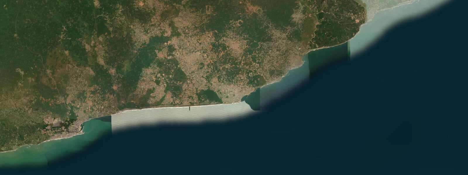
Cape Coast sits 110 km west of Accra on a rocky headland that has been a site of European commercial and military presence since 1555, when the Portuguese built the first fort on this promontory. The town's defining feature — Cape Coast Castle, rebuilt and expanded by the Swedes, the Dutch, and finally the British across three centuries — stands directly on the shoreline, its white-washed walls rising from the wave-washed base rock at the sea edge. This physical positioning, with the castle's sea-facing walls directly above the Gulf of Guinea, is not incidental: it allowed the castle to receive supply ships and, in the slave-trade era, to load human cargo directly through sea-level doors into waiting vessels.
The tidal regime at Cape Coast is mixed semidiurnal with a spring range of approximately 1.2 m. The Gulf of Guinea tidal pattern here produces two cycles per day with moderate diurnal inequality. At spring low water, the wave base of Cape Coast Castle and Elmina Castle (15 km west) is partially exposed: the rock shelf below the castle walls, which remains submerged under 0.5–0.8 m at high water, lies exposed enough at spring low water to walk along for short sections. The Door of No Return — the sea-level door at the bottom of the castle's slave dungeons, through which enslaved people were loaded onto ships — is at an elevation that makes the Atlantic wave surge visible through the door opening at low tide, and the surge covers the threshold at high tide. This physical relationship between the castle architecture and the tidal cycle makes tide state meaningful for understanding the site.
For visitors to Cape Coast Castle, the timing of the tour relative to the tide affects what is visible at sea level. The guided tour runs through the dungeons (male and female, at different levels) and out to the Door of No Return. At spring low water, the view through the door shows the exposed rock shelf and breaking surf beyond — the view most closely approximating what the departing enslaved people would have seen. At high water, the surf reaches the door threshold. The Ghana Museums and Monuments Board runs the official tours; arrival before 09:00 avoids the midday heat and the cruise-ship group crowds.
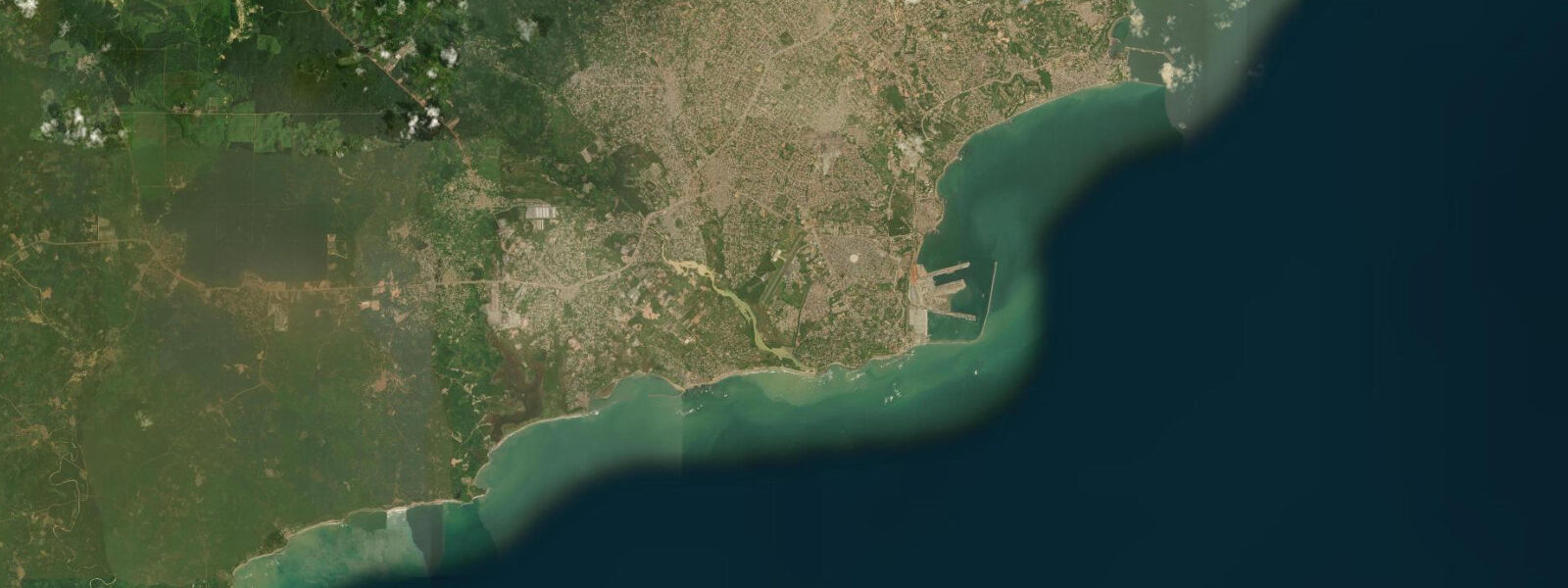
Elmina Castle, 15 km west by road, is older (built by the Portuguese in 1482, making it the oldest European building in sub-Saharan Africa) and architecturally distinct. The castle sits over a canal connecting the lagoon behind Elmina to the sea; the canal entrance is tidal, and traditional fishing canoes navigate through it to access the ocean. At high water the canal runs full; at spring low water the canal entrance shoals and requires timing. Elmina's castle architecture, the adjacent St. Jago fort on the hill behind, and the active fishing harbour adjacent to the castle wall make this the more layered of the two UNESCO sites.
The coastal upwelling from June through September brings cold water and high fish productivity to the Cape Coast area, the same oceanographic system that operates along the entire Gulf of Guinea coast. For anglers, the rocky headlands east and west of Cape Coast town provide shore access in water that is consistently productive in the upwelling season. The offshore banks west of Cape Coast — worked by the Elmina and Cape Coast fishing fleets — hold large aggregations of yellowfin tuna and skipjack during the upwelling peak.
The Kakum National Park, 30 km north of Cape Coast, is a contiguous rainforest reserve with a canopy walkway suspended 30 m above the forest floor — the standard excursion from Cape Coast combining coastal and interior Ghana in a single day. The park visit is independent of tidal timing.
Photographers working Cape Coast have two primary subjects. At the castles, the low-angle morning light from the east strikes the white-washed walls before the haze builds, and the sea-level perspective from the rock shelf (accessible at spring low water on the east face of Cape Coast Castle) gives the castle's relationship to the water its full expression. In Elmina, the Portuguese-era castle reflected in the canal at high water — when the canal runs full and the reflection is sharp — is the standard composition.
All tide predictions for Cape Coast come from the Open-Meteo Marine gridded model. Timing accuracy is ±45 minutes; height accuracy is ±0.3 m above Chart Datum.
Tide questions about Cape Coast
Quick answers to the most common questions about tide times, range, and water access at Cape Coast.
How does the tidal cycle affect a visit to Cape Coast Castle?
The spring tidal range of 1.2 m moves the sea level at Cape Coast Castle by enough to alter what is visible at the Door of No Return — the sea-level door at the base of the slave dungeons. At spring low water, the rock shelf below the door is partly exposed and the view through the door shows the full expanse of the Atlantic beyond. At high water, surf reaches the door threshold. For the most historically resonant view of the Door of No Return, time your tour to arrive at low water or within 1 hour of low water. Check the tide table before booking your tour time.
What is the difference between Cape Coast Castle and Elmina Castle?
Cape Coast Castle was built by the Swedes in 1653, expanded by the Dutch and then the British, and served as the headquarters of British colonial administration in Ghana until 1877. Elmina Castle, 15 km west, was built by the Portuguese in 1482 — making it the oldest extant European structure in sub-Saharan Africa. Both are UNESCO World Heritage Sites and former slave-trade holding facilities. Elmina is older, architecturally more complex (with a hilltop fort adjacent), and has an active fishing harbour and tidal canal at its base. Cape Coast Castle is larger and has better-documented tour infrastructure. Both are worth visiting if time allows.
What is the best time of year for fishing off Cape Coast?
The coastal upwelling from June through September brings cold, nutrient-rich water to the surface off Cape Coast, driving the peak fishing season. Sea temperatures drop to 22–24°C, and large aggregations of yellowfin tuna, skipjack, and sardinella come within range of the inshore fleet. Shore fishing from the rocky headlands east and west of town is most productive in this period. Offshore, the banks west of Cape Coast are the most productive grounds; charter arrangements can be made through the Elmina fishing harbour. The March through May warm, calm season before the upwelling is the least productive period.
How do I navigate the Elmina castle canal by small boat?
The Elmina canal connects the lagoon behind the town to the sea, passing under the castle wall. Traditional fishing canoes navigate it regularly. At high water the canal entrance is open and runs at full depth. At spring low water, the entrance shoals and larger canoes must wait for the tide to rise. If arranging a small boat tour of the Elmina waterfront from the lagoon side, check that the outbound timing is around mid-tide or above on a flooding tide — this ensures adequate depth at the sea entrance for the return passage.
Can I combine Cape Coast with Kakum National Park in one day?
Cape Coast Castle and Kakum National Park (30 km north) are the standard combination for a day trip from Accra or as a base town. The canopy walkway at Kakum — 350 m of swaying rope bridge suspended 30 m above the forest floor — opens at 08:00 and is best in the early morning before afternoon heat and afternoon thunderstorms (November–April dry season is clearer; June–September has more afternoon rain). Practical itinerary: Kakum at 08:00, Cape Coast Castle tour timed to the late-morning low water, then Elmina Castle in the afternoon. The 110 km road from Accra takes 2–2.5 hours by shared taxi or private car.
7-day tide table — Cape Coast
Heights relative to MSL. Predictions: Open-Meteo Marine (MeteoFrance SMOC, 0.08° grid) — heights relative to MSL (not chart datum / LAT). Model-derived.
| Day | Type | Time | Height |
|---|---|---|---|
| Sat 27 Jun | Low | 00:00 | 0.0m |
| High | 02:10 | 0.2m | |
| Low | 07:23 | -0.3m | |
| High | 13:50 | 0.4m | |
| Low | 20:15 | -0.6m | |
| Sun 28 Jun | High | 02:48 | 0.3m |
| Low | 08:12 | -0.4m | |
| High | 14:34 | 0.5m | |
| Low | 20:53 | -0.7m | |
| Mon 29 Jun | High | 03:24 | 0.4m |
| Low | 08:53 | -0.4m | |
| High | 15:00 | 0.5m | |
| Low | 21:25 | -0.7m | |
| Tue 30 Jun | High | 15:34 | 0.5m |
| Low | 22:02 | -0.8m | |
| Wed 01 Jul | High | 16:06 | 0.5m |
| Low | 22:38 | -0.8m | |
| Thu 02 Jul | High | 05:10 | 0.4m |
| Low | 10:48 | -0.4m | |
| High | 16:43 | 0.5m | |
| Low | 23:08 | -0.8m | |
| Fri 03 Jul | High | 17:19 | 0.5m |
| Low | 23:00 | -0.7m |