Zingst, Mecklenburg-Vorpommern tide times
Zingst, Mecklenburg-Vorpommern tide forecast — heights relative to MSL.
Today's tide times for Zingst, Mecklenburg-Vorpommern
Tide times at Zingst, Mecklenburg-Vorpommern on Friday, 19 June 2026: first high tide at 08:54, first low tide at 15:10, second high tide at 17:00, second low tide at 18:54, third high tide at 21:18, third low tide at 23:15. Sunrise 04:33, sunset 21:47.
Tide chart for Zingst, Mecklenburg-Vorpommern
24-hour cosine-interpolated curve around the present moment. Heights relative to MSL. Predictions: Predictions: Open-Meteo Marine (MeteoFrance SMOC, 0.08° grid).
Sun, moon and conditions on Fri 19 Jun
Snapshot at build time — refreshes daily. Sea state from Open-Meteo Marine.
Highs and lows next 7 days
Every predicted high and low for the next week, with the daily tidal coefficient (0–120; higher = bigger swing, > 95 means stronger currents).
Other spots nearby
The three closest curated TideTurtle locations to Zingst, Mecklenburg-Vorpommern, measured by great-circle distance.
Today's solunar windows
Solunar tradition: major periods are the ≈3h windows around moon transit and opposition; minor are ≈2h around moonrise and moonset. Pair with the local tide stage and wind for the best read.
Cycle dates near Zingst, Mecklenburg-Vorpommern
Next spring tide on Wed 24 Jun (range 0.2m). Next neap on Mon 22 Jun.
Spring tides cluster around new and full moons (biggest swings). Neap tides land on quarter moons (smallest swings). See the spring tide and neap tide glossary entries for the why.
About tides at Zingst, Mecklenburg-Vorpommern
A short guide to the coastline at Zingst, Mecklenburg-Vorpommern — geography, sea state, and what the tide is actually doing under your feet.
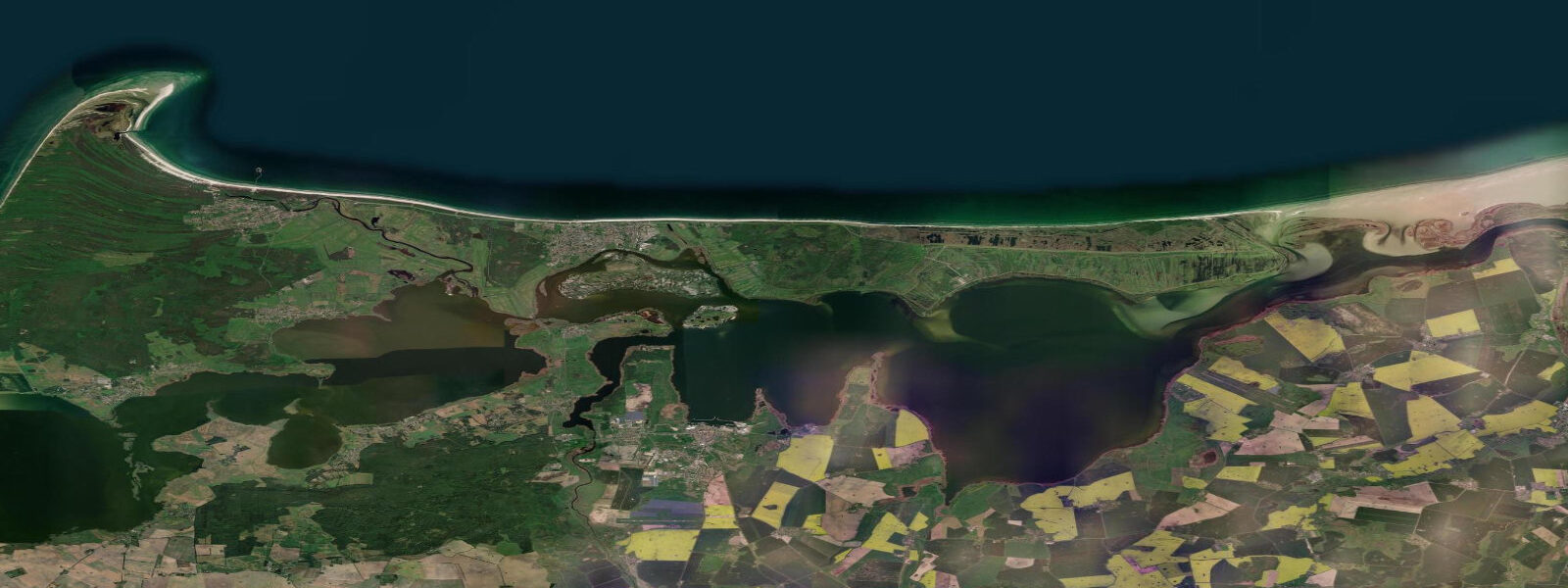
Zingst occupies a narrow strip of land that looks improbable on a map: the Fischland-Darß-Zingst peninsula runs roughly east–west for 45 kilometres, nowhere more than 2 kilometres wide, with the open Baltic on the north face and the Bodden lagoon system on the south face. The village of Zingst sits near the eastern end of this strip, and the duality of its position defines everything about the water conditions here. Two metres of dune and forest separate two completely different marine environments.
The Baltic side — the beach — faces northeast across open water. The astronomical tidal range is 10–20 cm, essentially nothing. Wind is the controlling variable. A sustained northerly or northeasterly builds real swell across the Baltic fetch; the beach at Zingst can see 1–2 metre wave faces in active conditions, and water levels rise 30–50 cm above mean during strong onshore events. The beach is wide and sandy, backed by dunes and a coastal forest that buffers the village from storm weather.
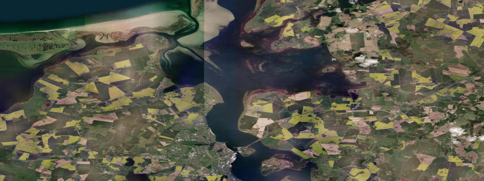
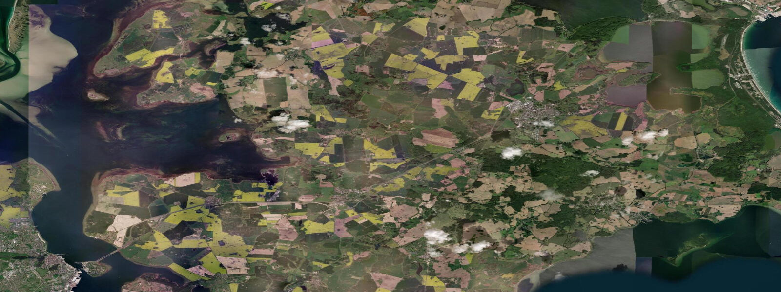
The Bodden side is the opposite character. The Bodden here — part of the broader Mecklenburgische Ostseeküste Bodden system — is shallow, typically 1–3 metres deep, reed-fringed, and calm except in strong crosswind conditions. The peninsula's southern shore hosts mudflats at the water's edge, exposed during low wind-driven water levels and submerged during westerly-driven high-water events. The Bodden is a national park zone; motorised boat access is restricted across much of the area.
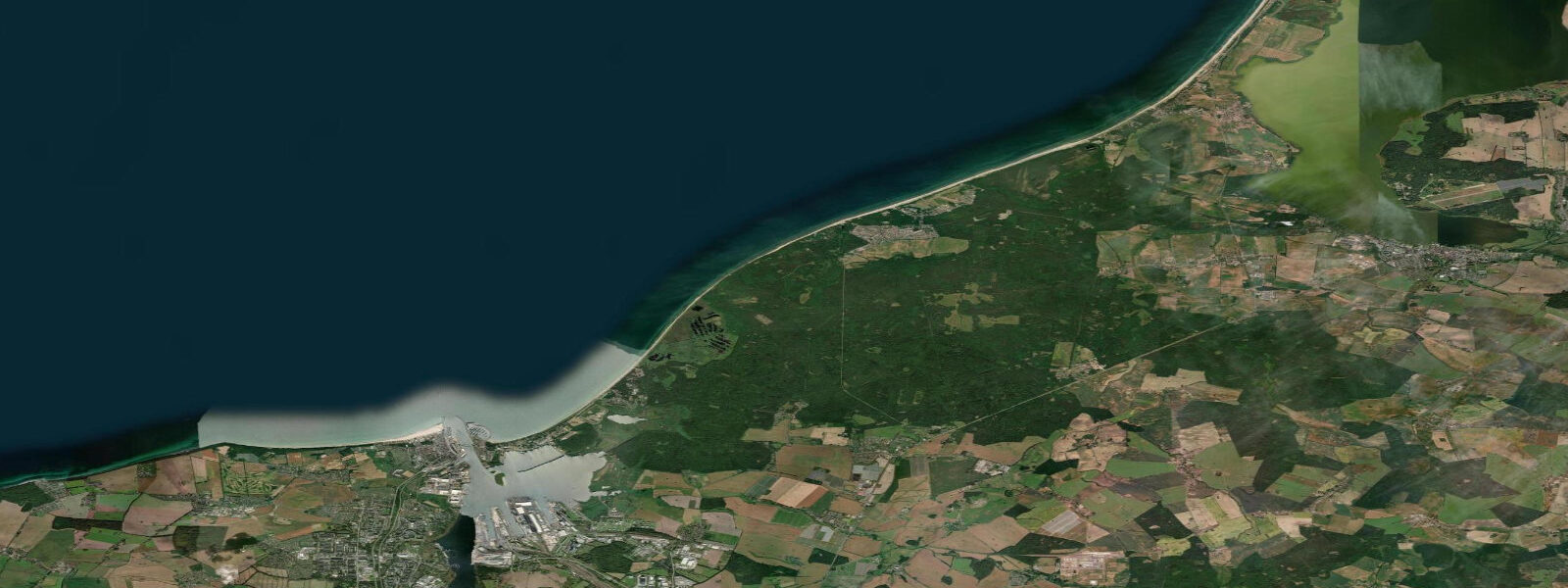
The national park status — Vorpommersche Boddenlandschaft National Park — shapes what is and isn't possible. The northern dune and forest zone is protected; a marked coastal hiking and cycling path runs the length of the peninsula from Ahrenshoop through Prerow to Zingst, and the stretch through the Darß forest (Darßwald) is one of the best easy-terrain forest walks on the German Baltic coast. Prerow, the village 8 kilometres west of Zingst, has more accommodation stock and a similar beach character.
The Darßer Ort lighthouse, at the western tip of the Darß section of the peninsula, is the navigational mark for traffic entering or leaving the Bodden from the west. The promontory at Darßer Ort is where the Baltic shore meets the Bodden entrance — a headland of wind-sculpted beech trees, eroding dunes, and enormous amber-hunting potential after storms. Amber fragments wash out of the glacial sediments in the cliff base and collect on the beach following northerly weather. Morning after a north storm: walk the Darßer Ort shoreline before the tide of fellow beachcombers arrives.
Crane migration is the seasonal event that distinguishes Zingst from every other Baltic beach destination. Between late September and early November, tens of thousands of common cranes (Grus grus) use the Bodden's shallow margins as a nightly roosting site during their southwestward migration. The numbers peak in October: counts of 50,000–70,000 birds in the Zingst–Prerow Bodden are recorded in good years. At dusk, the cranes arrive in continuous streams from the surrounding fields, dropping onto the Bodden shallows in stages. The spectacle is visible from the Bodden dike path on the south side of the peninsula. The tide — or rather the wind-driven water level — matters here because the cranes prefer to roost in very shallow standing water that deters foxes; a high-water event can displace them to less suitable areas.
For paddlers, the Bodden offers a calm inland sea with access to multiple Bodden arms and small islands within the national park. Guided kayak tours operate from Zingst and Prerow through the summer and crane season. Independent paddling is permitted in the designated zones; check the national park boundary maps before planning a route, as several bird-sensitive areas have seasonal access restrictions.
Tide data for Zingst, Mecklenburg-Vorpommern comes from the Open-Meteo Marine API, a gridded model product. Timing accuracy is ±45 minutes, height accuracy ±0.3 m — usable for trip planning, not for navigation.
Tide questions about Zingst, Mecklenburg-Vorpommern
Quick answers to the most common questions about tide times, range, and water access at Zingst, Mecklenburg-Vorpommern.
What is the tidal range at Zingst?
The astronomical tidal range at Zingst is 10–20 cm — the Baltic Sea is effectively non-tidal. Water level on both the Baltic beach side and the Bodden side is wind-driven. Northerly and northeasterly winds raise water level on the beach face and can produce 1–2 metre swell. Westerlies push water into the Bodden from the west, raising south-side levels 30–50 cm above mean. Easterlies do the reverse. Plan by wind forecast rather than tide tables.
When do the cranes arrive at Zingst?
Common cranes stage on the Zingst and Prerow Bodden from late September through early November, with numbers peaking in mid-October. Counts of 50,000–70,000 birds are recorded in good years. The evening arrival — cranes streaming in from the surrounding fields to roost in the Bodden shallows — is the event to see, best viewed from the Bodden dike path on the south side of the peninsula. Arrive at least 90 minutes before sunset to get a position. The crane season is the main reason visitor numbers remain high well into autumn.
How do the Baltic beach side and Bodden side differ at Zingst?
The Baltic side (north face) is a wide, open, sandy beach exposed to northerly and northeasterly swells. Wave heights of 1–2 metres occur during active Baltic weather events. The Bodden side (south face) is shallow, calm, and reed-fringed — a sheltered inland sea 1–3 metres deep, part of the Vorpommersche Boddenlandschaft National Park. The two environments are separated by a few hundred metres of dune and coastal forest. Baltic conditions suit beach swimming and wind sports; Bodden conditions suit kayaking and birdwatching.
Can I kayak in the Vorpommersche Boddenlandschaft National Park?
Yes, within designated zones. The national park covers most of the Bodden south of the Fischland-Darß-Zingst peninsula. Paddling is permitted in the open-water zones; several bird-sensitive areas have seasonal restrictions, typically April–June (breeding season) and September–November (crane staging). The national park authority publishes a zoning map that shows permitted and restricted areas. Guided kayak tours from Zingst and Prerow follow routes that respect these boundaries; independent paddlers should download the map before launching.
Is amber found on the Zingst and Darß beaches?
Yes. Baltic amber — fossilised resin from Eocene-era conifers — is present in the glacial sediments underlying the Darß and Zingst shoreline. Storm waves erode the sediment from the cliff base and dune edge, releasing fragments that wash up on the beach. The best conditions for finding amber are the morning after a sustained northerly storm, low slanting light (early morning or late afternoon), and a rising-water line where the froth concentrates material. The Darßer Ort headland, particularly the northwestern shoreline, is the most productive stretch. Fragments range from pea-sized to occasionally fist-sized pieces.
8-day tide table — Zingst, Mecklenburg-Vorpommern
Heights relative to MSL. Predictions: Open-Meteo Marine (MeteoFrance SMOC, 0.08° grid) — heights relative to MSL (not chart datum / LAT). Model-derived.
| Day | Type | Time | Height |
|---|---|---|---|
| Fri 19 Jun | High | 08:54 | -0.1m |
| Low | 15:10 | -0.2m | |
| High | 17:00 | -0.2m | |
| Low | 18:54 | -0.2m | |
| High | 21:18 | -0.1m | |
| Low | 23:15 | -0.2m | |
| Sat 20 Jun | High | 01:06 | -0.1m |
| Low | 03:42 | -0.2m | |
| High | 05:10 | -0.2m | |
| Low | 11:42 | -0.2m | |
| High | 13:18 | -0.2m | |
| Low | 16:04 | -0.3m | |
| High | 17:54 | -0.3m | |
| Low | 19:40 | -0.3m | |
| High | 22:12 | -0.2m | |
| Low | 23:54 | -0.3m | |
| Sun 21 Jun | High | 02:04 | -0.2m |
| Low | 04:18 | -0.3m | |
| High | 06:10 | -0.2m | |
| Low | 08:18 | -0.3m | |
| High | 10:18 | -0.2m | |
| Low | 12:15 | -0.3m | |
| High | 14:18 | -0.2m | |
| Low | 16:42 | -0.3m | |
| High | 23:00 | -0.2m | |
| Mon 22 Jun | Low | 00:45 | -0.2m |
| High | 02:50 | -0.2m | |
| Low | 05:06 | -0.2m | |
| High | 07:00 | -0.2m | |
| Low | 09:06 | -0.2m | |
| High | 11:12 | -0.2m | |
| Low | 13:18 | -0.2m | |
| Tue 23 Jun | High | 03:40 | -0.2m |
| Low | 05:54 | -0.3m | |
| High | 08:00 | -0.2m | |
| Low | 09:40 | -0.2m | |
| High | 16:04 | -0.1m | |
| Low | 18:12 | -0.2m | |
| High | 20:18 | -0.1m | |
| Low | 22:06 | -0.2m | |
| Wed 24 Jun | High | 04:00 | -0.1m |
| Low | 07:18 | -0.3m | |
| High | 08:00 | -0.3m | |
| Low | 10:55 | -0.4m | |
| High | 13:18 | -0.3m | |
| Low | 14:45 | -0.3m | |
| High | 17:00 | -0.2m | |
| Low | 19:00 | -0.3m | |
| High | 21:18 | -0.2m | |
| Low | 22:50 | -0.3m | |
| Thu 25 Jun | High | 02:00 | -0.1m |
| Low | 03:00 | -0.1m | |
| High | 09:45 | -0.1m | |
| Low | 11:15 | -0.1m | |
| High | 14:06 | -0.0m | |
| Low | 20:18 | -0.1m | |
| High | 21:45 | -0.1m | |
| Fri 26 Jun | Low | 00:00 | -0.2m |